Latest Progress

Ragged Ravine Run

“So, you want to be chased by dogs?”

https://www.strava.com/activities/3323445019
RATS #00221 – In the Ravines

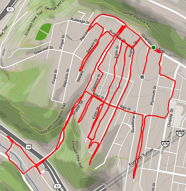
I planned this run thoroughly. Conveniently starting at Riverview Park, I would run around the park on the streets in the ravines. As usual, I had “runtime” surprises, including mapping inaccuracies with OpenStreetMap. If you haven’t looked carefully, you might not realize that maps from Strava and Google Maps are different. Strava uses OpenStreetMap, which relies on individuals to make corrections, whereas Google has their streets view cars and other tools. I suppose I need to contribute to OpenStreetMap myself, to make corrections.

OpenStreetsMap had an error about Doak Way. It placed it further down Dornestic than it actually is. On the other hand, I knew there was a set of steps from Dornestic to Dalton. I wasn’t sure if it this was in addition to Doak Way or not. While investigating this, a rather beefy bulldog mix decided to investigate me. He barked a little and sniffed, and was uncomfortably close to my calves. I was relieved when a man came quickly off of his porch and, in coaxing tones, said “Come on back! He doesn’t want to play with you!” Maybe if I had had a ball. Now I was a little unnerved, but no worse for wear, so I waved off the dog and went down the steps.

I uncovered a tiny blue church with mossy steps. Following Glenside Street as it becomes Oakdale Street, I was once again struck by the rural character of this nook of Pittsburgh. Oakdale Street eventually becomes dotted with houses, still very rural in feeling. Festoria Street is a dead-end dog-leg off of Oakdale. As I was about to make the turn to the dead-end, a woman came out of a house and asked me what I was doing. She was less than enthusiastic about me running up to the dead-end, so I turned around and went out on Oakdale. She was friendly enough, I suppose, but the first person to challenge me running on a public street, dead-end or not. When I checked later, Google Streetview had not gotten further, so they must have gotten the same message.

After that, the houses went downhill. I did come across the a house which looked like it dropped out of tornado in Oz. What is this anyway? A deluxe outhouse? Further on Oakdale, there are hulks of old cars and industrial debris just off the road.

Continuing on Woods Run I explored the small streets above Woods Run near Central Avenue. Here there were more OpenStreetsMap snafus and another loose dog nipping at my heels. This time, I only heard bottles clinking; no one called the dog back. At this point, I decided to cut short the run. That area, near Sorento and Smithton, quickly becomes very inner city, with houses tightly packed on each other. Honestly, while some houses are a mess, many are fine. There’s at least a half-dozen sets of stairs.

Smithton, Rothpletz and Grand Avenue all converge into Kilbuck Road at the bottom of Riverview Park. I came across the stables for the Pittsburgh Police and eventually ran into Riverview Park while getting a close-up view of a salt-dome.

So, I was a bit disappointed with this run. While there were some nice areas, the threat of loose dogs, auto wreckage and a greying sky dimmed the early promise. Nonetheless, got a good five miles in.

So, you want a hill to run?

https://www.strava.com/activities/3317477988
RATS #00220

In local online running communities, I sometimes hear that people get bored on “hill” day, because they are tired of running the same hill week in and week out. Maybe they’ve chosen a specific hill in North Park or Schenley Park, or somewhere in their neighborhood and keep at it. Let me tell you, Pittsburgh has no lack of hills and there’s no need to run the same one all the time.

Take this run, for example. Beechview is about five minutes out of downtown, either through the Liberty Tubes to West Liberty Avenue or using the Fort Pitt Tunnels to Banksville Road. Park along on one of the broad residential streets, say Fallowfield Avenue. Within a mile, you’re likely to get a 100′ change of elevation. Do that a few times, and I think you’ll be set.

Of course, if that doesn’t get your heart rate going, try a few staircases. There are plenty of them around here, too. Just don’t try the ones coming down to Goldstrom Avenue, unless you bring a rope. If the Rutherford steps or Belasco steps don’t tickle your fancy, cross West Liberty Avenue and go up Stetson Avenue or Ray Avenue.

That’s about it. I’ve become fond of Beechview in spite of its ridiculous hills. Whittling down the streets, I only have about a dozen left there, maybe two or three miles and perhaps a half-dozen sets of stairs.

Slip sliding away

RATS #00219

This was an interesting and surprising run in the Riverview Park area. According to Google maps, it was partially in Perry North and partially in Brighton Heights. After you see the pictures, though, you might think I teleported to West Virginia too.

Large houses along Perrysville Avenue
Perry North Neighborhood is characterized by very large houses

From a favorite parking spot on the entrance to Riverview Park, I traipsed over to a small subdivision near Perry Traditional Academy bounded by Semicir Street. Those city planners were clever… Guess what shape “Semicir Street” makes? However, the house builders weren’t so clever it seems.

Collapsed House

That’s not actually fair, I suppose, but seeing this collapsed house was shocking. Upon further research, it seems the rains of 2019 weakened the foundation. The residents were forced to move out and shortly after, the house slipped into the ravine. This happened about a year ago and the slope apparently hasn’t stabilized enough to remove the debris. Either that, or it is low on the priority list.

SemiCir Street is rather narrow, but finishes its short span as a driveway between two buildings of Perry Traditional Academy. On the other side of the Academy, Hemphill Street’s cobblestones crest a steep hill.

I finished this little warren of streets and moved on to the next section. This took me past the high school and down Mairdale Avenue. A few weeks ago, I ran down here, past the high school’s football field and noticed houses high on the right. Today I was exploring that neighborhood.

If hill repeats are your game, go to Portman Avenue. It’s not long, but damn it’s steep. The houses are a hybrid between the ostentatious mansions on Perrysville Avenue houses and the tall, narrow structures you see in Spring Garden. I followed Portman back to Perrysville Avenue then started down Vinceton Street, where the corner store is festooned with bold, colorful murals.

Now things began to diverge from the urban setting I was expecting. Menlo Street, the featured image, looks more like a Virginia horse farm lane rather than an inner city street. I made the next left onto Dornestic Street (that’s right “Dornestic” not “Domestic“). That street became a winding lane along the hillside, with houses haphazardly spaced here and there. The right onto Stolz Street completed the transformation with ponies grazing behind a fence.

Ponies
Ponies!

Jogging along in West Virginia now, I was jolted back to Pittsburgh by stairs which led me down to Oakdale Street, where the ravine widens up to a pleasant glade surrounded by towering oak trees.

At this point, I clambered back up the hill, took note of the streets and stairs I had missed and ran back to my car. This four mile run had transported me from turn of the century mansions to a collapsed house to a pasture. Where would I go next?

Washington’s Landing and Troy Hill

RATS #00218

This run was planned carefully. I would park on Washington’s Landing under the 31st Street Bridge. I would warm up on the flat Waterfront Drive then ascend Rialto Street. At the top, I would take a hard right and finish off Ley Street and Lowrie Street, the section of Troy Hill which stretches all the way to Reserve Township. On my first attempt, late last week, the depression of a cold rain and Covid19 meant I never got out of my car. Monday, I parked in the same spot, IMMEDIATELY got out of the car and began.

Washington’s Landing is a cute island in the Allegheny River just off of River Road. The 31st Street Bridge roars high above. It’s history includes an early visit by none other than George Washington, as well as uses as a rendering plant and a rail yard. It has since been redeveloped and currently contains a little park, a street of condos, some hiking paths and a restaurant. It also has these little pergolas overlooking the water on both sides of the narrow island.

Now that the warmup was over, I headed for Troy Hill, going up the Rialto Street Steps. Troy Hill houses are only about 100 years older than those condos, and honestly, don’t look too bad. Perhaps a bit closer together.

While going up Rialto, whether by foot or by car, is not for the faint of heart, once there, it’s pretty flat. It was stoop time and folks were out on their porches. I ran back and forth on the streets and alleys, inciting all the dogs to bark, from tiny white puff balls with their high yips to large black and brown hounds with their deep woofs. I came across several community gardens, perched on the cliffs over the Allegheny. There was a hint of a staircase which was clearly closed. Nothing below it but Route 28, far below. Voegtly Cemetery was bigger than I expected and a number of streets dead-ended into it.

I’m finished with most of Troy Hill. There’s only a section of Troy Hill Road, as it borders Reserve Township, which remains. This was a nice run and I was glad I did it finally.

Criss-Crossing the Hill

RATS #00217 – Hill District

Recently I have been traveling to different areas of Pittsburgh to find new streets and run them. Today’s run was closer to home, in the Hill District. The Hill District has several long parallel streets which roughly go from the hilltop above the University of Pittsburgh to Downtown Pittsburgh. These streets, Bedford, Webster, Wylie and Centre are the main thoroughfares which people take through the Hill District and I’ve already run them. Today’s run was about the smaller streets crisscrossing those major roads.

I had parked in West Oakland, so from this perspective, the small streets begin at a low elevation along Centre and rise to the cliffs off of Bedford Avenue. This is properly called the Middle Hill. Over the years, many of the structures in this area have been torn down, so now, there are plenty wide open grassy blocks.

I started with Junilla Street Steps, which come off of Centre Avenue. It continues, sometimes as a street and sometimes as steps, all the way to Bedford Avenue. Along one stretch of Junilla Street, I saw a few turkeys and heard their gobbles. Groundhogs were freely roaming in the vacant lots.

Morgan Street starts rather wide-open and then closes in as you reach Elba Street. From previous adventures, I call the flight of steps from Morgan to Centre the “Who’s You!” steps.

Briefly put, I had been accompanying a friend along these steps when she decided to go down to Centre Avenue to take pics. For some reason (perhaps because I had run a long way), I just hung out on the sidewalk in front of the porch in my black hoodie and woolen Army beanie. Turns out, a tall dude in a black hoodie and a woolen Army beanie hanging out in front of your porch in the Hill District can be a concern. After a few minutes, I heard some shouting. From the street above, a big black guy in a brown jacket was yelling:

“Who’s You? Who’s You?”

I had just realized he was yelling at me when my companion sprightly sprang up the steps, gave some big smiles and whisked me away. Whew! Even now I muse, “What was the proper response?… I am me?”

But I digress.

Francis Street was interesting. Starting from Centre, it is a rather broad avenue heading up the hill. Then, as I crossed Wylie Avenue, it became a cul-de-sac of newer, rather suburban housing. I did the big circle and went out the way I had come. Later, as I started down Francis Street from the other direction I spied some steps, took them, and again landed in the suburban cul-de-sac. Surprise, surprise.

Coming down the Watt Street steps provided a nice view of Christian Tabernacle Church. I gradually made my way towards the Upper Hill, aka Sugar Top, where the big blue water tower lives. I finished off Milwaukee Street and a few little streets before heading down Herron Avenue and headed back to my car. No one shouting at me today. Thank goodness for social distancing.

Hightide in Beechview

RATS #00216 – Beechview

Happy Easter! Normally, I would be finishing up a brunch with family and friends this morning. However, in the current state of things, I figured I’d blog a little and later try to find a chocolate egg around the house. Happy to have all the good in my life as it is.

So, I ran this route last week on a brilliant evening in Beechview. If you’ve followed my blog for anytime, you’ll know that Beechview is a friendly neighborhood with broad streets and booming hills. What you may not have known, is that in the last ice-age, Beechview was actually beachfront property. (How do you think they got the name?) In those days, everyone got around by boat, paddling from hilltop to hilltop. I came across a relic of the old days here, not far from a spanking new gas grill.

Continuing the fiction, it then happened that the seas began to recede. In those days, it wasn’t too convenient to lug your boat up to the house, so everyone made steps to get down to the water. You can see these steps all over.

Security was a concern, so residents bred vicious animals which required pets before passing. Most of them are pretty quick and shy these days, but every now and then an alpha guardian still stands his ground.

Beechview Guardian

But the seas indeed, have receded, leaving Beechview high and dry. The only waves you see are the undulating hills frothed with houses.

Take the Stairs Fatass 50k – DNF

https://www.strava.com/activities/3255634085
RATS #00213: Take the Stairs Fatass 50k (DNF) Got 17 miles in

Last Saturday I decided to take a shot at the 50k “Take the Stairs Fatass” route. The weather was pretty good, but I got a late start (it was close to noon) by the time I got out. Now, treating this more seriously than I did the 25k route, I suited up like I was doing Hyner. I dug into my ultra gear box where I found treasures such as TP and hand wipes.

Much of the route I’ve documented already, but I did hit a number of new streets and stairs. I also had the good fortune to meet up with Sherpes Hasher, who was doing the route in the opposite direction. There were a couple of snafus – Vista Street steps are under construction, which I had forgotten. Early on, I added in the steps from Howard St to Compromise Street, an effort which likely contributed to an overall DNF. But, I’m not too sad about this DNF, I covered seventeen miles with over 3,500 feet of elevation and traversed at least 37 sets of city stairs before calling it a day on Wyoming Ave.

Here are the pics. Take Dramamine now if you have vertigo…

Spring Hill City View Area

Rising Main and Fineview

Perry South/Marshall/California-Kirkbride

West End & Elliot

Duquesne Heights & Mount Washington

That’s all, folks! One day, I will persist!

Wells of Steps

https://www.strava.com/activities/3248165617
RATS #00212 – Duquesne Heights

This was a few miles around Duquesne Heights – the stepchild of Mount Washington. While my main purpose was to completely traverse Well Street, I made it from the great views of Grandview Avenue to the industrial bottom of Shaler Street.

I started out on Grandview Avenue. The view never gets old, especially on a clear sunny evening.

The grid of streets below Grandview are lined with modest houses with small yards. The alleys here mainly give access to garages and garden gates. They are also ideal playgrounds. Nice to see hopscotch markings and some gratitude for the garbage workers, but watch out for crouching panthers.

Shaler Street is a back-way off of Mt. Washington. It falls steeply through the Duquense Heights greenway and emerges between the pink buildings of the Minnotte Manufacturing Company. I ran around the block before heading back up the hill.

Finally, I started on Well Street, my target. From Shaler Street, it jumps up, hill after hill, stair after stair, until it reaches Oneida Street.

Well Street steps – some of them at least

Completing Well Street, I made my way back to the car. Another cool run in a super hilly section of Pittsburgh.

March 2020 Catch-Up

March 2020 will go down in history as the month in which the coronavirus exploded in the United States. According to World Meter’s Coronavirus stats, on March 1st, there were 75 cases of Covid19 in the U.S. By April 1st, there were over 200,000 cases. In this, the first week of April, we’re at over 336,000 cases and over 9,000 deaths. This has had a huge impact on everyone, locally, regionally and globally. Professional sports has been shut down. Restaurants, and non-essential businesses are shut down. Everyone is being told to stay home, except for grocery shopping and exercise.

Against this backdrop, my project to run all the streets of Pittsburgh seems pretty petty, but I’m lucky I can still do it. Also since all group running, even in two’s, is verboten, I’ve had the unencumbered opportunity to run solo and cover many new streets this month. Twenty runs covered new streets. My running mileage was 161 miles with more elevation than ever. I’m over 35% complete with the streets of Pittsburgh, according to CityStrides. I’ve covered dozens of staircases. Here are a few of the runs I didn’t get a chance to blog about during March.

RATS #00193

https://www.strava.com/activities/3149171706
RATS #00193

A dark run in Lawrenceville. Probably late for a PBR run, come to think of it.

RATS #00196

https://www.strava.com/activities/3178604063
RATS #00196

This was a late Thursday evening run in Lawrenceville. This was a little somber because I went to a viewing before running. A co-worker’s Dad had passed away from a long illness. So, no pics.

RATS #00205

https://www.strava.com/activities/3214973271
RATS #00205, lower Oakland with a bit of Greenfield

This was an interesting run in the early evening. Mainly, it was in Four Mile Run, a little hollow of houses wedged between Greenfield Avenue and the Parkway East.

But first, lets get the steps out of the way. I’m not sure whether the steps from Greenfield Avenue up to the defunct Greenfield Elementary School are “official”, but they are in good shape and lead to a ball field. The steep steps from Sylvan Street to Waldeck Street offer a quick, though heart-pounding route into the heart of Greenfield. On the bottom, the steps from Greenfield Avenue to Alexis Street lead into the Four Mile Run hamlet. On the other hand, the Anthony Street Stairs, next to an impressive Byzantine Catholic Church, essentially go nowhere.

Four Mile Run is dominated by highway overpasses. It is surprisingly large, with several miles of roads winding under the bridges.

But, as anywhere, people make the most of their surroundings and decorate for upcoming holidays.

Easter Decorations

RATS #00207

https://www.strava.com/activities/3225563189
RATS #00207

This run was to catch a few streets off of Hazelwood Avenue, including the Hilltop Street Stairs. From Winterburn Avenue, it was easy to see Hilltop steps.

Hilltop Street at Winterburn

However, off of Parnell, they were better hidden.

“Go halfway down the street, look for a yellow bush on the right.” I was a bit dubious, but these were, actually, the correct directions.

The yellow bush marks the spot! Following the dirt path, you get to the next section of steps.

The next few streets are remarkably flat and deserted. Perfect for the kid zooming past me on a four-wheeler. I trotted back to Hazelwood Avenue and jogged back up the hill.

RATS #00209

https://www.strava.com/activities/3232911274
RATS #00209

This was a big loop in the West End, Elliott and Sheraden. With no phone, I didn’t catch any pictures. It was a shame because Glen Mawr Street, from West Carson Street up into Sheraden is quite the trip. Sidewalk steps, a twelve-foot high viaduct under an active railroad track all made for an exciting run. I also managed to get from the West End to Sheraden on small residential roads. It was a beautiful day and a nice run.

RATS #00211

https://www.strava.com/activities/3240574835
RATS #00211

An evening run through Bloomfield on a wet Spring evening. Passed a WWI Memorial which I had never payed attention to before. the police tape of the playground is to enforce social distancing. While there are many businesses in this area, there are still single family houses and, of course, new condos.

And that’s all for March. It’s a topsy-turvy world out there and I hope everyone stays healthy.

Rainy Day in Sheraden

RATS #00208 – Sheraden

This run took me back to my first “RunalltheStreets” run, which started in Esplen and went up the hill to Brunot Avenue and Glasgow Street. Today I started on Allendale Circle. Allendale Circle is a newer development of townhouses. Just past the circle, the small streets and alleys are filled with typical Pittsburgh foursquares. Most everyone has at least a little yard and there are lots of dogs behind fences. The hillier area near Hammond Street and Narcissus Avenue features overlooks of the Ohio River and McKee’s Rocks Bridge.

In this last picture, the street falls away sharply. Notice the blue arches of the bridges in the center of the picture and the beginnings of a stairway on the right. That stairs takes you up Glasgow Street.

But not all stairs are as solid as the Glasgow Street Stairs. Off of Adon Street, which is actually blocked off to cars, there’s a significant set of stairs up to Fairdale St. They looked promising, but fall away unexpectedly.

There is a nice flight down to Sheraden Park, with a chalk square emblazoned between the raindrops.

The rain started again in earnest and I scooted back to my car, a little over six miles done.