PBR Scavenger Hunt

The pictures above are courtesy of Amy Scharpf, the team’s official selfie-taker.

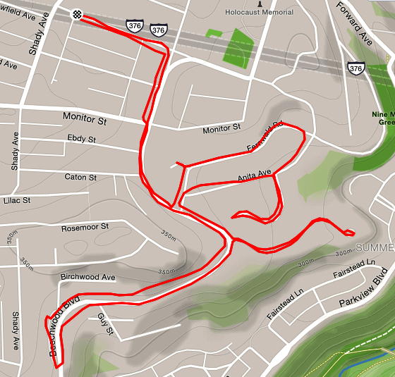
Teams, random locations, whatever route you choose, two hours to do it. This sounded fun! Then I had a look at the list of locations! Ninety spots where you needed to take a selfie with your team, capturing the location behind you. Some were general such as the “Fort Pitt Bridge”, some were very specific such as the “Singing Pigs in Wholey’s. This was Pro-Bike and Run’s Annual Scavenger Hunt Run. My team included friends I often run with on Wednesday nights, six of us. Collecting six people for a picture is not easy. “Where’s Kristen?” was the common call, as the first snapshot often missed her.

Denise had scouted out the Northside targets, so we started there. Probably the most interesting were the City of Asylum houses. City of Asylum is unique organization devoted to helping ‘endangered’ authors live and write. These writers usually face repression in their home countries but are energetic and expressive. The houses they’ve decorated with writings are unique. Cathy knows Chinese and was able to read some of the characters on the Poem House. No-one knew Burmese, but it is a beautiful flowing script.

We eventually made it to around forty locations, covering over seven miles. One of my favorite was the Singing Pigs photo. Wholey’s is hectic on a Saturday morning and the store manager didn’t appreciate groups of sweaty runners dashing in and out.

As the clock ticked down, the heat and the distance started getting to us. The selfies became more hurried. Nonetheless, we made it back in time and basked in the cool air of Nova Place as we uploaded our photos and rethought our route; making plans to be way more efficient next year!

Route we took trying to catch as many locations as possible in scavenger hunt.
PBR Scavenger Hunt: Run All The Streets 00077

Eleanor, Steady on the Steep

Strava Cadence – straight as the South Side Flats

Not a long run, Just take Eleanor Street up from Josephine Street. If there are stairs, take ’em. If the hill is epic, keep your arms and legs going. Even six inches a stride if you need. Whatever you do, don’t stop (unless its to take pictures). Watch yourself coming down, that’s almost worse than going up. One trip and it’s tumble-sault time.

The graph above is from Strava and shows the distance along the bottom axis, the elevation along the left axis and three squiggly lines. The blue and dark purple lines are my actual pace and my “gap” pace (which takes the grade into account). The nice flat magenta line is my “cadence”. It is remarkably steady, but makes sense, given that I was trying to keep an even effort. I daresay the two sharp dips in cadence just after 0.5 miles and at 1.5 miles were picture-taking opportunities.

Downtown Pittsburgh from Cobden St
Great view from Cobden St on the South Side Slopes
View of Oakland from Keibe Way
Oakland from Keibe Way in South Side Slopes

Running up these streets always takes my breath away, both literally and figuratively. Eleanor St is incredibly narrow and steep. Starting from Josephine St, the pavement only goes a block before it gives up and becomes stairs for a tenth of a mile. That might not seem like much distance, but it is 282 steps according to Mis.steps (see Trip#212). Not willing to hit the steps just yet, I veered off onto Leticoe St, only to suffer Barry St and Holt St before rejoining Eleanor on the upper side of the stairs. Unwittingly, I was taking on the Twelfth Hill in the Pittsburgh Dirty Dozen. You might think it is the last one, but Pittsburgh is generous that way, there are thirteen hills in the Dirty Dozen. But I digress. This area has houses of all sorts of sharp angles, clinging to the hills, with decks and porches high in the air looking out toward Oakland or downtown. Cobden St ends at an overlook, where I took a picture and exchanged greetings with a woman sitting on her rocking chair. I always expect people to ask what the hell I’m doing, but in this case, she said that lots of people come there to take pictures. Ha!

I traveled a bit into Arlington, running the rest of Eleanor Street. I returned to the South Side Flats via the Eleanor Street stairs. On the way down, I kept an eye out for stairs and streets not taken. I’ll be making another appointment with South Side Slope streets soon!

Eleanor St Route: RATS 00071

Denniston, Hastings and Glen Arden

Strava map of run 00065 which was in Squirrel Hill and Point Breeze.
Strava map for route down Hastings in Squirrel Hill: RATS 00065

This run was all about finishing streets so familiar to me I should have done them already. I often cross Denniston or Hastings, but its rare that I actually run the length of these streets. Today was the day!

Denniston has a couple of disjoint segments, one in Squirrel Hill and one in Shadyside. Today I was concentrating on the one that goes nearly a mile from Darlington past Wilkins. This is a nice street in Squirrel Hill, tucked between Shady and Beechwood. The houses are mostly three or four bedrooms on small lots. Everything is well-kept, but kinda close. Denniston is “flat” by Squirrel Hill standards and straight. The street just stops in front of some houses. There is a tiny cul-de-sac, but a van might have a hard time turning around in it. Looking at the map, it’s possible that years ago Denniston went through to meet up with its Shadyside segment, but I that would take it through Mellon Park, and that has been around awhile. Squirrel Hill is rather interesting, being one of the later parcels of land developed in the Pittsburgh area. The Squirrel Hill Historical Society has a wealth of cool information.

Crossing Denniston is the little street, Hastings. If you’re zipping by on Shady Avenue, you might even miss it. My impression was that Hastings was a short little street which didn’t go anywhere. My impression, however, was wrong. Hastings goes from Shady to roughly the intersection of Penn Avenue and Fifth Avenue. Tree lined Tinsley Way and Light Way branch off of Hastings and provide backyard and garage access to the surrounding houses. Hastings itself continues past Point Brugge until flattening out and running into Fifth Avenue. It was fun and peaceful to run here.

Finishing off the run, I headed back toward South Dallas. However, I got a little mixed up and ended up on Glen Arden Drive. Whoa! Whereas Hastings and Denniston were comfy streets with mixed housing, the houses on Glen Arden were definitely more upscale. Instead of three and four bedroom houses, most of these houses looked to have five or six bedrooms. It was also tree-lined with large, mature oaks towering over the brick homes.

Easy Swirl through Squirrel Hill

Strava map of running route
Squirrel Hill RATS 00064

Good morning! Today’s run was an easy run through the swirling streets of Squirrel Hill. The streets here follow the contours of the hills which makes for a much flatter run than in Greenfield, where contours are ignored and the streets are stubbornly laid out in a grid.

This part of Squirrel Hill has a mix of housing. There are older, huge houses up on Beechwood Blvd, with something like 5 bedrooms, innumerable chimneys, driveways (and likely to have tiny closets). There are smaller, mid-50’s split level houses with three bedrooms. There are a few avant-gard houses, with sharp angles and glass. There’s even a super-insulated passive house on Fernwald Street; apparently one of only 80 such houses in the United States, according to the Trib. There are newer McMansions concentrated on Rosemont Lane, with nicely manicured lawns which are truly loved by deer. One night I witnessed three deer lightly leap across a hedge and feast on the flowers.

This morning, no deer, just a few people running and walking dogs. My running companion had grown up in the area and had a story for every street. “That’s where my best friend in 7th grade lived. This street is pretty much a driveway. We used to hang out there! No, not the HILL!” Lastly was the prudent “No further, you have a big race coming up!” It was so true, too. A 40 miler on Saturday for which I was significantly under-trained. So this pleasant, pre-work run came to an end. This was a very efficient three mile run, covering mostly new streets.

HPRC Coffee Run and the ways of Lawrenceville

Classic Railroad Trestle along the Allegheny River in Lawrenceville
With me scanning the horizon, or maybe reading graffiti. Photo by Dayana R.

This was a fun run organized by the HPRC. It was from Espresso a Mano on Butler Street. With Steel City Road Runners going through some re-organization, HPRC picked up a number of new runners that morning. It didn’t hurt to be from a popular coffee shop. I ran easy with no intention of doing huge miles or a lightning fast pace. Spoiler alert; I was successful on both counts.

I ran with the 9:30-10 mile/min pace group, pretty much the same people I run with on Wednesday. We crossed the 31st Street Bridge, did the loop around Washington’s landing and had a photo op on the Southwest corner of the island, from which you can see downtown. We came back on the 40th Street Bridge, which is emblazoned with coats of arms every twenty or thirty feet. All of this part of the run was a standard route. Then, coming back to Lawrenceville, the planned route diverged from the normal. Sasha and Dayana busily crisscrossed streets to snatch low-hanging mulberries. We passed by one of the remaining Busy Beaver stores in the area and headed back to Espresso a Mano. Dayana wanted a few more miles and I wanted to cover a few more streets, so we ran together.

Lawrenceville is a neighborhood along the Allegheny River. The area closer to the river is dominated by warehouses, railroad tracks and other artifacts of its manufacturing and distribution history. Many of these warehouses are still in use, either by older businesses (olive oil, construction supply, tires) or by newer industries (restaurant distributors, Uber testing, auto garages). As the streets rise in elevation, newer Lawrenceville emerges. This area has yoga studios, bars, coffee shops, and at least one candle making store. The residential housing is being transformed from tall narrow row houses to large condo complexes, with gleaming glass facades.

Dayana and I ran in the older, warehousing section. Even though we did another four miles, we didn’t go far. We ran alleys like Mulberry Way, and down long broad streets like 36th Street, which are heavily rutted and end at railroad trestles. We ran past the place where I interviewed to be an Uber Test Driver and the fenced area where they keep their fleet of self-driving vehicles. We ran up to the railroad trestle, rising fifteen feet above the road. Dayana was a good sport, taking pictures and insisting on completing even the smallest alley. We covered many new streets that day.

Afterwards, the group gathered in the coffee shop. Corbin insisted that we all sit together which was a nice touch and helped welcome the newer HPRC runners.

A Strava map of the route through lower Lawrenceville, across the Allegheny River and back, winding through some alleys at the end.
HPRC Coffee Run: RATS 0063

May Catch Up

PBR Pre-Marathon Run: RATS 0051

With the Pittsburgh Marathon only days away, this was a short easy run with the Pro Bike and Run Wednesday crew.

Strava map of run 00056
HPRC: Run All The Streets: 00056

Highland Park Run Club Taco Monday run. A fun, quick run with a cool crew.

https://www.strava.com/activities/2389693228
PBR Run: RATS 0057

Wednesday run with Pro-Bike which actually covered a bit of new ground.

https://www.strava.com/activities/2401204085
Early Memorial Day Run: RATS 00059

An easy, early run on Memorial Day

https://www.strava.com/activities/2401909530
Fineview: Run All The Streets 00060

This run in Fineview combined street running, stair running and quite a few dead-ends. Compromise is a dead-end in Fineview. Literally!

https://www.strava.com/activities/2408601960
HPRC Morning Run: RATS 00062

An early morning run with HPRC

Dornbush

Bakery Square to Dornbush: Run All The Streets 00061

Dornbush Ave officially has a 31.98% grade. That makes it the second steepest street in Pittsburgh, after Canton Avenue. However, Canton is only 460 feet long, while Dornbush is close to 1,330 feet. Dornbush is also tucked away in the East Hills of Pittsburgh. This area has a bad reputation for violence and drugs. At least that’s what you hear over and over on the evening news.

That stormy Tuesday night, me and three companions met at Bakery Square and made the two-mile trek to the base of Dornbush Ave. The worst thing we encountered was weeds overtaking the sidewalk on several occasions. Once we reached the base of the hill, we paused for a moment and the plunged up the hill. Dornbush is not like a playground slide. The steepness comes and goes as the ribbon of road lays on the hillside. On one side are stairs. Churn, churn, churn, I kept my legs moving, a 3/4 mile version of high-knees. About halfway up, my breathing grew ragged and my heart rate skyrocketed. Staggering over the lip of the hill, I came upon a neat little street with modest ranch houses and nice yards. There were a couple of kids riding bikes along the level top street. I made the left and went down Wilkinsburg Ave. This was pretty steep as well. The few people I saw sitting out on their porches were friendly. There was a man assiduously chopping at a downed tree in his big front yard. I ran up Dornbush four times, taking a new way down each time. One woman shouted out that I was so brave to run down that street. Another woman, taking the stairs said “Hi” and commented that she should run u[ the hill as well. The fourth time I passed the wood chopper he just paused and quizzically said,”Again?”

Finally, I finished. My knees and calves were aching. I waited a bit for Tom, while Amy and Carson had started their run back already. Tom went up five times. There was a sprinkle of rain and we zipped back towards Bakery Square.

Here’s a view going down Dornbush Ave from a driver’s perspective. I didn’t have the temerity to capture a video running up it. Anyway, on long steep streets like this, I typically look down and just keep going. Trying to see the top of a mountain you’re trying to overcome is a sure way to get overwhelmed.

Dagmar Views

https://www.strava.com/activities/2399346482
Beechview, Take 2: RATS 0058

Again, I headed to the hills of Beechview on a warm Sunday morning. Again, I parked at the little playground on Westfield Street. This time, I followed Andick Way as it changed from a modest street to a set of stairs. They were broad and shallow stairs, several feet of flat concrete before rising to the next step. Hitting Rockland Avenue, I took a right and ran past Beechwood Elementary School. At the end of the parking area, presumably where vans, buses and cars drop off hundreds of kids in the morning, there was a large swale surrounded by ten foot chain link fences. It was dry this morning and a brown rabbit with the signature cotton tail happily bounced across this protected area. This is one of the highest points around and I was surprised to see such a massive drainage installation there.

At any rate, Rockland drop precipitously from the school, going all the way to a T-stop. My run plan originally had me doing this last, but I did it first. It meant that I had to run back up Rockland, ugh. Getting back to Andick, it morphed again into a street and then back to a sidewalk. Finally I broke out onto Dagmar, near the top.

From this vantage point, if you look toward Downtown, you can see the Trimont Building on Mount Washington. Looking down the other way, Dagmar flows down the hill like a roller-coaster. You might be able to pick out a bridge carrying the T far below.

At this point, I just crossed Dagmar and followed Bayonne to the end. The area was pretty nice. People were out mowing lawns, tending flowers and walking dogs. Bayonne is relatively flat, but starts to descend quickly near its dead-end. The cross street, Alverado Ave has some houses off of it nearly a block further downhill, accessible only by a long driveway. At any rate, I wandered up to Crane, then up another section of Dagmar until it, too, ended in a driveway. Then it was the long roller coaster down Dagmar. Nearly under the overpass, I veered off onto Cape May, hit the steep Milo Street Stairs and plodded up Alton, eventually reaching my car just as a rain shower broke.

Not sure, might be a dead-end

No Outlet No Kidding

This late morning run is brought to you by hills and hills and hills. Yes, this is Beechview, for all you arm-chair runners. I had previously called Greenfield the “Land of Hills”. This must be the “Motherland of Hills”. Beechview is a little bit out of my way, though I have actually run here before, doing the Hell on Hills 5K a few years ago. Check out the race! It was fun, though grueling.

I started on Westfield St, right above a cute little playground and ball field. Looking out over the fences I could see the top of the UPMC Building, in downtown Pittsburgh several miles away.

UPMC Tower from Playground Hill

I ran down Westfield, which goes all the way to a T-stop, then wound my way up and down hilly dead-ends. Princess, Brookside, Platt, Traymore were all lined with neat houses clinging to the steep streets. There were many “No Outlet” signs warning of dead-ends. Mostly they were accurate. Eventually I came to the eastern terminus of Hampshire Ave.

Hampshire runs roughshod over the massive hills in this area, taking no contours and no easy ways. Of course, it, too, ends in a dead-end. Actually three, count ’em, three “No Outlet” signs graced the corner of Hampshire and Napoleon! This is just before Hampshire ends at Canton Ave (“steepest street in America“). Now, I had hopes of getting down to Banksville Road and running UP Canton, so I was delighted to see a public stair off to the right as I ran past the “No Outlet” signs. The stairs looked promising, but, alas, just became more and more overgrown.

Sometimes, that’s what happens when you ignore signs. You get stuck at the bottom of a dead-end, with no where to go but to retrace your steps and get out of there. Continuing on, I made it down to Banksville Road via Canton and Coast. I took a break and got my bearings again. There were so many hot, hilly streets to run on! However, I was beat and just followed Fallowfield, to Sebring Ave, then to Westfield, where I had parked my car. It was a good start, though, in this neighborhood of crazy steep streets called Beechview.

PS Fallowfield was no walk on the beach either.

Fallowfield St in Beechview

Whoops! Forgot to post the Strava map! Here it is:

Strava map of route for Run All The Streets run number 55

Where in the World is Waco Way?!?

RunAllTheStreets 0054

This run started from a curious corner of Spring Hill. Mis.steps was exploring some stairs and I went with her. The exploration took us to the corner of Waco Way and Valetta Street, as the newish looking street sign attests. But it was all grown over and blocked off. That Google maps screenshot is accurate, we were just really off the beaten path. I’ll leave you to read the mis.steps account of them, since I’m concentrating on running. Nonetheless, I started on Radner Street (I’ve never seen Schillinger St, it doesn’t exist now) and immediately made the right onto a very steep Rostock Street. I jogged down again to Brahm Street and plodded up that very steep hill. There are stairs at the top of Brahm as well. I explored a dead-end which dropped off to the left. The houses at the end were surprisingly well-kept. Retracing my steps out of that rutted dead-end, I went on to Rhine all the way to Itin. A part of the day’s excitement was seeing a firetruck try to make the turn onto Yetta Street. Yikes!

From Itin Street, I bounded up the Lappe Lane Stairs. Whew! Talk about heart pounding! I’m not sure how many steps there are, but it takes you three blocks straight up the hill from Itin Avenue to Yetta Street. Once you get up there, the streets are lined with nicely kept houses and people walking their dogs.

Since I was up here, I decided to run a few more dead-ends in the neighborhood. Sophia Street was a cul-de-sac with a 1950’s suburban feel. Tank Street, appropriately named because it is an access road to a water tank, was being used for neighborhood parking. Frontier Street doesn’t exist anymore. It is just a grassy driveway below a house.

Close up of Hunnel , the non-existent Frontier and Tank Street

I ended my run on Lappe Lane, right before it goes into an old hilly cemetery. This is not a large area, but it is a neighborhood full of crazy slopes, great views and missing streets.