Here are three runs from December 29, 2021. I had taken off work and had the day free to run, so I covered streets in Oakland, Westwood and Mount Washington.
RATS #00489 in Oakland
I started on Frew Street in Oakland. I was hoping that the construction on Hamerschlag was open enough for me to slip by. Alas, it wasn’t to be. The area under a giant crane was well-blocked off.
Construction Blocking HamerschlagTowering Crane
Grudgingly, I moved on to Skibo Street. It is a small street and soon devolved into sidewalks between apartments.
No streets hereSkibo Patio
Covering that little bit, I moved onto a rather new “street”, Staley Family Plaza. It was behind Central Catholic High School. Honestly, it shoudn’t have been listed as a street by City Strides since it just a small plaza behind a building on Central’s campus. That campus is really getting squeezed by new CMU construction. I wonder if footballs ever hit the windows of the new Tepper building? Oh look, a balcony! Seems like a kicking target to me.
I finished back at Frew, two streets done.
RATS #00490 in Westwood
My second run of the day took me further afield, to Westwood. Prior to doing this project, I wasn’t aware of Westwood. Westwood is tucked against another forgotten Pittsburgh neighborhood, Ridgemont and abuts Crafton Heights and Greentree. It’s a decent little area. There might be a hill or two, but it’s filled with well-kept houses and conveniently close to the Parkway West. AND, I saw Elmo, apparently waiting for the school bus while keeping an eye out for something. Eagles maybe? Giant squirrels? I didn’t ask.
Whatcha looking at, Elmo?
Moving on, I crossed Noblestown Road (carefully, looking in both directions) en route to Milnor Street. Milnor Street is one of those fractured Pittsburgh streets, a section here, a section there. The section I was trying to finish could be an alley, or maybe didn’t exist. I wasn’t sure.
End of Milnor’s PavementClearly an alley, paved or not
It was an alley, some paved and some just a grassy path. I wonder who mows it? After documenting Milnor Way, I continued down Harris and up Mueller. That little section of Mueller was the steepest section of the run, with grades from 9% to 36%, but generally around 18%. For comparison, the Negley Hill Strava segment averages 15%.
From here, I went up Cumberland Avenue then scooted left on Steuban Street; a border between Pittsburgh and Crafton. The next left took me up Ridenour. Ridenour dead ends for cars but becomes a footpath which connects to steps and pops up on another segment of Ridenour. The wooden steps were passable, but not in great shape.
Ridenour Steps Ridenour thru the woodsSlick wooden steps
Finishing up Ridenour, I trekked back to my start. I don’t remember seeing Elmo, so maybe his bus came. Or he was carried away by an eagle.
RATS #00491 in Mount Washington, Beltzhoover and Duquense Heights
From Westwood, I went directly to Mount Washington. I intended to finish up Wyola and then catch a couple of streets at the bottom of Beltzhoover. I parked on Bigham and turned down Piermont. Piermont, like most of Mount Washington, flow up and down the hills like waves. I turned on Wyola and followed it past new townhouses to the encircling Emerald View Park.
Piermont StreetNew townhouses on WyolaEnd of Wyola as it enters Emerald View Park
I retraced my path back to Bigham, where I made a left and headed to Grandview Avenue. I made my way to Bailey Avenue and thence to Estella. The top of Estella is rather nice, but literally and figuratively heads downhill as it enters Beltzhoover. Beltzhoover is a large area and improves slightly as you get away from East Warrington Avenue and Beltzhoover Avenues. However, it never really blossoms.
Estella Street View
The two streets of my desire sat at the bottom of the Beltzhoover, near the T-lines. The first, Buffington Avenue, is a dead-end street at the end of an alley. It was blocked off for cars, but there were no “No Trespassing” signs, so I continued on the grassy street. At the end was a communication tower, bristling with antennas.
Blue Buffington Sign Buffington StreetAlien Pinecone
Emboldened with my success on Buffington, I went a couple blocks over and went down Schuck Street. It should have been called “Oh Schucks, My Garbage Blew Around and No One has Picked It Up Street”. But that would be silly, that’s way too long for a street sign.
From here, I climbed back to Mount Washington. Over six miles and my third run in a day!
Hi Folks! So, I’ve been neglecting this blog for a bit. My last post, back in September of 2022, brought you up-to-date on my 487th RATS run, which I ran on December 28, 2021. (Ouch, that was a long time ago!) Today is February 7, 2023.
What have I been up to? I did a flurry of streets in the last week of 2021 but really changed focus in 2022. Instead of concentrating on streets, I concentrated on marathon training runs with City of Bridges Run Club. I ended up running four marathons in 2022. I also had the opportunity to do a 50 mile hike on the North Country Trail in Allegheny Forest and the popular 36 mile Rachel Carson Challenge.
I did finish about ten streets in 2022 and there are only a handful more that I’ll complete. Without more ado, I’ll catch you up on my streets runs, starting with RATS #00488.
RATS #00488 in Chartiers, Corliss and Sheraden
December. Pittsburgh. The best I could hope for was misty streets and mild temps. That’s what I got on another journey into Sheraden. I parked down in Sheraden Park, down in the hollow. There’s a city pool here, long closed. I don’t think it was open in summer, either. The playground looked cool, though.
No Trespassing Pool
From the low park, I made a foray up into Sheraden on the left. I tried to reach a street by bushwhacking, but it didn’t seem promising so I went back to the pavement. I took Ashlyn around to Motor and Menges. Strava has two Menges’ streets, while Google calls them Menges and Slope. Only the blue signs know for sure, so we’ll see.
Menges and Slope Streets in Sheraden
And the winner is…. Slope! Claps all around for Google! Good job labeling streets with the right names. So, in the above pic with the cinderblock; that’s the end of Slope, regardless of how far into the woods City Strides thinks the street goes.
This area is such a crazy quilt of hills and streets; and streets falling off the hills. In this picture, my cell-phone camera was actually level.
Top of Stadium Street
Moving on, I finished up Krewson Way, did the little knob of “West” Paudling Avenue and decided to run to the end of Sacramento. In previous runs, I had stopped short on Sacramento, thinking that it was just a driveway.
Krewson Way West Paudling StreetSacramento StreetMossy Roof
Much to my delight, Sacramento Street continued along the lip of the hill, past a mossy shed and around to the far end of Stadium Street. I had been to this end of Stadium Street before, but in the summer couldn’t get through the thick vegetation.
Looking Down the Ohio to Downtown PittsburghEsplen Below with McKees Rocks Bridge on Right
Now I found my way back to Chartiers Avenue, en route to finishing alleys like Alora Way, Cream Way and Condor “Road”.
Right now, the sunny September days are getting shorter and Steeler season is kicking off. Puffy cumulus clouds are punctured by fighter jets in formation screaming over the stadium. But last December, I had extra vacation days and took them off to run. This run, RATS #00487, was on Monday afternoon, December 27th. For late December, the weather was pretty good, around 40 and humid.
Black and Gold Ready to Fight Your Fire
I parked in the Allegheny Cleanways parking lot on North Charles and proceeded to knock off McIntyre Place, a little hook of a road at the end of West McIntyre, filled with small brick houses, neat and tidy. Kenwood Avenue intersects McIntyre and continues up the hill as steps. I had already completed them, so it was back to North Charles.
McIntyre AvenueKenwood StepsPerry North Community Garden
Making a right onto North Charles, I had the pleasure of tromping over the Swinburne Bridge. It is high over I-279 and looks down into the city. Yeah, that’s early afternoon in December. It looks more like a gray morning.
View of I-279 from Swinburne Bridge
Circling around a cluster of horribly named streets, Sunset Avenue, South Side Avenue and Entrance Street, I came to Hobbs Street. I’d been here before, but somehow missed the cross-street at the top, Norris Street. This time, I made sure to do it. On the way down, I was greeted once again by the spectacular views.
Looking Down Hobbs
I took a left at the bottom and proceeded up to Marathon Street. It would really be cool if the Pittsburgh Marathon came up here, but I’m guessing runners would not be too happy about climbing 500 feet from the Point.
Dogs on MarathonPlayslide on Mordor’s DoorstepCity View
Climbing down from the Marathon high, I passed the ballfields on Romanhoff. I needed to revisit Beckfield Street and Zell Way. These are all tiny streets which don’t have the will to live. Instead they simper out under vigorous weeds and broken asphalt, making liars of old maps.
South Side Park CourtsSpringhill GreenwayZell WayBeckfield StreetBeckfield Street
However, it is a cute neighborhood with breathtaking views.
Deck off of BeckfieldBlooming Daisies!What a view!
From here, I climbed and fell to Frontier Street, a boldly named swath of grass off of Hunnel Street. Why it has a new brilliant blue street sign is beyond me.
Frontier StreetWhy are new city signs put up for non-existent streets?
I started back and scooted through St. John’s Lutheran Cemetery as a shortcut to Lappe Lane (the upper section). This was quite a billy-goat run.
RATS Run #00481 – Marshall Shadeland and Brighton Heights
RATS #00481 was a little four miler last December when the skies were clear and the weather cool. Honestly, just a little cooler than it is today, about six months later. Anyway, I started up in Brighton Heights, parked at the Legion Park parklet. I thought I did a pretty good parking job, much better than the dude or dudess who crashed there earlier. After examining the crime scene for a few minutes, I trotted down Brighton Road.
Legion ParkBrighton Road Rowhouses
I needed to find the end of Ribb Way. Oh? Never heard of it? Me neither. It’s off of Harbison Road and Rigel Street; basically a driveway overlooking Brighton Road far below. Be careful of parking here too, as the trees will drop a heavy ticket on you.
Parking along Rigel WayThe Very Smallest SantaHouses along Brighton Road
I continued down Brighton on my way to find Sheriff Street. That’s one of those I had missed several times before. Duh, I had kept going down obvious paths. Finally, I found it tucked behind the Circle K and leading to a loading dock. A loading dock for a company called “Stetson”. I think it’s totally appropriate for there to be a Stetson on the Sheriff, but it’s neither a hat nor a law-enforcement agent, just Cosmic Humor. This, apparently, is Stetson’s national headquarters. They’re in the “Convention Services” business.
End of Sheriff StCool House
Moving on, I revisited a little triad of streets; Plough, Tumbo and Toberg tucked off of Woodland and above Superior. Once upon a time, steps came off of Toberg and provided a short-cut to Woodland. With this run, I verified those steps are cut-off at the top. Tumbo just stops at some woods and Plough digs into a driveway. They do have cute views, though.
End of Tumbo Plough View of St. John the Baptist Orthodox Church
From here I made my way down to California Avenue on my way to Fenway. The cold air had its benefits as the vegetation had died back, giving me great views of industrial Pittsburgh.
House at end of WoodlandRailroad LoomsCoal Cars to Brunot Island
I had been on Fenway before, but apparently hadn’t run the whole thing. Today I did. It wasn’t a walk in the park, more like a trot through trash. What a shame, it could be a beautiful spot.
Fenway TiresAnd the trash continues
From here, I made my way back to Legion Park. I did Hertzog Street on the way. December 2021 was relatively warm and this was the first of many runs that month.
Here are three runs to close out November 2021. RATS run #00478 was a little three miler in Arlington, Mt. Oliver and St. Clair, while #00479 was a seven miler in Crafton Heights and Elliott and #00480 was a four miler in Lincoln Place. All were designed to fill in ends of roads and alleys missed.
RATS run #00478 in Arlington and St. Clair
For RATS run #00478, I started high on the hill next to Arlington Playground. There is a small water park here and a ball field. A good batter might be forgiven if they think they could hit the ball downtown, it seems so close. Leaving the dreams of the field behind, I bounded down Mountain Avenue then made a sharp right onto Parkwood Road.
This section of Parkwood Road ascends a steep hill going into Pittsburgh’s Mt. Oliver. The left side has steep lots speckled with houses. The right side, where the sidewalk is, passes medium and small houses whose back yards drop off quickly. Once I got to Otilla, Parkwood had leveled off, 120 feet above its Mountain Avenue intersection.
Making the left onto Otilla Street, I sought out my first goal, Poco Way. This small alley goes behind five houses on St. Joseph Street and ends. Returning to Otilla, I made a left onto Walde Way en route to Farina Way. Like many of these later “streets”, Farina Way looked like a driveway at first. However, I was pleasantly surprised when it hooked up with Ignatious Way behind leaf-strewn yards. Ignatious intersects with Rectanwald Street and I took Rectanwald’s short flight of broad steps back to Walde.
Yard Decor on MountainEnd of Poco WayIgnatious WayRectanwald Steps
From here, I scampered down to McManus as it travels behind an elementary school. Steps down, steps up and I was back on Mountain. I went up to Henger to complete a section I had missed. A Jersey barrier blocks the road, but residents have sprayed a message for drug dealers: “Go elsewhere…We Are Watching!”
McManus Behind the SchoolHenger StreetGo Elsewhere!
They must have been listening, because there was no one there. I scampered over the barrier and continued on Henger to the fences. The fences enclose what was once St. Clair Village. From what I’ve read, it became a festering spot for crime and drugs and was subsequently torn down. That was years ago. It is still vacant. Some sections are now used by the Urban Hilltop Farm, but none of the housing has been rebuilt.
Blue GlassFields of St. ClairForlorn, Empty Landscape
From here, I returned to Arlington Playground via Mountain Avenue. It was a rather satisfying run, what with the unexpected passage on Ignatious, clarifying Henger and Poco. Henger even gave me some souvenirs; seedlings stuck to my tights.
RATS Run #00479 in Elliott, Crafton Heights and the West End
RATS run #00479 was a romp in the West. I started at Herschel Park, one of my favorites. I think it’s the unexpected view and the easy access, both getting to Herschel Park and running the western neighborhoods from it. Anyway, for this day, I had more dead-ends to explore. My first one was Coey Way off of Arnold. Coey Way is a rather tame alley which goes directly uphill, behind brick suburban houses to a parking spot.
Then it was off to Corso Way, less than a quarter mile away. However Corso Way seems to be in a different world. To get there, I took Obey Street as it steeply falls off toward Noblestown Road. Just past “Grimes Signs”, Magnus Way on the left, snakes uphill past a couple of houses. When it turns, Corso Way begins. Corso Way, goes about 1/4 mile into the woods. I ran down it, splashing through muddy ruts, six inches deep. At the end, a low slung house or trailer stood, with “Beware of dogs” signs, and a couple of cars parked in front.
Herschel PlaygroundCoey Way from the EndFittingly, Grimes SignsAlbia Way
I was happy to return out of that alley. I worked my way up Obey Street to Albia Way, just off of Steuban. That was an uneventful alley, mainly for garage access. Now, once I made it to Steuban, I made a left and continued down Middletown Road, looking for a cross-street, Woodlow. Alas, I had made a left when I should have gone right and I had to retrace my steps to find Woodlow.
Woodlow cuts from Steuban Street to Crucible Street through a large housing development in Carnegie Heights. It’s hard to tell if it is one big complex, or several smaller apartment complexes adjacent to each other. Now, rather than one house on the end of a muddy alley, like Corso Way, there were twenty or so multi-unit apartment buildings, where hundreds of people live.
Meadowbrook WayGreenway School Drive looking at SheradenApartments Along Woodlow, with McKees Rocks Bridge in Background
I wrapped around Crucible to Dickens then made the right onto Meadowbrook Way. Much like Poco Way in the previous run, this just curved behind some houses and ended. I took a driveway at the back of Pittsburgh Classical Academy which put me out on Chartiers Avenue.
On an earlier run, later at night, I touched on little Elf Street, off of Chartiers. Today, I wanted to do the whole Elf, so again I tromped down Chartiers, past the grimy Marathon Gas, past Inner City Towing’s junk yard and past the muraled retaining wall. The right onto Nittany took me uphill. Large yards from adjacent streets converge on Nittany. They were kids playing and backyard picnic tables along the high-side of Nittany, where it curves and intersects Elf. Elf, itself, is very small; maybe twenty yards. At its end, a nice, large house sits.
Elf StreetLoading DockUp the hill we go!
Returning to Corliss Street, I now began my ascent of the back-end of the West End. Just before the Corliss Tunnel, Rupp Street on the right takes you to Danley. A two-hundred foot hill climb later and I came out on Mark Way. The road up, Lakewood Street, had nice views across Corliss Street to houses in Sheraden. There were also several house ruins along the way. From Mark Way I could make out the McKees Rocks Bridge through a break in the trees.
View from LakewoodOld FoundationMcKees Rocks Bridge from Mark Way
Now I kept to the high road; Lakewood to Lorenz to Valonia. I needed to finish off Lander Street. This section of Pittsburgh never ceases to amaze me, with the views and the houses stuck at crazy angles on the hillsides.
ValoniaNice house on the end of LanderDowntown Peaking Above HousesUmm, Rip’s Van ?
Lander Street, itself, is falling off the hillside. Part is blocked off and the hillside is encroaching on the houses.
Lander StreetAlso Lander Street
From Lander Street I went down the Planet Street steps toward the West End. From South Main, you can see Walbridge Street splitting off with sidewalk steps on the right and a cool flight on the left (which takes you to Kerr Street). I took the sidewalk steps.
Planet St StepsWalbridge St, Steps to the Left and RightStone Church Just Below WalbridgeEast Chestnut Street
Almost back at Herschel Park, I just had East Chestnut to do. Once I found it, running the fifty yards to the end wasn’t too hard. And that was that, seven hilly miles and a many alleys done.
RATS Run #00480 in Lincoln Place
In Lincoln Place, RATS Run #00480 took me.
Longer to picture than to run, was Plaport Way, with its non-intersecting ends.
Plaport WayAlso Plaport WayAnd, finally, Plaport Way
Cooley Way took me coolly beyond the pavement onto a grassy strip behind large yards.
Cooley Way
But I earned it, a grand view of Lincoln Place from Commission Way.
Lincoln Place from Commission WayCommission Way
So, in this abbreviated style, you’ll see that I started at McBride Park and did odds and ends of Lincoln Place. Please pray the Krampus doesn’t get me!
Prayer FlagsKrampus at the General Store
That’s all for November, 2021. Ten of my thirteen runs covered new streets on only 65 miles of running. Finishing these “streets” was becoming getting more and more tedious. Mostly, it is running to the ends of alleys or re-running street sections to make sure CityStrides picks it up. Nonetheless, I’m getting there.
I’m looking out my third floor window and low, scuttling clouds are throwing out splatters of rain. The heat is on again and it seems much more like November than May. So, digging back into yet-to-post archives, here are three November 2021 runs.
RATS Run #00474 in Brighton Heights
This was a very targeted run in Brighton Heights. Only four miles, I was trying to finish out the ends of small streets above Brighton Heights Park then follow Farragut to the Ohio. Friend, runner and storytelling extraordinaire, Rich, “BugayMan”, came with me on this Sunday morning adventure.
Steese Street was typical; a gravel driveway past a half built extension at the end of a dead-end street. It was high on the hill off of Benton Avenue and Lapish Street. Then adventures in dead-ends continued as I wandered down Haller hill with the twin streets/driveways of Dugan and Karwich off of it.
Steese StreetHoller DownThe House at Holler and Speck
Making a right at the green house on Holler and Speck, we curved around the end of Edwin Street then made our way across Flora Street. Flora is pretty flat for this area. The back-windows of the homes must have great views. Transvaal Street dips back to Holler, where we caught steps down to Lapish Street. It was nice to see this in daylight; the last time I was here it was quite dark.
Transvaal StreetSteps from Holler to Lapish
Crossing Benton Avenue at San Pedro, we made our way through this area, with its mysterious twists and turns popping out onto the busy Brighton Road. We trekked downhill towards the old Giant Eagle. Finally, dodging grocery traffic, we made the left onto Farragut Road.
A few weeks prior, I had considered doing this road in the late evening and I’m very happy to have reconsidered. It looks much better in the daylight. Farragut straddles the Pittsburgh-Bellevue border as it snakes down to the Ohio. There are a number of business down there, businesses which need lots of room; auto yards, trees services, landscaping companies.
An isolated house remains under the Jacks Run Bridge. It looks older than the bridge, but I’m surprised it wasn’t torn down during bridge construction.
Jacks Run BridgeTroll House Under the Bridge
Farragut dies out at an outflow pipe just before the Ohio River. I believe that that flat black rubber nozzle protruding from the pipe allows water out, but collapses, closing before river water can go back into the pipes. Railroads rule the remaining 100 yards to the river. Peeking out, I got a nice view of the McKees Rocks Bridge.
RATS #00475 – Lime Street
Lime Street has been a sore spot for me for awhile. There’s no feasible, safe, way to run to it. It’s off of Saw Mill Run Boulevard as folks accelerate to highway speeds. I drove there, anxious about getting rear-ending as I made the sharp right turn then abruptly parked.
I ran a tenth of a mile to the end of the street, ran back and hopped in my car. Sorry, no pictures. But if you’ve been following along, I think you can picture it. Tall narrow houses clinging to the hillside with lots of old cars parked out front.
RATS #00476 – West Liberty and Brookline
This is the longest run of these three and served the same purpose; finishing up the ends of small streets I had missed and making sure I couldn’t go through such streets as Fercliffe or Elmbank, regardless what maps were telling me.
I parked in my favorite spot at Moore Park, then made my way to the end of Levitt Street. En route I re-ran Southcrest and Linda Drive. For some reason CityStrides calculated that I had missed Southcrest. This time, I ran right down the middle of the street. Levitt is at the end of Fallow, which overlooks Saw Mill Boulevard and the Bon-Air T Station. I think I had dog issues the last time I was on Levitt – in that a large German Shepard was running around unleashed. If I was as much a dog-whisperer as I am a cat-whisperer, this streets project would have been much quicker.
Southcrest Linda DriveFallow Street
Anyway, with no dog incidents here, I returned to Pioneer Avenue. Mayville Avenue, Elmbank and Ferncliffe were my first stops. These streets plunge off Pioneer’s Golden Path. The bottoms are wet and woody.
An end of ElmbankFerncliffe ? Ferncliffe? Where did ya go?Mayville Views
Next up was the OTHER end of Elmbank and the major thoroughfares of Raeburn Way and Alumni Way. Completeness is a curse.
Proud EagleWeeping Willow on GaylyAnother Elmbank EndRaeburn WayAlumni WayGoing Nowhere
After Alumni, I circled Kenilworth and returned to Moore Park along Pioneer. Once again I passed this cool Little Free Library. You can find @cheesemeadowlfl on Instagram.
CheeseMeadowLFL
I’m really hoping NOT to have snow in June, but that seems to be the blogging trend here. Thanks for continuing to follow along.
As I sit at my desk, the Saturday before Easter, the weather is certainly reminiscent of early November. So, here are three runs in early November 2021. I do expect, though, as the days get longer and warmer, I won’t be able to find late November or December runs mirroring May weather!
RATS Run #00471 in Beechview
This little run was exclusively to find and traverse Parody Street. Turns out Parody Street is a two-block set of steps from Beechview Avenue to Rutherford Avenue. At 6:27 PM on an early November evening, the sun was fading fast as I parked above Vanucci Park in Beechview. I slogged up and down on Sebring until I made a left onto Beechview. I knew I wasn’t supposed to go as far as Hampshire, but it kept getting closer and closer. Finally, just beyond a building on the right a little driveway gave egress to steps. Can’t park here, though.
Parody Way Steps Parody Way – Can’t Park Here!
The steps cut a path to Methyl Street and continued steeply to Rutherford.
Down to Methyl StreetAnd on down to Rutherford
By the time I got to Rutherford, the night was full on. I had a momentary thought of finding the end of Canton, but it was too dark. So, I returned to Vanucci and drove away.
Rutherford Street
RATS Run #00472 – Knoxville and Bon Air
In contrast to RATS Run #00471, this run was in the bright full sun of a Saturday afternoon. However, much like running Parody Way, I was focused on completing obscure alleyways; Michigan Way, Partridge Way, Voix Way and Elite Way.
Michigan WayBrownsville Road
Michigan Way, in Knoxville, was an easy one – just run up Knox Avenue until you get to Michigan and turn left. Knox Avenue exudes inner city dirty ghetto charm, without cool graffiti, but the perfect, cool, sunny running weather made up for it. I came back on Brownsville Road, looking for Alice Street.
Partridge and AlicePartridge Looking Toward Alice
Near the end of Alice Street, Partridge Way juts off to the left. Partridge Way has two sections, interrupted by a small hill, overgrown bushes and a barrier. You definitely can’t drive all the way through. I had done the upper section and wanted to see if the lower one somehow connected. No dice, after passing garages and a woman doing yard work, the alley came to an end; no apparent way through. This area was much more typical Pittsburgh; garages off the alley, large four-square houses closely packed up and down the hill.
Now, a funny thing happened on my way to Bon Air. For those who don’t know, Alice Street continues into Bon Air, changing names at Tarragonna Street to Bon Air Avenue. As I was ascending the little hill past Tarragonna, I noticed some strange leaves in the street. They were clumped together and rather green. The wind started to blow them around as a pick-up truck stopped just past me. Two young dudes hopped out, leaving their car doors open. The green leaves were twenties.
I asked them if this was their money and just got, “Not mine, but there’s enough here for all of us!” Not known for letting a loose twenty lie, I picked up a couple and continued up the hill. Crossing into Bon Air, which has a different, more suburban feel than Knoxville, another truck slowed down. An older guy shouted out “Hey, did you drop something? There’s money on the street back there!” I just waved him off and continued running. I made the right on Conniston Ave, pleasantly surprised at suddenly having extra pizza money when a small gray SUV slowly approached. A young muscular man inside rolled down his window.
“Hey man!”
“Yeah?
“Did you pick up my money back there?
“I picked up some, how much did you lose?
“$400 “
“Wow! I didn’t pick up THAT much! Only $40. Do you want it back?”
He gave me a long hard stare, then said “Nah, man. You’re so honest. Just keep it” and drove off.
Argh, I was a bit nervous at this but continued on my route to find Voix Way. It was a short alley between Conniston and Fordyce. Then I was onto finding Elite Way, off of Roseton Avenue. Elite Way isn’t on Google Maps but made it to the Pittsburgh Blue Street Sign List. It’s not very Elite either, just ending in a ivy covered hillside.
Roseton AveEnd of Elite WayElite Way at Roseton
Now, as I trekked out of Bon Air, I took an alternate route to the moneyed hillside and returned to my car. That was a lot of excitement for just a three mile run. On the way home, I got some Mineo’s.
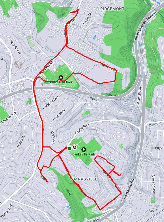
RATS #00473 in Banksville and Ridgemont
The following Saturday I got out for a longer RATS run, this one in Banksville and Ridgemont, crossing through Greentree a bit. Again, I was mainly targeting obscure alleys such as Henwood Way, Roseberry Lane and the misnamed Lampe “Avenue”. I also got the deserted office park vibe by running around Mall Drive (Parkway Center Mall, that is). What a wasteland.
But let’s start with Lampe Avenue. It is a small spur of a road off of Greentree Road. Most of the time, a chain blocks off the drive, but today it was open. It seems it is used by a construction company to store vehicles. It goes through stands of Japanese Knotweed until disappearing into piles of dirt and debris.
Lampe AvenueGoes NowhereLampe Debris
From here, I trekked back up Greentree Road to McKinney Lane. From this high hill, I could see the tops of buildings downtown. McKinney Lane shoots past large office park buildings and empty parking lots. Perhaps they would be more full on a weekday? However, this whole Parkway Center Mall development seems empty and outdated. I continued on McKinney past the offices until I found a small path down to the Giant Eagle, the last tenant.
Downtown Buildings Peeking OutPath from McKinney to Giant EagleDesolate Office Park
From here, I crossed over the Parkway West on Greentree Road and made my way back toward Banksville. Arbor Drive is just a little dead-end. From there I took Winchester Drive and Carnahan Drive towards Henwood Way. Carnahan is a bit tricky for running, as it loses sidewalks early on.
Greentree RoadWinchester DriveCarnahan Road
Now, one reason I had missed Henwood previously was it looked like a driveway off of Roseberry Street. I should have known better. It turned out to be beary welcoming street, after all. Further up the hill, past the drive into a trailer park, Roseberry Lane tops out in the parking lot of The Log Church, whose buildings ramble along the top of this hill.
Private StepsBoat Theory Henwood LaneChappel Ave
I returned along Carnahan Road to Banksville Park and that was it, a relatively unadventurous run.
Here are three runs from the end of October, 2021; Squirrel Hill, Westwood and another Windgap adventure.
RATS #00468 – Westwood
On a rainy Friday afternoon in October, I set out for Westwood again. My goal was several small streets I had earlier missed; Kearns Place, a section of Oakbrook Circle at the end of Kearns (before it dissolves into a path down to Greentree Road); Sky Way, appropriately named; and the ends of Valora and Winona.
Roughly speaking, this section of Westwood sits on the top of a large hill bounded by Greentree Road on the East and South and Noblestown Road on the North and West. On the highest streets such as Warriors Road, you can see downtown buildings peeking out through the trees. Kearns crosses Warriors and starts a long plunge down toward the West End. Right before it is blocked off, a little section of Oakbrook Circle juts off to the right. It is completely disconnected from the rest of Oakbrook Circle across the street and higher on the hill.
Looks like a drainage projectLooking up Kearns from dead-endWarriors Road and Kearn Ave with Solar Panels and UPMC Building in the background
Streets tightly packed with houses were interspersed with long wet alleys. Fall colors along Coverdale were especially bright on that rainy, gray day.
Highman WayWittman StreetFall Foliage Along Coverdale
The houses were generally large here with sizable yards. Some were decorated for Halloween, but I didn’t see any “natural” haunted houses, like I’ve seen on other parts of Pittsburgh.
Cute Blue HouseSkeleton Preparing to Dunk This mint green beauty could be Yours!Almost a Salt Box?
And that was it, three hilly miles and several street-ends done.
RATS #00469 – Squirrel Hill and Greenfield
RATS #00469 was a six mile run around Squirrel Hill and Greenfield to catch such major thoroughfares as Hempstead Street, Webb Street and Traynor Way. I’m not sure what possessed me to start from the track at Schenley Park at 8 AM on Saturday, but I think that’s where the City of Bridges group run was starting and I started with them.
Nonetheless, shortly after we crossed the Greenfield Bridge, I veered off to the right, down Greenfield Avenue and up Kaercher. Finally I took the right on Yoder and started the steep descent, with views of Oakland before me. Webb Street looks more like a broad driveway and ends above Yoder at a gated backyard.
Webb StreetDone with Gardening For the SeasonMusgrave and Yoder
Returning to Yoder as it crashes down the hill, I took the Alvin Street Steps to the top of Alvin Street. Alvin Street has a 16%-25% grade with sidewalk steps and also ends at Greenfield Avenue.
Top of Alvin Street StepsAlvin Street
My next stop was Traynor Way, so I returned up Greenfield Avenue in search of this elusive prey. Actually, it wasn’t so elusive, just camouflaging itself as a driveway. Eschewing camouflage altogether, a flock of colorful flamingos quietly graced the hillside.
Traynor WayEnd of TraynorRainbow Flamingos
Now for Hempstead, a quarter mile of old-style apartment buildings in the heart of Squirrel Hill. Such large scale, older apartment complexes are common in Squirrel Hill.
The Morrowfield Hempstead ApartmentsThe Wendover
From there, I just worked my way back to Schenley Park, happy that the heights of Greenfield were behind me.
RATS #00470 – Windgap & Fairywood
RATS Run #00470 was another visit to Windgap. I wanted to verify a few things. Does Summerdale go further than I thought? Is Acasto Way really on the wrong place on the map? How about Youghegheny Street and that area under the bridge?
I parked on Summerdale, above Chartiers Playground; finished up Celina Place and made my way to the Windgap Bridge; under it actually. It was a bright Sunday afternoon and no one was out.
Foursquare on ClarksonWindgap BridgeTracks Along Chartiers Creek
Going under the Windgap Bridge brought me to a small industrial park. Large warehouses stationed themselves at the ends of wide roads, meant for 18-wheelers. On the way out I noticed steel I-beams lazily placed along the road; perhaps in lieu of railings.
Windgap Industrial ParkSteel Beams for RailingsElectrifying Puddle
Coming out from the industrial park, I made a right on Youghigheny Street to it’s mulched end. It goes behind long backyards and ends near the railroad tracks. Now I went down Windgap Avenue and took the right on Summerdale. City Strides claims Summerdale pokes past Mayfair, but that’s not the case. Even back ten years, Google Streetview shows nothing but woods at the end of Summerdale.
Youghigheny Street Ends in mulch near the railroad tracksSummerdale and MayfairEnd of Summerdale
Now I sailed down Chartiers in search of the real Acasto. There it was, with a bright blue street sign, to boot! Alas, the Open Streets Map on which Strava and CityStrides are based have it in the wrong place, about fifty yards from its actual location. From there, I took a stab at Alora Way but didn’t feel comfortable towards the end. Perhaps I have another trip to Windgap in store!
Real Acasto WayCondemned vs Maintained, uneasy neighbors.
RATS Run #00467 Allegheny West, Allegheny East, Spring Garden
This post-work run was supposed to be a preview for a City of Bridges Run, but turned into an adventure all of its own. I started near West Park and was happy to see that the Ridge Avenue bridge had been completed. Several runs have been extended when I forgot it was closed and had to go the long way around.
Ridge Avenue Bridge Over Norfolk Southern Tracks
From there, I made my way through East Allegheny towards Spring Garden. I took Gerst Way over I-279. At East Street, I made the left and rambled up to Royal Street. I was looking for a small street, allegedly off of Bly Street. I hadn’t seen it on a previous run, and was hoping to find it tonight.
Gerst Way, Mooch!Looking up and down for street off of Bly
All I found off of Bly was an overgrown hill. Perhaps the “street” had been steps which have since fallen down. Oh well, I turned back to clear up some more mysteries. For instance, the mystery of Radnor Street and Callen Street, known on Google Maps as Vallette Street; did it exist? Was it passable? I returned to East Street, heading back into town, then turned left onto Rostock Street.
A couple of houses up, I came to the end of Radnor. A barrier prevented cars from going further, but I scooted around. I went deeper and deeper into the underbrush. Eventually I found it impenetrable. Perhaps in the dead of winter this would go through. Returning to Rostock, I came across an open manhole. That’s a long drop and I’m happy I didn’t have a misstep into it. Apparently, though, there is a whole world of manhole-lids. For the curious, check out “The Ultimate Manhole Covers” site.
Vallette/ RadnorVallette/ CallenManhole missing its cover
My next target was a spur of Kaiser Street off of Haslage Avenue. Those were high on the hill above me and I approached them via Vista Street. I had heard the Vista Steps had been re-opened after a two-year renovation project. In fact, a September 21, 2021 City of Pittsburgh Facebook post says, in part, “…This $750,000 Department of Mobility & Infrastructure project saw the preservation of the mosaic mural created by Linda Wallen and nearby residents.” I am a bit surprised at the cost of this, but I suppose these steps will last another 100 years. I’d hate to see what it will cost to fix the Troy Hill Steps. Anyway, it has one of those bike runnels, so that if you’re riding your bike up Vista Street, you can scoot it up alongside you on the steps.
Mosaic MuralsBike RunnelRenovated Vista Street Steps
Now, if you ARE riding your bike up Vista Street on a regular basis, you are one hell of an athlete. Between the top of the steps and Goehring Street, the grade is between 8% and 17%. While I have run up it a few times, I think it would be harder on a bike.
Elevation on Vista Street
Making the left onto Goehring Street and right onto Kaiser took me higher and higher. I was disappointed that Kaiser became a driveway at Haslage, with a rope across it and a guy fooling around in the yard. So, for now, I skipped it.
Doorway off of VistaGoehring at KaiserHunnel Steps
I like this area of Spring Garden / City View. The hills are punishing, the houses are surprisingly cool. At my back, Pittsburgh spreads out below.
Hunnel Street is another unbelievably steep road. Those wooden steps are pretty sturdy in spite of their wavy look. Just before the top of Hunnel, Frontier “Street” goes off to the left. In some regions, that would be called a yard. Today, I took a pass on it.
Frontier StreetGhosts on HomerLooking Down SteinStein at Rhine, notice steps on the right
Hunnel turns into Stein and goes abruptly downhill. Stein, the street, continues as steps past this decrepit white house. Can’t drive that way, of course. If it had a bike runnel, too, I suppose you could sail down the steps on a bike. As it is now, you’d just go bump, bump, bump on your bike. Since I was NOT on a bike, I just went clomp, clomp, clomp down the stairs to Homer Street. My time was getting short and after passing the ghosts of Homer, I scurried back to the Allegheny Center.
En route, I passed the Aviary and saw only one big bird was roosting in a tree. I was hoping it was Cody, but couldn’t really tell.
I’m writing this blog on March 12, 2022 and am very depressed by the current state of world affairs. I’m sad for Ukraine, angry at Russia and exasperated by the U.S. response. Nonetheless, here are four runs in October, spread across the city from Belmar to Fairywood. Hopefully recalling better days will brighten my mood, and yours too.
RATS #00463 Belmar
RATS Run #00463 in Belmar was another effort to finish up some small streets and dead-ends in the area. It was just to the northwest of RATS Run #00462. I started on Meade Street and caught Calway Street and Heart Court right off the bat. Then I made a long trek on Upland and Apple past the Negro Opera House. I’ve remarked on this house before. Now, it looks like renovations are underway. Yay! Perhaps these will be completed?
Negro Opera HouseStone Steps
Moving on, my next goal was Mingo Street. Earlier, on a run with Rich, I balked at going past the barriers at the bottom of the hill. Today, though, I wanted to take a closer look. It turns out that Mingo Street does, indeed, continue. It passes two houses which seem ready to fall down. Reflecting on yesterday’s run on Hallam Street, I expect these houses to be gone without a trace in ten years.
Up Mingo StreetPast Decaying HousesAround the leaf strewn path You’ll find cool toy trucks
I followed Mingo around the hill. It emerges onto Latana Way, where kids still play with trucks and a very red shed hosts basketball tournaments. Turning back onto Grotto Street, I crossed Lemington Avenue and made my way onto Elrod Way. Tucked up the hill was the alley of my destiny, Mayo Way.
One end of Mayo To the other end of MayoBut please, no parkingJoshua Street
I had some Mayo sandwiched between two dead-ends. Along the way, I daresay I surprised an old guy hanging out in his garage, but I made sure not to park it anywhere. To be honest these “No Parking” signs crack me up. I mean, really? Is this a problem? People parking in front of an inaccessible, broken down garage? Or is it that “No Parking” signs are more durable than your regular signs?
Anyway, moving on, I made it to both ends of Ebel Street and, again, verified that I’d be sanctioned heavily if I trespassed onto Highland Drive, a former site of the VA Hospital.
St. Peters Cemetery Cornerstone Baptist ChurchNo go onto Highland Drive
From here, I made my to Easton Way and through the Paulson Playground. On a warm afternoon, this place is swarming with kids. Today was quiet, though. Then it was a short jaunt up Clifford Way. I did not see a Big Red Dog, but he could have been hiding in the dense undergrowth.
Clifford Way UpClifford Way DownPaulson Playground
From here, I made my Dreary way across the Larimar Avenue Bridge and followed Relic Way to its bitter end. For some reason, the GPS thinks I ran through yards, houses and sheds instead of straight down Relic. And that was it, a solid 8.84 mile run.
RATS #00464 Fairywood
RATS #00464 was on the opposite edge of town; a few Pittsburgh streets off of Ingram Avenue and then into Fairywood. I was a bit surprised to find an historical marker for Pittsburgh way out here. I suppose it’s a border sort of thing.
Edge of PittsburghOld Sharp EdgeThis Way to Cellone’s Italian BakeryEnd of Napor
After running halfway across the Steubanville Pike Bridge, I came back skirted past an old “Sharp Edge” restaurant, with inviting red awnings. However, the windows were dark and the place was deserted. Closed. I have heard, though, that another restaurant will be moving in.
I ducked under the bridge to run along Napor Boulevard. Napor runs along the edge of an light industrial park on the edge of Chartiers Creek. Cellones is a large scale Italian bakery which has facilities here. Chartiers Creek looked peaceful.
Bridges Crossing Chartiers Creek Chartiers Creek
Coming back to West Steuban Street, I crossed over Ingram Avenue and onto Woodmere Drive. An Amazon warehouse sits at the end of Woodmere. With a quick left then right, I found myself back on Industrial Highway. While only 3/4 of a mile long, it is built like a full scale highway. I’m always a little scared to run on it and really push the pace. Today was no exception, as my leisurely 10 minute pace increased to a 7 min/mile pace before I got winded and had to drop back to an 8:30. Great place to sprint.
Chartiers Valley LaneNo Pedestrian Access
I intended to go to the end of Industrial Highway, or as Strava calls it, “Chartiers Valley Lane”. However, the road went through a gate, marked “No Pedestrian Access”. Hmm, that seems pretty clear. Hey, I went further than the Google Streetview car did! It looks like Maple Grove Aggregates is the only thing down there.
I turned back toward the heart of Fairywood. As I’ve mentioned before, there used to be a housing development here. That one is empty land now. An empty pool is starting life over as a forest, tree by tree. But there is a housing development on the other side of Broadhead Road and one of Pittsburgh’s biggest landowners, the URA is trying to develop this.
I finished up running along Windgap Road. That’s a street in bad need of sidewalks. I did get a peek into the 25 yrd long Medford Street before finishing up in the Ingram Crafton Shopping Center.
RATS #00465 Brookline
RATS Run #00465 was a quick run in Brookline to finish up alleys like Pontoon Way (both sides), Minor Way, Redbird Way, Mossrose Way and Georgette Street among others. However, it was already dark by the time I got going, so I don’t have many pics. I think this neighborhood, nestled between Glenbury Road and Carmalt Field is pretty nice. It is all suburban residential, but the hills and alleys give it a mysterious air. From the end of Wychelm you can see the lights of downtown.
Pontoon Way Ivy GarageWychelm Street With City Lights
After going up to the end of Wychelm, I went down Parklyn, catching the left and right to get to the end of Mossrose Way. I returned along the long stretch of Mossrose, where it rises above the houses as a lane covered in pine needles. Making two rights, I decided to be bold and go down Georgette Lane. It was not, indeed, a driveway, but rather a respectable, short street with a house at the end.
I finished up Minor Way and went to the end of Redbird. That alley just bailed out at the top of a hill into someone’s backyard. Whoops! A wet, short night run all done.
RATS #00466 Duquesne Heights and Mount Washington
Returning to daylight and hills again, RATS Run #0466 wrapped around Mt. Washington and Duquesne Heights. I spent some time on the Emerald View Trail, which encircles this section of town.
High VoltageCielo Lane
Cielo Lane juts off of Fingal Street to provide some nice views of the Point. I tromped down to Greenleaf, which dives toward the West End Circle. However, about half way down I took the steep right onto Homer Street. There are only a few houses there, perched high on the hill. Homer leads directly into Emerald View Park.
Homer StreetLooking Down Into West EndEmerald View Park EntranceEmerald View Park Trail
I took Emerald View until I popped up on Grandview. From there I completed Augusta Street, en route to Wyloa Street. I thought I had completed Wyola, but it turns out there is a little spur which remains to be done. However, I got to traverse some of my favorite steps, Greenleaf and Well.
End of AugustaMore Emerald View ParkGreenleaf Street StepsWell Street
Now, my next target was Chess Street, but that was well on the other side of Woodruff Street. I took a “shortcut” by going up the Mann Street Steps to get me closer to the southern end of Mt Washington Park. I was appalled by the lack of a retaining wall behind condos being built on Grace Street. I can already see the road being undermined.
In the woods I lost my sense of direction and ended up on Norton, instead of Spahrgrove. Chess Street, wasn’t much to see, in spite of the cobblestones.
Mann Street StepsWhat! No Retaining Wall?End of Chess StreetChess Street
From here, I ran back to my car on Bigham. Damn, this area is hilly!