Today’s run was carefully scripted and went off pretty well, with only a couple of surprises. Honestly, I wasn’t too motivated for this run, but figured I’d knock out a few streets I had missed while running with George a few months ago.
This area is Perry South, sometimes called Perry Hilltop. Most of the houses are variations of brick Pittsburgh four-square, mostly built between 1900 and 1925. Many are in disrepair and the “Condemned” blue sign of death is not uncommon. To be fair, there are a few brilliantly restored turreted houses. I lived in an old, 1900-era house for many years and can attest that maintenance and upkeep is very costly. As for restoration, that’s another tax bracket. There’s also the occasional high-rise apartment building.
Steelworkers Towers Apartments
Stedman Street with Split Lanes
East McIntyre Street
West Burgess Street
Turreted House
It was a quiet morning, but the neighborhood was already perking up, with folks washing cars, waiting for the bus and going to church. At Wilson and Drum, singing burst through the walls of an otherwise nondescript building; it was a church. The lead vocalist was as good as any female jazz singer I’ve heard. One day, I’ll just sit outside and listen.
Not far away is a curious memorial to Negro League Baseball. It is a corner lot with a semi-circle of panels, like super-sized trading cards.
Corner Lot Baseball Cards
And, it wouldn’t be Pittsburgh without some Belgian block streets and steps. Looking at the map, I wondered why I never had been on Cutler Street. Then I saw it, a steep culmination of cobblestones and steps. Wouldn’t be surprised if they close this off after the first snow.
Bottom Cutler Street
Top of Cutler Street
There were some steps off of East McIntyre which seemed to go nowhere. Then, I saw that the bottom steps had merited a “No Trespassing” sign. These hillside garages were cute, but I couldn’t decide whether they were somehow attached to the houses on the hill above or for the houses across the street. Russell Avenue looks absolutely manorial in this picture, in spite of being a long, rather deserted dead-end.
East McIntyre Steps
Hillside Garages
Russel Avenue
That’s about it for now. There are still many streets in this area I need to cover, so expect more runs from Perry Hilltop. Who knows what else I’ll find?
Whoo! My 300th time covering new streets on a run through Pittsburgh! This run was rather adventurous for me, covering streets from North Homewood to Lincoln-Lemington-Belmar. It is a residential area, with a few churches and small businesses. The houses tend to be older, occupied and in decent shape. There are big yards and lots of open spaces. There are also crowded streets, alleys used as dumping grounds, broken staircases and testy drivers.
Homewood Snack Mural
Arbor Street Steps
My intention was to ascend the steps going from Lincoln Avenue to Arbor Street. Unfortunately, they were severely overgrown, so I ended up just running up Arbor Street. It was a steep one and there were several men in the street, cleaning brush and arguing. It was a little uncomfortable running past this group but happily they ignored me. Arbor Street makes a steep, sharp turn to the top of the hill where it becomes Pointview Street. There’s a small square of streets on this hilltop, which I had visited the previous day, working with Allegheny Cleanways, a group that is cleaning up illegal dump sites around the county. Pointview intersects Bower Street, another side of the square. One end of Bower Street are steps leading to Lincoln Avenue.
Bower Street
Bower Street Steps
The other devolves from a decent residential street to a back-alley strewn with trash and cars. I continued along the alley until it started to curve closely around a house, like a driveway. I scooted back the way I came, noticing deer among the derelict cars and trucks.
Bold Deer Hanging Out
Old Mack Rusting Away
Making the right onto Hyatt and then Hedge Streets, I noticed a driveway into that alley. Skull-decorated “Do Not Enter” signs adorned the entrance. Glad I didn’t go all the way around that building! While many areas I cover are empty, deserted streets, this area was alive with kids riding bikes, men walking home from the Dollar Store and people putzing around their yards. I got more than one quizzical look, as I suppose old white men don’t run up there too often.
I made my way to the start of Olivant Street, which has a long and meandering path. On one side, glass filled steps made their way from Olivant Street to a rather nice ball field. On the other, houses shouldered up the slopes.
Olivant Street
Steps to Paulson Playing Field
From here, I crossed Paulson Avenue and explored the dead-end remains of Olivant Street on the other side. At the end of Olivant, as far as publicly accessible roads go, was a Duquense Light Power Substation. It’s desert-like gray gravel contrasted sharply with the surrounding lush green woods. Here, too, people were out; weed-whacking and taking in garbage cans. The streets up here are all dead-ends. Some are marked “Private” well before the end of the road. While frustrating to me, I don’t go down those roads.
I did manage to get to the end of Olivant Place, a narrow lane which became more and more grassy. I was awarded by the sight of a flock of wild turkeys, five or six large ones and maybe six smaller chicks. (Of course, turkey ‘chicks’ are rather large as well.) Startled, they abruptly scooted down the slope and flew into the trees. I only caught a fleeting photo of them. Usually the only Wild Turkeys I see are empty bottles. Must say, from the hilltops you get a pretty good view.
Flying Wild Turkeys
Montezuma and Apple
From here, I just ran a few more, flatter streets, before completing Paulson Avenue and heading back to my car. Eleven miles in the bank and some new areas covered.
More about the 300 runs
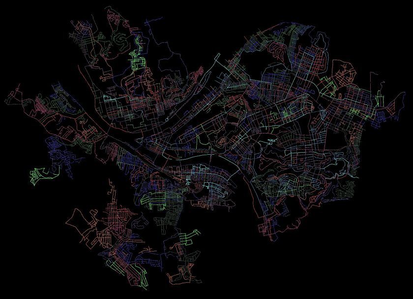
Pittsburgh Streets I’ve Run
I use a couple of methods to estimate how much I have done in Pittsburgh. The “golden standard” is my map of the Pittsburgh, where I color in each run as I do them. When the map is incorrect, I make notes. Streets that don’t connect are stricken through in black, additional streets are marked. In my ‘rules”, I state that doing 1/2 of a dead-end is acceptable. That is a bit weak, though, and generally, I’ll go to the end unless it becomes a private drive. I’ll be done when my “golden standard” is complete and anything I’ve ‘missed’ has an explanation such as “doesn’t go through”, “is a private road”, “not safe for pedestrians”.
Another method is CityStrides, which processes Garmin route data to determine which streets are completed. It uses a concept of “Nodes” to determine if you’ve completed a street. Do all the nodes, you’re done. Miss a node and and you’re not. With that being said, CityStrides has me at 58% of Pittsburgh streets completed. If this were all linear, that would mean another 217 runs. Of course, it is not.
I estimate I’ll need 90-110 more runs to complete the city. It depends greatly on how much I cover per run and how efficient I am at covering streets. Either way, it looks like I’ll be done sometime between New Years and Easter, 2021.
The sun is setting earlier. I’m not getting out earlier. The result? Lots of sunset and dusky runs. This short, steep run was in the Carrick area. Lucky for me, I wasn’t going up and down the hills, just across. Even so, I had over 100 feet of elevation per mile.
I started overlooking St. Adelbert Cemetery along Brownsville Road, then sauntered past backyards and into the cemetery itself. Just putzing around for information about it, I came across this “Pittsburgh Cemeteries” blog, which is pretty interesting. In an older section, trees have re-asserted themselves around the plots, making for a spooky evening scene.
St Adelberts and Southside Cemeteries
Wooded Graves
I made my way down West Meyers Street. It actually dead-ends, for cars, but a little wooden staircase leads to the end of Mt Joseph Street. It was rather small, but is actually an official City of Pittsburgh stairway. From there the streets generally went “parallel” to Brownsville Road. “Pittsburgh Parallel”, that is; they followed the same contours and did not intersect. As is typical for the area, it is densely packed with two and three story houses. This one caught my eye, with it’s red and teal trim.
Neat house
West Meyers Steps
I worked my way back up the hill towards Brownsville Road, crossing Newitt Street from time to time. At the top, where it meets Bownsville Road, it has street steps. The picture of the parked car parked gives some scale for that slope.
Newitt Street
Pretty Darn Steep
The night came on fast and I didn’t get anymore pictures. But, it was a worthwhile run, covering some streets and chipping away at the vast network that is Carrick.
Good morning! Last Sunday I mapped out a little run in Brookline and left some room for exploration. Explore I did, crossing over into Banksville as far as Greentree, then coming back through Mount Lebanon and Dormont.
Brookline
Many of my “goal” streets were in Brookline, where Brookline Boulevard curves down to West Liberty Avenue. It is the site of the “Brookline” sign and has several small streets crammed together. The Boulevard circles a small section of lower ground packed with small houses. A few sets of stairs, such as Bodkin Steps and Kenilworth Steps rise out of the bowl. After the run, I feasted on strudel from DeLuca’s.
Brookline Up Close and Personal
DeLuca’s Bakery and Deli on Brookline Boulevard
Bodkin Steps
Kenilworth Steps
Wenzell and Louisiana
When Brookline Boulevard crosses West Liberty Avenue, it changes name to Wenzell Avenue. Wenzell Avenue has spotty sidewalks and rather steeply drops through Beechview to its terminus at Banksville Road. Some sections of Wenzell border the Borough of Dormont. Given this topography, it is no surprise this section is riddled with steps. Neeld Way, dropping out of Beechview streets, is a rather long set of steps going from Candace Street to Wenzell. Wenzell, itself, has a long section of street steps as it drops to Banksville Road.
Mural Under Broadway
Neeld Way Step Entrance
St. Frances of Neeld Way
Wenzell Avenue Street Steps
However, the most impressive and interesting sets of steps is Louisiana Street. Just after the Neeld Way steps dropped me unceremoniously onto a shoulder of Wenzell Avenue, I looked up and saw the sign for Louisiana Street. In the summer, it looks like one of the many street signs to nowhere, swallowed up in knotweed. However, brushing aside the branches, I found myself in a long shady step tunnel. Along the way, a house arose on the right. It’s common to find ruins along stairs, but this large cream colored house looked pretty nice. Continuing as the stairs become a causeway, I came across the house’s mailbox and garbage cans. A living, breathing orphan house! Shortly after, it rises again to a streets blending into Dormont. Taking Ordinance Avenue steps out, I circled around to see it again.
Wenzell and Louisiana
Louisiana Steps
Louisiana Mailbox
Ordinance Avenue
Orphan House
Now, when I came down to Banksville Road, I was blocked by construction from crossing into Banksville itself. Not to be denied, I followed small streets to Potomac Avenue, whereupon I crossed over and ventured, for the first time, into Banksville.
Banksville
Banksville Neighborhood
Banksville is roughly bounded by Banksville Road, Greentree Road, the Parkway West and McMonagle Avenue. I was not familiar with the area at all. I crossed at Potomac Avenue, took the flat Banksville Avenue to steps and found myself in a curious area. On one hand, it looked very suburban with a range of houses from smaller 1950’s ranches to new McMansions. On the other, The Log Church was a rather hidden church complex near mobile home parks. Most of the roads did not have sidewalks. The steps from Banksville Avenue to Carnahan Road were impressive in length and the Anise Steps ended in the shadow of construction along Banksville Avenue.
Colorful Fuel Depot
In the Shadow of Construction
Younger Avenue
Artillery Lawn Ornament
Banksville to Carnahan
Anise Way
Boat Theory
Finishing Up
After exploring Banksville a little, I headed back to Potomac Avenue to finish off this run. I was trying to complete a half-marathon distance, which would wrap up my running goal for the week. While I’ve stopped paying attention to hills when planning, Potomac Avenue was a killer in the eleventh mile. I came across a chalk square, which happens from time to time, as I cross paths with other adventurers.
Keeping the Gnomes In
Glad to be back
Potomac Ave Steps
Chalk Square Along Potomac
Potomac and Banksville
I still had a mile or so to go when I got back to Brookline, so I completed Bayridge Avenue and most of Harex Way. That’s a cool name, “Harex”. Anyway, with the 13.1 miles complete, I stumbled into DeLuca’s for my post-run treat. Yum!
A six mile run, with a few ‘targeted’ streets to begin and some exploration to end. Another Carrick evening run, which, in my humble opinion, traced a route which could be a dog drawn in Picaso’s style. Do you see it?
But first things first. My ‘targeted area’ was a small set of streets wedged between Brownsville Road and Becks Run Road. Athena Street was the entry-way and I was pleased to find some classical yard decorations right off the bat. Athena Street itself, was more of a country lane.
Attempt at Peristyle Garden
Athena Street
Athena Street took me to a small enclave of two and three bedroom brick homes nestled below it. Beyond the unexpected interruption of Nuzum Avenue, there wasn’t too much to see here. Once done circling the block, I popped out on Brownsville Road and hopped over to Parkfield Street. The drive behind Carrick High School is actually listed as a street, and, luckily was still open and had a nice view of the residential valley below.
Mother and Child Sculpture
Houses below Carrick High School
Coming up Santron, I saw three or four tweens grass-sledding and giggling while moms watched for cars. “Grass-sledding” is a high form of sport wherein you take a large cardboard box, place it on the edge of a grassy slope, and whizz down gripping the sides, trying to stay on. It is summer practice for the winter sledding season.
Eventually I came down Westmont Avenue, meeting the Mother and Child sculpture, with its greenish patina as Westmont met Ravilla. Ravilla, which I’ve already traversed, does have a set of stairs smack next to a rather active house. I missed the steps my first time through, but today took them down to Almont. I encountered another lending library, very emphatic in its instructions to NOT BRING THE BOOKS BACK!
Ravilla Steps
Free books – Don’t Bring Back!
From here, I wound my way to Maytide Street and followed it to Saw Mill Run Boulevard. Maytide starts promising, with decent sidewalks, but as it descends, it deteriorates into broken sidewalks and then no sidewalk. There were a couple of step flights reaching up into the hillsides, but they had the “Thou Shalt Not Pass” bar across them. Saw Mill Run is not runner friendly. At least there are so many parking lots and businesses you don’t have to run in the street. This area has the prototypical used-car lots, with shiny streamers and lights. An older dealership had this mural, replete with the Pittsburgh skyline, traffic, houses and greenery.
Balcony overlooking Maytide
Car dealer mural
Now my dilemma was finding my way back. I spied some steps and made my way to them. The first set was confusing. They looked like bona fide city steps, but after going up, I felt like I was on someone’s front porch. That didn’t feel comfortable, arriving unexpectedly on someone’s porch in Carrick in the dusk without even a six-pack or bottle of wine to share. So, I went down and checked out the next set of stairs, Sinton Avenue. These even had a street sign so they must be legit.
Public or private?
Sinton Avenue Steps
Looks like a second set was on the left
Sinton Avenue went up several flights, finally dropping me off near the high-school. There was one, minor detour, but except for that missing block, they went straight up the hill. Love the street sign of Marland Way and Sinton Avenue where steps meet alley. It was all the more incongruous in that the alley had run out of pavement at this point and was just a grassy space between yards. Got to love the sign department.
Sinton Avenue
Whoops, a detour
Sinton Avenue Continues
Weird Intersection
That brought me back to Brownsville Road and the civilization of Dunkin Donuts. Another section of Carrick explored, another doughnut devoured.
This day’s run was more about distance than making sure every street was new. I did, however, have a few target streets on my mind and covered most of them.
I started in Oakland. While it was moderately busy, it was nowhere as crowded as normal. The city has closed a number of streets so that restaurants can spill out into the street.
Forbes Avenue in Oakland with Cathy in the distance
I progressed up to Centre Avenue, doing the steps which go from Centre Avenue to Ewarts Street. Saw some attractive butternut squash along the way, as well as mysterious gates and doors.
Butternut Squash out for the night
Postern Gate
Ewart Street Steps
Ewart Street brought me to Iowa Street. From there, I did a few cross streets. These were long residential streets, very typical of the Hill District.
Iowa Street
Typical Upper Hill
From this point, as dusk settled in, I found myself on dim steps and small roads. From Webster Avenue down to Ridgeway and then to Bigelow Blvd, the steps are a very direct way down. The roads were quiet and empty.
Orion Street Steps
Hancock Street
King of the Hill
Harding Street to Bigelow
Finally I crossed over Bigelow Boulevard on the pedestrian walkway. While it looks a bit threatening, it was well used and much better than dodging cars. I crossed over the Bloomfield Bridge and sailed down 42nd Street.
The return up Fisk was easier than I expected. Actually, with all the hills I’ve come across, I didn’t feel it was too bad. I finished out by returning to Oakland. A nice eight mile run! It’s been awhile since I just popped out a longish run on a weeknight. Yay!
This August was hot with fifteen days of highs above 85; and busy, with a move. While I love this project, sometimes it is a chore. So in August, I’ve been slightly more relaxed about running with friends or just for an adventure, without regard to the streets I’ve covered. I’m keeping my knee problems at bay with a combination of new pair of shoes and using KT tape. (I’m back in a new pair of Altra Escalante 1.5’s.)
As of end of July 2020
As of end of August 2020
I’ve made large strides of progress in the South Hills, including Beltzhoover and Carrick, and continue to fill in the gaps in the North and West sections of Pittsburgh. August’s 97 miles was considerably more than July, and doubled my elevation, increasing it to 11,189 feet. Of the seventeen runs I recorded in August, fifteen covered new streets.
Without further ado, here are the rest of the August runs.
RATS #00279
RATS #00279 Allentown & Beltzhoover
Just a short evening run to cover some streets before it got too dark. Looking at the pictures, maybe it was already too dark. Long dim streets filled with kids playing and adults coming home from work.
Lamps along fence
Ghostly Ivy Enshrouded House
Spooky Steps on Bernd Street
RATS #00281
RATS #00281 – Carrick
Another evening run, this one in Carrick with its busy streets and close houses. Georgia Avenue dead-ends into a ghostly cemetery, especially at dusk.
Setting Sun
Grimes Avenue
Dusk at the dead-end
RATS #00284
RUN #00284
Hammering it out with the evening runs in Carrick. This one took me down Overbrook Avenue to Saw Mill Run Boulevard. The uphill slog was epic. Nighttime phone pics + running = streaks.
Maytide Street
Whee!
Overbrook at Saw Mill Run
RATS #00286
RATS #00286 – Beltzhoover and Bon Air
Finally, a daytime run! This Sunday run was intended to clean up a few streets Erin and I had missed the previous day. Turns out, one of the alleys in Bon Air which I had ‘missed’ doesn’t exist anymore. No worries, there were plenty more alleys, with more cars rolling down them than you might expect! If it sounds like a broken record, it is… at least you can still hear “Tubby the Tuba” on Youtube. Between this run and the previous, I covered 95% of Bon Air.
Bernd Way
Parked Too Long
Carrick
Dead End
Garage Door Art
Hills and Houses
Brick Alley in Allentown
Tree Down in Carrick Alley
Broken Record, “Tubby the Tuna”
RATS #00287
RATS #00287 – Brighton Heights
For a change, I headed north to Brighton Heights and traversed the small streets ending high above Route 65. These small streets are quite the mix and you can see the smokestacks of Brunot Island from several. Davis Avenue ends in steps down to Rt 65 and one house on Verner Avenue sported a manatee guarding its mailbox. That’s a first.
Davis Avenue Steps
Calico Purring in the Parking Lot
Brunot Island’s Smokestacks
The only Mailbox Manatee I’ve seen
Neat house
RATS #00288
RATS #00288 in Bloomfield, Friendship and Garfield
This was short run to catch some alleys in Bloomfield. Within the first mile, I had most of the target streets done, including all of Jordan Way in Garfield. I was surprised to find the painted doors along the alley. Not only were there dozens of bird houses in that tree, there’s also a “Little (Bird House) Library” in front of it.
West Penn at the end of the alley
Bird Houses Galore!
Alley Art looking at you
More Alley Art
Sun setting along alley
RATS #00289
RATS #00289 in West Liberty
This last run, on the last Saturday of August, hit another section of alleys and streets in West Liberty. I think the auto artifacts along an alley’s garage and the yard decorations were the most surprising finds of this run. I get a kick out the various little libraries I see.
Auto Artifacts
watch out for the dino dogs!
Norm Weiss
White Rabbit Salon
Relax…
Hills and Houses
Finally, there were several sets of steps; long ones like Ray Avenue and Belle Isle Avenue. There was also a shorter set of steps, Templeton Street, but the lower section was too overgrown to use. Ironically, the City of Pittsburgh’s steps webpage give these a fairly high score. Here’s the Belle Isle set.
Belle Isle top
Belle Isle keep going
Belle Isle and on
Belle Isle and on and on
Here’s the Templeton set.
Starting at West Liberty Ave
Becomes overgrown
From Woodward to Plainview
And finally, here’s Ray Avenue.
Start at West Liberty
Up and
Up, now past yards
Now crooked
On to September
So, that’s all for August. I’m looking forward to cooler temps and a reprieve from moving boxes.