Starting under the Birmingham Bridge, near the Boat Ramp off of 18th Street, I crossed over the bridge and embarked on some more exploration of the Lower Hill and Uptown. While Forbes Avenue and Fifth Avenue take thousands of people downtown, it is rare for people to venture up the slope for even a street or two. There are reasons, of course. Most of these streets spill out onto Kirkpatrick Street and stop. Further into the Hill District, Centre Avenue is alone in continuing all the way through Oakland. Webster becomes a small residential street after Herron Avenue while Wylie stops entirely there.
It is also generally poor, rundown and is considered dangerous. Nonetheless, I needed to do these streets. Along Fifth Avenue, not far from the Birmingham Bridge, there’s a set of wooden steps (Rising Way) which take you to De Raud Street. One section of De Raud winds along past a couple of abandoned buildings to a little playing field off of Kirkpatrick Street. I was nervous about running there, but had no problem. In fact, the playing field had been used as a garden and several folks were out there in the cool early evening cleaning it up. (Don’t confuse Rising Way with Rising Main. Rising Main is in the Northside and is much longer.)
Rising Way Steps from Fifth to DeRaud
Faces at DeRaud and Wyandotte
I actually did the Rising Way steps twice, because I looped around Kirkpatrick Street upon exiting the park. The second time around, I took a left to the corner of DeRaud and Wyandotte. A brief look at Strava indicates that Wyandotte continues on the right for a bit. In a sense, it does, but not for cars. It continues as a long set of steps and walks.
Wyandotte starts
and keeps going
and going
to its end in a path
While not shown, when you make a left off of these steps at the end, you’re at the end of Diaz Way. There’s a lone house there with cars parked in front. That’s the only house on Diaz until you get to Wicks Street about a quarter mile away. Unfortunately, Diaz Way has been trashed for years. A fence on the uphill side holds back layers of leaves interspersed with cans, bottles and other debris. Halfway to Wicks Street are the Lombard Street Steps. The lower section takes you to Colwell Street, while the upper side takes you to Lombard Street.
Lower Lombard Steps
Upper Lombard Steps
Colwell Street
I took the lower section, making a left to the end of Colwell Street, which, I must say, is blocked off and doesn’t actually meet Wyandotte anymore. Turning around, I got that view of the downtown skyline, a mile and millions of dollars away. Returning to Diaz Way took me to the Wicks Street Steps, very similar to Upper Lombard Street. Here, though, the steps don’t plop you out onto a street, but rather a narrow sidewalk. The street is held back by a shoulder-high retaining wall, even in front of a house.
Wick Street Steps
Wick Street Walkway
Animal Silhouettes on Lombard
Once up these steps, the small roads curve to Dinwiddie Street, where scores of homes have been reconstructed or built anew. From here, I wandered along Reed Street and Colwell Street but eventually worked my way to the end of Crawford Street. Crawford ends in Cliff Street, aptly named because it sits high above the Veteran’s Bridge and the East Busway. Cliff Street ends at a private walk strewn with leaves.
End of Cliff Street (this section, at least)
Working my way back to the Birmingham Bridge, I came across the construction at Mercy Hospital and some very stoic dogs. You might even say they were wooden.
RATS #00313 – Manchester, California-Kirkbride with a little Perry Hilltop thrown in
This Monday evening run took me through the Northside, into Perry Hilltop and down through California-Kirkbride. The early evening in this area is quite active. There’s still lots of renovations going on in the Mexican War Streets. Kids are playing before dinner and men and women are getting home from work. My route meandered through the Central Northside, with its narrow streets eventually rising up Buena Vista Street.
Buena Vista is flat near West North Avenue, but by the time it passes behind Propel School, it has a 14% slope. It gets as steep as 17% before leveling off in three tenths of a mile. On my way down, I took the picture below, surprised how close Trimont seemed.
Looking Down Buena Vista
Yale, another closed street
Steps from Overlook to Rolla
Overlook “intersects” Rolla with a nice set of steps. Rolla itself is just a short street from Buena Vista to Yale Street. Yale is blocked off and has been for a number of years, apparently. A cursory internet search didn’t turn up any specific reason, but checking the real estate site revealed that most lots on Yale are owned by the City of Pittsburgh. The other Yale Street in Pittsburgh is in Carrick.
That aside, one end of Rolla Street hits Buena Vista while the other drains down a steep staircase to Irwin Street. Those steps apparently had houses and other steps branching off from it. Towards the bottom, a sidewalk veers off of the steps to the Propel School grounds.
Rolla Steps
Towards the bottom
View from Irwin
From here, I trotted over to California-Kirkbride. It is not a large area, but has bedeviled me with its grid of streets, for some reason. Ah, I know one reason, some of the “streets” are paper streets, which quickly ruin a planned route. Nonetheless, there’s things going on there recently. Many old houses have been demolished and lots have been landscaped. There are new houses and a little bit of artwork on the lonesome walls. One of the remaining buildings hosts a faded sign for “Clays”, a bar.
Embryonic Twin Mural
Clays – Interesting Building Still Remaining in California-Kirkbride
At this point, I had done most of my planned route and decided to venture further up California Avenue. I ended up in a land of exits and entries for cars where it intersects Marshall Avenue. Not sure, but do you think I can get to Route 65 or Route 19 from there?
Five signs for Rt 65 and three for Rt19
I finished off exploring by doing Ridgeland Drive. For the day’s final set of steps, I discovered this small set of steps at the end of Ridgeland Place going to Oliver High School and Brighton Road.
From here, I just made my way back to my car. It had been a good run with lots to see.
Early on a Sunday afternoon, I got out and ran to catch some streets in Mount Washington. These were not the touristy streets near Grandview, but rather small residential streets and alleys on the backside of Mount Washington as it slides toward the Saw Mill Run ravine. Between the lunchtime start and an early breakfast, my stomach was grumbling right from the beginning.
Starting Point
Stairs are as ubiquitous here as Steeler’s flag. Here’s a quick collage of some of the steps I did.
Whitworth Street Steps
Dewitt Street Steps
Gray up to Dillworth Street
Sandwich Way
The area is filled with houses on impossible slopes packed right next to each other. The foliage was beautiful and I got a kick out of the fun Halloween decorations. Many of the houses were apparently built from the same plan, with slight variations.
Not every street was gorgeous. Some of the alleys in the hollow are lined with worn houses and old cars. I didn’t get a good pic of the car on blocks, but its age was notable. Just how long has it been on blocks?
Wrapping up on Sandwich Way and Dillworth Street, I glanced over and did a double-take. There were two live chickens peacefully pecking around the grass. If only I had had some buns and mayo! Speaking of double-takes, just up the street, Dillworth Street intersects Dillworth Street.
Now with my empty stomach was making louder noises, I scooted back to the car and headed off to lunch. Hmm, chicken sandwich anyone?
Lincoln Place is the southernmost neighborhood in the City of Pittsburgh. If you take the Glenwood Bridge out of the city and keep going along Mifflin Road, you’ll come to it. There are three Pittsburgh neighborhoods down here, Hays and New Homestead being the others. Lincoln Place is, by far, the most populous.
Lincoln Place
I parked at McBride Park, intent on doing the grid of streets to the right of Mifflin Road. McBride Park, which is on the top of a ridge overlooking the neighborhood has a playing field, some tennis courts and wide open fields. There are a couple of pedestrian-only entrances which enhances its neighborly feel.
Looking Out onto Lincoln Place
McBride Park
Speaking of the neighborhood feel – it is solidly suburban. Small, two and three bedroom houses at the top of the ridge give way to sprawling houses at the bottom.
View from the top
Larger houses with lots of land
This looks like a good neighborhood for trick-or-treating. Nearly every house is decorated, some more profusely than others. There is even a small graveyard off of Nollhill Street. I actually came upon it through a small path from Orchid Street where I can imagine a preteen Disney movie unfolding. You know, someone intrudes upon a house while the parents are at a Halloween party, so the kids must hide out in the graveyard which has its own dangers.
Is it haunted?
Nollhill graveyard
Completing these streets, I crossed over Mifflin Road and explored a bit. Interboro Avenue has the distinction of being parallel to itself for about half a mile. Physically, they are two distinct streets, as my feet can tell you. McElhinny Avenue is interesting in that one side is full of houses whereas the other looks out onto a wilderness. Turns out, most of that wilderness is just a couple of lots combining for 50 acres of land. Across that “wilderness” is the Allegheny County Airport.
Working my way back to McBride Park, I was pretty pleased. Over seven miles in another one of Pittsburgh’s great neighborhoods.
A slight detour and no easy path to the Swindell Bridge. Boo!
And that, my friends, was this run in a nutshell. Starting out near work, I made it to the same area I had run; Perry Hilltop. This time, I hit a few small streets, University and Langley, from the Perrysville Avenue side of the hilltop. Turning onto University, these neat mosaics jumped out at me, hidden though they were, on the back side of nondescript brick building.
Peacock
Cat
Butterfly
University is a short dead-end and my next street was Langley. It goes steeply half a block and then says “Oh shit, this is too steep” becoming steps to the next, flatter section. These weren’t the only steps I encountered. One wooden set of steps, named either McKee’s Lane (according to the city’s step website) or Cheese Street (according to Google Maps) took me from Perrysville Avenue to Burgess Street. Burgess Street, itself, has sidewalk steps as you power your way up to Osgood Street.
Langley Street – Step portion
McKee’s Way, aka Cheese St Steps
West Burgess Street Steps
From here, high on the hill overlooking I-279, I made a fateful decision. If I turned now, I could finish off Brightside Avenue and have a nice 5-6 mile run. If I took Suffolk Street, I could hopefully take the Swindell Bridge back and have perhaps a 7-8 mile run. It was sunny, cool and I was feeling good, so I decided on the later and turned onto Hazelton Street.
Hazelton Street is a curious pocket of houses. As I started down it, a traffic jam was emerging. The large white truck was having a hard time making the sharp left turn as the smaller cars zipped around it. Eventually, the driver got it right and made its way down Suffolk Street. It took me a little longer, as I went to the end of Hazelton, where the TV tower pricks the sky.
Traffic jam on Hazelton
TV Tower
I did make it to Suffolk, which is notable because from I-279 coming into Pittsburgh, you can see it on your right; steps rising into the hillside.
Suffolk Street Steps
Going Under i-279
Running, and more generally exploring on foot, changes the scale. At my pace, I got to examine the steel beams of the highway as they slowly came into view. Very impressive, I must say. At any rate, Suffolk plopped me onto East Street. This is the point in the run where my planning stops and I’m exploring, with only general goals in mind. At this point, I was looking for a street or steps to take me up the hill to the Swindell Bridge, high above.
Swindell Bridge
Unfortunately, I didn’t see anything. So I just continued up East Street and came down Perrysville Avenue. It is familiar to me now that I’ve run all these streets here. But there’s always something to see.
Little Free Library
I did get to do Brightside after all, but finished with ten miles, roughly double my original plan.
Running directly after work took me up past the marque Fineview destinations to some of the less spectacular streets, in the Notsofineview area. Nonetheless, it was a gorgeous afternoon, just right for running.
Nestled in the East Allegheny neighborhood, at the foot of the bluffs going up to Fineview are small cobblestone streets marked by spectacularly renovated row houses. In contrast, houses on Lafayette Street, on the ‘backside’ of Fineview, are twice the size and half the price.
East Allegheny Streets
Huge houses on Lafayette
View of Downtown from Lanark
Driving into Fineview requires navigating steep twisting roads. As a pedestrian, I had an easier time, just going up the James Street steps. Up and up, my path took me to Edenvale Street, and Fineview Avenue. In spite of its bold name, Fineview Avenue is only two blocks long and dead-ends into a wooded hillside. Lanark Avenue has a typical view. There’s a TV tower stretching into the sky at the top of the hill and, on the other side, in what I call ‘the backside’ of Fineview, Lafayette Street is dominated by huge old houses high off the street.
From here, the neighborhood descends literally and figuratively. Tiny alleys with 15% grades drop down to parallel streets tilting off the hill. The area was busy, with men working on houses and washing cars, kids playing on their porches and in the streets. Trotting down Olive Street, a cloud passed over the sun and I was dismayed with a trifecta of bad signs. First: a small dead-end with rapidly declining houses, second: a robust dog vigorously barking and testing the structural integrity of its porch gate, and third: two shiny cars parked in the middle of the street. As I approached, though, a teenager came onto the porch. I asked whether there were steps at the end of the street. He shushed the dog and proudly assured me that the steps were there. The sun came out and I was treated to this amazing set of wooden steps.
Olive to Letsche Street
Olive steps impinging on tree
From here, I ventured up onto Perry Hilltop, on the other side of the ravine now carrying Federal Street. Encircled by Perrysville Avenue and Federal Street, there are only a few streets there. However, in spite of the views and convenience, this section of town looks forgotten. There are offices for Allegheny County, and Triangle Tech has a campus up here. However, it has the look of a dusty shopping area no one goes to anymore. The backstreets are lined with derelict houses. Kenyon Way must have been an impressive set of steps in its heyday, but now, its a jungle. From Clayton Avenue, the top of the steps’ railing is visible through the knotweed. That house is the same as in the “Lithgow Avenue” picture and the houses in the far hill are where I came from.
Lithgow Avenue
Kenyon Steps
View of Lithgow from Clayton Ave
From here I traipsed down to North Park along West North Avenue. Last year, they restored one of its fountains, which, I must admit, looks great.
After checking I had my Garmin, the phone, a flashlight and two alternate sources of light I emerged from my auto-cocoon and pressed the button to initiate satellite linking. While waiting there…
RATS #00308 – Duquesne Heights
I had heard through the grapevine populated with cats that certain steps in this area had been redone and I was encouraged to go out and be the first one to run on them.
That, my friends, is the genesis of this run. It didn’t hurt that I had a couple of lingering streets to cover here (looking at YOU, Crooked Way). So, as October 1st was coming to a close, I found myself parking along Shaler Street in the early evening.
After checking I had my Garmin, the phone, a flashlight and two alternate sources of light I emerged from my auto-cocoon and pressed the button to initiate satellite linking. While waiting there, cooling my heels, I noticed an urban deer emerge across the grassy lot on the hill above. Now, being an urban deer, it knew to cautiously wait at the stop sign for a chance to cross.
Urban Deer
Then, all of a sudden several things happened at once. A woman driving up Shaler slowed and stopped; asking me if I thought she would hit the deer by continuing. Glancing at the deer and the other traffic, I figured she could proceed slowly. About the same time, a couple in their mid-20’s approached the intersection from the other direction. They were walking a white, terrier-like dog on a long leash.
All of this time, the deer stood waiting for everyone to clear out.
Then, Mr. Scotty, the dog in his red plaid sweater, spied the deer.
“Yip, yip, yap!” he pulled the leash taunt.
At that, the young man, six feet tall with a long stride, started racing the dog towards Mr. Urbane Deer, now sipping some chai and nibbling grass. Startled that such small slow animals would be chasing him, Mr. Urbane spilled his tea and galloped across the field. Flash Gordan and Mr. Scotty actually started to gain on him, blurring in the twilight. But as the field narrowed toward two houses, Urbane elegantly leaped over a tall fence and disappeared.
Agog at this display of speed and agility, I turned back to the woman and suggested that it was clear to go now. Shocked as I had been, she just nodded.
In the interim, I had finally acquired satellite and proceeded up Rutledge.
Down and up Rutledge Steps
Once small step for runners everywhere
Unfortunately, the steps weren’t complete. However, they look like they’re doing a thorough job, so these should be here another hundred years.
Crooked Way wasn’t the only street here I needed, but several, like Wyola, led into Emerald View Park trails in the dusky light.
Wyola Street going into trails
From here, I bounced over to Woodruff Street as it fell towards Saw Mill Run Boulevard. It only had sidewalks about a quarter way and from there it was gutter running. At the end, though, the Wabash Tunnel emerged from underground like a fiery oven. Shortly after, Saw Mill Run goes under an overpass. It probably wasn’t meant for pedestrians, but there I was. A bit on the spooky side, I must say.
Wabash Tunnel
Looking onto Saw Mill Run
With this, I made my way up Wabash and back to Shaler Street. All the excitement was gone, no deer, no dogs, just a couple of other runners in the cool night.
September 2020 was a pretty busy month with 124.8 miles run and 12,500 feet of elevation gain, the most since May. I ran often, 23 days with 17 of these covering new streets. I crossed over the 300 run threshold. With any luck, I’ll be done before I hit 400 runs, but that remains to be seen. I can see a flicker of light at the end of this project tunnel!
Unfortunately, my blogging hasn’t kept up with my running, so this catch-up blog will be a veritable book. Oh well, here goes!
RATS #00292
RATS #00292 in Squirrel Hill
This was a short run to cover a few errant streets in Squirrel Hill and Schenley Park. I cut through Frick Park, using Iron Gate Trail to vault me over the big hill separating Swisshelm Park and Squirrel Hill. By the time I came back, it was too dark to gallop through the park without a flashlight.
Iron Gate Trail in Frick Park
Last of Sunflower Season
Nice Squirrel House near the park
RATS #00293
RATS #00293 in Perry Hilltop
This was roughly a 10K to Perry Hilltop from West Park. It got started off with a sparkling sculpture, a yellow-eyed cat and a colorful backyard.
Starting Sculpture
Colorful Yard
Demanding Cat
Then, I explored Irwin Avenue, which rises out of Central Northside. Surprisingly, it is blocked off for a few hundred yards and then jumps up to the top of Perry Hilltop on steps.
Irwin Street is so flat!
That it is blocked off
Thick with moss
Then rises on steps
and more steps
to the top at Chautauqua Street
Steps end shortly after Irwin Ave
I zigged-zagged up here a bit, eventually finding my way to North Charles Street. Just before crossing the Swindell Bridge, I cut off to the left on Hazelton, to clear up that dead-end. Further along, up on the hilltop, I got a good view of the Swindell Bridge over I-279 and then wandered down into Fineview. That’s not something you hear much… “DOWN” into Fineview. Everything is steep over here. On one side, you have the ravine down to I-279, on the other the streets fall steeply towards Perrysville Avenue. Tall houses stare down from their perches like vultures.
Mural on North Charles
Swindell Bridge
Typical house perched on steep hillside
Another one, under construction
Welcome Mosaic
RATS #00295
This was a run cut short by tired knees and mistaken maps. Nonetheless, I made some progress on a few Shadyside alleys and small streets near Ellis School. By the time I got to East Liberty, though, I was done.
Shadyside Street
Entrance to Ellis
Say Their Names
RATS #00297
RATS #00297 West Liberty and Brookline
This was a gut check run. It was late and I didn’t go far, but I got out there. I did finish off Flatbush Avenue in Brookline, but it was too dark to do much exploring and I didn’t stop long enough to take crisp pictures.
My view at night
Enlivened by Halloween decorations
RATS #00298
RATS #00298 – Brookline
Another evening run in Brookline. This time, I made a beeline for streets on the left of Whited Street, as you go towards Saw Mill Run Boulevard. I really wasn’t sure what I would find, but found very residential, suburban streets perched on a plateau. There were tweens goofing off in the street, a couple walking their golden retriever and a mom walking up and down the street with a stroller and a chatty three year old; “Mom, why is he running THAT way?”
Coming back along Whited Street is NOT something I would recommend, especially in the darkness. At least, I could see headlights in time to huddle off the road.
Moonflowers
Flashlight lit flowers
Wide residential streets
RATS #00299
RATS #00299
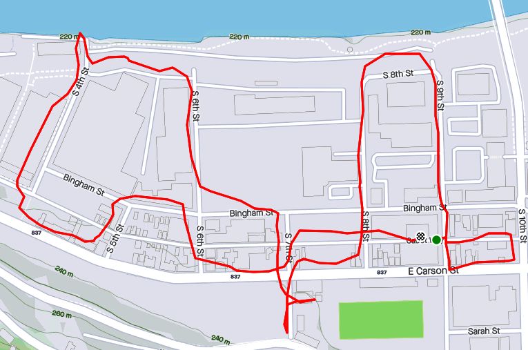
This was a short run in the South Side Flats. Like a vampire, this neighborhood keeps coming back with some little street or alley I’ve missed. I’m really trying to drive a stake through the heart and get this area done. In spite of the short run, there was lots to see. Perhaps my favorite were the pierogie signs around Saint John the Baptist Ukrainian Catholic Church. Downtown Pittsburgh is just across the Monongahela River and the skyscrapers caught the evening sun nicely.
Dowtown seems just across the tracks
Downtown
St John the Baptist Ukrainian Church
St John the Baptist Ukrainian Church
Under McCardle Ramp
Monongahela Bridges
RATS #00301
RATS #00301
This was quite an adventure. I checked out one of the lesser known neighborhoods, New Homestead. It is west of West Homestead/Munhall, east of the Glenwood Bridge interchange and south of Sandcastle yet north of Mifflin Road. Looking at the map below, you might notice that there are three disconnected areas of New Homestead. I ran most of the northeast section.
New Homestead
Also looking at the map, you might notice a lack of streets. Okay, a lack of anything. Your observations would be pretty much correct. There’s just a number of long streets dotted with houses and large areas of woods. Deer were everywhere and seemed offended by me disturbing them. I actually parked in West Homestead, above a baseball diamond.
Deer- Outstanding in the Field
Country Roads
House – Church
Aerials
Lots of mowing
Little Library in West Homestead
RATS #00302
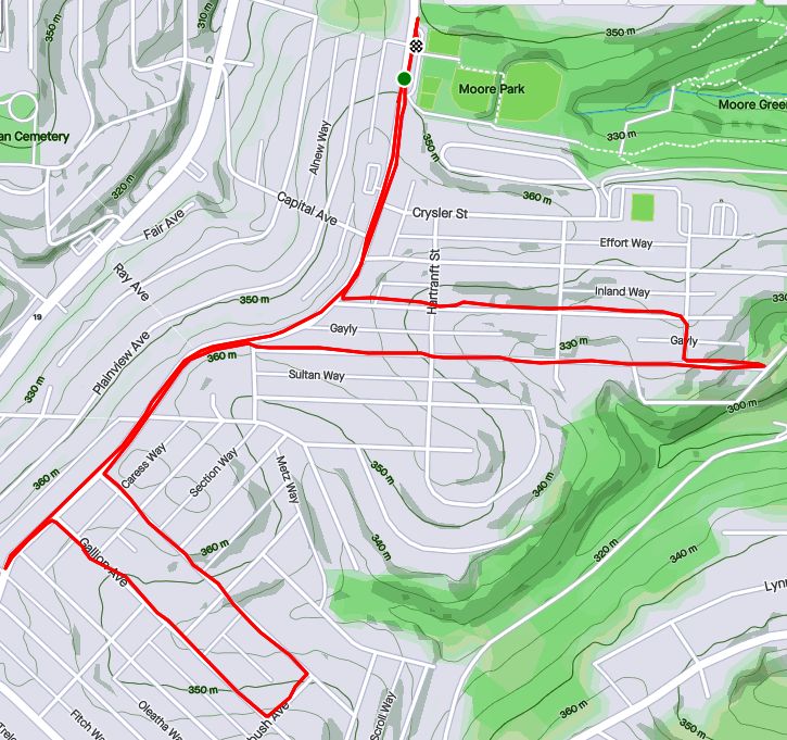
RATS #00302 – Carrick & Overbrook
Run number 302 saw me back in Carrick and Overbrook. Unlike New Homestead, this area is dense with houses and people. Hills, steps, alleys, this run had it all. I don’t remember seeing many deer, though. I was amused by the war memorial in front of Carrick High School. Most memorials of this age have howitzers or bronze soldiers. This one had a bronzed shell. Many lawns were covered in political signs; often with neighbors cheering opposite sides. Just think how fun that block party would be! That cat, however, wasn’t the least ruffled as I run past it, huffing and puffing up the hill.
Shell for a War Memorial
Parkfield Street
Booming Hills
Unruffled Cat
The Englert Street steps conveniently took me from Saw Mill Run Boulevard up the hill again, while the Dartmore Steps were just a convenience. Unfortunately, the Antenor Way Steps were blocked off, even though they didn’t look too bad.
Englert Steps
Wee Steps on Dartmore
Antenor Steps
RATS #00303
RATS #00303 – Lawrenceville
Speaking of neighborhoods which keep coming back with uncovered alleys and streets, Lawrenceville takes the cake. This five mile run just went round and round dim back alleys. Interestingly enough, it was busy enough, between restaurants and residents that I felt more comfortable here than in New Homestead.
Unruffled Chalk Cat
Night Street
Barb’s Kitchen
RATS #00304
RATS #00304
This was a nine mile run (not to be confused with the stream of the same name) through Manchester. With this run, I’ve covered all the streets between the railroad and Chateau Street. This is a large, flat area. Mexican War Streets, with their 1890’s row houses gradually transform into sprawling mixed housing, newer three bedroom split levels interspersed with magnificent mansions. Some of the ‘mansions’ have seen better days.
Mexican War Streets
Gated Garden
Treelined
Renovating the Row Houses
Fully Transformed
Alleys are where you see the underside of a neighborhood. These show the old warehouse nature of the area. There’s also a major railroad line, below grade, which dominates the eastern fringe of this area.
Old brick warehouse
Rusting warehouse and playgrounds
Under the Columbus Avenue Bridge
But there’s a lot going on here. New construction isn’t too surprising given the great location and flat land. People have gardens and little libraries and seem to generally be active. I didn’t expect to see that huge rooster mural or a booming market along Juniata Street, but there it is.
Bee Friendly
Little Library Needs A Little Renovation Itself
New Construction
Rooster Farmers Market
RATS #00306
RATS #00306
Once again, I returned to Carrick and Overbrook in the evening. At this point in the month, I was really trying to complete a Strava Challenge (200km), so after doing Yale Street, I just went exploring.
Yale Street is in the same are as RATS #00302. One section has extensive steps leading up into Phillips Park, then it drops precipitously to Dartmore Street. Clawing my way back to Brownsville Road, I needed a couple more miles, so trotted along Carrick Avenue. It was fully dark and I wasn’t 100% sure where I was going. Nontheless, I ‘just needed to bear right’ a couple of times to take me back to Brownsville Road and into Pittsburgh again.
Ahhh, run!
Yale Steps into Phillps Park
Off the cliff
Welcome to Carrick!
RATS #00307
RATS #00307 – Banksville
Must say, I’m proud of this run. I planned it pretty well and stuck to the plan. It was a little over seven miles in Banksville where it borders Greentree and Mount Lebanon. It is a nice area with long winding streets. However, there weren’t many distinctive things to see. At the start, I did pass a soccer field off of Hillsdale Avenue, where a girl’s soccer game was in progress under the lights. They have a powerful PA system, and for the rest of the run, I could hear the announcers.
Soccer Field
Suburban Residential
Strachan Road
Welcome Back!
That’s All Folks!
So, there you have it. September 2020 in the books. I think this is the longest “Catch-Up” blog I’ve had and I might change things up a bit to avoid this in the future. Maybe a weekly blog?
At any rate, I want to run a bit farther in October and continue to efficiently cover streets. I’ll try to get into Lincoln Place, another outlying neighborhood, as well as continue to finish out the Hill District, Marshall-Shadeland and Carrick.