March 2021 Catch-Up

Summary

March 2021 was one of my most productive months in terms of mileage and streets covered. Among my 162 miles and 20,000 feet of elevation gain, I completed 192 more streets in Pittsburgh in 15 RATS runs. I even completed the “Take The Stairs 50k” course I published last year. That course, a small revision of Lamar’s original course, took me on roughly 78 sets of steps throughout the city, but, alas, did not cover any new streets.

Blogging-wise, March was less than stellar. I only published four posts and it has taken me all of April just to get this summary out, touching on three short runs in Carrick, Brookline and West Liberty.


https://www.strava.com/activities/4979989103
Route of RATS #00384 in Brookline

I had grand plans for this run, but was out-of-synch and got frustrated by small ‘streets’ just being driveways into hills. Argh! Just took one picture, before it all went downhill. I did end up with over four miles and several alleys covered.

Brookline Alley
Brookline Alley

RATS run #00386 Around South Side Cemetery

In this run, I inadvertently circumnavigated South Side Cemetery. I started on Brownsville Road and took the steep West Meyers Street to Oakhurst en route to Newett Street, one of the steeper roads I’ve been on. I took Plateau Street to its dead-end above Volunteers Park, then came back to Newett, expecting to see Plateau on the other side. However, Plateau falls off of Newett so quickly that the other side looked like a driveway which disappeared over the hillside. Once upon it, though, I found my way down Plateau and was pleasantly surprised to find that Volunteers Field was an active hubbub. It looked like a fire department team was practicing on one field, while on another field, a younger group practiced base-running under the tutelage of a barking coach.

Moving on, I dodged cars on my way down Colerain to Noble Road. No sidewalks and not much of a shoulder made it tricky running. Then I peeled off and went down Denise Street. My internal map had Denise going a little way and dead-ending. It seemed to go on forever, but afforded nice views of the T tracks. Returning, I came across some steps which took me to Noble Road.

Once up on Noble, I backtracked a bit and went up Glade Street. The few streets up on that hill are tucked into a corner of the cemeteries looming above. It was a nicer area than I expected. Some kids were playing basketball in the street and others were riding bikes. Along the Montrose Steps I heard a rustling and noticed a deer in the woods. I took a picture and continued to Cloverdale Street. Only after looking at the picture more closely did I realize there were four deer there!

Cloverdale Street completed the southern border of the cemetery, bringing me back to Noble Street. This short, three mile run certainly had a lot to see.


Route of RATS #00387

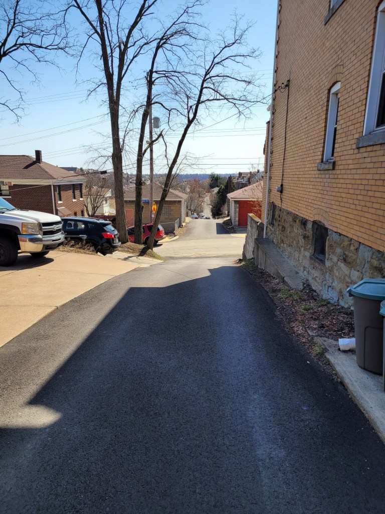
This was an evening run in West Liberty to catch some alleys. I caught several in my alley catcher, but some were only paper alleys (here’s looking at you, Mascot Way!) Overall it was a pleasant, hilly run with over 400 feet of elevation in only three miles.


So that was it for March, 2021. I’m still chipping away at the streets. At the end of March I had a little over 800 more to complete. I’ve come a long way considering there are over 4,800 streets in Pittsburgh. I can now see the light at the end of the tunnel.

Epic Eighteen To Fairhaven

https://www.strava.com/activities/4987052124
Route of RATS run #00385 from South Side to Fairhaven

On a bright Sunday morning in March, I undertook one of my longest RATS runs ever. I had a couple of goals. First, see how much of Beck’s Run Road I could traverse without getting run over and second, explore Fairhaven, nestled in the corner of Library Road and Saw Mill Run Boulevard, without getting run over. I was ramping up mileage in preparation for an April 50k.

First off, I decided to climb into the South Side Slopes in order to catch Parkwood Road, which I could take to Beck’s Run Road. While using East Carson is the fastest way by car, that whole ‘without getting run over’ idea convinced me the steps were a better idea. And of course, I would get to enjoy the great views.

Oakley Street has an impressive step-mosaic where it begins on Josephine Street. It does continue, however, for several more flights. I wonder about that handicap parking, though. It must be difficult for anyone with mobility issues to live in a spot surrounded by steps.

At any rate, now on the crest of the South Side Slope, the views were amazing. on breaks between houses, you could see across the Mon to Oakland, with the Cathedral of Learning prominently displayed. On the far side of the crest, the neighborhood forms a steep bowl, with steps on each side.

Once past Arlington Avenue, I made my way to Mountain Avenue and the long, one lane road known as Parkwood Road. On the left side of Parkwood, a ravine deepens and water drips down the cracking rock on its way to becoming a creek. Parkwood is blocked off about a tenth of a mile above Beck’s Run Road, due to erosion. Just before this, two small streets on the left are lined with houses. The creek has grown to a significant size by now and the city, I suppose, has built quite an impressive retaining wall to keep one house from falling in. It is very isolated, but the ten houses are all nicely maintained.

Once at Beck’s Run Road, I ran toward Paige’s Dairy Mart and then up towards Carrick. Even though it was a 40 degree day, people were lined up to get ice-cream goodies from that venerable establishment under a bridge. Beck’s Run is the name of the small creek alongside the road. The road is a major thoroughfare, but doesn’t have many buildings along it. The hills coming down are too steep to build on. The flat areas probably flood.

So, I made my way up Beck’s Run Road, then explored a little along Agnew Road. Not far from its intersection with Beck’s Run, there’s a heavily fortified water filtration plant.

I found one section of Beck’s run a bit too tight for running and went up Madeline Street instead. Crossing over Brownsville Road, I took Maytide to Saw Mill Run Boulevard. This is car heaven. Car dealerships of all shapes and sizes line the road. Luckily there is some thought to pedestrians, as there are walk signals. You just have to be willing to wait a long time. At least I could recover a bit.

Finally making it across, I came to the Fairhaven neighborhood. It is wedged between Saw Mill Run and Library Road. From this intersection, one lonely road and a set of steps lead you there. Once there, I was, actually, pleasantly surprised. Medium and large houses stood on large lots. The subdivision backs onto “Fairhaven Greenway”.

Hillview Street is steps in two sections, the one coming up from Saw Mill Run and another one, just slicing up the hillside between yards.

The far side of Fairhaven abuts Castle Shannon and Whitehall. I came down Elwyn Street and made my way along Transport Street, a half block behind Library Road. Transport Street had much more character than I expected.

At this point, I started heading back to the South Side. I went along Saw Mill Run until I could go no further. Luckily, a tiny section of steps became Dartmore Street and led me up into Carrick. From there, I just plodded along Brownsville Road and cut-through Mt Oliver along Amanda Street. I was surprised to find Amanda actually stopped and was separated from Hay’s Street by a barrier. It turns out Hays, at that point, is so steep, it is hard to even walk down. Still, those hilltops can see the downtown buildings peeking over.

With this, I made my way down South 18th, Mission Street and back to my car on the South Side. Whew, that was a long run!

Shadow Selfie

Short March Runs

Here are three short runs I did in mid-March. These were “squeeze-them-in-runs”, where I had only a short time and planned out a very limited route. Though perhaps not as epic as some runs, they still took me to interesting places.


https://www.strava.com/activities/4947105503
Route of RATS run #00381 in West Liberty

This run started at Moore Park along Pioneer Avenue. I had mapped out a shorter, “nearly flat”, route for my girlfriend to run while I tackled the longer hill on Dunster Street.

Dunster is pretty much suburbia up near Pioneer Avenue, with a long straight stretch rolling east. After reaching the sunrise, it drops precipitously. Large lawns spread out and the bottom cross-street, Timberland, ends in trails. (The trails, incidentally, go back up to Moore Park.)

Following Timberland away from its trail end brought me to Edgebrook Avenue. At this point, Ballinger Street ascends as a staircase. This area was a bit more junky. I did spy what must have been an elf playhouse off the stairs. Also, I garnered more evidence for “Boat Theory”, as a speedboat was right next to the stairs.

I continued all the way to Whited Street before turning back. It is a neat area, off the beaten path but literally a quarter mile to Saw Mill Run Boulevard and overlooking the South Busway.

Returning to Moore Park, I had the pleasure of running up Dunster. Turns out that is a Strava Segment (“What a Dunster Fire”) and for the moment, I’m 4th overall! I also had the pleasure of getting some feedback for the “flat” run I had planned for Naomi. Ha! Perhaps it wasn’t as flat as I remembered.


Brook Street Route
RATS #00382, Brook Street in Carrick

Nestled between South Side Cemetery and Saint Georges Cemetery, a handful of streets and an amazing number of houses cling to steep slopes. This run, #00382, was a rare morning run and I just had enough time to do a couple of miles. I parked along Brownsville Road and ran north on that dusty road to Cedricton Street. Between the houses on the left, it was a long way down.

Once at the end of Cedricton, I jigsawed my way over to Brook Street, which flowed downhill, an amazingly far way downhill. There was actually a turn-around at the bottom, where all the views were up, up along fallen vine covered trees. A brook did emerge at the bottom.


https://www.strava.com/activities/4965153998
RATS #00383 in California-Kirkbride

This was a short run I tried to squeeze in before my regular City of Bridges Wednesday night run. I managed to catch Sigel Street, which has recently been repaved then ascended the Hyena Street Steps. No pictures, I suppose I forgot my phone.

Turns out I misjudged my timing as well, for by the time I got back, the COB runners had already left. Whoops! I had the map and tracked after them. However, with a ten minute head start, I only caught up with a couple. At least Modern Cafe was open and I got to enjoy some post-run libations with them.

Finishers From Stanton Heights to Windgap

Here are a couple of runs I did in early March, 2021. The first, a short evening run in Stanton Heights, finished up that area. The second, an epic wandering run through Corliss, Chartiers and Windgap was in the blinding sunlight and pretty much finished those areas as well.


https://www.strava.com/activities/4921240664
Route of Run #00379 in Stanton Heights

Starting in Upper Lawrenceville, I clambered up Stanton and finished off a few streets and alleys for run #00379. Previously I’ve pictured this pleasant, residential area. This evening, dog walkers were out and kids played in the streets. The end of Downlook Street has an unexpected view of Sharpsburg across the Allegheny River. I finished up in Dinian Park, skirting a baseball field overlooking Morningside. It was cool to see the sparkling lights through the bare trees.


https://www.strava.com/activities/4941383592
Route of RATS #00380 through Corliss, Windgap and Chartiers

At the start of most every run, I have some anxiety about part of my route. For this run, I was worried about the area near Hollywood Cemetery as well as Alora Way and a confusing section of streets Windgap. I was also worried about how safe it would be to run on Windgap Avenue. Let’s see how my worries played out.

Off the bat, I screwed up my route coming out of Ingram. Instead of going on West Prospect, I went on East Prospect and ended up coming into Pittsburgh along Steuban Street instead of Berry Street. This turned out OK, as I made sure to complete Charlton Street coming into Berry right at Jenkins Street. I’m not sure if you recall, but in an earlier run, I came across the Jenkins Street steps and through internet sleuthing, found that they go nowhere. Today, emboldened by the bright sun, I battled the scrubby brush and went to the top of the stairs. Nothing, nada, zilch. And, on the way down, I stepped on a nail protruding from an overturned plank. Luckily, it missed my foot and toes. But it was a hassle stepping into the street with a three foot piece of wood attached to my shoe. Once on Berry, I was able to remove it.

The next stop was a little cul-de-sac, Kathy Drive. Looks like a nice residential street. From there I made my way to Evanston Road, winding around Harrisburg Road to Clearfield. Clearfield went right into Hollywood Cemetery. The map show Clearfield continuing through the cemetery to Windgap on the other side. The road does not clearly go through. At the far end, though, I was treated to a neat view of Windgap and the Windgap Bridge.

I traced my way through the streets and alleys here off of Middletown Road then took Middletown Road’s curvy dive down to Chartiers. The far side of Chartiers Avenue has a number of small residential blocks and with some roads leading right up to an active railroad. Down here, power lines towered above the houses.

Now, I had to face my fears and venture to the steps on the end of Alora Way. The first time I saw the steps from Chartiers Avenue to Alora Way, a large dog was yelping at me from the bottom of the stairs. I was concerned he would still be there. But I was in luck! No dog. The steps were an adventure to get to, but led straight up to Chartiers, as expected. Flushed with this success, I decided to see, one last time, if I could find the steps which were supposed to come off of Moyer Street in Sheridan. From the end of Moyer, last summer, all I could see was gardening debris at the end of the street. This time, though, on this sunny, leafless day, I found them! Shallow red brick steps climbed alongside a Jewish cemetery until they were buried under branches near the top.

Now I needed to face some more uncertainty. Alora Way also has steps which rise on the other side, towards Oltman Street. I had run on Oltman before, and only saw a rundown house at the end, no steps. From this direction, though, the Oltman steps looked good. Well, they looked good until I came across a fairly large broken section. Sometimes, I stop when I see steps like these, but not today. I made my way on the edges and fought my way through the new growth to the other side, on Oltman Street. While there was a lot of trash and dumped appliances, there really wasn’t much to be afraid of.

From here, I wandered around the streets and alleys of Windgap. I found an amazing scene, ferocious deer cornering a wild T-Rex. Poor T-Rex, he looked scared to death.

With this, my exploring was done. I decided to run straight up Windgap Avenue. It wasn’t pretty or particularly safe, but I made it without a problem. I was so close to a half-marathon, I ran an extra block just to get in that last tenth of a mile.

Alleys in Oakland

https://www.strava.com/activities/4915176085
Route of run #00378 in Oakland

As I’ve covered more and more of Pittsburgh, my runs are increasingly on smaller streets and alleys. This early March run into Oakland definitely fits that description. I started in Dinosaur Playground, as my kids used to call it. It’s a great little playground and field at the tip of Schenley Park. Pre-Covid, parking in Oakland was so expensive and scarce that many people would park here and walk to Pitt on a daily basis.

But let’s get things started with shoes and sunsets. Shoes on the wires and a nice sunset across the “Charles Anderson Memorial Bridge” carrying Panther Hollow Road out of the Park, where it mysteriously renames itself to Boulevard of the Allies.

Continuing into Oakland I made my way down Coltart Street to Iroquois Way. For some reason, it isn’t on most visitors’ “must-see” list! Coltart Street is very typical of Central Oakland. Low houses, duplexes and apartments struggle for space under the rising tide of Pitt development.

Students and medical professionals flow through Oakland, going to work, going home, going to classes, laundromats, restaurants, and bars. I think the colorful mural is along Bates Street, but Gene’s Place is harder to find, well hidden off of Atwood Street. It does not serve food, so with the strange restaurant laws in Pennsylvania, it still allows indoor smoking.

Rounding out the neighborhood tour, I came back to Dinosaur Playground via the Panther Hollow Bridge passing in front of Phipps. A short run, a short blog!

Ivory Avenue

https://www.strava.com/activities/4909505912
RATS #00377 Ivory Avenue

Nearly a month ago, March 7, to be exact, I explored the Ivory Avenue section of Pittsburgh. This little ‘Burger slice is isolated from the rest of Pittsburgh by I-279 and Ross Township. It is closer to Ross Park Mall than to Downtown, but retains a neighborhood feel, once you get off the busy feeder roads to the interstate.

I started, as I often do, from Riverview Park, winding down Venture Street and up East Street. “Up” being very literal here. That brought me to wide, sunny streets in this northern hinterland. The houses and yards here tend to be large. With that theme, someone is really serious about staking their garden. Is it for “Godzilla Big Boy” tomatoes, or hops plants? I’m not sure.

Grizella Street (yes, that’s the actual name) sports little dead-end spurs, Radium, Rutland and Montana. They are pleasant enough to run on, but after a short flat section, they fall off the hill, and the climb back up is very steep. Montana continues as steps from Grizella to Swanson, where a KDKA transmitter sits. The tower is contained behind a rusty fence and old antenna shells litter the ground below, like petals falling off a flower.

From here, I continued toward Ivory Avenue, passing Fiasco Art Center en route. Eventually I came to I-279 as it passes under Perrysville Avenue. The city border is pretty jagged here, I had to run out of the city on Connie Drive to get the section of Connie Drive which was in the city. While that was a bit of a pain in the butt, at least I found the murder weapon. It was Colonel Mustard on Connie Drive with the Crowbar, right?

This area wasn’t very runner friendly. While there was a sidewalk on one side of the bridge, it dropped me off on a wide and somewhat busy Ivory Avenue with no sidewalks. Luckily the far neighborhood was much more cozy, perched on a hill and full of three and four bedroom homes.

Ross Township cuts in and out of the neighborhood but I could keep my bearings by glancing up at the Channel 11 TV Tower. The far side of the hill dropped me onto West View Avenue as it intersects McKnight Road. This was another pedestrian-unfriendly area. Nonetheless, traffic wasn’t too bad and I dodged in and out the shady streets like Zane Way, Valley View Street and Cherryland Street. Darting into Summer Hill briefly, I made my way back to Evergreen Road, pleasantly surprised to find a sidewalk through the rock garden under the interstate bridges.

Evergreen Road
Evergreen Road Passing Under the Interstate

Returning by going up Venture Street, I finished up with 15 miles and a nice 1,700 feet of elevation.