Uptown and Lower Hill on a Beautiful Morning

https://www.strava.com/activities/3467145326
RATS #00240

This morning’s run was meticulously planned to be in Brookline. Unfortunately, I was day-dreaming on the Boulevard of the Allies and ended up on the Crosstown Boulevard instead of the Liberty Bridge. Oh well, sometimes its better just to start where you are. So I ran in Uptown and the Lower Hill. I must say, it was still a rewarding run, with a number of grand views and murals.

Uptown and the Bluff are dominated by Duquesne University and other large facilities, such as PPG Paints Arena. With the amount of pollution generally in Allegheny County, I’m not sure why there’s a continual flame above the People’s Natural Gas Gate, but it is cool to see.

Further east of Duquesne is Mercy Hospital with its helicopter pad and construction. Given the depth of the digging, it looks like something big is being built next to Mercy. I had to stretch out to get a pic over the fence. For a bit there, my GPS became wonky – claiming that I had run a four minute mile. That worried me for the rest of the run, but it turns out the route was recorded properly, regardless of that mile.

Eventually, the area settles down to small streets and alleys with row houses and small businesses intermixed. While there’s a lot of chain-linked fencing enclosing parking areas, there’s also bold murals along the houses and walls.

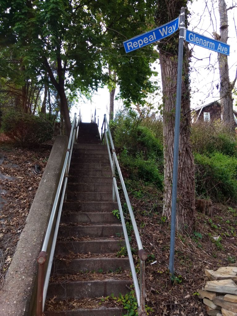
Crossing over the Lower Hill, I ran among the residential streets and alley ways in Crawford-Roberts and Bedford Avenue. Much of the area has been rejuvenated, with townhouses, condos and tree-lined streets. However, there are some older structures; dark-brick row-houses, standard Pittsburgh brick four-squares and tall narrow houses which are still in poor shape. Beyond Bedford Avenue, there are a number of places with views across the Allegheny River.

This is a very urban area, but is more green space than I expected, such as this parklet overlooking the Allegheny. The ‘featured image’ of the tire-swing surrounded by a grassy field is something I attribute to more suburban and rural settings.

This area is also pretty big. These seven or eight miles didn’t cover nearly the streets I had hoped. It looks like I’ll have at least two more runs in the Hill District before I can cross it off my list.

Little Library and Big Steps in Hazelwood

RATS #00239 – Hazelwood and Glenwood

So, I’ll have to share a secret…. sometimes, just every once in a while, planning a run is a pain in the butt. I inevitably go down the “Oh, I can do THAT” mode of thought. Ten miles and a hundred turns in, the route looks awesome on my 32″ monitor. However, I’ve learned a thing or two along the way.

  • The first is that OpenStreetMap is not always 100% accurate in the fine details, small things like, “Do these streets intersect?
  • The second is that a logical rectangular grid in Pittsburgh means incredibly steep streets.
  • The third is that temporary obstacles, such as loose dogs, tree-trimming closures or police scenes, upset carefully laid plans.

Lastly, the longer I’m out there running, the less likely I am to remember where I need to turn, which is a direct consequence of the first and third things I’ve learned. Just use a route-funder, you say. Well, I have used the RunGo app several times. Once it is off course, you either have to turn it off or accept hearing “You are off-course” in a disapproving voice for the rest of the run.

Today’s run was meticulously laid out to cover a few small streets off of Tesla Street and the grid of streets east of Glenwood Avenue. In spite of its electrical name, Tesla Street looks rural. It is one of the steepest streets in Pittsburgh. Luckily, I was going down it this time.

There are a few small streets off of Tesla, which look like they were the beginnings of housing subdivisions that never quite took off. Nonetheless, they are lined with neat brick houses carefully maintained. Crossing Clarion Street, the last of those small streets, I descended Dido Way, a stairway, to Flowers. Once on Kilbourne, I spied the bottom section of the Eddington Street Steps. I know, from a previous jaunt, they are closed on top. They’re closed at the bottom, too, but I went up them a bit anyway. For awhile, the steps are decent, but then the jungle closes in and there’s no way to continue.

I did feel a little guilty clambering over the “Steps Closed” sign, while across the street small children chattered and played. I hoped they didn’t get any ideas from me.

At any rate, my plan was to go down Kilbourne and Odin then take an extensive flight of steps from Nordica Street to Steele Court. Alas, these steps are either very well hidden or gone. Checking Google Street view, they haven’t been visible for a number of years either. Perhaps on a cold winter’s day, when the foliage has died away, they would be visible. I must say that Odin has lost some of his thunder to only have such a small street named after him.

That left me on another powerful street, Ampere Street. Ampere Street abuts the Hazelwood Greenway. This large undeveloped tract is generally overgrown, but is home to several radio towers. The effect is that people have large yards which back into the woods. In spite of this, during this early evening run, there were more people out than I expected.

I wound my way to Steele Court. This would be the bottom of the expected steps. I did see several flights, but not the ones I was looking for. An aggressive dog barking between the porch railings on Steele Court didn’t encourage me to explore too closely.

This type of neighborhood specializes in micro-decoration. No HOA here, with rules about paint color and height of grass. Here, there are vistas of lawn ornaments, Steeler flags, and other personalizations. High on Glenwood Avenue, a blocky school building sports an avant garde sparrow clutching an iron gear. Perhaps it is a jayhawk, but it looks like a sparrow to me.

Finishing the whole of Glenwood Avenue, I noted a few stairs rising off of it, but figured I would save them for a later run. There’s no easy way back, so I picked my way to closed Nansen Street in Owl Hollow. Nonetheless, they have a nice little library at the bottom, emblazoned with their owl emblem.

Nansen Street is slipping off the hill, sidewalk steps first. Below are pics of the bottom, middle and top sections of those sidewalk steps.

Nansen Street Steps – bottom, middle and top, left to right

Nansen Street is so steep that I was happy to get to the more gradual Hazelwood Avenue and jog back to my car.

Noble way to Crafton Heights

https://www.strava.com/activities/3447167472
RATS #00238 – Into Crafton Heights from Noblestown Road

This was a pretty well-planned run in Crafton Heights. Instead of approaching Crafton Heights from Steuben Street, I approached it from Noblestown Road. Honestly, a big draw was the availability of parking at the Shop ‘N Save on Noblestown Road. I wasn’t familiar with the area and didn’t know what to expect. I must say, I was very pleasantly surprised and look forward to running more in this area.

To get to my designated parking spot at the Shop N Save, I actually went out of the city on the Parkway West, exiting at Greentree. A few minutes and a few turns later, there I was, pulling into a rather empty parking lot. Social distancing and Covid19 fears has certainly made traffic lighter!

Noblestown Road, at this point, is a broad avenue crossing street after street of modest two and three bedroom houses built in the 1950’s. It sweeps down to Crafton Boulevard, where I took a left and caught Stratmore Street as it climbed steeply. I turned around at Steuben Street, which is the border between Pittsburgh and Ingram. From there, I went back and forth on the grid of streets between Stratmore and Arnold. Much of the area resembled Hollywood Street shown above.

Round Top Street dives down a particularly steep hill. It also has one of the newest set of steps I’ve seen in the city.

Round Top Street Steps

Eventually, I got to Clairhaven Street. For cars, that’s where you have to turn left onto Norwalk Street, but people can take steps from Clairhaven Street to Arnold Street. These stairs are a little wonky. The wooden top section is a work-around. Older concrete stairs, having fallen into disrepair, were simply bypassed. There are two “orphan houses” here. An “orphan house” only has entrances on the stairs.

Crossing Crafton Boulevard again, I came across this, the busiest front yard in the ‘Burgh. They had at least a dozen shiny mannequin heads on stakes.

How many lawn decorations can you count?

Making my way back to the car, I was happy with this nice run in the sun in a pleasant part of Pittsburgh. I’ll be back.

Let It Be, Brookline

https://www.strava.com/activities/3442124900
RATS #00237 – Brookline

PLAN “BROOKLINE EVENING B”

  • Insure I was covered by the local artillery
  • Circumnavigate S Scroll Way via Starkamp and Glenarm
  • At 18:23 storm the Repeal Way barricade
  • Perform reconnaissance and establish elevation gradients
  • Avoid vicious dogs and those aggressive small humans on bikes

That was the plan, as texted to me in a secure message by the Mothership. I had no choice but to execute the plan. I parked my vehicle, disguised as a dusty Honda and made it to the first checkpoint: A triangular park containing a “Canon de 155 C Modele 1917 Schneider”. I verified the serial number.

Brookline’s 155mm Schneider Howitzer in their Memorial Park

Now covered by the local artillery, I trotted over to Starkamp Street and around Eathan Avenue and Glenarm Avenue. I was a bit early for stair storming, so I took a couple of pics while I waited. At 18:23 on the dot, I raced up the Repeal Way Steps. Squirrels scurried and sparrows screeched as sparks flew from my heels.

Heart pounding, but no enemy in sight, I was free to scout the area. Clearly the local population was devious; giving steep, hilly, cobblestone streets, monikers such as “Flatbush”.

Flatbush – anything but flat

Continuing my scouting and keeping an eye out for those ferocious canines, I came on a street so steep, so rugged, I nearly lost it. Drawing upon my extensive training, I pushed up the hill, perspiration and expletives exploding from me at every step. Running out of breath, I finally shouted “Holy Mary, Mother of God!!” and looked up. There she was.

….Let it be, let it be…

I swore I heard a Beetle’s song in the background. Humbled and blessed, I relaxed and took in the area. Wide streets and alleys rumbled across the green lawns and flowing gardens. Steps took me though meadows of freshly cut grass. Free lending libraries opened my mind.

I reported to the Mothership that there were no enemies here, only playful pooches and energetic families. With that, I rambled some more, eventually getting back to that dusty Honda.

19:15 Signing Off

Upper Lawrenceville – Mission Accomplished? Not quite.

RATS #00236

Today’s run embodied a simple plan; start in Lower Lawrenceville, struggle up the steep streets into Stanton Heights and come back around on Butler Street. It went pretty well and I covered a few holes in my map.

My rough approach to Stanton Heights was to ascend 54th Street, pick my way over the steps from Leydon Street to Kendall Street and go from there. In the top corner of Lawrenceville, it was interesting to see the differing housing type. That simple small house is on Kendall. The larger traditional house is on Duncan and the new modern condos are perched on the top of 54th Street, before it becomes a stairway. These are all within a couple of blocks from one another.

In an earlier blog I documented the stairs down to Upview Terrace and Woodbine Street. Today, I continued on Woodbine as it re-crossed Stanton Avenue into another section of suburban-in-the-city living. This is quite a contrast to the densely packed houses of Lawrenceville. Off to the left, down Oglethorpe Street, Garage Way and Drive Way (yes, that’s a real street name, “Drive Way”), the streets take you to the edge of bluffs where wildlife abound.

I would like to come here some quiet morning and just watch the birds. Continuing down to Morningside, I made my way to Baker Street with its nice view of the Allegheny. The road steeply falls toward Butler Street, where the sidewalk ends and the steps begin. From here, it was a flat fast run back to my car.

I’m now a half-block away from completing the streets between Butler and Stanton Avenue and have only a half-dozen streets in Stanton Heights itself. Once I get One Wild Place done and a couple of streets jutting off of Butler done, I will have run every street from Butler Avenue to North Negley Avenue.

Esplen Revisited

https://www.strava.com/activities/3426791452
RATS #00235 – Revisiting Esplen and Sheraden

On this chilly, snowy day (yes, in May!), I revisited Esplen, where I first “officially” started this Run All The Streets project. That was in December of 2018. (blog “Esplen in Winter“). Now, 234 streets later, I came back to Esplen, with a little more direction and method. This time, Esplen was just a side-bar. My main objectives were in Sheraden: to run the corner where Stadium Street becomes Menges Street; cross Boulder Way off my list and run the length of Merwyn Avenue.

But, for old time’s sake, here are some pics from Esplen. Oregon Street is pretty typical. Radcliffe Street here is crossing railroad tracks on its way climbing the hill into Sheraden. Isolated from the rest of the community, at the corner of West Carson Street and Stanhope Street, is the Veteran’s Memorial.

Shortly after the Radcliffe Street Steps, I turned right and climbed Stadium Street. The middle section of Stadium Street is blocked off. I had been wondering why, then realized that someone had thrown out a piece of garbage and the street was sliding off the hill. Of course, it is only because the street is sliding off the hill that it is closed. But I wonder, what would happen if we closed streets because people threw garbage out? I suppose all the streets would be closed. Or would people learn to NOT throw garbage out of their car? Hmm… Honestly, this isn’t too bad compared to some areas I’ve seen.

Stadium Street. The top is blocked off by Jersey Barriers.

In my journey across the Sheraden plateau, I always like to go over to Brunot Avenue, with its sweeping views of the Ohio River and Brunot Island.

Coming off of Stafford, I saw a stairway rise to my right. It was Ashlyn Street. For a good bit, the stairs were solid, then the platform gave out, making little red stick figure dude scream for help. He only fell two feet and then was able to clamber out to Brevet Way, on the far side. I did learn from his mistake and just made the left onto Merwyn Street. While there’s usually an obstacle, some dynamic thinking and flexibility allows one to continue.

Merwyn wound its way into some verdant pastures where I saw turkeys and deer. It crossed Wyckoff Avenue on the way. In spite of the “Avenue” in its name, Wyckoff Avenue is primarily a stairway. Brooch Way wasn’t very sparkly either. I demand ACCURATE NAMING, damn it!

Brooch Way did take me back towards Boulder Way. This steep alleyway changes into a steep, two-block set of stairs down to Stafford Street. I love the arching old tree trunk which creates a portal for these steps.

With my main goals achieved, I circled around to West Carson Street. Earlier I had run Glenmawr Avenue, but didn’t have a camera. I ran up it a bit and got some pics this time. I feel that the railroad trestle is smaller than normal. It is certainly exciting to go under it when there is a train overhead, rattling small pieces of gravel as it rumbles past.

High in the streets of Sheraden, I found more evidence to support my “Pittsburgh Boat Theory”, while down on a small street off of West Carson, I found this old brick building. It looks like an abandoned old factory now, but nothing gave evidence as to its former use.

So that was it. I’ve covered much territory in these last 235 runs, but will have to revisit Esplen again before this project is all done.

Gardening in Garfield

https://www.strava.com/activities/3413828815
Rare morning run – RATS #00233

Ah, mornings, that time when I like to slowly awaken, shake off vivid dreams, think about the upcoming day and blink myself into consciousness. This morning, however, I popped out of bed, shoved my contacts in and darted out the door for a pre-work run. It was rather cold for early May, in the 30’s, but I think I overdressed. I headed for Garfield, just off of Penn Avenue. It wasn’t too far away and I had many streets to run there. I pressed the like button on a bold mural on North Evaline.

Then there were the steps. North Evaline begins as an average residential street but then continues to Hillcrest on two sets of stairs, becoming more and more overgrown.

Thankfully, Garfield is only really steep on the road coming off Penn Avenue. The cross streets, like Hillcrest, Kincaid, and Broad, are wavy, but not too extreme. Hillcrest is crisscrossed by other small streets and alleys. While some areas are tightly knitted with houses, there are also many wide open spaces. Presumably, there used to be houses on all the lots, but they were torn down as the houses fell into neglect. On Garfield’s hilltop the result is space for gardens and urban farms. Garfield residents seem to also have an artistic flair.

Of course, there are lots of steps as well. In addition to North Evaline, I did the steps on Fannell Street and Ardary Street. The Ardary steps come up from Columbo Street and widen into a full-fledged street. I’m had not been on that street before, so its always suspenseful to see what’s at the top of a set of stairs.

Warmed up by the run and the rising sun, I descended once again to the flat lands of Friendship. Nice way to start a morning, I must admit.

Shadows and Sunlight

https://www.strava.com/activities/3399200884
RATS #00231 – Duquesne Heights into Mount Washington

This was a six mile run up and down alleys and streets in Duquesne Heights, centering on Piermont Street. While the map makes Piermont “look” straight, it was as hilly as they come. On the other hand, with clear skies and brilliant sun, I really didn’t have any complaints. Duquense Heights, like many Pittsburgh neighborhoods is densely packed with houses, yet has some very woodsy areas too.

Tree grove

The early evening sun and low humidity made this a happy run. However, running in alleys is always fraught with uncertainty. Does the alley go through? Are there wild dingoes on this alley? Are there huge butterflies and gnomes? Tonight I found a huge butterfly and red gnome.

Running west on Piermont Street, I think I found the stairway to heaven. I even heard a voice saying “Come, come into the light”, only to find a young woman helping her grandmother read a map.

That was about it. In some areas, streets in one direction are relatively flat, while the cross streets are super steep. Here, they are generally steep in both directions. That makes running in Duquesne Heights and Mount Washington a challenge.

Steps to Singer Place

https://www.strava.com/activities/3392709444
Point Breeze to East Hills RATS #00230

This was a long Sunday run. In the normal course of life, this would have been Marathon Sunday for both the Pittsburgh Marathon and the Cincinnati Marathon. As it was, I did a half marathon, concentrating on completing the streets near Singer Place, high on a hill in Homewood. I parked in Point Breeze, along Frick Park Bowling Greens, another unique feature of Pittsburgh. You can play lawn bowling there. The “bowls”, not balls, are not sphere’s but rather two half-sphere’s of different radii joined together along their equator.

Frick Park Lawn Bowling Greens

From there, I crossed Penn Avenue and completed a short section of Thomas Street. Quite the contrast, I must say, from the bowling greens. This area is actually showing signs of development. Had I pointed the camera the opposite direction, I would have captured construction scaffolding along an adjacent warehouse.

I continued into Homewood proper, working my way over to Oakwood Street. Oakwood Street plunges into Wilkinsburg, where its name changes to Wood Street. The hill rising above Oakwood was my main target this morning.

A memorial, either to a shooting or a car accident, has sprung up along Oakwood.

There’s one main street, but three sets of stairs you can take to get up to Singer Place. Here are the steps.

Once in the warren of streets on top of the hill, the pavement mostly flattened out. Large, multi-story houses stood sentinel on the overlooking slopes. At one point, I was surprised to find an entirely different structure, more like a farmhouse than a brick, four-square house.

I made my way down to Oakwood again, then finished up Frankstown Road, coming up East Hills Drive to complete the circuit. Again, I found a boat at the top of a hill, providing further confirmation of my “Pittsburgh Boat Theory”.

On the way back to my car, I passed another Pittsburgh feature, Clayton Mansion, the former home of Henry Clay Frick, a pivotal figure in the area’s steel industry.

Clayton

Getting back to my car, I was just shy of a half-marathon, so I ran a few more blocks to finish that out.

Gilded in Highland Park

https://www.strava.com/activities/3386291976
RATS #00229 in Highland Park
Typical Highland Park Street

Last Saturday was a stunningly beautiful day in Pittsburgh. Bright sun, deep blue skies and mild temperatures. I took this opportunity to run some stunningly beautiful miles around Highland Park. I started at Wellesley and Farragut, catching sections of hilly Bryant Street earlier missed. Then I snaked along the alleys behind Bryant Street business area enjoying surprisingly bold colors.

Gallery Alma was cute, but closed. As a city that loves itself, perhaps it was no surprise to see a naive mural of Pittsburgh. Its happy and mischievous honeybees look a lot like the Steelers’ throwback uniform.

Moving on, I hit another goal, to run down Elgin Street. At the end of Elgin is Baywood, aka the Alexander King Estate. If you’re looking for completely renovated example of Gilded Age houses, check out this real estate listing. The tribune review has an nice article about it as well.

King Estate in Highland Park

I did a circle around the driveway, I must admit. But then it was on to the only stairs of the day, a small affair going down to King Avenue.

After this, I went back and forth in alleys and streets of Highland Park as it flattens out between Stanton Avenue and Black Avenue. Got another picture of a cat and a few dogs along the route.

This relatively ‘short’ run ended up over seven miles. I crossed paths with a few other runners along the way, though with face masks and social distancing, I wasn’t actually sure who they were.