Little Library and Big Steps in Hazelwood

RATS #00239 – Hazelwood and Glenwood

So, I’ll have to share a secret…. sometimes, just every once in a while, planning a run is a pain in the butt. I inevitably go down the “Oh, I can do THAT” mode of thought. Ten miles and a hundred turns in, the route looks awesome on my 32″ monitor. However, I’ve learned a thing or two along the way.

  • The first is that OpenStreetMap is not always 100% accurate in the fine details, small things like, “Do these streets intersect?
  • The second is that a logical rectangular grid in Pittsburgh means incredibly steep streets.
  • The third is that temporary obstacles, such as loose dogs, tree-trimming closures or police scenes, upset carefully laid plans.

Lastly, the longer I’m out there running, the less likely I am to remember where I need to turn, which is a direct consequence of the first and third things I’ve learned. Just use a route-funder, you say. Well, I have used the RunGo app several times. Once it is off course, you either have to turn it off or accept hearing “You are off-course” in a disapproving voice for the rest of the run.

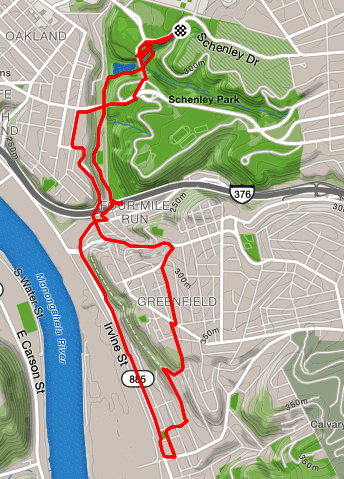
Today’s run was meticulously laid out to cover a few small streets off of Tesla Street and the grid of streets east of Glenwood Avenue. In spite of its electrical name, Tesla Street looks rural. It is one of the steepest streets in Pittsburgh. Luckily, I was going down it this time.

There are a few small streets off of Tesla, which look like they were the beginnings of housing subdivisions that never quite took off. Nonetheless, they are lined with neat brick houses carefully maintained. Crossing Clarion Street, the last of those small streets, I descended Dido Way, a stairway, to Flowers. Once on Kilbourne, I spied the bottom section of the Eddington Street Steps. I know, from a previous jaunt, they are closed on top. They’re closed at the bottom, too, but I went up them a bit anyway. For awhile, the steps are decent, but then the jungle closes in and there’s no way to continue.

I did feel a little guilty clambering over the “Steps Closed” sign, while across the street small children chattered and played. I hoped they didn’t get any ideas from me.

At any rate, my plan was to go down Kilbourne and Odin then take an extensive flight of steps from Nordica Street to Steele Court. Alas, these steps are either very well hidden or gone. Checking Google Street view, they haven’t been visible for a number of years either. Perhaps on a cold winter’s day, when the foliage has died away, they would be visible. I must say that Odin has lost some of his thunder to only have such a small street named after him.

That left me on another powerful street, Ampere Street. Ampere Street abuts the Hazelwood Greenway. This large undeveloped tract is generally overgrown, but is home to several radio towers. The effect is that people have large yards which back into the woods. In spite of this, during this early evening run, there were more people out than I expected.

I wound my way to Steele Court. This would be the bottom of the expected steps. I did see several flights, but not the ones I was looking for. An aggressive dog barking between the porch railings on Steele Court didn’t encourage me to explore too closely.

This type of neighborhood specializes in micro-decoration. No HOA here, with rules about paint color and height of grass. Here, there are vistas of lawn ornaments, Steeler flags, and other personalizations. High on Glenwood Avenue, a blocky school building sports an avant garde sparrow clutching an iron gear. Perhaps it is a jayhawk, but it looks like a sparrow to me.

Finishing the whole of Glenwood Avenue, I noted a few stairs rising off of it, but figured I would save them for a later run. There’s no easy way back, so I picked my way to closed Nansen Street in Owl Hollow. Nonetheless, they have a nice little library at the bottom, emblazoned with their owl emblem.

Nansen Street is slipping off the hill, sidewalk steps first. Below are pics of the bottom, middle and top sections of those sidewalk steps.

Nansen Street Steps – bottom, middle and top, left to right

Nansen Street is so steep that I was happy to get to the more gradual Hazelwood Avenue and jog back to my car.

June Catch-Up

run all the streets 00066

RATS Squirrel Hill 00066

This run was specifically to cover some streets such as parts of Aylesboro and Northumberland near Homewood Cemetery which I had previously missed. This area is tree-lined with nice, but not palacial homes. There were lots of people out and about, playing with kids or walking dogs.

Run All The Streets 00068

Strava map of a running route through Shadyside and Oakland.
Run with HPRC: RATS 00068

HPRC had an early morning run from the Cathedral of Learning. It was a fun run with a lot of familiar faces, but, oh, so early!!

Run All the streets 00070

Run All The Streets 00070

Another run just to cover some streets and get some miles. The area near the end of Hobart had a surprising number of small alleyways that led to cool houses.

run all the streets 00072

3ROC Run: RATS 00072

Three Rivers Outdoor Company (3ROC) is an outfitter store on South Braddock Avenue, at the end of the Regent Square business district. While they have cool stuff in their store, they also are big into community fitness events, such as their weekly trail run. This run covered a few new trails and maybe a bit of some streets. It was fun!

run all the streets 00073

Run All The Streets 00073

A run up to Pro Bike before their Wednesday night run. I got some little streets in which had otherwise escaped by attention!

run all the streets 00074

RATS 00074

Another run to cover some streets. Gotta catch them all!

run all the streets 00075

Running down a dream in Greenfield: RATS 00075

A double-rarity – a Friday run and an early morning run! As with many of these catch-up runs, this was specifically to cover some streets. I’ve done between 50% and 75% of the streets in Greenfield now.

run all the streets 00076

Run to the Run on Webster Ave: RATS 00076

Down the wide open streets of the Hill District. It was relatively early and quiet, with the UPMC Building looming over me the entire run.

run all the streets 00078

How far from Phipps to Hazelwood? RATS 00078

A final run for June. I wasn’t sure where I wanted to go, but wanted to end in Oakland and go to the library afterwards, so I started near Phipps, ran down into Schenley Park. One route would have taken me over to the South Side, but I choose to go through Hazelwood and cut through Greenfield, so the mileage and time wasn’t too crazy. Thanks to some stairs which connect the two neighborhoods I was successful.

There were parts of the route which were a little stressful, such as running down Irvine Street in Hazelwood. It had the feel of a street which really wanted to be an interstate but never quite made it. Irvine Street was busy and dirty, with narrow, overgrown sidewalks. Going up into the hills of Hazelwood is always a bit surreal. The hills and steps are steep and the greenery is suffocating (oh, maybe that was the heat). There are parts of Hazelwood where the houses are kept up nicely, but on the streets I ran, mostly the houses were falling apart and often empty. Lastly running along Frasier Street and Swinburne Street was pretty scary. There is not a lot of room to drive, much less run, and the streets are curvy and hilly. Nonetheless, I persisted and found my way back to the car.

Whew! This was the last run of June. I covered lots of miles (132) and climbed lots of elevation (13,400) in June.

Lost in your Hazel Highs

Hazelwood InfoGlen Hazel Info

Ah, Hazel, that bewitching color between brown and green, subtly shifting with the light. There was lots to think about on this run. I started running through South Squirrel Hill and into the Summerset subdivision. It’s relatively new and was built on the mountains of slag dumped there during between 1922 and 1972. (NYT article: Houses Are to Replace A Pittsburgh Slag Heap) . That development spurred some other interesting things, including the Nine Mile Run Organization which has done a lot of work to clean and take care of the Nine Mile Run watershed. This has directly impacted Frick Park, with improved natural areas and the removal of some old playgrounds. For those not familiar with local usage, a “Run” is a creek. Many have “mile” designations which approximate how far upriver (from the confluence of the Monongahela and Allegheny) the creek empties into the river. Thus Nine Mile Run empties into the Mon approximately nine miles from the Point.

Running out of Summerset, I carefully crossed Browns Hill Road and made my way up Imogene Road. Taking a quick detour down Desdemona Avenue, I skipped the stairs which would have taken me back to Browns Hill Road and went up Johnston Avenue. Summerset was a dense subdivision. Desdemona was lined with modest houses. Johnston Avenue was deserted. A long trek up a big hill with not much around. A high slope to the right and a sharp drop to the left. But after the crest was one of the Kane Centers, Kane Center, Glen Hazel. After that, just a number of small cul-de-sac’s with modest homes which look like they were built with great expectations but have been neglected a little. With just this one run, I ran most of the street mileage in Glen Hazel.

Happy to be out of that somewhat eerie area, I descended to Second Avenue and made the brave decision to climb Hazelwood Avenue. Late in most of my runs, I stop worrying about streets to see and start worrying about how to get back to my car. It was the same here, I knew Hazelwood Avenue would eventually take me back to a familiar area. One mile and nearly 400 feet of elevation later, I was back on Browns Hill Road. Whew!

Running through the area, and looking at the map afterwards, I was thinking about why some areas are expensive, why some are cheap. I reflected on the location of the Kane Center in a hidden, deserted part of Pittsburgh. I thought about how big the Calvary Cemetery is and how much space in Hazelwood is “greenway”, while right down the road, houses are pressed together. No answers here, but invitations to think about how the city has evolved.

Run All The Streets 0025