Rambling Run

https://www.strava.com/activities/3146562623
RATS #00192

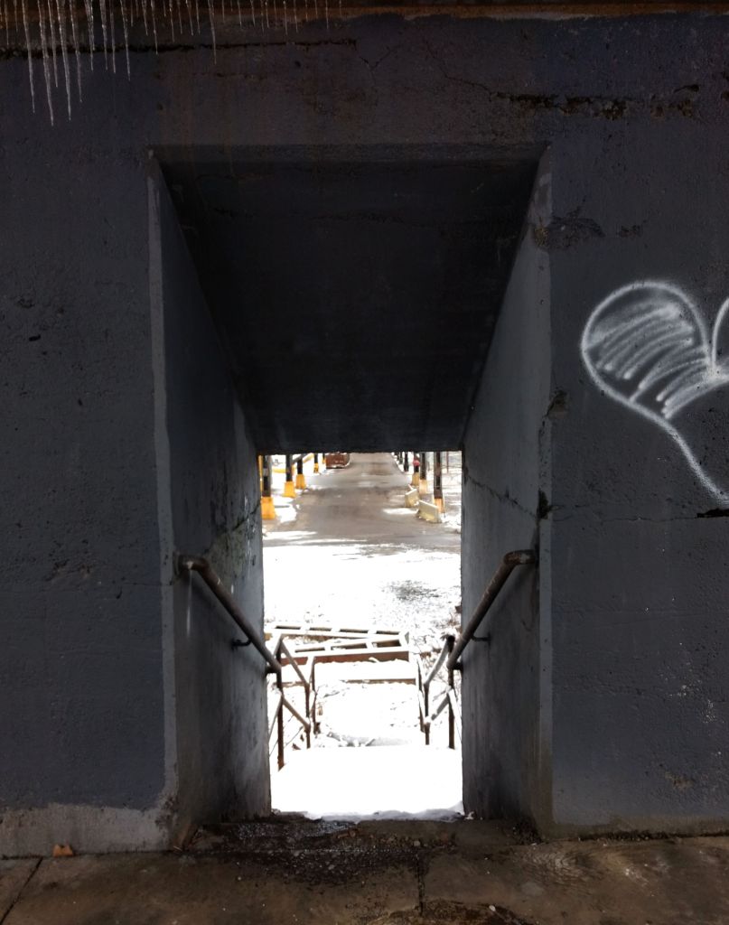
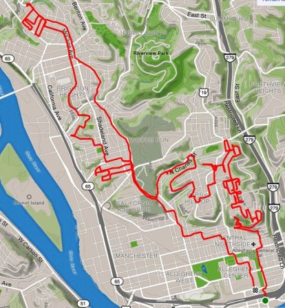
This was a rambling run across the Northside from East Allegheny to Elliot in the West End. It included densely residential areas such as Central Northside as well as the wide open warehouse district between Route 65 and the Ohio River. I crossed bridges, went up stairs and finished with seventeen miles on this sunny, but chilly Sunday.

Starting out on the Northshore, I specifically wanted to finish off Virgin Way and Tripoli Street. In spite of the brilliant sun and crystal clear skies, Virgin Way was very threatening. Circling back to Tripoli Street, I noticed the Neu Kirche building, built, if the stones do not lie, in 1859. Originally a German Church, perhaps Lutheran, it has been repurposed as a center for arts.

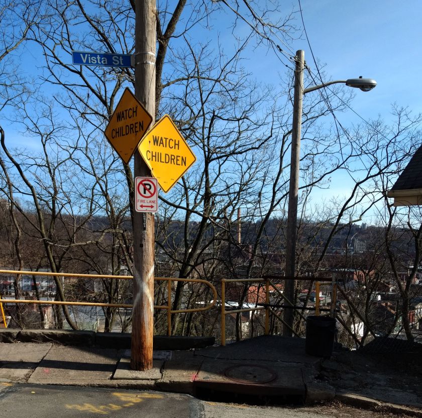
This took me to Vista Street. I had hopes of trotting a little up the hill and taking the Vista Street steps down to Itin Street. Alas that was a navigational mistake, as these stairs were closed.
Turning my attention to the Central Northside, I did the grid of Sandusky, Lorraine and Boyle Streets. Unlike the other two, Boyle doesn’t have an outlet at the top of its steep rise from North Avenue. As I was running up Boyle, two women, likely in their mid-to-late thirty’s were chatting at the top. I drew closer and closer, hoping to find an alley or staircase to Fountain Street. A few yards before the retaining wall, the women looked more and anxious as I approached. Finally realizing there was no way out here, I said something lame like:

“Oh, I thought this street went through”.

“Nope, doesn’t go through”, the dark-haired woman with brown knee high boots stated flatly. Her companion, with a black and white checkered coat tried to be positive, commenting “At least you’re getting some good exercise!”

If she only knew, I thought, reversing direction. Somewhere along the way, I also saw an outdoor beehive oven. Again, I was glad for the brightness of the day as I zig-zagged through the streets and alleys. But then, I noticed something following me. On one street, there it was. The next block over, I saw it again. Whew, just a true alley cat.

Now I went up Chateau Street. My left knee started to twinge a little, but I decided to run through it. This took me to Warehouse Land. Large warehouses and garages were separated by large, wide streets. While some of the buildings were in disrepair, just about everything was occupied with some business or another. There’s one section, an “Industrial Park” with high fences and a big gate. Just inside is “Get Hip Records”. Around the corner is the whimsically painted “Bicycle Heaven”.

I finally made my way across the West End Bridge. Coming onto Steuben Street, I took the first staircase I saw. A couple of years ago, these stairs went all the way up to Lander Street. Today, however, they only made it to Elliot Street. The second flight was closed. I had to detour a bit down the street, taking the Planet Avenue steps instead.

Thus began my ascent into the West End Overlook area. Huffing and puffing my way to the top of Valonia, I came to Saint Martin Cemetery. Apparently all the tallest hills have cemeteries on them.

At this point, my knee was truly complaining, so I started back towards the Northside. Gamely trying to hit new streets wherever I could, I ran down Crucible Street. Sure enough, there were some stairs! But, no. They were closed. I was a bit bummed and just went to Steuben Street via Amherst Street. On the lower end, I could see why those steps were closed. A lower section of the stairs and railing had completely collapsed.

Crucible Stairs Top and Bottom

Steuben Street is a main road and the sides are littered with trash, most likely thrown from cars. I took the stairs from Steuben to South Main Street, where I surprised four deer. Just for fun, I highlighted one of them in red below.

Steuben Street to South Main Street

That was about it. It was another two and a half miles back to the car, which felt like it took forever. Getting into the car, I greedily drank water and gobbled pita chips.

February Wrap-Up

February was a busy month for running all the streets of Pittsburgh. Of the twenty runs I recorded to Strava, fifteen of them covered new territory. I was also pretty good about posting, so there are only five runs in this wrap-up. Overall, I feel I’m making good progress, with an increasing number of runs in new areas, such as Homewood and Larimar in the East; Brighton Heights and Marshall-Shadeland in the North, as well another foray in Beechview. By the end of February I had completed 191 “Run All The Streets” runs, so that 200th one is coming up soon!

It’s also been an exciting month planning an event, “Take the Stairs FatAss” – a 50K and 25k fatass (unsupported run) around the city, using many of the Pittsburgh city steps along the way.

Run #00179

Run #00179 was a group run with PBR, from Cinderlands, a bar-restaurant. Towards the end of the run, I caught a few new blocks in Lawrenceville.

https://www.strava.com/activities/3069678216
RATS #00179

Run #00181

RATS run #00181 was a Saturday group run organized by PBR. It also featured a pierogie and pie fundraiser for Team NDSS, organized by Gina. I ambled along the snowy streets of the Strip District, taking pics and trying to stay upright in those slippery conditions.

https://www.strava.com/activities/3082820904
RATS #00181

It ran past 31st Street Studios Stage doors and under Iron City Brewing’s tall smokestack. I ran past old four-story warehouses and gleaming new condos.

Some of the shortest stairs on the 50K route are here, as well as the 28th Street Bridge and a forlorn hopper, towering over silent tracks.

RATS Run #00186

Again, this was a PBR run, onto which I tacked on a couple of streets in Bloomfield, Garnet Way in particular.

https://www.strava.com/activities/3109296696
RATS #00186

RATS Run #00187 – so Dark!

A run through the tiny streets of Park Place. Very nice houses crowded together in dark alleys, camouflaging many speed bumps, one of which tripped me up. Torn tights and a bruised hand were the result, but nothing serious.

https://www.strava.com/activities/3117951204
RATS #00187

RATS Run #00191

This was a short run in the West End Overlook area with stunning views and merciless hills. Like some runs beforehand, a planned route with RunGo was interrupted by the reality that not all alleys on paper survive IRL.

https://www.strava.com/activities/3143137398
RATS #00191

The West End neighborhood wraps around the hillside and spits you out on dirt roads ending on a cliff. Usually there’s a “No Outlet” sign, but not here.

With Spring almost upon us, the threat of cold weather is nearly gone and I’m looking forward to many miles in March.

North Lang

https://www.strava.com/activities/3125467710
RATS Run #00189

This run was along North Lang Avenue from Point Breeze to the steps at Apple Avenue. Outside the excitement of fire engines racing by on Penn Avenue, it was an uneventful run. The building “Engine House No 16” was, indeed, a fire station, but more recently has been renovated to its current state. City of Pittsburgh firetrucks came from a more modern house.

Crossing Penn, as North Lang drops out of Point Breeze into Homewood, the houses and yards are large. This one below was pretty typical, likely built in the early 1900’s. It seemed prim and proper to me, with its blue trim and cream colored brick and the morning sun blazing.

Neat house along North Lang

Crossing the railroad tracks and East Busway on the North Lang footbridge, tall church spires against the bright blue skies caught my eye.

St. Charles Lwanga Catholic Church

Keeping to North Lang, I continued until the street, itself, gave out. This marked the end of flat Homewood. Steps led up to Apple Avenue, a delightfully named street which is disappointingly drab.

North Lang steps

Up on top of the stairs, the hillside held vestiges of past grandeur. This magnificent house looks to be on the upswing, but I’d be reluctant to trick-or-treat there!

I ran the length of Apple Avenue until it ended at small, unimpressive, street. Circling back, I finished where I had started in Point Breeze. It was a great run, an extra 4.7 miles after my earlier 4 miles in Frick Park.

Brighton Road Long Run

RATS #00185 – Fineview, Perry Hilltop, Brighton Road

This was a long weekend run, to cover some streets in the northern neighborhoods of Pittsburgh, and see what’s out there. Short story – there’s hilly streets, stairs, creepy areas with houses falling down and nice areas with magnificent homes. I took more pictures at the start than the finish. The long story is below. Happy reading!

I started out in Allegheny Center and made my way up to Fineview on the James Street Stairs up to Fountain Street. Fountain Street and Henderson Street collide in a sharp angle, both steeply coming down the hill. I made the right onto Henderson Street and realized there was a little cul-de-sac on my left I had previously missed. Sandusky Court was a relatively new development and the condos were shiny, clean and modern. As I started around the cul-de-sac, I noticed a solid set of stairs in the back, leading to the neighborhood uphill. The stairs were nice, but, alas, blocked off at the top. I guess SOMEONE didn’t want foot traffic from Sandusky Court to go to Allegheny Dwellings, or vice versa.

Back down to Henderson, I wrapped around Carrie Street, where a magnificent set of stairs drapes over the hillside. BikePGH’s “The Steps We Take” had a performance on these stairs, which was quite mesmerizing, involving a “live portal” and flowing, multicolored fabric.

Continuing past this city-side of Fineview, I pushed even higher, where large houses sat high on the hills. Some sidewalks were raised ten feet above the street, with towering residences above. There’s a Pittsburgh Water Reservoir up here, a radio tower and crazy steps and alleys. This area was exciting and I was somewhat familiar with it from previous jaunts.

Now, my rough plan was to do a long part of North Charles Avenue and also head up Brighton Road. I went up Osgood, which starts where the steps go wild and terminates on East McIntyre Avenue. I did the little residential loop which sits about 225 feet above the Parkway North and East Street. This area has potential, big houses, large trees, a cool view, but lots of dumping, with mattresses, tires and other debris just strewn everywhere. It was sad to see and a bit creepy. From there, Kenwood Avenue starts inauspiciously as a parking spot next to steps. The steps gently go down toward Maple Avenue, then become an ugly asphalt path all the way down to Perrysville Highway. The last time I was here, we saw a mewing cat in the window of a neglected house, were accosted by the local neighborhood watch van and had to dash to the car as a summer storm let loose. This time, I was undisturbed in my journey, except for memories.

Wrapping around Perrysville to North Charles to Maple again, I was surprised to see that North Charles went under Maple with a cool viaduct.

I finished off Maple and then found my way to Brighton Road, along many winding roads. Brighton is a long way uphill, with dusty, dirty sidewalks nearly all the two and a half miles out of the city. When I saw the “Ross Township” signs, I rejoiced, took a bathroom break at a Giant Eagle and headed back towards downtown. I took the Winhurst Street stairs up into Brighton Heights, wandered a bit and followed McClure towards the city. This area was a marked improvement from Kenwood Street. McClure gradually descends to meet Woods Run Avenue. Shortly after that intersection, punctuated by a corner bar, I took the Malden Street Stairs to Geyer Avenue.

Geyer wound down to Eckert Street, giving up all the elevation I had just gained. I was tired and ready to be done. But up Eckert I trudged and made my way back to the Northside as the weak winter sun set. By the time I got to my car, it was dark.

But, overall, cool run with over 2000′ of elevation…

Hill District

https://www.strava.com/activities/3086233868
RATS #00182 – Terrace and the Hill

For this run I was joined by my friend Dayana. We met at Dippy the Diplodicus on a chilly, but sunny Sunday.

Dippy in the Snow

The first order of business was to cover a few streets off of Terrace Street, high on the Oakland Hill. About a year ago I had blogged about Terrace Village and today I was finishing it up. After a flat warm-up along Forbes, we went up Darragh, down Chesterfield, with its really rugged cobblestones then up Robinson. Regrouping at Allequippa Street, we found a nice view at the end. Branching off of Terrace Village, we made our way to Breckenridge St. It is a short street high off of Centre Avenue and well below the Pitt athletic facilities above it. I was looking for two sets of stairs, but only found the one.

We took Centre Avenue all the way downtown. The approach from the hill gave us more striking views. Here the roads really widen out and there’s a residential, downtown merge. We didn’t dally and soon were heading back up Bedford Avenue.

Huffing and puffing with the continual climb, we were treated to a mural of a family. In front of that building was a historic marker. Turns out this was the birthplace of August Wilson, Pulitzer Prize winning playwright. Tres cool!

Unfortunately, the hill didn’t end there. As we trudged up it we were treated to some Gospel music as we passed the Macedonia Church of Pittsburgh. Well-dressed church goers were still streaming in and cheered us on as we ran by. Continuing, we came across this gentlemen, tall and sparse in his Sunday hat.

Iron Mesh Man

We made it to Sugartop, dominated by the blue water tower and then skedadled down the other side into Oakland to our cars.

Does this route work? Part 3

https://www.strava.com/activities/3080725206
RATS #00180 – Windom Street Warren

In this latest installment of “Does this route work?”, I was interested in exploring a couple of staircases I had never been on. This was in a small warren of streets between PJ McCardle Roadway and Arlington Avenue. The pedestrian gateway to this neighborhood are the 10th Street Stairs. On the lower side, these stairs rise in five landings from dead end flat streets just to clear the railroad tracks. The landings provide respite from the stairs and some nice views. On the other side, though, the stairs rise again.

At the top of these stairs, the city seems to have fallen away and I was in an enchanted forest. Felt like I was Edmund first stumbling into Narnia. On the left, the untouched snowy street curved around into the Knoxville Incline Greenway. I disturbed four deer in their evening ramblings. They were not pleased to see me and only grudgingly gave way, staring me down like truculent teens as I jogged by.

Just past the herd, stairways to Hartford Street rose on my right. Despite the four inches of fluffy snow, the going was good. The stairs were solid and the snow crunched, packing as I went up. Hartford Street is narrow, but with cute houses. Squeezing past a resident who had parked in the street unloading groceries, I came all the way up to Arlington Avenue, but not before I got a good glimpse of the top of the German Square Stairs. I’d be back for those.

Making a right onto Arlington, I kept a lookout for my next set of stairs, Lauer Way. No, not Behring Street, whose steps were a vertical cul-de-sac. Behring Street is one of the few named stair streets which dead-ends. Ceasar Way in Southside Slopes declines into a grassy path but doesn’t really dead-end. Behring Street just traipses in front of a house and stops. Maybe it went through in years gone by.

At any rate, Lauer Way has an impressive stack of snowy steps. It traverses the slope from Arlington Avenue to Windom Street, two blocks below. Again, in spite of the snow, the stairs were solid, both in treads and handrails.

I meandered a little, and found myself trotting past little houses on Newton, which became another wooded glade of snowy stairs, Owl Way. These have a right-angle turn and landed me on Windom again. I took the German Square Steps all the way up the hill again.

German Square and Lauer Way are part of the “Take the Stairs Fatass” 50k route. I couldn’t fit them into the 25k, but it is a beautiful little section of stairs and hills pretty close in to the Southside Flats. This part of the route looks solid.

Field of Dreams

https://www.strava.com/activities/3065914065
RATS #00178 – Oakland

If you build it, he will come…

Field of Dreams, 1989 Kevin Costner

Who is he? Sunday, “he” was me. I was running in Oakland and decided to pay the remnants of Forbes Field a visit. The first remnant was the outfield wall, 457 feet from home plate. The second was home plate itself, preserved under plexiglass in the floor of Posvar Hall. Sleepy studying students looked askance at a bundled up runner traipsing in, taking a picture and running out.

But, as Pitt has built up Oakland, “he” could also be every student, parent and professor drawn to its burgeoning educational, medical and research center. Here is Pitt’s research page, where you can see for yourself how large it has gotten. I’m a graduate of Pitt myself. But this day, I was just a runner, trying to capture a few more streets. Old Oakland is hard to see here, but there are glimpses.

After a few miles I stopped by the Cathedral for a few trips up the stairs.

Cathedral of Learning Up Close and Personal

Does this route work? Part 2

https://www.strava.com/activities/3057870998
RATS #00176

For those who missed it, I’m organizing a run around Pittsburgh, focusing on taking public stairs where ever possible. In my previous “Does this route work?”, I verified a section of the route in Oakland. It was a good thing I did, because some of the stairs indicated on my maps were not, in fact, there. This run was meant to check out part of the route, circled in yellow above, in Fineview, Perry South and California-Kirkbride. Fittingly enough, only half of this involves the 25K, but all you 50k people, pay attention!

Going out of the Northside toward Fineview, I took James Street all the way up the hill. As the roads plows into the hillside, a pretty solid set of stairs, with only a few shaky treads, rises to Fountain Street. Good thing, too, since it is high on concrete pillars.

Once on Fountain Street, signs for the Fineview Fitness Trail lead to the next stairs. The 50k’ers will be going up these. The 25k folks will be coming down them, almost done. At any rate, the next sets of stairs take you to Graib Street and then onto Henderson Street. The pictures really don’t do this view justice.

The 50k follows along Henderson, crossing Federal and landing at the end of Arch Street. There’s an angled set of steps going up to Perrysville Avenue. A few years ago I saw “Steps In Motion: A Northside Animation”, at the Carnegie Library in Oakland. It is an animation about community project which cleaned up the Arch Street stairs. As you start up these, you can see the fading paint from that project.

The top of the Arch Street Stairs is Perrysville Avenue. You stay on that for a short section, then charge down the O’Hern’s ruts and uneven steps. I remembered it as all overgrown, but it looks like someone actually uses this road, despite the wavy asphalt. A little later, going up North Charles street, I made a left at the bold mural on Ferris Street. Stairs are at the far end of that small street and there’s a rather intimidating house and rambling porch besides them. I would advise moving past this place quickly. In fact, I waited until I had clambered over the fallen tree and up the stairs before I took a pic.

Staying on the 50k route, I made the left onto Island Avenue. Where did they get that name? This couldn’t be a more land-locked street. At any rate, making the left on Hyena Way was promising, but the entrance to the stairs off of Success Street looked more like a walkway between houses.

The Hyena Street Stairs are in reasonable shape, but don’t seem to get much use. Dried vegetation was strewn across the treads as it dropped in on Marvista Street. This lower section of Marvista Street still has a few occupied houses but also a few houses on the brink of failure. The 50k route continues down Hyena. Hyena and Ferris stairs were the ones I wanted to verify. Whoo! This part of the route works.

Now that that was settled, I started to work my way back my car. It wasn’t the easiest way, but Sunday Street was a pretty straightforward way back. It also happened to include an incredible set of brightly painted stairs. At the top was an amazing house set on the top of the hill. At one point, perhaps most of the houses here looked like that? I don’t know.

That’s a wrap. Hyena Way does indeed lead to viable steps.

Northside Grid

https://www.strava.com/activities/3049276898
Run Around Northside – RATS #00175

I squeezed this run between work and a performance at Alphabet City. I had loosely mapped it out the night beforehand. It went pretty close to plan, with one annoying exception.

Anyway, by the time my GPS had locked in, I was, once again, near the Children’s Museum. I crossed West Commons and made my way up Arch Street. The main features of this run were the narrow alleys and streets of the Northside, along with the surprising amount of art and decorations among the old, tight houses.

This is still an area in transition. Even among the row-houses, there is often a gorgeously refurbished house next to a dilapidated one. The streets range from small two-way streets to very narrow one way streets and even smaller alleys paved with bricks. The grid of streets between West North Avenue and Jacksonia Street is flat. Past Jacksonia Street, the land abruptly rises. Arch St unceremoniously ends in a pile of brush, but there’s a long flight of stairs providing egress to the streets above. Tonight, I skipped the stairs.

One of the most flamboyant houses in all of Pittsburgh is here – Randyland. Clicking its picture below will take you to Randy’s website. Incredibly detailed painting brings out the architectural details of the building. Randy also uses the building as a canvas, with larger-than life insects crawling and flying up the walls.

Randyland

Finishing up my explorations, I took a final pic of the city skyline looming over the neighborhoods and jogged back to my car. The annoyance? I had forgotten my running shoes and ran the whole thing in boots.

Greenleaf

https://www.strava.com/activities/3042263741
RATS #00173 – Going Rogue After 3 with PBR

This was my favorite type of run – start with friends and then grab some new streets on the way back. Actually, my FAVORITE run would have been to have all these folks come with me, but a 300′ hill is a hard sell.

Pre-run Groupfie with Pro Bike

It was a cool, humid and cloudy morning. Temps held steady in the low 40’s with intermittent drizzle. We started at Ascend, nestled as it is between old multi-story brick buildings. We made our way to the Liberty Bridge, accessing the sidewalk via a muddy walk-way under the bridge and a short set of stairs to the deck. Once on the deck, the downtown skyline spread out before us.

Once in downtown, we zigged and zagged toward a water stop near the Wyndham. This was three miles in. The planned route took the group in a cloverleaf around downtown, coming back to this water stop several times. I decided to branch out on my own. I had various choices – explore more of Brighton Heights; criss-cross my way through Manchester; climb Greenleaf onto Mount Washington. Eventually, I decided on Greenleaf, in part because it was going to be closed for construction soon. After some tearful goodbyes (just kidding, a couple of people waved bye), I started out.

Now getting to Greenleaf is not straightforward. It is a small residential street which falls off of Mt. Washington into the West End Circle. To get to the West End Circle, I had to cross the West End Bridge and find my way to the other side of the Circle. The West End Bridge has approach ramps and stairs for pedestrians. The pedestrian ramps are notoriously flexible and you can feel it bucking up and down when a group runs across.

After crossing the bridge, I was able to cut across the circle, passing the end of Sawmill Run (notorious for flooding). Finally, I got to the base of Greenleaf Street.

Elevation Profile. Marker is at base of Greenleaf St

From here it was up. On one hand there’s no sidewalks, on the other hand, there’s not much traffic. Even though you’re supposed to run facing traffic, on hills like this, I find running on the uphill side better. Cars aren’t going to be zipping by. Pretty quickly, Greenleaf climbed high enough to start showing off views.

At the top, Greenleaf wraps around into the modest residential neighborhood of Duquesne Heights. George and Guy Trail hugs the cliff below Skookum Field, where a baseball hit 190′ would tumble far down the cliff.

The views are spectacular and several snazzy houses vie for space along the cliff with the WBZZ radio tower. Small lanes between the newer houses had the best security. I felt watched.

Greenleaf Street continued through Duquesne Heights. This is an interesting area. Tall narrow houses are literally under large view-hogging condos. Street stairs and connecting stairs abounded. Greenleaf Street transformed into a stairway before transforming again into an alley. Sioux Way was part-stair, part brick.

Typical Duquense Heights View, with various types of houses and stairs

Finally, I made my way to Grandview Avenue, that popular promenade overlooking Pittsburgh. At the eastern end of Grandview, Vinecliff Street, a weathered set of stairs and asphalt, struggles down the hill. I took that en route to finishing back at Ascend.

Greenleaf Street Stairs, Sioux Way Stairs, Vinecliff, up and down.