and a little hint of May
Summary
April 2021 was a busy month in the running department. I ran 133 miles and completed the Hyner 50k, a challenging, rocky trail race. Group runs had returned and at least once a week I ran with City of Bridges run club. As for neighborhoods, checking my April maps, it looks like I was really hitting the edges – Lincoln Place, Hays, Belmar, East Carnegie and Summer Hill. Blogging in April took such a hit that I spent most of the month talking about March. That trend has gotten worse, as it is early June and I’m just now finishing up these April runs. Oh well, I’ll get to them all eventually. For this catch-up I’ll be running you through six gorgeous routes, ending with RATS run #00399.

I love a little quickie in the dusky evening. Here, I did a couple of miles circumnavigating Phillips Park. Nice two-mile run!

Love the Greenery 
Carrick Downhill Backyards 
Phillips Park 
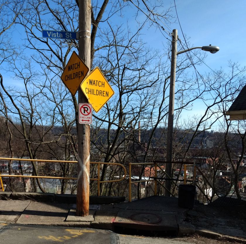
Lybrig Way, maybe 
Eye Stump

RATS run #00395 was a long hard run from Point Breeze, to East Liberty, through Larimar and into Lincon-Lemington. It was mid-morning on Saturday and I was surprised to find a crowd along Paulson Avenue. It seems that Mt. Ararat Baptist Church was having a mass vaccination event. I felt a bit odd running down dead-end Tyler Way with dozens of people milling about. At the end of Tyler Way, this odd structure stands. I have no idea what it is, but UFO has to be a choice.

Tyler Way 
Landed UFO
Graffiti and artwork adorn many of the neighborhood’s walls. Raymer did a Mac Miller tribute, while a lesser known artist renders bold angles and a someone remembers a friend. Artful graffiti is slowly outpacing the simple spray job; graffiti gentrification.

Loud and Bright 
Old School Memorial 
Mac Miller
Moving deeper into Larimar, there’s a lot going on. Houses with the deadly blue ‘condemned’ sign are getting renovated. The “Know Thyself” school is surrounded by bulldozers and fences. Just remember to report to the office when you get there and ask “What ARE you doing?”

Renovations Planned 
Looks Great! 
Report to Office, Please
Elmer Williams Square has some cute houses while the Freedom Temple Church looks like it’s seen better days. Those painters didn’t spend much time accentuating the detail of that building, did they? Further into Lincoln-Lemington, the land rises enough to provide a decent view all the way to Oakland’s Cathedral of Learning.

Elmer Williams Square 
Freedom Temple Church 
Cathedral of Learning in distance
Way up on Lemington Avenue, I saw an interesting school facade and took a closer look. Earthy, bold, colors and Mayanish tiles contrasted with the “young Queen Victoria” face staring out. And perhaps it is a theme, but make sure you report to the office here, too. Now it is called “Catalyst Academy” and I wonder if chemistry is the core curriculum.
Above this school several streets dead-end into St. Peters’ Cemetery. Some dead-ends you can go right up to, like this wall, while others are guarded by downed trees and old home foundations.

End of Churchland 
End of McClary Way 
Flath Way 
Older Brick Alley 
Catalyst Academy
Speaking of St. Peters Cemetery, they spared no expense with the sign. The front declares it is “Historic”, while the back lists which wars the vets fought in. All the way back to the Revolutionary War, I see. That’s impressive.

Front Sign 
Back Sign
From here, I trundled down Highland Avenue to Washington Boulevard. The greenspace on the left is actually part of Highland Park. I didn’t see any cat tails, neither mammals nor plants.

Cat Tail Trail 
Blooming Trees
Lastly, the arched bridges along Washington Boulevard are quite impressive. Several carry the streets above, such as Lincoln Avenue and Larimer Avenue. One, though, carries an old railroad. Apparently this railroad spur crosses the nearby Allegheny River and is being considered for a rail-to-trails project. At the moment, though, the Brilliant Bridge just crosses Silver Lake Drive, home to storage warehouses and a car wash. It used to actually be a lake, then a drive-in movie theater.

Highland Drive at Washington 
Common Place Coffee? 
Over Silver Lake Drive
From here, I trotted back to my car with fourteen miles in the running bank.

RATS run #00396 was a short run in the West End and Elliott. This was one of those frantic days, where just getting out for a run was an effort. Par for the course, I ended up in the wrong lane driving to the West End and just decided to park in Allegheny West, near Modern Cafe. It was OK, as I wanted a little more mileage than my planned route.
Crossing the West End Bridge has become an adventure these days. There are a couple of fenced-in walkways suspended above the street and below the bridge, taking you from the street to the bridge deck. I’ve run across it without a problem for years, but recently people have been sleeping on the walkways well into the day, leaving their bags and things strewn about. Covid or not, it is much closer to people and personal items than I’m comfortable with.
At any rate, I crossed the Ohio on the West End Bridge and made my way up to Elliot, Janewood Way in particular.

Janewood Way 
Amherst Street Steps 
Ohio River
Marking that one off, I visited Herndon Street, high on the opposing hill. I had previously taken it for a driveway and did not realize how long it was. A few houses clung to the hillsides there. I used the Attica Street Steps to come back down to the quaint business district of the West End.

Herndon Street 
Attica Steps 
Hello Down There!
The West End Business district is a small grid of street off of Steuban. Motorists trying to avoid tunnel backups often zip through this alternate route. On the far side from Steuban, a mere two or three blocks, streets generally end at the Saw Mill Run (creek), while cars on Saw Mill Run Boulevard scream by. Mount Washington rises above in steep cliffs.

Old buildings cut off from the main road 
Creekside 
Mount Washington 
That’s acute angle
There are some cute parts of town. It even has a gazebo. However, trudging on Violet Way I looked up and became concerned. There seemed to be a police incident in progress, as several officers were milling around. Indeed, as I passed, it turned out maybe a dozen officers, in full gear were there behind a building.

Gazebo! 
Sanctus Steps 
Yoga Wellness! 
Violet Way
They were chatting and joking. Shift change, I suppose. In 25 feet or so, it was a dead-end and I felt a little sheepish going back through the police crowd. With that I crossed the West End Bridge again, this time seeing two dudes rummaging through the homeless guys’ debris. I thought about the police a half-mile away as I whizzed past.

Not a whole lot to say here. This was a short evening run in Banksville. Banksville Park was quite active this time through. The last time, it was a rather cold evening. Now, guys were playing cricket in a ballfield, while scads of people lined a dek-hockey game in progress. Further on, it looked like a Little League baseball game was starting.
The surrounding neighborhoods are quite residential, with big lawns and big garages. Oakville Drive, though, is a mass of apartments. There could be as many as 1,000 garden apartments there. It looked pretty nice, honestly. Just know that you can’t actually drive the way I came. The northern section of the apartment complex overlooks the Parkway West as it bends toward the Fort Pitt Tunnels.

Daleland Avenue 
Oakville Drive 
Nice sky! 
More apartments with downtown buildings peeking out
A cell tower dominated the end of the playground. Lots of satellite dishes are clustered around that thing. Who knows how many antennae are on the tower? 50? 100? It’s hard to say.

Banksville Cell Tower 
So many dishes

Northview Heights is an area I had been avoiding. There are security gates on Mt Pleasant Road and Penfort Street, which I found intimidating. However, I had taken some time off work to recovery from Hyner 50k, so had the chance to run here on a sunny weekday morning. I had no problems, other than a little soreness in the legs. People were out, waiting for buses or picking up kids. Maintenance workers were vigorously mowing lawns and doing repairs.

Crossing I-279 on Swindell Bridge 
Church of Our Savior 
Penfort Street 
Northview Heights
Chicago Street branches out of the housing development and stops at a cliff above I-279. I wonder if it ever went across. A lone turkey sauntered into the woods as I passed. Eventually I made my way out of the development, down to Spring Garden Avenue and back to Essen Street.

Chicago Street 
Is this a fire-pit which gleams with “Church of Our Saviour” when lit? 
Essen Street
Crossing the Swindell Bridge again, there’s a neat glimpse of Downtown through the fence links.

Swindell Bridge 
I Spy Downtown

Last but not least, RATS run #00399 was a 5K run in Squirrel Hill North, land of the big houses. But I’ll start out on an alley and end on the public golf course.

Bainbridge Way 
Robin Road
Now, Robin Road is private, but since I’m not immune to doing private roads, I intended to go down it. However, it really felt more like a private driveway, so I bailed. This section of Squirrel Hill, “Murdoch Farms” has immense, imposing homes beautifully kept. Not so far away, little developments off of Schenley Park Golf Course include various “modern” style houses. Oh, so modern, they were built in the 1960’s.

North of Forbes area 
Darlington Court
The sun was setting across the golf course as I finished up, just past 5K distance.

That’s a Wrap!
(May was a busy month, too, but only 106 miles. I’ll start blogging about those soon. Thanks for reading.)