August 2019 Catch Up

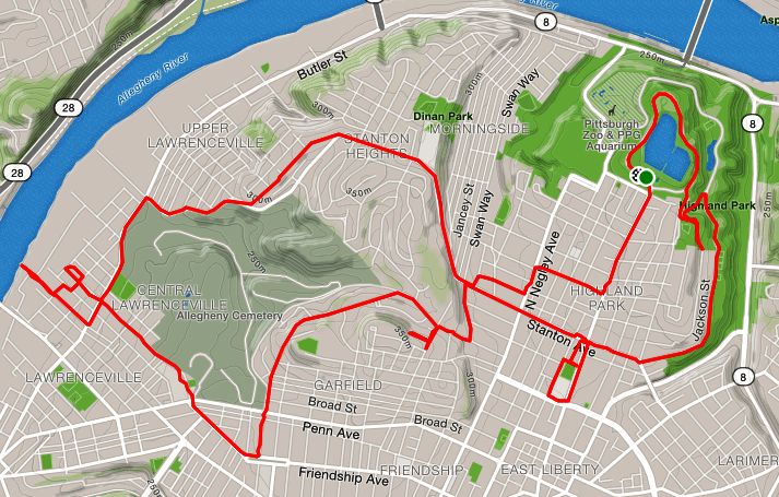
August was a pretty good month for running. Weather was hot but mainly dry. I hit 137 miles for the month with significant elevation. I got out to Morningside and am starting to fill in the big central Pittsburgh neighborhoods of Garfield, Friendship, Highland Park and Shadyside. I didn’t get out to the southern neighborhoods of Pittsburgh even once, though. Brookline and Beechview are still uncharted territory.

Route from Ellsworth Ave to almost the zoo shown on a map.
RATS #00101

Early morning run with Sasha simply going up and down long streets in Highland Park. Euclid Ave was on the outbound.

https://www.strava.com/activities/2602969129
RATS #00104

A rare evening run with SCRRC. We covered a few new streets near Penn Brewery, otherwise a usual route mainly on River Avenue.

https://www.strava.com/activities/2609800854
RATS #00105

Covering more of Shadyside. This time went down Devonshire St, which is a surprisingly quick way to get from Fifth Avenue to Centre Avenue.

https://www.strava.com/activities/2626838114
RATS #00107

A very short run into the Southside Slopes. Once you hit Josephine St, the streets are very steep, or they are actually stairs until you get to Arlington Avenue, (not on this map). It didn’t help that this was immediately after a quick ten mile run.

https://www.strava.com/activities/2634095350
RATS #00109 – Neeb Street

This was another short but steep run. Each of those contour lines is ten meters (~32 feet), so Hoosac St climbs over 60 feet from Alger St to the top of the hill past Neeb St, a distance of no more than a tenth of a mile.

https://www.strava.com/activities/2639858948
RATS #00110 – A PBR run

This run went down College Avenue in Shadyside, earning its RATS number. With Pro Bike & Run , which is always enjoyable.

https://www.strava.com/activities/2655584176
RATS #00113

This was another morning run in Shadyside. It drizzled a bit, and we went round and round on the alleys.

https://www.strava.com/activities/2667219500
RATS #00114

This was a quick six miles with pHPRC – Perry’s route in lieu of an HPRC route. The section going straight through Uptown on Fifth Ave earned this run the RATS badge.

In Friendship We Meet

Friendship Perk & Brew – start of run, thanks to HPRC

This was a cool run, both in temps and character. A cold front had pushed out the scorching August heat. The day was sunny, too! The Highland Park Running Club had met at Perk and Brew earlier in the morning and their runners were finishing up. Many were relaxing outside or lined up inside getting coffee and ice cream. I chatted a bit and then set off. My plan today was to do a few streets in Friendship and then take off to Morningside.

Running in Friendship was great! The flat, tree-lined streets were lined with large brick houses. There were many runners and walkers out. Children rode bikes and parents pushed strollers. I liked the street names, too; Harriet, Evaline, Winebiddle, South Pacific and South Atlantic, to mention a few. Even the alleys had cool names. Who can resist Asterisk Alley?

My overall goal was to run at least 13.1 miles, a half-marathon distance. I wasn’t exactly sure how many miles I’d get in Morningside, so getting two or three in Friendship would be a good start. Peeling off of Harriet, I went up Roup Street, then zig-zagged over to North Aiken Ave. North Aiken is one of the few of theses streets to go straight through Garfield. It also rises precipitously once you’ve crossed Penn Ave. Another zig and another zag found me on Chislett Street, which would take me into the heart of Morningside.

Morningside is a long narrow neighborhood nestled between Highland Park, the Pittsburgh Zoo and Stanton Heights. It is comprised of four parallel streets, Chislett, Jancey, Morningside and Duffield, and an equal number of alleys. At their northern end, are bluffs overlooking the Allegheny River. There are a number of cross streets, too. Also, at the end of Chislett and to the right is a section of short roads and alleys. While Friendship is tree-lined, Morningside is mostly open. Small lots with small houses line the streets. It is packed with people; few vacant houses, no open lots. As I ran on Chislett, I passed a coffee house and a few other small businesses. This was rather plain running. Then, at the end of Chislett was a nice view of the Allegheny River. Making a right onto Witherspoon St, I came to a flight of public stairs. Of course, I had to go down them, whereupon I realized I was very near the road entrance to the Pittsburgh Zoo! That was a little surprise!

I re-traced my steps back to Witherspoon and did the necessary ins and outs to run the warren of streets there. The edge street, Antietam, directly overlooks the zoo entrance. At the end of Antietam, a baseball game was in progress at Natoli Field. Also a working water fountain! (Yay!)

From there I went back and forth on Jancy Street, Morningside Avenue, and intervening alleys; stopping for a moment at a Rite Aid to get some OJ. I spied the Adelphia stairs (there’s a street sign on them), but resisted the urge to run up them. I was getting tired and wasn’t going to cover every street at once. I made my way back to Perk & Brew, via North Negley and Mellon Street, getting in a solid fifteen miles.

From Friendship to the end of Morningside: RATS #00111

HPRC Tribute Run

Run through Highland Park and Stanton Heights: RATS 00069

I got out of my neighborhood for this run, starting in Highland Park. Ironically, I had skipped over an HPRC run which started a little earlier, but was from downtown. Highland Park is both a city park, but also a neighborhood. The history of each are intertwined. The park dominates the neighborhood and the park is dominated by the Highland Park Reservoir. It rests about ten or fifteen feet above the rest of the park. Surrounding the irregularly shaped reservoir are conformal streets and paths, with sections descending to lower curves. This is a major portion of the water system run by the Pittsburgh Water and Sewer Authority. The history of the water system is fascinating. It takes vision, significant engineering and an ability to bring together fractious local politics to create and maintain public water systems. Clean water is also a bedrock of public health, relegating diseases like cholera and typhoid fever to the dim past in modern cities. The 125 million gallon Highland Park Reservoir #1 was put into service in 1879, 140 years ago, for those who are counting. In recent years, lead levels in the city water have become a major concern. PWSA has a number of projects ongoing to mitigate this problem, including installing pipes like those below.

Pipes for the next 100 years

While I was pretty quiet exiting the park on Stanton Avenue, I apparently scared the horses. I guess I was breathing harder than I thought! There are some nice tennis courts along Stanton Avenue, the street I would follow for much of the run.

Horses Guarding Highland Park Stanton Avenue Entrance

Highland Park is a large area. While the housing stock varies from garden apartment complexes to single family homes, there are not many small houses. Usually they are large brick affairs with three floors and decent sized yards. Many have been converted into apartments. The streets are largely tree-lined. There are broad, relatively flat areas surrounded by some big hills. For the size of the area, businesses are rare, being concentrated along Bryant Street and Negley Avenue.

At any rate, I ran down Stanton until I caught Chislett Street and exited Highland Park. I turned onto Black Street until it became Mossfield. I caught a few small streets off of North Aiken Avenue, too. I veered onto Schenley Avenue (nowhere near the park of the same name) and then to North Mathilda Street. This area was much hillier than Highland Park and the houses were not as impressive. There was surprising new construction but also older houses and the too-often seen ragged Pittsburgh row house. This neighborhood is Garfield and this was my first time running though it. My initial impression was that it was very green, hilly and a little empty. North Mathilda dumped my down onto Friendship Avenue. From there, I cruised past Children’s Hospital, into the narrow houses and steep streets of Lawrenceville. I followed 45th Street to Butler, then caught 43rd Street to it’s terminus at the Allegheny River. Is has a cool view, but is also the entrance to 43rd Street Concrete (which has an impressive operation going).

40th Street Bridge from the end of 43rd Street

Finally, I needed to turn back to the car. I made my way to the low end of Stanton and followed it (mostly) back to Highland Park. That’s quite a climb! This was a cool run, having covered many different areas of the city and taking me from one of the highest points in the area to river level.

the·od·o·lite

Strava map of route on Theodalite Way in Greenfield
Horizontal and Vertical Angles along Theodolite Way: RATS 00067

I’ll admit it, I just like the name, “the·od·o·lite”. I like the way it rolls off the tongue. I like the image of an explorer pulling out a theodolite to measure tracks of land in the jungle. Not sure if they did. The French Geodesic Mission, an expedition to measure the roundness of earth, used quadrants instead. Robert Whitaker wrote a fascinating book, “The Mapmaker’s Wife” about events surrounding that journey. These days, you’re more likely to see theodolites at roadway construction sites, as you crawl by in traffic. I do think they’re cool. Here’s more info about them if you’re curious.

But getting back to the run. Theodolite Way is a rather long alley in Greenfield which mirrors Greenfield Ave, only one short block away. Like many residential alleys in this area, Theodolite Way provides access to garages and a place for garbage cans. Like most of the streets in this area, Theodolite Way is hilly. There are two dead-end segments of Theodolite Way, separated only by fence and a flower garden. After traversing Theodolite Way along its length, I tried to cover as many Greenfield streets as possible; Montclair St, Lopez Way, Kish Way, Norfolk St, Millington Road. Slowly, but surely I’m traversing many routes in the warren of streets of hilly Greenfield.

Dagmar Views

https://www.strava.com/activities/2399346482
Beechview, Take 2: RATS 0058

Again, I headed to the hills of Beechview on a warm Sunday morning. Again, I parked at the little playground on Westfield Street. This time, I followed Andick Way as it changed from a modest street to a set of stairs. They were broad and shallow stairs, several feet of flat concrete before rising to the next step. Hitting Rockland Avenue, I took a right and ran past Beechwood Elementary School. At the end of the parking area, presumably where vans, buses and cars drop off hundreds of kids in the morning, there was a large swale surrounded by ten foot chain link fences. It was dry this morning and a brown rabbit with the signature cotton tail happily bounced across this protected area. This is one of the highest points around and I was surprised to see such a massive drainage installation there.

At any rate, Rockland drop precipitously from the school, going all the way to a T-stop. My run plan originally had me doing this last, but I did it first. It meant that I had to run back up Rockland, ugh. Getting back to Andick, it morphed again into a street and then back to a sidewalk. Finally I broke out onto Dagmar, near the top.

From this vantage point, if you look toward Downtown, you can see the Trimont Building on Mount Washington. Looking down the other way, Dagmar flows down the hill like a roller-coaster. You might be able to pick out a bridge carrying the T far below.

At this point, I just crossed Dagmar and followed Bayonne to the end. The area was pretty nice. People were out mowing lawns, tending flowers and walking dogs. Bayonne is relatively flat, but starts to descend quickly near its dead-end. The cross street, Alverado Ave has some houses off of it nearly a block further downhill, accessible only by a long driveway. At any rate, I wandered up to Crane, then up another section of Dagmar until it, too, ended in a driveway. Then it was the long roller coaster down Dagmar. Nearly under the overpass, I veered off onto Cape May, hit the steep Milo Street Stairs and plodded up Alton, eventually reaching my car just as a rain shower broke.

Adventures with Alyssa

Adventures with Alyssa: Run All The Streets 00053

Alyssa is a planner, a runner, and, ugh, a morning person. She delights in running different routes throughout the city, finding cool public art and seeing the sunrise. She also organizes runs, often two or three a week. This is pretty impressive because it requires her to figure out a place, time, a rough route and invite people who are likely to come, and who are likely to get along and have fun. At any rate, Alyssa often invites me to come along. Most of the time, it’s too early for me, or too far away. But this time, it was a special run, several regular runners were going to be traveling for awhile, Rich was going to have surgery in a few days, and it was Rich’s birthday.
So, I dragged myself out of bed and drove in the murky pre-dawn light to Duquesne University. Street parking was free till 8 am, yay! We gathered in a parking lot, nine of us. Everyone was a pretty good runner, often doing trail ultras. Many had run the Pittsburgh Marathon the previous Sunday. Kim and Rich got birthday hats and a personal photo op with Alyssa.
Then, whoosh, we started! There’s no slow start with these guys. We cruised along Forbes up into Oakland, then down steep Bates Hill and across Hot Metal Bridge. As the run group morphed and changed around me, I had a chance to talk to most everybody. Rich was tired, having been celebrating his birthday until late the previous night. John had had a great Pittsburgh Marathon and was looking forward to upcoming marathons. Tim was talking about running while away. Sarah, Tony, Alyssa, and Kim were talking about Glacier Ridge and Thunderbunny, two upcoming ultras. Just as I started wondering where we were going, we paused at a “Just Good Donuts”, which is co-located with “The Pub Chip Shop”. Alyssa got us all doughnuts with a 1,000 calorie minimum. We did a photo shoot and then ran down Carson Street, all carrying little white bags full of deliciousness. It was quite comical, something you might see on Monty Python. Crossing the Smithfield Street Bridge, we came back to our starting point, salty but sweet.