This was a five miler through Polish Hill, trying to finish this tight neighborhood of narrow streets, impossible hills and stairs. I ran right after work, as a chilly evening rainstorm swept past. That storm was not fun, as the wind tried to tear my jacket off and the steep streets turned into rivers. Luckily, it didn’t last long.
Polish Hill is now an eclectic mix of the narrow old houses perched on cliffs, spectacular, renovated, $450k homes and small businesses. The WORLD HEADQUARTERS of Pepper’s – which sells polarized sports sunglasses, is unceremoniously perched on Pulaski Way, atop a cliff overlooking Liberty Avenue. Herron Ave winds steeply from Bigelow Boulevard to Liberty Avenue, cutting Polish Hill in two.
World Headquarters! Who knew?
Typical Polish Hill Street
Harding Way – complete with stairs at the end
Back on the narrow, winding streets off of Herron, homeowners stake out extra space, from making dead-end stubs of streets their personal parking spots to reclaiming a bit of the hillside. I love this “Kenny’s Woods” sign, looking just like the ubiquitous “Kennywood” signs you see all over town. Of course there are stairs. Jewel Street stairs intersects Flavian steps on a landing.
Jewel St Stairs
Jewel and Flavian
Now starting to dry out, I made my way down Herron Avenue and onto Sassafrass Street on the other side of the East Busway. This valley road becomes Neville Street, then Lorigan Street as it passes far under the Bloomfield Bridge. Car dealerships keep excess inventory down hill, behind barbed wire fences. There is a cool place down here, Iron Eden, which makes ornamental ironwork and looks like some bizarre hovel in a medieval tale. Continuing on Lorigan took me to the Ella Street Stairs. These climb the high hill with a few turns, eventually leading to Ella Street (if you go straight), or Wertz Way (if you make the right turn at the last landing).
Iron Eden
Ella Street Stairs
Top Ella Street Stairs
I saw a toy truck on one of the landings. I can just imagine a six year old boy playing with his truck there, only to be called away by his Mom, accidentally leaving the truck. He was probably forbidden to go on those stairs anymore, and after a few years moved away. I can’t imagine he forgot about it. I hope that one day, as an old man with grandchildren, he takes them back to visit his old neighborhood and finds his truck still there.
Toy Truck
Coming back through Bloomfield and Lower Lawrenceville, I crossed the Herron Avenue Bridge again. Immediately after crossing the bridge, there is an impressive set of stairs on the right. These Downing Street Stairs, took me back into Polish Hill, where I finished up. Now, except for three sets of stairs and a small alley, I’ve run all the streets of Polish Hill!
This was a rambling run across the Northside from East Allegheny to Elliot in the West End. It included densely residential areas such as Central Northside as well as the wide open warehouse district between Route 65 and the Ohio River. I crossed bridges, went up stairs and finished with seventeen miles on this sunny, but chilly Sunday.
Starting out on the Northshore, I specifically wanted to finish off Virgin Way and Tripoli Street. In spite of the brilliant sun and crystal clear skies, Virgin Way was very threatening. Circling back to Tripoli Street, I noticed the Neu Kirche building, built, if the stones do not lie, in 1859. Originally a German Church, perhaps Lutheran, it has been repurposed as a center for arts.
Virgin Way
Neu Kirche
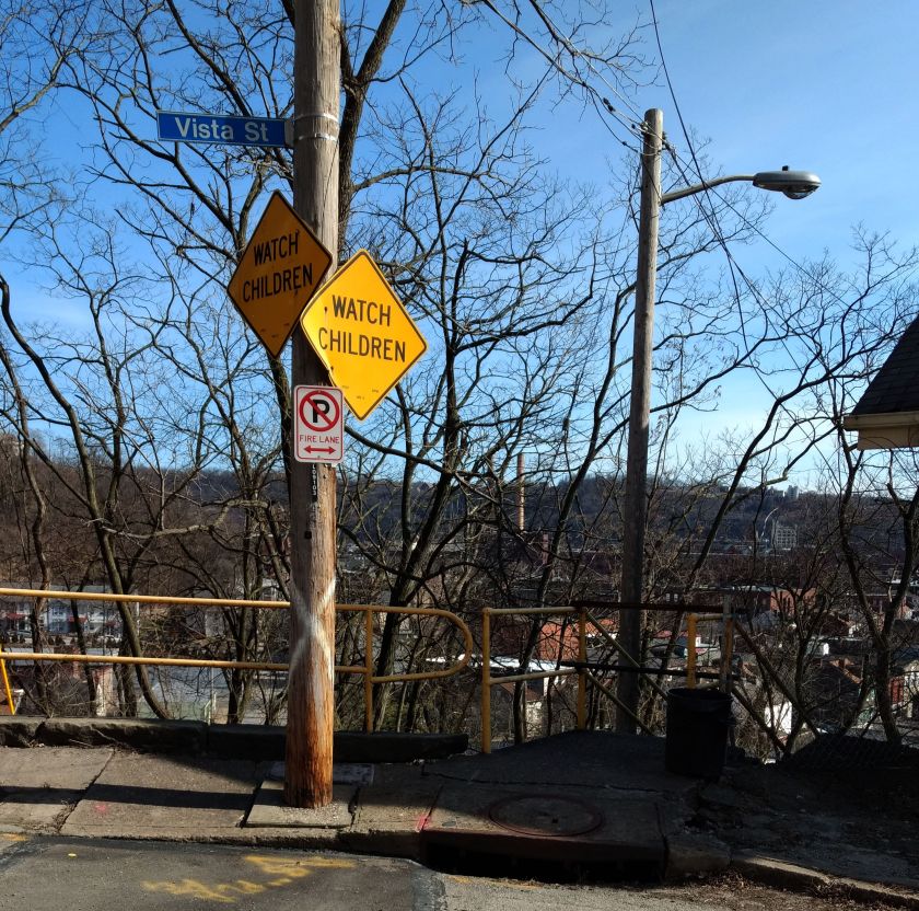
This took me to Vista Street. I had hopes of trotting a little up the hill and taking the Vista Street steps down to Itin Street. Alas that was a navigational mistake, as these stairs were closed.
Make sure those kids aren’t playing on the Vista Street Steps
Apparently Thomas was here
Leaning Houses of Vista Street
Turning my attention to the Central Northside, I did the grid of Sandusky, Lorraine and Boyle Streets. Unlike the other two, Boyle doesn’t have an outlet at the top of its steep rise from North Avenue. As I was running up Boyle, two women, likely in their mid-to-late thirty’s were chatting at the top. I drew closer and closer, hoping to find an alley or staircase to Fountain Street. A few yards before the retaining wall, the women looked more and anxious as I approached. Finally realizing there was no way out here, I said something lame like:
“Oh, I thought this street went through”.
“Nope, doesn’t go through”, the dark-haired woman with brown knee high boots stated flatly. Her companion, with a black and white checkered coat tried to be positive, commenting “At least you’re getting some good exercise!”
If she only knew, I thought, reversing direction. Somewhere along the way, I also saw an outdoor beehive oven. Again, I was glad for the brightness of the day as I zig-zagged through the streets and alleys. But then, I noticed something following me. On one street, there it was. The next block over, I saw it again. Whew, just a true alley cat.
Beehive Oven
Boyle Street
Run All The Alleys Cat
Now I went up Chateau Street. My left knee started to twinge a little, but I decided to run through it. This took me to Warehouse Land. Large warehouses and garages were separated by large, wide streets. While some of the buildings were in disrepair, just about everything was occupied with some business or another. There’s one section, an “Industrial Park” with high fences and a big gate. Just inside is “Get Hip Records”. Around the corner is the whimsically painted “Bicycle Heaven”.
Get Hip Records
Bicycle Heaven and Museum
Old Garage Door
I finally made my way across the West End Bridge. Coming onto Steuben Street, I took the first staircase I saw. A couple of years ago, these stairs went all the way up to Lander Street. Today, however, they only made it to Elliot Street. The second flight was closed. I had to detour a bit down the street, taking the Planet Avenue steps instead.
Lander St Stairs bottom
Planet Ave Stairs
Closed Valonia Stairs
Thus began my ascent into the West End Overlook area. Huffing and puffing my way to the top of Valonia, I came to Saint Martin Cemetery. Apparently all the tallest hills have cemeteries on them.
Elkton Street
Saint Martin Cemetery
At this point, my knee was truly complaining, so I started back towards the Northside. Gamely trying to hit new streets wherever I could, I ran down Crucible Street. Sure enough, there were some stairs! But, no. They were closed. I was a bit bummed and just went to Steuben Street via Amherst Street. On the lower end, I could see why those steps were closed. A lower section of the stairs and railing had completely collapsed.
Crucible Stairs Top and Bottom
Steuben Street is a main road and the sides are littered with trash, most likely thrown from cars. I took the stairs from Steuben to South Main Street, where I surprised four deer. Just for fun, I highlighted one of them in red below.
Steuben Street to South Main Street
That was about it. It was another two and a half miles back to the car, which felt like it took forever. Getting into the car, I greedily drank water and gobbled pita chips.
This run was along North Lang Avenue from Point Breeze to the steps at Apple Avenue. Outside the excitement of fire engines racing by on Penn Avenue, it was an uneventful run. The building “Engine House No 16” was, indeed, a fire station, but more recently has been renovated to its current state. City of Pittsburgh firetrucks came from a more modern house.
Not only the Engine House, but also engines blaring past
Crossing Penn, as North Lang drops out of Point Breeze into Homewood, the houses and yards are large. This one below was pretty typical, likely built in the early 1900’s. It seemed prim and proper to me, with its blue trim and cream colored brick and the morning sun blazing.
Neat house along North Lang
Crossing the railroad tracks and East Busway on the North Lang footbridge, tall church spires against the bright blue skies caught my eye.
St. Charles Lwanga Catholic Church
Keeping to North Lang, I continued until the street, itself, gave out. This marked the end of flat Homewood. Steps led up to Apple Avenue, a delightfully named street which is disappointingly drab.
North Lang steps
Up on top of the stairs, the hillside held vestiges of past grandeur. This magnificent house looks to be on the upswing, but I’d be reluctant to trick-or-treat there!
I ran the length of Apple Avenue until it ended at small, unimpressive, street. Circling back, I finished where I had started in Point Breeze. It was a great run, an extra 4.7 miles after my earlier 4 miles in Frick Park.
Who is he? Sunday, “he” was me. I was running in Oakland and decided to pay the remnants of Forbes Field a visit. The first remnant was the outfield wall, 457 feet from home plate. The second was home plate itself, preserved under plexiglass in the floor of Posvar Hall. Sleepy studying students looked askance at a bundled up runner traipsing in, taking a picture and running out.
Outfield Wall
Home Plate
But, as Pitt has built up Oakland, “he” could also be every student, parent and professor drawn to its burgeoning educational, medical and research center. Here is Pitt’s research page, where you can see for yourself how large it has gotten. I’m a graduate of Pitt myself. But this day, I was just a runner, trying to capture a few more streets. Old Oakland is hard to see here, but there are glimpses.
The “O” Hotdog Shop
Older house dwarfed by newer buildings
Medical Center
After a few miles I stopped by the Cathedral for a few trips up the stairs.
A few years back, before I starting this “Run All The Streets” project; before I did a stairs tour; before all of that, Lamar, a local runner and urban explorer organized a “Take The Stairs Fatass” event. A Fatass in the running community is an unsupported, no frills run. No fees, no bling, just a run for the fun and adventure of it. So, one morning in March 2018, I found myself under the Birmingham Bridge with about 20 other running nuts, ready to do a big loop around Pittsburgh, taking city stairs whenever possible. I was running with Monica and Amy.
At that point, I had run a few Pittsburgh Marathons and even a few trail ultras, but otherwise had run mainly in the East End of the city; Regent Square, Squirrel Hill, Frick Park, Edgewood. Well, that 50k was an eye-opener for me. Polish Hill, City View, West End, Duquense Heights were some of the areas we went through. Despite examining the map in detail the night before, we spent a lot of time just finding the stairs. One of us had the directions, one of us had Google Maps on the phone and another tried to take in the big picture and keep us moving in the right direction. Unfortunately, after 20 miles, we got turned around coming out of Emerald View Park and couldn’t find our way anymore. We bailed and ran back to our cars, a mere 22 mile day. Ever since then, Amy and I have been chatting about finishing it.
Now I’m over a year in to my project of fastidiously running every street, alley and stairway in Pittsburgh. I’ve run on thousands of streets. I’ve run hundreds of miles and dozens of stairways. I’ve seen many stairs and nooks of the city with mis.steps, as the muses of the stairs speak to her and inspire her stories. I’ve covered many areas on my own, up hills unbelievably steep, seeing deer everywhere, finding surprisingly cute homes everywhere. I always find a house at the end of those long dead-end’s.
So I’m re-creating this “Take The Stairs 50K Fatass”. It will be on March 29. This time, I’m starting at Threadbare Cider instead of underneath a bridge. I’m relying heavily on Lamar’s original map, but I have changed it slightly to include a few more stairs. This run was about verifying some of the route. My friend and fellow runner, Naomi, was feeling adventurous and came with me to explore the route in Oakland.
RATS #00174 – Hodges St
Corner of Hodges And Bates
Up one fork of Hodges
Stairs from Hodges to Bates
We started in the South Side and crossed the Hot Metal Bridge. Just past Parkway overpass on Bates is a little side street – Hodges. Only a dozen houses populate this neighborhood in the holler. Stairs rise on either side. I was interested in the ones going up to Bates, so we took those. Sunday morning traffic was light, so we were able to scamper across Bates to catch the Frazier Street Stairs. This is part of the upcoming 50k.
Frazier Street Stairs
Looking Down Frazier Street Stairs Towards Bates
Frazier Street is a long street at the edge of South Oakland. This area is generally overrun by students, but there are still some single-family homes holding out down here. Unfortunately, some people have given up the ghost, even though their houses look good. If you can’t read it, that sign says “Sorry, We’re Dead”.
Haunted House?
From there, we traversed on Dawson to hit Diulius Way. Years ago, when I was a student at Pitt, I found this route from Schenley Park to South Oakland. This is also on the new race route.
Diulius Way – takes you from Dawson to Boundary
Now, once down at Boundary Street, Naomi wanted to just run for a bit, so we ran about a mile or so to the train trestle. Coming back, I wanted to verify a couple of stairways I saw on maps which would take me up again to South Bouquet Street. Unfortunately, development in Oakland has taken over some of the stairs I hoped to find.
No bueno
Talk about an obstacle
Finally!
Eventually I did find a path, albeit between two apartment buildings. So, I’m glad I did this run. I verified that the route through Hodges Street works, yet found some paths just didn’t exist anymore. The route will also include the newly refurbished Joincare Street Stairs, gleaming on the next hill. Just one more section to verify before springing the updated route on the world. Stay tuned!
This was a fairly long run, over half-marathon distance, on a cool, cloudy Saturday morning. I started at Nova Place, on Pittsburgh’s Northside. It is literally around the corner from the Children’s Museum, a place where I spent many hours with my children. It was quite an adventure land for them, with so many activities, from a multi-story maze to painting and screen printing.
Modern Entrance to the Children’s Museum
Post Office now part of Children’s Museum
“P” for Post Office
Running out of the Northside along Chateau Street, the neighborhood becomes less stately and more forlorn. Old architecture still shows its fine bones, even in decay.
St. Peter’s Church
Boarded up house along Chateau St
Crossing under the Route 65 highway took me to an industrial area. It features wide flat streets and is lined with large yards for the Port Authority, Duquesne Light, Mascaro Construction and others. Railroads coming out of the city make a large curve here and cross the Ohio River on massive bridges.
Duquesne Light Wire Coils
Under the train trestle
Railroad Trestle and Bridge
Knowing these flat streets wouldn’t last forever, I made a turn onto Eckert Street. Strangely enough, a group of runners passed by, coming down Eckert Street. I was curious as to which running group they represented, so asked the last one ” Who are you running with?” She just smiled, threw up her hands and said “I’m in my own pace group!” She was only 50 yards behind the other five, but it must have seemed like a mile.
Now, I was truly exploring. Like all good explorers, people had actually been there before, but it was new to me.
Three bridges over Eckert Street
Eckert St Stairs
View from California Ave Bridge
With all the bridges, hills and houses on the hills above, I knew there would be stairs somewhere. Sure enough, just past Don’s Diner, in the shade of the California Avenue bridge, I found a set of stairs. Coming off the stairs on top, I landed in a cove of fences and backyards with a narrow sidewalk leading to the bridge. Once on the bridge, I headed north, away from downtown. I was officially in the Brighton Heights neighborhood. Rising slowly, California Avenue goes past a mix of houses, mostly on the larger, older side where dinosaurs peaked out from the bushes.
Typical Brighton Heights Street
Dinosaur & Satellite Dishes
Grand Residence
Eventually, on Wilksboro Avenue, I ignored another “No Outlet” sign, and ran to the end, hoping to find another set of stairs. I didn’t, but what I DID find was amazing! There was a long pedestrian bridge rising high off the ravine floor. It had the structure of a full size bridge, but only the width of a sidewalk. Unfortunately, it was closed. I haven’t seen another structure like this in Pittsburgh. As I later discovered, this is the “Wilksboro Avenue Footbridge”.
My detour around the closed bridge brought me to another typically Pittsburgh scene, a small neighborhood park with a lively game going on. In an earlier run through the Hill District, it was football. Here it was Deck Hockey.
Deck Hockey
Crossing into Bellevue briefly, I turned around and made my way back toward downtown. I kept a block off of California, on Massachusetts. There were some cool houses; the blue portal house, the rambling wooden wreck with a rounded porch. I found myself going down Richardson Street, nearly to Eckert St again, but took the stairs up to Bainton Street instead. That was a long flight!
Beautiful Porch
Crumbling Glory
Bainton St Stairs
I ran through the upper section of California-Kirkbride, where Success is a two-block street. It is better than Fineview, where Compromise is a dead-end. Finally, I got to Marvista street and its long flight of stairs. This one is not for the faint of heart. Many of the railings are missing and there’s a section of broken stairway as well. At the low end, Marvista is a sad street rising up from California Avenue. But some people still live here beside the houses emblazoned with the city’s blue “condemned” badge. Missing from my pictures are the set of stairs on Hyena Way that come down at right angles to Marvista St.
Marvista St Stairs
Don’t worry, you’d only fall three feet
Lower end of Marvista St Stairs
From here, I just ran back to Nova Place, catching a few more streets on the Northside. Nova Place was busy when I got there, full of runners and families recovering from the Children’s Museum.
This day’s run was in Sugar Top. My starting point was the edge of a small square park dominated by a blue water tower and fenced water reservoir at the apex of the hill. From the walkway around the reservoir, on a clear day you can see all across the city. However, it was rather foggy, so I concentrated on the nearby streets. Carnak Street is more like an alley and quickly disappears into grassy asphalt. The Alpena Street Stairs allow quick access to Bigelow Blvd. Houses in the area varied from dilapidated row houses to large, nicely kept homes. Lilian McKibbin Steiner wrote the paper “Sugar Top and the Cobblestone Jungle” about redevelopment in the Hill which includes interesting tidbits and maps of this area.
After the previous day’s long run, this was a recovery run. For those not aware, a “recovery run” is an easy run after a very long, strenuous run, usually the day after. The rough idea is that after a long run the body needs to recover. Simple rest and good nutrition provide all the necessary ingredients for recovery. However, training is about improving. To improve you need to stress your body and then allow it to recover. Training is also about schedule, so the faster you can recover, the faster you can apply additional stress, improving even more. Some athletes use anabolic steroids to achieve quick recovery. For running, my preferred method is the recovery run. Practically, it is a slower and shorter run.
Neighborhoods
Larimer Neighborhood
Highland Park Neighborhood
I haven’t run much in Larimer. It has a more interesting history than I had thought. Honestly, I had not thought much at all until I was writing this. I think that’s the same for many in this region. Only when it makes the news do you even think about Larimer. It is geographically isolated, bounded by deep ravines and off the beaten path. Highland Park, an adjacent neighborhood, is a bustling, busy area, with a large park and the zoo.
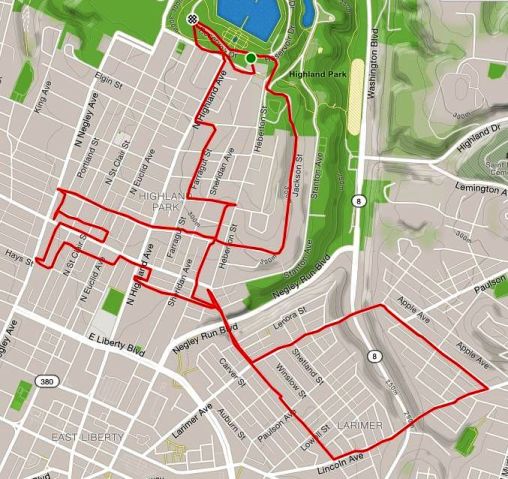
Finally, the run
RATS #00136
I started in Highland Park, near the reservoir. My goal was to run five to ten miles at a leisurely pace and, afterwards, meet some friends at yoga in the park. Street-wise, I wanted to complete Jackson St and then see how Larimer Ave looked. Jackson Street emerges from the park, makes a ninety-degree angle and dashes down the hill to North Negley. One curiosity is the bright blue City of Pittsburgh street signs on Jackson for BRYANT St and HAMPTON St, even though there’s nothing, not even a stairway, which suggests that those roads actually intersect Jackson.
Curious case of street signs on Jackson St for Bryant St and Hampton St
Completing Jackson, I wandered a bit and then made my way up Larimer Ave. This was all new to me. I crossed the Larimer Avenue Bridge. There was no elevation change for me, but the bridge crosses Washington Ave, about 250 feet below. The houses were fairly typical Pittsburgh brick construction, four-square houses, narrower than what you see in Highland Park and usually approached by a healthy staircase up to a porch. There was an “African Peace Garden” in a vacant lot with an impressive wrought metal entrance. As it started to sprinkle I traced a square and made my way across another, nearly identical bridge. The sprinkle was brief and I got back to Highland Park just in time to do some yoga. Then nap.
September was quite the month. I ran more miles (189) and second highest elevation (12,425) this month than any other. I covered many streets, but still did not get into the Big Southern neighborhoods. Nineteen September runs got the “RATS” Badge, covering new streets. Here’s the wrap up.
RATS #00117
RATS #00117 – covering the last bit of Nicholson St finally
RATS #00117 got the badge for finally crossing off Nicholson St off my list. Whoo!
RATS #00118
RATS #00118
This run originated in Shadyside and traversed into East Liberty. The Strava route is a bit misleading in that the first few miles actually went on South Graham St, crossing the East Busway on a pedestrian walkway. Little Brownwell St has some neat old houses on it. Unfortunately they now only look wistfully over at Bloomfield across the wide bus way.
RATS #00121 Pre-run, run, a pre-run run
RATS #00121
A couple of miles before my initiation into Sami’s runs, singing tunes!
RATS #00122 Sami’s Run!
RATS #00122 Sami’s Run
This is a run worth the explanation. Let’s go into the Wayback Machine. …whooowhooowhooo <flashing lights> …
…landing a few years ago on a random Tuesday. In those days, Steel City Road Runners had a track workout. Elijah would run it from the Schenley Park track. (A few more “whooos” of the Wayback Machine would have taken us to the CMU track…) A man of more medals than words, Elijah religiously taught us the “A-skip”, the “B-skip”, and brought “high-knees” and “strides” into my vocabulary.
Then there was “reorganization” within Steel City. (Oh, no!!) At some point, the remaining leadership decided to cut track. Like energetic saplings rising from the trunk of a felled trip, several small running groups have emerged. One of them, HPRC, I have mentioned often in this blog. Another one, which I like to call pTNT!, is Perry’s Tuesday Night Track group. Perry was one of the coaches in Steel City and carries on the track tradition. In addition to posting about track, pTNT! also posts about other runs going on. That’s how I found out about Sami’s Thursday runs. Sami is part of HPRC, but, like me, has some issues getting to those 5:30am runs.
So, we started, promisingly enough, at Silky’s on Liberty Ave. Nothing but wide open, nearly flat streets! But Sami had other ideas. We galloped into Oakland via Centre Ave. That was worrisome, as Centre keeps rising. But then we cut over to Bayard St. Ah, nice trees, slight uphill. But then, up DeSoto! Up Terrace! Up Allequippa!! Now on level with the top of the Cathedral, we caught a little break on “Champions Dr”, only to climb up the backside of Centre Ave again! Five miles, 460 feet of elevation, it wasn’t easy. Luckily, it also ended at Silky’s, and they were stocked with Runners Honey, aka beer.
RATS #00125 – Ascend Runner Party
Ascend Run Club RATS #00125
In addition to climbing, yoga and some fitness equipment, Ascend also has a small run club. Tonight’s run was inspired by the promise of beer and Chipotle after the run. That was quite the right promise, as they had nearly 50 runners show up. The routes were three, five and seven miles. Needing lots of miles, I went out with the seven mile group. What they didn’t mention was that they were moving at a 7:30 pace!! Like the last hippo in Jumanji, I struggled to keep up. After four miles of lightning speed (for me), I slowed down to a more comfy pace and caught a few new streets. It was a good run, with good food and friendly faces.
RATS #00126
PBR Run, RATS #00126
This run was with Pro-Bike’s Wednesday night group. A few new streets around Schenley Park earned this run a RATS badge.
RATS #00127 A Northside Pre-Run Run
Exploring the North Side before a group run. RATS #00127
Nothing too spectacular about this run. Eloise St was longer than I expected. Manchester streets are pretty desolate. Many houses must have been taken down, so there’s lots of open space.
RATS #00128
RATS #00128
This was a group run from Allegheny City Brewing. I believe the two blocks of Middle St, earned this run the RATS badge.
Steuben St Doughnut Run RATS #00130
Doughnut Surprise on Steuben St: RATS #00130
This was a recovery Sunday run after a long run on Saturday. I had gone to the the West End Overlook to take some pics and just wandered a little from there down Steuban St. This area is super hilly. Going down from the overlook, I took a long flight of stairs at the end of Fairview, which took me to Furley St. A couple of blocks of stairs…pretty impressive. A couple of turns later, I took the Amherst St stairs up from Chartiers Ave, which eventually took me to Steuben St. The neighborhood coming off the overlook was reminiscent of Morningside – small houses, close to each other. There were lots of people out, fixing cars, mowing lawns, walking dogs. Steuban St. was a bit different. It is an alternate route for drivers going to the Western suburbs, so it can be pretty busy. In this area, the houses are a bit farther apart, bigger yards, but not very cozy. Then, going up a large hill in the sun, I saw this sign:
Ahhh! A sign runners love to see!
Not the best sign, but a woman coming out of the store said “They’re open! I drove from Ohio to get these! You’d better get one!” I smiled and nodded and planned to come back. Another mile along this road and I returned. This time, people were parking randomly along the road and coming in and out the store. I went inside and searched for my cash while a young couple came in. The woman was impressed that I had run there and offered to buy my doughnut. I thanked her but declined, having come up with the dollar required. It was still warm!
The reward
RATS #00131
RATS #00131 Polish Hill
A short run in and around Polish Hill. Lots of narrow streets and stairs in this cliffhanging neighborhood.
RATS #00132
RATS #00132
A moderate distance through Shadyside and Friendship. Caught some new alleys in Shadyside.
RATS #00133
RATS #00133
Starting in Grandview Park, I ran some of small streets perched over the Liberty Tunnels.