Here are three runs from December 29, 2021. I had taken off work and had the day free to run, so I covered streets in Oakland, Westwood and Mount Washington.
RATS #00489 in Oakland
I started on Frew Street in Oakland. I was hoping that the construction on Hamerschlag was open enough for me to slip by. Alas, it wasn’t to be. The area under a giant crane was well-blocked off.
Construction Blocking HamerschlagTowering Crane
Grudgingly, I moved on to Skibo Street. It is a small street and soon devolved into sidewalks between apartments.
No streets hereSkibo Patio
Covering that little bit, I moved onto a rather new “street”, Staley Family Plaza. It was behind Central Catholic High School. Honestly, it shoudn’t have been listed as a street by City Strides since it just a small plaza behind a building on Central’s campus. That campus is really getting squeezed by new CMU construction. I wonder if footballs ever hit the windows of the new Tepper building? Oh look, a balcony! Seems like a kicking target to me.
I finished back at Frew, two streets done.
RATS #00490 in Westwood
My second run of the day took me further afield, to Westwood. Prior to doing this project, I wasn’t aware of Westwood. Westwood is tucked against another forgotten Pittsburgh neighborhood, Ridgemont and abuts Crafton Heights and Greentree. It’s a decent little area. There might be a hill or two, but it’s filled with well-kept houses and conveniently close to the Parkway West. AND, I saw Elmo, apparently waiting for the school bus while keeping an eye out for something. Eagles maybe? Giant squirrels? I didn’t ask.
Whatcha looking at, Elmo?
Moving on, I crossed Noblestown Road (carefully, looking in both directions) en route to Milnor Street. Milnor Street is one of those fractured Pittsburgh streets, a section here, a section there. The section I was trying to finish could be an alley, or maybe didn’t exist. I wasn’t sure.
End of Milnor’s PavementClearly an alley, paved or not
It was an alley, some paved and some just a grassy path. I wonder who mows it? After documenting Milnor Way, I continued down Harris and up Mueller. That little section of Mueller was the steepest section of the run, with grades from 9% to 36%, but generally around 18%. For comparison, the Negley Hill Strava segment averages 15%.
From here, I went up Cumberland Avenue then scooted left on Steuban Street; a border between Pittsburgh and Crafton. The next left took me up Ridenour. Ridenour dead ends for cars but becomes a footpath which connects to steps and pops up on another segment of Ridenour. The wooden steps were passable, but not in great shape.
Ridenour Steps Ridenour thru the woodsSlick wooden steps
Finishing up Ridenour, I trekked back to my start. I don’t remember seeing Elmo, so maybe his bus came. Or he was carried away by an eagle.
RATS #00491 in Mount Washington, Beltzhoover and Duquense Heights
From Westwood, I went directly to Mount Washington. I intended to finish up Wyola and then catch a couple of streets at the bottom of Beltzhoover. I parked on Bigham and turned down Piermont. Piermont, like most of Mount Washington, flow up and down the hills like waves. I turned on Wyola and followed it past new townhouses to the encircling Emerald View Park.
Piermont StreetNew townhouses on WyolaEnd of Wyola as it enters Emerald View Park
I retraced my path back to Bigham, where I made a left and headed to Grandview Avenue. I made my way to Bailey Avenue and thence to Estella. The top of Estella is rather nice, but literally and figuratively heads downhill as it enters Beltzhoover. Beltzhoover is a large area and improves slightly as you get away from East Warrington Avenue and Beltzhoover Avenues. However, it never really blossoms.
Estella Street View
The two streets of my desire sat at the bottom of the Beltzhoover, near the T-lines. The first, Buffington Avenue, is a dead-end street at the end of an alley. It was blocked off for cars, but there were no “No Trespassing” signs, so I continued on the grassy street. At the end was a communication tower, bristling with antennas.
Blue Buffington Sign Buffington StreetAlien Pinecone
Emboldened with my success on Buffington, I went a couple blocks over and went down Schuck Street. It should have been called “Oh Schucks, My Garbage Blew Around and No One has Picked It Up Street”. But that would be silly, that’s way too long for a street sign.
From here, I climbed back to Mount Washington. Over six miles and my third run in a day!
I’m writing this blog on March 12, 2022 and am very depressed by the current state of world affairs. I’m sad for Ukraine, angry at Russia and exasperated by the U.S. response. Nonetheless, here are four runs in October, spread across the city from Belmar to Fairywood. Hopefully recalling better days will brighten my mood, and yours too.
RATS #00463 Belmar
RATS Run #00463 in Belmar was another effort to finish up some small streets and dead-ends in the area. It was just to the northwest of RATS Run #00462. I started on Meade Street and caught Calway Street and Heart Court right off the bat. Then I made a long trek on Upland and Apple past the Negro Opera House. I’ve remarked on this house before. Now, it looks like renovations are underway. Yay! Perhaps these will be completed?
Negro Opera HouseStone Steps
Moving on, my next goal was Mingo Street. Earlier, on a run with Rich, I balked at going past the barriers at the bottom of the hill. Today, though, I wanted to take a closer look. It turns out that Mingo Street does, indeed, continue. It passes two houses which seem ready to fall down. Reflecting on yesterday’s run on Hallam Street, I expect these houses to be gone without a trace in ten years.
Up Mingo StreetPast Decaying HousesAround the leaf strewn path You’ll find cool toy trucks
I followed Mingo around the hill. It emerges onto Latana Way, where kids still play with trucks and a very red shed hosts basketball tournaments. Turning back onto Grotto Street, I crossed Lemington Avenue and made my way onto Elrod Way. Tucked up the hill was the alley of my destiny, Mayo Way.
One end of Mayo To the other end of MayoBut please, no parkingJoshua Street
I had some Mayo sandwiched between two dead-ends. Along the way, I daresay I surprised an old guy hanging out in his garage, but I made sure not to park it anywhere. To be honest these “No Parking” signs crack me up. I mean, really? Is this a problem? People parking in front of an inaccessible, broken down garage? Or is it that “No Parking” signs are more durable than your regular signs?
Anyway, moving on, I made it to both ends of Ebel Street and, again, verified that I’d be sanctioned heavily if I trespassed onto Highland Drive, a former site of the VA Hospital.
St. Peters Cemetery Cornerstone Baptist ChurchNo go onto Highland Drive
From here, I made my to Easton Way and through the Paulson Playground. On a warm afternoon, this place is swarming with kids. Today was quiet, though. Then it was a short jaunt up Clifford Way. I did not see a Big Red Dog, but he could have been hiding in the dense undergrowth.
Clifford Way UpClifford Way DownPaulson Playground
From here, I made my Dreary way across the Larimar Avenue Bridge and followed Relic Way to its bitter end. For some reason, the GPS thinks I ran through yards, houses and sheds instead of straight down Relic. And that was it, a solid 8.84 mile run.
RATS #00464 Fairywood
RATS #00464 was on the opposite edge of town; a few Pittsburgh streets off of Ingram Avenue and then into Fairywood. I was a bit surprised to find an historical marker for Pittsburgh way out here. I suppose it’s a border sort of thing.
Edge of PittsburghOld Sharp EdgeThis Way to Cellone’s Italian BakeryEnd of Napor
After running halfway across the Steubanville Pike Bridge, I came back skirted past an old “Sharp Edge” restaurant, with inviting red awnings. However, the windows were dark and the place was deserted. Closed. I have heard, though, that another restaurant will be moving in.
I ducked under the bridge to run along Napor Boulevard. Napor runs along the edge of an light industrial park on the edge of Chartiers Creek. Cellones is a large scale Italian bakery which has facilities here. Chartiers Creek looked peaceful.
Bridges Crossing Chartiers Creek Chartiers Creek
Coming back to West Steuban Street, I crossed over Ingram Avenue and onto Woodmere Drive. An Amazon warehouse sits at the end of Woodmere. With a quick left then right, I found myself back on Industrial Highway. While only 3/4 of a mile long, it is built like a full scale highway. I’m always a little scared to run on it and really push the pace. Today was no exception, as my leisurely 10 minute pace increased to a 7 min/mile pace before I got winded and had to drop back to an 8:30. Great place to sprint.
Chartiers Valley LaneNo Pedestrian Access
I intended to go to the end of Industrial Highway, or as Strava calls it, “Chartiers Valley Lane”. However, the road went through a gate, marked “No Pedestrian Access”. Hmm, that seems pretty clear. Hey, I went further than the Google Streetview car did! It looks like Maple Grove Aggregates is the only thing down there.
I turned back toward the heart of Fairywood. As I’ve mentioned before, there used to be a housing development here. That one is empty land now. An empty pool is starting life over as a forest, tree by tree. But there is a housing development on the other side of Broadhead Road and one of Pittsburgh’s biggest landowners, the URA is trying to develop this.
I finished up running along Windgap Road. That’s a street in bad need of sidewalks. I did get a peek into the 25 yrd long Medford Street before finishing up in the Ingram Crafton Shopping Center.
RATS #00465 Brookline
RATS Run #00465 was a quick run in Brookline to finish up alleys like Pontoon Way (both sides), Minor Way, Redbird Way, Mossrose Way and Georgette Street among others. However, it was already dark by the time I got going, so I don’t have many pics. I think this neighborhood, nestled between Glenbury Road and Carmalt Field is pretty nice. It is all suburban residential, but the hills and alleys give it a mysterious air. From the end of Wychelm you can see the lights of downtown.
Pontoon Way Ivy GarageWychelm Street With City Lights
After going up to the end of Wychelm, I went down Parklyn, catching the left and right to get to the end of Mossrose Way. I returned along the long stretch of Mossrose, where it rises above the houses as a lane covered in pine needles. Making two rights, I decided to be bold and go down Georgette Lane. It was not, indeed, a driveway, but rather a respectable, short street with a house at the end.
I finished up Minor Way and went to the end of Redbird. That alley just bailed out at the top of a hill into someone’s backyard. Whoops! A wet, short night run all done.
RATS #00466 Duquesne Heights and Mount Washington
Returning to daylight and hills again, RATS Run #0466 wrapped around Mt. Washington and Duquesne Heights. I spent some time on the Emerald View Trail, which encircles this section of town.
High VoltageCielo Lane
Cielo Lane juts off of Fingal Street to provide some nice views of the Point. I tromped down to Greenleaf, which dives toward the West End Circle. However, about half way down I took the steep right onto Homer Street. There are only a few houses there, perched high on the hill. Homer leads directly into Emerald View Park.
Homer StreetLooking Down Into West EndEmerald View Park EntranceEmerald View Park Trail
I took Emerald View until I popped up on Grandview. From there I completed Augusta Street, en route to Wyloa Street. I thought I had completed Wyola, but it turns out there is a little spur which remains to be done. However, I got to traverse some of my favorite steps, Greenleaf and Well.
End of AugustaMore Emerald View ParkGreenleaf Street StepsWell Street
Now, my next target was Chess Street, but that was well on the other side of Woodruff Street. I took a “shortcut” by going up the Mann Street Steps to get me closer to the southern end of Mt Washington Park. I was appalled by the lack of a retaining wall behind condos being built on Grace Street. I can already see the road being undermined.
In the woods I lost my sense of direction and ended up on Norton, instead of Spahrgrove. Chess Street, wasn’t much to see, in spite of the cobblestones.
Mann Street StepsWhat! No Retaining Wall?End of Chess StreetChess Street
From here, I ran back to my car on Bigham. Damn, this area is hilly!
This run was the second RATS run of the day, the earlier one being a little over 3 miles in New Homestead, described in my last post. For this run, my intention was to get to the bottom of Starch Street and the top of William Street.
Of course by “bottom of”, I’m thinking “the bottom of the story”, rather than the lowest elevation. Starch Street is purportedly at the end of Excelsior Street. I had been down Excelsior before, but stopped at the Jersey barriers at the end. Today I wanted to see how far it went “Beyond the Barrier”. I trotted up McClain and then took the quick right, left combo onto the end of Excelsior. At that point, the asphalt gave way to brick. There were a couple of cars parked there and then the barriers. I hopped over them and went a few feet. The road disappeared into a mass of vegetation. I pressed on. Maybe just past these bushes? But no, I just disturbed a deer, who noisily clambered down the slope. Perhaps in the dead of winter there’s a path. Perhaps a pith helmet and machete are required, but I’m considering this one inaccessible.
Starch Street?Hmm, not much hereExcelsior StreetEmerald Street Steps
I turned back up Excelsior and found the Emerald Street Steps, which conveniently led me down to Arlington. I think Arlington is a cool street. It twists and turns, decorated with streetcar tracks and overhead wires. As it slinks down the hill, a few small streets shoot off uphill to the left or downhill to the right.
Arlington AvenueBSOD House on RoanokeArlington Curving Downhill
William Street was one of those going up to the left. In 2018, mudslides caused the street to be closed. They’ve made some major improvements to it, but parts are still eroding off the hillside. Cars can’t drive through anymore. On foot, however, I was able to skirt the falling hillside and emerge onto Bailey Avenue.
William StreetViews of Liberty Bridge and DowntownStabilized HillsideCrumbling Road Fenced Off
From here, I crossed over Mount Washington, taking Boggs down to the end of West Warrington Avenue. (I had missed that intersection in my previous travels.) I came back up the hill on Southern Avenue. Here the houses are all perched on precarious hillsides with guard dogs, and, in this case, a guard lion. Looks like he’s on the tomb of the last trespasser.
Guard LionRusty Rail Along Southern Avenue
I made my way through Emerald View Park back to my car. The views here were outstanding, especially on this sunny Saturday.
Looking Down the MonDowntownSmithfield Street Bridge crossing the Mon
This blog will cover two runs I did earlier in December. RATS #00335 covered yet more little streets in Mount Washington. It seems that every time I look at my maps, I discover another missed street there. The second, RATS #00336, was a foray into East Carnegie, a small (Western) neighborhood jutting into Carnegie, a borough separate from Pittsburgh.
RATS #00335 – Niggly Alleys in Mount Washington
RATS #00335 in Mount Washington
By this point, if you’ve read anything about Pittsburgh or followed this blog at all, you’ll know that Mount Washington has iconic views of Pittsburgh, overlooking the Point, where the Ohio is formed at the confluence of the Allegheny and Monongahela Rivers. Inevitably, I got a couple of such views.
Broad View of the Mon, Uptown (left) and South Side (right)
Monongahela Incline
However, I really planned this run to cover Beam Way, Laura Way (aka Thorpe Way on Google Maps) and Dill Way. I also had my eye on Volk Street, but I was unsure about it since it was marked as a “private drive”. Sometimes, a “private drive” is gated and guarded against the common folk. Perhaps that was their vision, but going up Volk’s street steps, I gather that maybe the rest of Mount Washington should be guarded from Volk Street. Laura Way is more of a service driveway between a couple of eateries.
Volk Street Steps
Laura Way
Nicely Renovated Mount Washington House
That is it. Any run in December is a good run. And, it looks like I just have one more super-niggly alley to do in Mount Washington before finishing that whole damn area.
RATS #00336 – East Carnegie
RATS #00336 – East Carnegie
East Carnegie is a small neighborhood in the western fringe of Pittsburgh; beyond Westwood and beyond Oakwood. It is generally bounded by Noblestown Road, Chartiers Cemetery and Chartiers Creek. This was my first foray into East Carnegie and I actually parked in Carnegie’s business district to trot over.
I’m always happy to see the “Welcome to Pittsburgh” signs on a run. However, East Carnegie is rather dominated by warehouses and mills along Chartiers Creek, and there’s not too much to see there. It was one of the flattest areas I’ve seen around here.
Come on In!
Steel Mill
Someone Lost a Mitten
And, of course, there are steps: Pringle Avenue
In Pittsburgh, ‘flat and near creeks‘ often spells “F L O O D I N G”. A cursory search revealed a few instances of flash flooding in East Carnegie, but not too much in the last decade. Mine run-off, seems to be a more persistent problem. This small creek, “Whiskey Run” is on the border with Carnegie and has the tell-tale orange look of an iron-laden stream. It doesn’t seem to impact Chartiers Creek much, but it does flow there.
Whiskey Run
Pedestrian Bridge Over Chartiers Creek
In spite of the quiet and out-of-the-way nature of this neighborhood, while I was running, a car went off the road on Idlewood Road, so I avoided that area. I’ll be back, to get, all those, niggly streets.
Early on a Sunday afternoon, I got out and ran to catch some streets in Mount Washington. These were not the touristy streets near Grandview, but rather small residential streets and alleys on the backside of Mount Washington as it slides toward the Saw Mill Run ravine. Between the lunchtime start and an early breakfast, my stomach was grumbling right from the beginning.
Starting Point
Stairs are as ubiquitous here as Steeler’s flag. Here’s a quick collage of some of the steps I did.
Whitworth Street Steps
Dewitt Street Steps
Gray up to Dillworth Street
Sandwich Way
The area is filled with houses on impossible slopes packed right next to each other. The foliage was beautiful and I got a kick out of the fun Halloween decorations. Many of the houses were apparently built from the same plan, with slight variations.
Not every street was gorgeous. Some of the alleys in the hollow are lined with worn houses and old cars. I didn’t get a good pic of the car on blocks, but its age was notable. Just how long has it been on blocks?
Wrapping up on Sandwich Way and Dillworth Street, I glanced over and did a double-take. There were two live chickens peacefully pecking around the grass. If only I had had some buns and mayo! Speaking of double-takes, just up the street, Dillworth Street intersects Dillworth Street.
Now with my empty stomach was making louder noises, I scooted back to the car and headed off to lunch. Hmm, chicken sandwich anyone?
RATS #00260 – Mount Washington Above Liberty Tunnels
Ah, history, it explains a lot. I had no intention of doing a historic run last Saturday, but I came across a couple of historic artifacts, some in use and some not. It all started with a rough plan to complete the Haberman Avenue between Bailey Avenue and Kingsboro Street. After that, I wanted to drift west to cover a series of streets off of Boggs Avenue in Mount Washington.
Haberman Ave
Eureka Steps Between Haberman and LaClede
Wildflowers on Eureka Steps
Not far down Haberman, I encountered Eureka Street where it transforms into steps leading to LaClede Street. While LaClede and Haberman are essentially parallel, and, at one point connected by a 50 yard span of asphalt, they ‘feel’ different. At this point, Habermann seems more spacious and open compared to LaClede. Perhaps it is because the yards off of Habermann have backyards sloping down and away, whereas the lots on LaClede are steeply sloped up, seeming closed in. Perhaps it is because Haberman continues across East Warrington, whereas LaClede dead-ends into Secane.
Steps from Harwood Way to South Hills T
Along Trolley Lines
House facing Trolley, away from street
At any rate, the streets west of LaClede are in a regular grid. One street, Harwood, goes straight downhill. After Secane, it becomes Harwood Way, an increasingly steep set of steps. The steps descend all the way to the South Hills’ trolley line; the “T” as it is known. Coming back up those steps, I noticed that the last house on the steps, with all its gargoyles, actually faces away from the road. I also noticed immense brick towers rising out of the earth.
Liberty Tubes’ Venting Towers
Venting Towers
Entrance to the Towers Complex
Running around them, I saw “Liberty Tunnels” emblazoned on the lintel. They were vents for the Tubes. A little digging revealed that these are the original ones, built 96 years ago after a traffic jam on May 10, 1924 caused motorists to get sick from carbon monoxide fumes. The Pittsburgh Quarterly has a great article about it. They had been planned anyway, but the May incident hurried those plans along.
Now my journey took me to Paur Street; that’s right “Paur” not “Paul”. At the end of Paur Street are a set of stairs with the touch of death – bar across them indicating they were closed. It was easy to get over. The steps were generally in great shape, except a couple of places where the concrete treads were totally missing. They were also fairly wide and took me to an asphalt path under the spreading trees.
Paur Steps are missing treads
While this section is seriously closed
But the path continues
and reaches the Albert Street Steps
Which, from this side seem to be verboten
But here is okay, as long as you avoid the dog poop
One section, presumably going down to the South Hill’s trolley lines, was seriously closed; blocked by a chain link fence and missing platform. Apparently, in the ‘good ole days’, Brookline kids used these steps to get to school, as told in Brookline Connections.
On the right, the asphalt path continued. I dodged fallen trees and passed an old metal cabinet. Its slightly ajar door revealed a new, bright orange bag of Reese’s Pieces. Just then, I was startled by a man coming down steps towards me. In his short sleeve, light blue dress shirt and black pants he quickly bore left and went down another section of steps, ignoring me completely. The smell of his cigarette lingered, though, as I went down those steps far behind him. At the bottom, I looked up and saw a “No Trespassing Sign”. Whoops! I returned up the steps, retracing the man’s steps which led me to the intersection of Westwood Street and Albert Street.
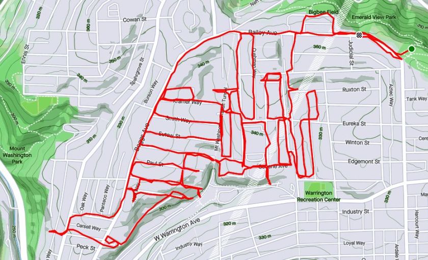
Further down Westwood Street, I eventually came the Walden Street steps. Here, they are narrow, wooden and very overgrown. Cutting down an alley, I came upon Tuscola Street, with disintegrating sidewalk steps, also overgrown. Several streets off of Westwood, such as Kramer head straight up to Boggs Avenue. A high section of Albert Street near Boggs Avenue yields more distant views of the venting towers.
Walden Steps
Tuscola Steps
Kramer Way
Albert Street – Another Section
As you go south, the streets off of Boggs Avenue get shorter and shorter and more steeply fall on the end. Several of them have steps to South Hills Junction, where the South Busway and South Hills T line intersect.
Lelia Steps to SHJ
Jacob Street Steps from SHJ
South Hills Junction
Soffet Street Steps
For a moment, I ventured past Boggs, catching the Soffet Steps. However, my secret hope that they went all the way to Warrington Avenue was dashed and I had to backtrack. Along the way, I did come across this yard, complete with red table, Triceratops skeleton and Christmas lights strung along the fence.
Coolest Yard
Finishing up, I was tired, but pleased with this eight mile jaunt. The run was more interesting than I expected and I got to see those venting towers up close and personal.