Here are three runs in 2022, taking me from blustery February to green leafy May. While these are the only runs finishing new streets, I was running very consistently in that period, with three months over 100 miles intermingled with two marathons.

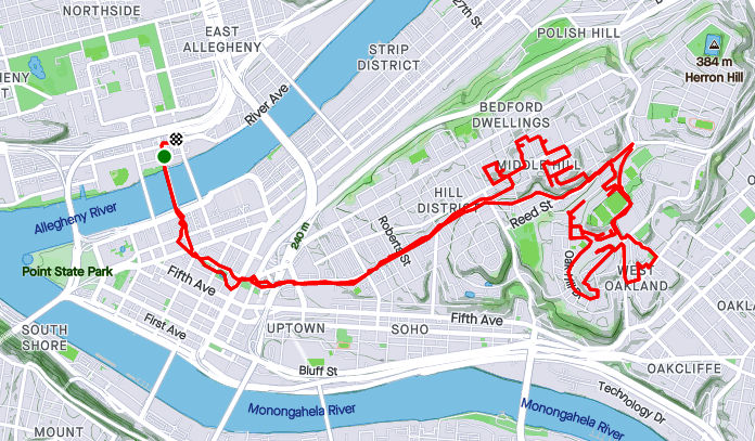
RATS #00497 was a 20 miler in 30 degree weather. Which, I always say, is better than a 30 miler in 20 degree weather! The sliver of street I completed was Station Square Drive, .04 miles out of 20.25. Luckily, it was a City of Bridges group run, so that extra 20.21 miles wasn’t all on my own. I didn’t get extensive photo coverage of Station Square Drive, but got a few pics of us running through the Armstrong Tunnel and onto the 10th Street Bridge.


Eventually the snow caught up with us. We were very upset.

And that’s all I have for RATS #00497.

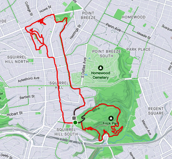
Fast forward a couple of weeks and I was again running far to cover a few streets. This run, I was going to take another whack at Hammerschlag and University Drive A.
Hammerschlag, which in the days of yore, snaked down from Frew Street to Neville Street had been closed due to construction at CMU;a new building, no less. Unfortunately, it was still closed when I stopped by.

Bummed out with that, I figured I would try my next quixotic street, University Drive A. No dice, you can go up the hill only so far until the construction fences close in on all sides. They are digging big trenches up there.


Moving on, I encircled Oak Hill Court. It is indicated on the map by the yellow arrow. No pics of that little section. Returning home by another path, like so many wise men before me, I caught this cute alley, Decre Way, off of Robinson Street.

Finding my way back to the car, I saw that Dippy was ready for St. Patrick’s Day.

There’s a theme for these last few blogs – long runs completing one or two streets at best. Often, it is just the last few yards of a street. RATS run #00499 was no exception. The only road finished on this nine mile run was Chapel Hill Road. I had finished most of it earlier, but needed to run around the top level of a parking garage to finish it off. There’s some cool steps beyond, but they’re private.

I also looked in vain for a way to finish Woodland Road. There are two entrances to this street, one from Wilkins and one from Fifth Avenue. A house with a garage and high walls sits between the two sides. I think you have to run past the gate when cars come and go to complete this street. At least this was a pretty run, with greenery taking over from the long-gone snow.
There you have it. Up to 499 streets runs as of May 30, 2022. It would be a few months until I got to RATS #500.