Revisiting Vista’s

RATS Run #00467 Allegheny West, Allegheny East, Spring Garden

This post-work run was supposed to be a preview for a City of Bridges Run, but turned into an adventure all of its own. I started near West Park and was happy to see that the Ridge Avenue bridge had been completed. Several runs have been extended when I forgot it was closed and had to go the long way around.

Ridge Avenue Bridge Over Norfolk Southern Tracks

From there, I made my way through East Allegheny towards Spring Garden. I took Gerst Way over I-279. At East Street, I made the left and rambled up to Royal Street. I was looking for a small street, allegedly off of Bly Street. I hadn’t seen it on a previous run, and was hoping to find it tonight.

All I found off of Bly was an overgrown hill. Perhaps the “street” had been steps which have since fallen down. Oh well, I turned back to clear up some more mysteries. For instance, the mystery of Radnor Street and Callen Street, known on Google Maps as Vallette Street; did it exist? Was it passable? I returned to East Street, heading back into town, then turned left onto Rostock Street.

A couple of houses up, I came to the end of Radnor. A barrier prevented cars from going further, but I scooted around. I went deeper and deeper into the underbrush. Eventually I found it impenetrable. Perhaps in the dead of winter this would go through. Returning to Rostock, I came across an open manhole. That’s a long drop and I’m happy I didn’t have a misstep into it. Apparently, though, there is a whole world of manhole-lids. For the curious, check out “The Ultimate Manhole Covers” site.

My next target was a spur of Kaiser Street off of Haslage Avenue. Those were high on the hill above me and I approached them via Vista Street. I had heard the Vista Steps had been re-opened after a two-year renovation project. In fact, a September 21, 2021 City of Pittsburgh Facebook post says, in part, “…This $750,000 Department of Mobility & Infrastructure project saw the preservation of the mosaic mural created by Linda Wallen and nearby residents.” I am a bit surprised at the cost of this, but I suppose these steps will last another 100 years. I’d hate to see what it will cost to fix the Troy Hill Steps. Anyway, it has one of those bike runnels, so that if you’re riding your bike up Vista Street, you can scoot it up alongside you on the steps.

Now, if you ARE riding your bike up Vista Street on a regular basis, you are one hell of an athlete. Between the top of the steps and Goehring Street, the grade is between 8% and 17%. While I have run up it a few times, I think it would be harder on a bike.

Elevation on Vista Street

Making the left onto Goehring Street and right onto Kaiser took me higher and higher. I was disappointed that Kaiser became a driveway at Haslage, with a rope across it and a guy fooling around in the yard. So, for now, I skipped it.

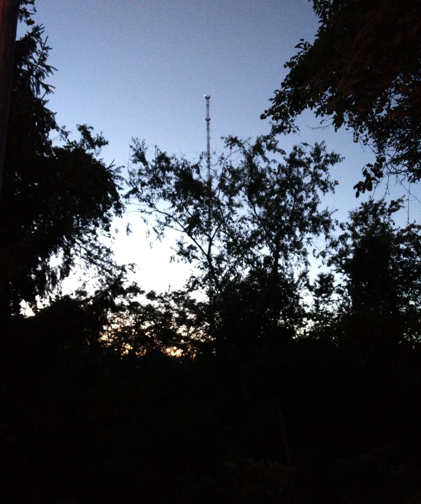
I like this area of Spring Garden / City View. The hills are punishing, the houses are surprisingly cool. At my back, Pittsburgh spreads out below.

Hunnel Street is another unbelievably steep road. Those wooden steps are pretty sturdy in spite of their wavy look. Just before the top of Hunnel, Frontier “Street” goes off to the left. In some regions, that would be called a yard. Today, I took a pass on it.

Hunnel turns into Stein and goes abruptly downhill. Stein, the street, continues as steps past this decrepit white house. Can’t drive that way, of course. If it had a bike runnel, too, I suppose you could sail down the steps on a bike. As it is now, you’d just go bump, bump, bump on your bike. Since I was NOT on a bike, I just went clomp, clomp, clomp down the stairs to Homer Street. My time was getting short and after passing the ghosts of Homer, I scurried back to the Allegheny Center.

En route, I passed the Aviary and saw only one big bird was roosting in a tree. I was hoping it was Cody, but couldn’t really tell.

Aviary

Splashing in Spring Garden

RATS #00442 – Spring Garden and Troy Hill

Spring Garden seems to summon the rain. For this run, RATS #00442, I was prepared. I brought a zip-lock bag for my phone just in case, but for a few minutes thought I wouldn’t need it.

I parked on Herr’s Island under the 31st Street Bridge and romped past the tennis courts to the northern end. I could see far-away thunderstorms, but here there were only a few drops. The Rialto Street steps were under construction, so I had to go the long way along the “trail” next to Route 28 and ascend Troy Hill Road. On this roundabout way to Rialto Street I ran by E&C Beer Distributor with its grinning horse. I wonder, did he get a glug-glug of apple cider? Rialto continues off its famous slope into the heart of Troy Hill, where I ran past this house built around 1880.

Mt. Troy Road and Luty Avenue have broad views of Pittsburgh. I believe that’s Lower Lawrenceville and Polish Hill getting rained on. Luty Avenue ended unceremoniously in a weird little hut structure.

Now, a more rational person (probably not a runner) might have thought, “Wow, look at those storms. I should go inside, because it will probably rain here soon.”

My inner dialog was more like “Look at all that rain WAY OVER THERE. It’s probably not going to rain on ME. Besides…how wet could I get?” ( I said these same words earlier this summer and apparently didn’t learn how much clouds hate that.) Coming off of Mt. Troy Road, I sped down Wicklines Street, using the momentum to carry me across Spring Garden Avenue onto High Street. And that’s where it began. A burst of thunder, kids and parents scrambling to get out of the rain, and me, happily running along Spring Garden Avenue.

The rain was pretty heavy, but seemed to taper off as I approached the safe haven of Family Dollar. Since the rain was stopping, I went ahead and slogged up the very steep Mauch Street. It climbs about 100′ in well under one tenth of a mile and Strava shows it with a 43.7% grade! Hmm, that seems dubious.

Nonetheless, I proceeded onto another section of Mt. Troy Road where a curve dips into Pittsburgh briefly. The rain intensified. I thought there might be a place to duck in for a moment. But no, lightning bolts and bursts of thunder surrounded me and there was no place to hide. I sloshed to Fornof Lane and back to Mauch. Finally the rain tapered off. I had planned to go further north along Spring Garden Avenue, but cut things short, heading back down instead. The back-yard ducks seemed pretty happy, though.

As I neared Threadbare Cider, my sense of adventure returned and I explored Tell Street. In days of yore, cats ruled this street. Nearby, someone had even constructed a home for wayward cats; patriotically painted with stars and stripes. I didn’t see the cat house nor the cats this time. A house at the bottom of Tell Street was being renovated, but the houses higher on the hill are digressing, with broken windows and climbing vines.

There’s a gentle set of steps from Tell to Voskamp above. Vines arch between fences, making a tunnel of lovely green. There’s a shy old yellow house on Voskamp Street, keeping back from the street.

I returned to Herr’s Island along the pedestrian trail waterway adjacent to Route 28. Just a pitter-patter of rain now, but the hills were still streaming with water.

Flooded Pedestrian Trail Along Route 28

Old Upper Lawrenceville and Spring Garden Sidestreets

Once again, you get two May runs in this blog. The first, RATS run #00405, was on a gray day in Upper Lawrenceville. The second, RATS run #00406, was on a cool, but sunny, day in Spring Garden.


https://www.strava.com/activities/5254142747
RATS run #00405 in Upper Lawrenceville

51st Street, Berlin Way and Harrison Street were the objects of my footfalls on this Thursday evening. It was relatively flat, except the jaunt up to Bissel Way, with its little surprise.

Cavacini Landscaping was bursting with flowers and shrubs ready for planting. I’ve rarely been on this section of 51st Street in daylight, so this was a surprise for me. (Spirit, up the street, is a popular nighttime music venue.) Further towards the Allegheny, 51st Street crosses old railroad tracks and ends at a power line tower.

From here I scuttled past the Goodwill Building and onto Berlin Way. It is only a block from Butler Street and you can see murals on the back walls of Butler Street businesses.

But Berlin Way isn’t free end-to-end. Portions of it run afoul of chain link fences and nondescript buildings. However, Adelman’s Lumber looks cool, as did the sun setting way down a 55th Street alley.

Finally caught the end of Bissel Way and found this rusted monolith stretching to the next hillside. What is it? A lost railroad spur? A preemptive retaining wall with nothing to retain? I don’t know.

That was it. Three miles on a Thursday evening.


https://www.strava.com/activities/5263913969
RATS Run #00406 in Spring Garden

RATS run #00406 was my Saturday long run. I mainly focused on side-streets off of Spring Garden Avenue and then touched a couple of other missed streets as I rounded out the run in Perry Hilltop, California-Kirkbride and Allegheny West.

I started with a little detour up some steps to Salter Way. It looked like the yellow handrail has gotten hit by a car. Nonetheless, Salter Way is a short alley dead-ending into the hillside. Several houses are boarded up, and they even have guards. Cat guards, that it is. This no-nonsense kitty strode right up to me and, after shout-meowing at me, escorted me off the street.

The Welcome to Spring Garden sign is a bit of a ruse, I think. I don’t find it a very welcoming area, but perhaps it is just claustrophobia from the towering hills and overwhelming vegetation. I do get a kick out of the clock at the back wall there. Don’t stay too long!

Further on Spring Garden Avenue, I kept branching off onto the little streets, which tiredly run out of asphalt and just end. Some spots have several little streets with houses huddled together.

St. Peters United Church of Christ was pretty cool looking. About that point in the run, two little girls, bundled against the cold, decided to race me up Spring Garden Avenue. I was able to dodge into Giddy Way before they could catch up. Must say, I find Spring Garden Avenue dangerous to run on, much less ride a bike.

The turn onto Baun looked promising, but a half-dozen “No Trespassing” signs and “Beware of Dogs” signs later, I decided to cut it short.

So, away I went. Up towering Willams Road into Spring View/City View. I was lucky enough to find a shortcut to the top of Donora and was rewarded with a sweeping view.

Donora Street

From here, I wandered to the end of Hazlett Street and the curious little cul-de-sac, Boyer Street. Par for the course, Boyer actually is continuous, but someone keeps their car parked in the middle. Remnants of previous businesses still stand. Eventually I made it all the way down to Vista Street steps. There is a nice mosaic at the bottom, but the $600,000 step reconstruction is still not open. Is it just that the handrail is missing?

I used Milroy Street to cut through to Perry Hilltop. Those are some astounding steps which remain open, in spite of their flaws. As I approached several turkeys clucked their way out of sight while an old sad house came in sight. “Condemned”, said the blue sign of death.

Continuing my circuitous route, I caught the end of Hawkins Street, as it plunges toward Highwood Cemetery. Luckily there are steps there, too, so going back up wasn’t too bad. Eventually I made it to Riversea Road, a little inlet off of Brighton. By now, I was eager to finish up but got caught in the narrowing trap of West Park’s construction. Luckily, a little pedestrian bridge was available to cross.

Traipsing through Children’s Way and Allegheny Center, I found my way back to my starting point, a good 14 miles done.

Sunset views in Spring Garden

https://www.strava.com/activities/3938468063
Route for run number 00283

This run, in Spring Garden, and the previous one , in Spring Hill, were both in the “Spring Hill /City View” area of Pittsburgh according to Google Maps, but each had a different feel and, quite literally, a different view of the city. Spring Garden seems more 1950’s residential than Spring Hill. While still boasting huge hills, Spring Garden’s main streets seem a little tamer than Spring Hill’s.

At any rate, I started as before on Vinial Street, due to its convenience for parking. I ascended the Arcola Street steps as a short-cut to Damas Street. So, let’s take a short aside here. I pronounce “Damas” as “dah-MAHS'”, with soft southern “ah’s”, stressing the “mas”. The first time I was on Damas Street, I was lost and a little late and mentally christened it “Dumb-Ass” Street. This time, though, I found it a delightful little street. At it’s entrance, Steel City Boxing has set up a ring in an old building fire station. Right across the street is Voegtly Spring. I like to think this put the “Spring” into “Spring Garden”.

Moving on, I found Admiral Street, Noster Street and the intervening alleys to be quite nice. It was a pleasant evening, so people were in their backyards having gatherings around their fire pits and playing in their pools. Along Admiral Street a small flagpole and a simple cast statue stood as a personal memorial along an empty lot overlooking the city. I found it touching.

Many of these streets dead-end into hillsides. I was surprised to find there’s actually a “Spring Garden Greenway”, with its own official sign. Curious what a “greenway” is? Here you go!

In 1980, the Greenways for Pittsburgh program was established to consolidate steeply sloped, unbuildable land for the purpose of protecting hillsides and preserving passive open space resources.

http://www.pittsburghpa.gov/dcp/greenways/

I was not surprised to find deer. Of course, I didn’t find them on the greenway. I found them in a side yard, where I cornered a doe and fawn munching on yummy landscaped flowers.

As the evening became night, I finished up on the tremendous hill of Donora Street. Not far behind it, a radio tower stood dark against the sky.

Coming back to the rather flat Rockledge Street, I considered covering “just one more street”, but thought the better of it and headed home with over four miles in, and another 600′ of elevation. Looking at the map later, I’m really happy I called it a day when I did. I would have had a two more miles of small streets, alleys and dead-ends; but in the dark.