From West Liberty to Library, Road, That Is

RATS Route #00415 from West Liberty to Library

With alleys to do in West Liberty and busy streets to do on the Southern Edge of the World, I started RATS run #00415 from Moore Park in West Liberty. Moore Park is very convenient, just off of Pioneer Avenue. There are tennis courts, basketball courts, a spray park, a pool and large fields rolling down toward Moore Greenway. For my purposes though, there is a nice little parking lot.

Anyway, I started there and cut down through Our Lady of Loreto’s driveway, aka Herman Drive. Making the right onto Crysler Street, I found myself in the maze of driveways around West Liberty Elementary
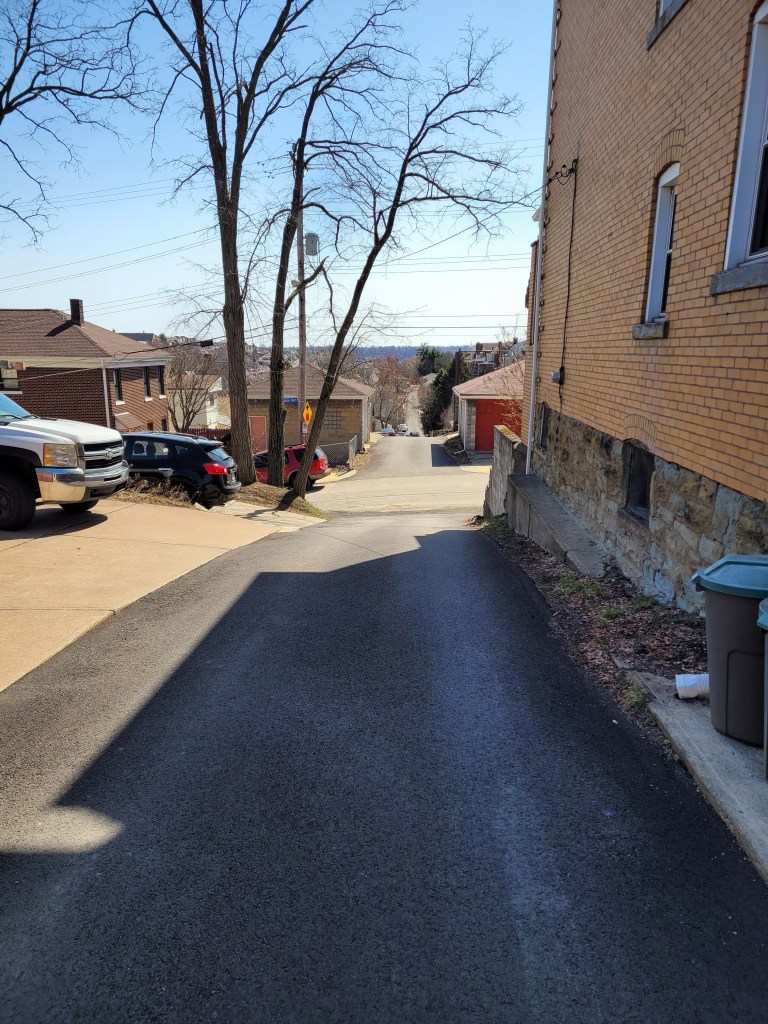
. I got spit out onto Elmbank Street, which falls precipitously to a green dead-end.

Speaking of green dead-ends, Fernhill Avenue has several, in spite of any map which shows that it continues in a long circuit. Inland Way took me on a ridge below Dunster. From there I headed toward Brookline.

I think it was on Lugi Way that I found a salute to veterans and recycling as well as an alley duck. This tour of the lesser known views of Brookline eventually took me to McNeilly Road. McNeilly is rather busy and not meant for pedestrians. I ducked onto McNeilly Court as it curved up the hill. It dead-ends abruptly after the curve. Returning to McNeilly Road, I then went up another curvy street, Aidan Court. It turns out that that new subdivision was pretty much built on top of the older homes on McNeilly Court.

Luckily, though, the wide shoulders and parking lots afforded places to run. I also found Black Dog Car & Dog Wash. I mused what the options could be:

  • One pass dog and car – “Just get him to sit on the hood, ma’am. He’ll be OK.”
  • Slobber wash – “We have ten golden retrievers just waiting to lick your dog and car clean.”
  • First World Wash – “Just open all your windows and let Fido sit on the front seat.”

Moving on, McNeilly narrows under a train trestle right before it hits the McNeilly T-Station. There’s a slim little sidewalk there and it takes you all the way to busy Library Road.

Library Road took me briefly out of the city into Castle Shannon. Again, it’s not very pedestrian friendly there, so I stayed up on the green embankment. My target was Belleville Street, up steep 6th Street. I was very happy that Belleville narrowed into a trail and I got a nice little shortcut back to Library Road, before any need to trespass on a power-line tower.

Circling back into the City, I braved the traffic along Saw Mill Run and Provost Road. I thought I’d need to scurry up Arcata Street, but it was just a 50 yard driveway to a washed-out bridge. No, I didn’t scale the bridge or swim the creek.

With that, I trundled up Glenbury Street, gasping for air and watching out for cars. Upon returning to Moore Park, I ran right into the cold spray, screaming like a little kid. Or a like a dog going through a car wash.

Old Upper Lawrenceville and Spring Garden Sidestreets

Once again, you get two May runs in this blog. The first, RATS run #00405, was on a gray day in Upper Lawrenceville. The second, RATS run #00406, was on a cool, but sunny, day in Spring Garden.


https://www.strava.com/activities/5254142747
RATS run #00405 in Upper Lawrenceville

51st Street, Berlin Way and Harrison Street were the objects of my footfalls on this Thursday evening. It was relatively flat, except the jaunt up to Bissel Way, with its little surprise.

Cavacini Landscaping was bursting with flowers and shrubs ready for planting. I’ve rarely been on this section of 51st Street in daylight, so this was a surprise for me. (Spirit, up the street, is a popular nighttime music venue.) Further towards the Allegheny, 51st Street crosses old railroad tracks and ends at a power line tower.

From here I scuttled past the Goodwill Building and onto Berlin Way. It is only a block from Butler Street and you can see murals on the back walls of Butler Street businesses.

But Berlin Way isn’t free end-to-end. Portions of it run afoul of chain link fences and nondescript buildings. However, Adelman’s Lumber looks cool, as did the sun setting way down a 55th Street alley.

Finally caught the end of Bissel Way and found this rusted monolith stretching to the next hillside. What is it? A lost railroad spur? A preemptive retaining wall with nothing to retain? I don’t know.

That was it. Three miles on a Thursday evening.


https://www.strava.com/activities/5263913969
RATS Run #00406 in Spring Garden

RATS run #00406 was my Saturday long run. I mainly focused on side-streets off of Spring Garden Avenue and then touched a couple of other missed streets as I rounded out the run in Perry Hilltop, California-Kirkbride and Allegheny West.

I started with a little detour up some steps to Salter Way. It looked like the yellow handrail has gotten hit by a car. Nonetheless, Salter Way is a short alley dead-ending into the hillside. Several houses are boarded up, and they even have guards. Cat guards, that it is. This no-nonsense kitty strode right up to me and, after shout-meowing at me, escorted me off the street.

The Welcome to Spring Garden sign is a bit of a ruse, I think. I don’t find it a very welcoming area, but perhaps it is just claustrophobia from the towering hills and overwhelming vegetation. I do get a kick out of the clock at the back wall there. Don’t stay too long!

Further on Spring Garden Avenue, I kept branching off onto the little streets, which tiredly run out of asphalt and just end. Some spots have several little streets with houses huddled together.

St. Peters United Church of Christ was pretty cool looking. About that point in the run, two little girls, bundled against the cold, decided to race me up Spring Garden Avenue. I was able to dodge into Giddy Way before they could catch up. Must say, I find Spring Garden Avenue dangerous to run on, much less ride a bike.

The turn onto Baun looked promising, but a half-dozen “No Trespassing” signs and “Beware of Dogs” signs later, I decided to cut it short.

So, away I went. Up towering Willams Road into Spring View/City View. I was lucky enough to find a shortcut to the top of Donora and was rewarded with a sweeping view.

Donora Street

From here, I wandered to the end of Hazlett Street and the curious little cul-de-sac, Boyer Street. Par for the course, Boyer actually is continuous, but someone keeps their car parked in the middle. Remnants of previous businesses still stand. Eventually I made it all the way down to Vista Street steps. There is a nice mosaic at the bottom, but the $600,000 step reconstruction is still not open. Is it just that the handrail is missing?

I used Milroy Street to cut through to Perry Hilltop. Those are some astounding steps which remain open, in spite of their flaws. As I approached several turkeys clucked their way out of sight while an old sad house came in sight. “Condemned”, said the blue sign of death.

Continuing my circuitous route, I caught the end of Hawkins Street, as it plunges toward Highwood Cemetery. Luckily there are steps there, too, so going back up wasn’t too bad. Eventually I made it to Riversea Road, a little inlet off of Brighton. By now, I was eager to finish up but got caught in the narrowing trap of West Park’s construction. Luckily, a little pedestrian bridge was available to cross.

Traipsing through Children’s Way and Allegheny Center, I found my way back to my starting point, a good 14 miles done.

March 2021 Catch-Up

Summary

March 2021 was one of my most productive months in terms of mileage and streets covered. Among my 162 miles and 20,000 feet of elevation gain, I completed 192 more streets in Pittsburgh in 15 RATS runs. I even completed the “Take The Stairs 50k” course I published last year. That course, a small revision of Lamar’s original course, took me on roughly 78 sets of steps throughout the city, but, alas, did not cover any new streets.

Blogging-wise, March was less than stellar. I only published four posts and it has taken me all of April just to get this summary out, touching on three short runs in Carrick, Brookline and West Liberty.


https://www.strava.com/activities/4979989103
Route of RATS #00384 in Brookline

I had grand plans for this run, but was out-of-synch and got frustrated by small ‘streets’ just being driveways into hills. Argh! Just took one picture, before it all went downhill. I did end up with over four miles and several alleys covered.

Brookline Alley
Brookline Alley

RATS run #00386 Around South Side Cemetery

In this run, I inadvertently circumnavigated South Side Cemetery. I started on Brownsville Road and took the steep West Meyers Street to Oakhurst en route to Newett Street, one of the steeper roads I’ve been on. I took Plateau Street to its dead-end above Volunteers Park, then came back to Newett, expecting to see Plateau on the other side. However, Plateau falls off of Newett so quickly that the other side looked like a driveway which disappeared over the hillside. Once upon it, though, I found my way down Plateau and was pleasantly surprised to find that Volunteers Field was an active hubbub. It looked like a fire department team was practicing on one field, while on another field, a younger group practiced base-running under the tutelage of a barking coach.

Moving on, I dodged cars on my way down Colerain to Noble Road. No sidewalks and not much of a shoulder made it tricky running. Then I peeled off and went down Denise Street. My internal map had Denise going a little way and dead-ending. It seemed to go on forever, but afforded nice views of the T tracks. Returning, I came across some steps which took me to Noble Road.

Once up on Noble, I backtracked a bit and went up Glade Street. The few streets up on that hill are tucked into a corner of the cemeteries looming above. It was a nicer area than I expected. Some kids were playing basketball in the street and others were riding bikes. Along the Montrose Steps I heard a rustling and noticed a deer in the woods. I took a picture and continued to Cloverdale Street. Only after looking at the picture more closely did I realize there were four deer there!

Cloverdale Street completed the southern border of the cemetery, bringing me back to Noble Street. This short, three mile run certainly had a lot to see.


Route of RATS #00387

This was an evening run in West Liberty to catch some alleys. I caught several in my alley catcher, but some were only paper alleys (here’s looking at you, Mascot Way!) Overall it was a pleasant, hilly run with over 400 feet of elevation in only three miles.


So that was it for March, 2021. I’m still chipping away at the streets. At the end of March I had a little over 800 more to complete. I’ve come a long way considering there are over 4,800 streets in Pittsburgh. I can now see the light at the end of the tunnel.

Bright in Brighton Heights

RATS Run #00350

https://www.strava.com/activities/4563278250
RATS #00350

This was a late afternoon run one January Sunday. I started from Riverview Park and made my way through Woods Run to Brighton Heights. A now familiar path, I cut through the park’s trails to Kilbuck Avenue. The dead-end at Kilbuck is always much more active than I expect. This time, someone was dropping off refuse at the Department of Public Works’ Kilbuck collection point. It seems out of place, this drop-off point. Picture the bottom of a ravine surrounded by steep hillsides of oak, maple and pine; very scenic until you come across a battered chain link fence, a twenty-foot concrete salt dome and muddy yellow front loaders. Last time, motor-cross bikes were zooming up and down the trail.

At any rate, I continued down Kilbuck and finally ran the length of Central Avenue, coming out at the Woods Run branch of the Carnegie Library. Just a little further I passed under the towering Shadeland Avenue Bridge and worked my way out of the valley.

Up top was an intricate lace of streets and alleys. Unfortunately, they weren’t all implemented as planned. Stokes Way, for instance, isn’t paved beyond Gass Avenue. Crossing Brighton Road, I touched on some dead-ends at the end of Davis Avenue. Harbison Road not only leads onto a trail, but also has this twin set of Little Libraries. Very cool.

Further on, I explored the end of Wapello Street. It is a classic, alternating between a residential throughway to stairs and back. It was also my “shortcut” when I realized that dusk was quickly gathering. Of course, by the time I had returned to the bottom of Riverview Park, there was a new group down there…having an evening of signing around the campfire.

RATS Run #00351

https://www.strava.com/activities/4568317810
RATS #00351

This run, on a Monday after work, was in the northern part of Brighton Heights. I must apologize now for the grainy pictures; with the later start, it was full on dark by the time I saw something new and noteworthy. I ran along flat Brighton Heights, with the large houses and ample yards, for a bit before climbing to the edge of Pittsburgh along Cliffview Road.

I putzed along Benton Avenue and took a stab at Lapish Street. Lapish appears to be an older road. The houses along it were large and haphazard. Thank goodness for steps, or else I would have gone far out of my way to reach Flora Street. I would like to go back in the daylight, as they had some spectacular views over the whole northern Pittsburgh area. I was surprised to hit upon some steps in the dark; but was guided home by a red-nosed reindeer and 50 of his brightest friends.