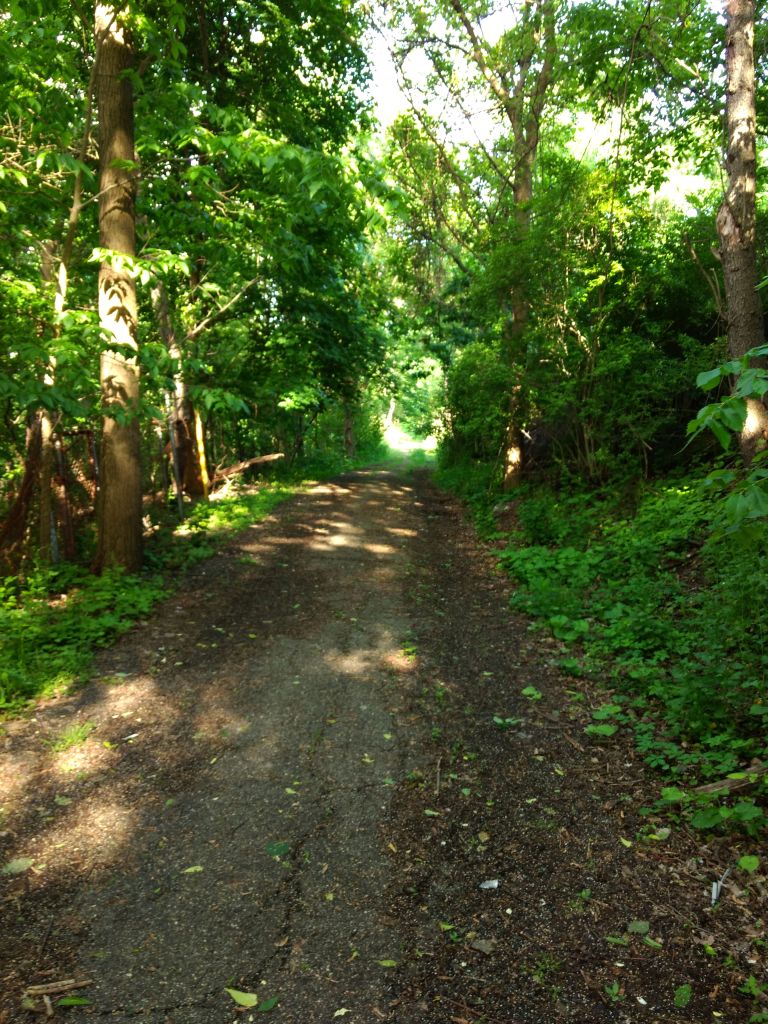
Running late in the evening in Shadyside took me down streets with million dollar homes and large porches filled with dinner guests. This section of Shadyside, bounded by Forbes Avenue and Ellsworth Avenue, extending from Neville Street to South Aiken Avenue is one of the most opulent sections of Pittsburgh. Nearby are a number of landmark Pittsburgh institutions; WQED, Central Catholic, CMU, Pitt, and Rodef Shalom, to name a few.
Apartment building off of Ellsworth Street
CMU Sumo has grabbed this one, too
Like sumo wrestlers straining to push each other off the mat, these institutions are constantly pushing and shoving each other to build on precious Oakland real-estate. The wrecking ball awaits any building the sumo can replace.
While that sounds ominous, the new buildings are pretty nice, I must admit.
CMU’s New Tepper Quad
WQED has a prominent history and was home to Mr. Rodger’s Neighborhood. I suppose that means I was actually running in Mr. Rodger’s Neighborhood! Or maybe the Land of Make Believe!
WQED Historical Marker
WQED Studios
I tell you what, these houses were unbelievable. The short dead-end streets are lined with ones like the seven bedroom jewel below. I’d be surprised if anyone can guess how much it last “sold” for. Just for perspective, it is neither the largest nor smallest home I saw.
Nice starter home in a quiet neighborhood
Devon Road becomes a “Private Road” at some point, although it really looks like the same crews are maintaining the public road and the private road. There are even steps here, from Fifth Avenue to Warwick Terrace, but the steps are closed. What a shame. Perhaps the folks living here don’t want vagrants, runners, and broke students traipsing through.
Devon Road
Warwick Terrace Steps
Beyond Devon Road, I wove my way up and down the little streets. It was cool to hear the clink of glasses and chatter of conversation as so many people were sitting on their verandas enjoying the slightly cooler night. The evening drew on to full night by the time I finished four miles.
There’s a puzzle out there. They call it “Pittsburgh”. It is a puzzle of geography, rivers, ravines, hills, roads, and steps. It is also a puzzle of people, living side by side, mostly in harmony, but sometimes not. I’m trying to put this puzzle together. I’m assembling it run by run. Sometimes, I don’t understand. How does this work? But I do know one thing… I know the pieces fit!
There’s a puzzle out there. They call it “Pittsburgh”. It is a puzzle of geography, rivers, ravines, hills, roads, and steps. It is also a puzzle of people, living side by side, mostly in harmony, but sometimes not. I’m trying to put this puzzle together. I’m assembling it run by run. Sometimes, I don’t understand. How does this work? But I do know one thing… I know the pieces fit!
I’d been puzzling over this little enclave of Pittsburgh for some time now. Just out of Riverview Park, the area between Watson Boulevard and Perrysville Avenue kept thwarting me. Every time I planned to do it, I’d invariably experience a setback; I’d forget my watch, forget my phone, have severe knee pain, get a nail in my tire or experience one of other 1,000 reasons I couldn’t fit this piece of Pittsburgh into the big picture. It was my personal Bermuda Triangle. But not today.
Riverview Park Entrance
I must say, the Perrysville North Bermuda Triangle did put up a good fight. I started in the 95 degree heat at Riverview Park’s entry steps. In spite of the heat, my knees weren’t warmed up yet and complained vociferously that first quarter mile.
Watson Boulevard
Talco Street
A slight mistake on the route took me onto Watson Street. Argh, it looked like this piece would win again! Then I noticed Talco Street and it realized I needed to do that one, too. It was more like a long shaded driveway than a road. Getting back onto Watson, I spied the Sigma Street Steps. These steps aren’t on Google Maps, or OpenStreetMaps. But they are there in reality. Pounding up the stairs, I noticed one jigsaw puzzle piece, then another and then a few more. I could just envision a small boy walking up the steps, holding an opened puzzle box by his side, with pieces dripping out. I felt a bit sorry for those trying to put it together.
Sigma Street Steps
Missing Piece!
The stairs, Sigma Way, must have been the key to this Bermuda Triangle, the key to getting back on track. I popped up on Delaware Street, just opposite Portola Avenue. I was not waylaid on Wayland Way; in fact it was a pleasant, wide brick lined alley. Here, just a small adjustment to my planned route took me around to Chemung Street and Orleans Street as originally intended.
Chemung Street
Black Lives Matter Garage
Orleans Street
Orleans Street hooked around to Viola Street. So far, the run had been flat, but that was about to change. Viola swoops like a roller coaster to Milroy Street. Here, once again, I was connected to the bigger picture by views, steps and crazy curves.
Viola Street Steps to Milroy
Shifty Milroy Steps to Perrysville
Massive retaining wall on Milroy
Cars labored to navigate Milroy’s steep curves. The bottom of Milroy crosses I-279 on a high bridge. For pedestrians a magnificent staircase provides a shortcut. One poor house, off of the winding stairs, has been half-eaten by grasping vines.
From the top of Milroy Steps
Back and forth
A house eaten by shrubbery
On Viola Street, I noticed an imposing red brick building. On closer examination, it was in disrepair, with broken windows and boarded up doors. However Milroy House was built to last and hopefully will see better days.
Milroy House
Boarded Up Doors
Clambering up the shaking wooden steps to Perrysville Avenue, I ran back to my car. I even tried to put on a burst of speed and ended the day with four solid miles. Another piece of Pittsburgh experienced.
I’ve been all over this town but never to Carrick. Today I’m changing that. For today’s run, I started overlooking Downtown from Grandview Park, did a grid of streets in Allentown and then plunged south to sample Carrick.
Grandview Park is a narrow strip of greenery high above the Monongahela River. From here, you can practically open the windows on the skyscrapers downtown. There’s not much there except benches to look at the view, a viewing platform to look out over the city and a little natural amphitheater, with views over the city. And all of them are grand! I’m not sure if all cities are like this, but Pittsburghers really like to look at pictures of Pittsburgh.
I love these neat Citiparks Signs
Indeed, a grand view
Tearing myself away from the view, I embarked on the grid of streets behind the park, high in Allentown. In spite of the proximity to the views and Mount Washington, this residential area is tight with small, rather shabby houses. I saw at least five houses with the blue “condemned” sign on them. Small streets disappear into the vegetation. Of course there are steps and boats here, too.
Steps on Science Street
Tank Way
Tower between the water towers
End of Excelsior Street, with requisite escape boat
Speaking of steps, Emerald Street drops off the hillside and becomes steps on its way to Arlington Avenue, passing Canary Way en route. Arlington intersects East Warrington, with its small business area.
Emerald Street Steps to Canary Way
Canary Way to Arlington
East Warrington is not a large street, but is usually busy. If you are vegan, you should stop at Onion Maiden. The food is excellent and the music is rocking! No neighborhood is complete without a Little Library, and there’s one here too, a few houses from Beltzhoover Avenue. Of course, everyone needs a laundromat every now and then. Here, “Splish Splash” is incongruously nestled on the first floor of an older red and pink apartment building.
Another Little Library
Splish Splash
Onion Maiden – Vegan Restaurant with Heavy Metal Theme
While completing several streets south of East Warrington Avenue, I came across another “Project Picket Fence” site. If you’ll recall, that was a mid-90’s project by Mayor Tom Murphy to encourage communities to brighten up vacant lots. Here, while the picket fence is down, the lot is nicely kept.
Another Picket Fence Project
From there, I found the source of Amanda Avenue, at its intersection with Manion Way. Amanda Avenue has a few street steps as it meets Arlington Avenue. I stayed on Amanda until it merged with Brownsville Road. (Not to be confused with Browns Hill Road, which is in another part of the city.) Here, Brownsville Road also forms a border with Mount Oliver, the independent borough entirely surrounded by the City of Pittsburgh. Just to make life interesting for dispatchers, there’s also a neighborhood in the City of Pittsburgh called “Mount Oliver”. It’s adjacent to the borough, of course.
Amanda Street Steps
Noble Lane
In spite of the local differences in jurisdiction between Pittsburgh and Mount Oliver, there are few visual differences on that rather dirty, dusty street. Just the street signs; Pittsburgh’s are bright blue and Mount Oliver’s are a dusty green.
I continued to Noble Lane. In spite of its name, it is not a noble place to run. Where there are sidewalks, there are cars parked. Otherwise, you just have a narrow grassy, rocky path to navigate as the cars whiz by you on their way to Saw Mill Run Boulevard. Approaching Saw Mill Run, at least you get a nice view of the South Hills T-Line near Whited Street.
T-Line Bridge over Saw Mill Run Boulevard
Climbing out of the pit that is Saw Mill Run Boulevard, there are some more spacious residential areas. I made my way back towards Brownsville Road via Copperfield Road. At nine miles in, I was a bit disheartened to see the multi-block set of steps rise above me.
Copperfield Steps rising to Brownsville Road
Returning to my starting spot, I ambled along Brownsville Road until I hit Knox Avenue. Knoxville, along Knox Avenue is similar to Allentown, with undulating streets lined with houses and old three story apartment buildings. Ironically enough, yesterday I was listening to Malcom Gladwell’s book “Talking to Strangers” as he discussed the Amanda Knox case. Today, I ran on Amanda Street and Knox Avenue. Coincidence?
May 2020 was a long month. It started off cold and even had a few flurries early on. However, by the end of May, things had heated up in many ways. Cases of Covid19 are slowly lurching lower. However, we’ve gone from bad to worse in social upheaval. In early May, I did a “Run for Ahmaud” to show solidarity in the killing of a black jogger in Georgia. It was an emotional, sad, run. Then, on May 25, a black man, George Floyd, was killed by Minneapolis police officers. That has set the spotlight on racial inequity in the country and simultaneously sparked protests and called into question police tactics all over.
Against this backdrop, I’ve kept running and covering new streets. In May, I ran 130 miles, close to my goal of 135 miles a month. I completed all eight of my Strava challenges for May, including the distance challenge (210km), climbing challenge (4,229m) and the “Sufferfest Beer Challenge” which required four activities a week for four weeks. Of the 21 runs I did in May, 20 of them covered new streets. By May 31, I had completed 248 “RATS” runs in all. I’m over 45% done with the streets of Pittsburgh, according to CityStrides.
However, this sole focus on running has impacted my flexibility. I’ve cut more than one run short because of tight hamstrings. I’m hoping to put that behind me, by adding yoga and stretching into my routine.
RATS 00232 – Short and rainy in Scotch Bottom
RATS #00232
Ah, a short run in Hazelwood. My heart wasn’t in it today, although I ended up seeing a few cool things. This church, for instance.
St. Ann’s Roman Catholic Hungarian Church
This church has been closed for awhile, but the Diocese of Pittsburgh still owns the building. In researching this, I found a short history of Hazelwood, taken from a 1972 issue of the Carnegie Magazine. Apparently it used to be known as “Scotch Bottom”.
Now the area is pretty run down, but still filled with people living and working among the old buildings. Wouldn’t it be cool to construct automobiles with biodegradable materials, so that once the engine fluids stop running, the whole thing decomposes?
Hungarian Food
Chatsworth Street
Downtown Looming Above Cut Wood
Whoops, I guess I parked too long
Pink, even in the Misty Evening
RATS #00234 – Bloomfield
RATS #00234 – I run for Ahmaud
Short, chilly run in the rain. Fitting since it was dedicated to the memory of Ahmaud Arbery. Nonetheless, Bloomfield is quirky and I captured a little of it here. The immense building behind “Mend Way” is a hospital. <facepalm>
There’s a bar across from the mural. Had it been open, it would have been a pleasure to sit there and look at the bright mural.
RATS #00242 Brookline Evening
RATS #00242 Brookline
Whew, Brookline is big! This run was over six miles, with minimal duplication, yet only covered one small section of Brookline. It is a suburban style community, flat except where it falls off of ravines. Running up Whited Street was heart-pounding not only for the elevation, but also for the lack of sidewalks.
Typical Brookline
Brookline Blvd
Altmar Street
Looking Out Over Brookline
The Jacob Street Stairs were cool and tunnel to the South Busway was interesting. In broad daylight, it wasn’t too bad, but it would be creepy on a misty November night. Birchland Street also gets steep enough to warrant steps.
Jacob St Steps…down one side
Jacobs Street Steps …up the other side
and continuing up on Jacob Steps
Birchland Street Steps
Viaduct to the South Busway.
Tunnel to South Busway
South Busway
Stay Strong
RATS #00243 Hills of Westwood
RATS #00243 – Westwood
This was an evening run on the hills above the Westwood Shop ‘N Save. I’m not sure what I was expecting, but the streets were very steep there. This seems to be an older area than across Noblestown Road. A number of the streets dead-end at the top of ravines.
Cute house
Looking Down Keane Avenue – See Trimont in the distance?
Westchester
Valora Street
Surprisingly, there were not many sets of steps here. Guyland Street’s steps are pretty impressive, though.
Guyland Street Steps
RATS #00244 Another Jaunt in Mount Washington
RATS #00244
This was a rather laborious run through Mount Washington. You know the drill, hills, steps, views. Of note was finishing West Sycamore Street.
Chatham Village
Amabell Street
Steps from Merrimac to Omaha
Ulysses Street
Fence along St Mary of the Mount
The best
Cuthbert St
West Sycamore
RATS #00245 South Oakland
RATS #00245 – South Oakland
The last few runs had really done a number on my hamstrings. I looked up ways to alleviate the tightness and pain in my left leg. Ignoring the first suggestion, “Stop running”, I decided that the next suggestion, “Avoiding hills”, was more doable. I realized I had a few streets left in South Oakland and so headed there one Sunday afternoon.
South Oakland is a curious mix of students and a few long-term residents. At one point, three white-haired ladies, maybe even older than me, were gingerly helping each other off the three inch curb for a little walk. At the same time, less than a block away, cleverly tucked in an alley, a full scale frat party screamed with booming bass, a flashy car and beer pong.
But I’m getting ahead of myself. To get the opportunity to appear at that party, I had to face a dinosaur, run down the Romeo steps and uncover a wild strawberry.
Romeo Street
Wild Strawberry
The Dinosaur of Dinosaur Playground
From there, I used the Cathedral of Learning as a beacon to knowledge navigating the alleys of Oakland.
City Skyline
Edith Place
There’s my North Star
Beacon of Knowledge
RATS #00246 South Oakland
RATS #00246 South Oakland again
Continuing the “no hills” mantra, I again ventured into South Oakland. As you can see, I’m getting closer to downtown.
Behind Halket Place
Joe Hammer Place
Are these street steps on Hamlet Street?
Ophelia Street
RATS #00247 – Southside Flats – and a hill
RATS #00247 – Twelve miles in the Southside
Continuing to live up to my “Flatlander” reputation, I traversed the Southside Flats for twelve miles. It started out a bit rainy, but became beautiful. At the end I threw in one big hill and ran up South 18th Street to St. Patrick’s Street.
I did not encounter great sets of steps, but I have to say, the Wharton Street Passage is exciting. It will allow bicyclists and pedestrians to go under the Birmingham Bridge instead of going up to Carson Street. It’ll be great when it is fully opened.
Steps from 24th Street to Joshephine St
Steps on St. Patrick’s Street
Wharton Street Passage
While I traced five fingers up and down the Southside, I came across a mural painted to look like house fronts. That was cute. I also ran on Edward’s Way, which, honestly, could be more impressive. As it is, it is tucked against a railroad bulwark.
Fox Way Mural Looks Like House Fronts
Thanks Healthcare Folks!
Edward’s Way COULD be more impressive!
This is Mr. Rogers’ Neighborhood – at least Mr. T-Rex Rogers! Looks like he’s not giving up King Friday without a fight.
Mr. TRex Rogers
War Memorial
Carnation Garden
RATS #00248 – Couple miles in Garfield
RATS #00248 – Garfield
I was hanging around, waiting for someone and decided to run a couple of miles in the interim. Mainly covered North Winebiddle and North Millvale in the Garfield neighborhood. The North Winebiddle steps are long, going up several blocks to Hillcrest Street. Shamrock Way was as green as the Emerald Isle, while closer to Penn is a totally tagged door.
North Winebiddle
North Winebiddle Steps
Continuing
Shamrock Way is quite lush
I suppose you had to tag the door to get in
All Done!
That’s all for May. Looking forward to June, with its late sunsets.
This morning’s run was meticulously planned to be in Brookline. Unfortunately, I was day-dreaming on the Boulevard of the Allies and ended up on the Crosstown Boulevard instead of the Liberty Bridge. Oh well, sometimes its better just to start where you are. So I ran in Uptown and the Lower Hill. I must say, it was still a rewarding run, with a number of grand views and murals.
Uptown and the Bluff are dominated by Duquesne University and other large facilities, such as PPG Paints Arena. With the amount of pollution generally in Allegheny County, I’m not sure why there’s a continual flame above the People’s Natural Gas Gate, but it is cool to see.
Duquense University Along Forbes
PPG Paints Arena – Home of the Pittsburgh Penguins
Further east of Duquesne is Mercy Hospital with its helicopter pad and construction. Given the depth of the digging, it looks like something big is being built next to Mercy. I had to stretch out to get a pic over the fence. For a bit there, my GPS became wonky – claiming that I had run a four minute mile. That worried me for the rest of the run, but it turns out the route was recorded properly, regardless of that mile.
Mercy’s Helipad
Something BIG this way comes
Eventually, the area settles down to small streets and alleys with row houses and small businesses intermixed. While there’s a lot of chain-linked fencing enclosing parking areas, there’s also bold murals along the houses and walls.
Stevie Wonder Wall
Keep Swimming
Bold Mural
Sax in the City
Crossing over the Lower Hill, I ran among the residential streets and alley ways in Crawford-Roberts and Bedford Avenue. Much of the area has been rejuvenated, with townhouses, condos and tree-lined streets. However, there are some older structures; dark-brick row-houses, standard Pittsburgh brick four-squares and tall narrow houses which are still in poor shape. Beyond Bedford Avenue, there are a number of places with views across the Allegheny River.
Lot with a view
Eight Bridge View
This is a very urban area, but is more green space than I expected, such as this parklet overlooking the Allegheny. The ‘featured image’ of the tire-swing surrounded by a grassy field is something I attribute to more suburban and rural settings.
Parklet Along Bedford Avenue
This area is also pretty big. These seven or eight miles didn’t cover nearly the streets I had hoped. It looks like I’ll have at least two more runs in the Hill District before I can cross it off my list.
On this chilly, snowy day (yes, in May!), I revisited Esplen, where I first “officially” started this Run All The Streets project. That was in December of 2018. (blog “Esplen in Winter“). Now, 234 streets later, I came back to Esplen, with a little more direction and method. This time, Esplen was just a side-bar. My main objectives were in Sheraden: to run the corner where Stadium Street becomes Menges Street; cross Boulder Way off my list and run the length of Merwyn Avenue.
But, for old time’s sake, here are some pics from Esplen. Oregon Street is pretty typical. Radcliffe Street here is crossing railroad tracks on its way climbing the hill into Sheraden. Isolated from the rest of the community, at the corner of West Carson Street and Stanhope Street, is the Veteran’s Memorial.
Oregon Street
Radcliffe Street Steps
Esplen Honors Its Vets
Shortly after the Radcliffe Street Steps, I turned right and climbed Stadium Street. The middle section of Stadium Street is blocked off. I had been wondering why, then realized that someone had thrown out a piece of garbage and the street was sliding off the hill. Of course, it is only because the street is sliding off the hill that it is closed. But I wonder, what would happen if we closed streets because people threw garbage out? I suppose all the streets would be closed. Or would people learn to NOT throw garbage out of their car? Hmm… Honestly, this isn’t too bad compared to some areas I’ve seen.
Stadium Street. The top is blocked off by Jersey Barriers.
In my journey across the Sheraden plateau, I always like to go over to Brunot Avenue, with its sweeping views of the Ohio River and Brunot Island.
Ohio River with McKees Rocks Bridge in distance
Brunot Island
Coming off of Stafford, I saw a stairway rise to my right. It was Ashlyn Street. For a good bit, the stairs were solid, then the platform gave out, making little red stick figure dude scream for help. He only fell two feet and then was able to clamber out to Brevet Way, on the far side. I did learn from his mistake and just made the left onto Merwyn Street. While there’s usually an obstacle, some dynamic thinking and flexibility allows one to continue.
Ashlyn Street from Stafford
Ack! Help!
Onto Merwyn Street
Merwyn wound its way into some verdant pastures where I saw turkeys and deer. It crossed Wyckoff Avenue on the way. In spite of the “Avenue” in its name, Wyckoff Avenue is primarily a stairway. Brooch Way wasn’t very sparkly either. I demand ACCURATE NAMING, damn it!
Brooch Way
Wyckoff Avenue
Brooch Way did take me back towards Boulder Way. This steep alleyway changes into a steep, two-block set of stairs down to Stafford Street. I love the arching old tree trunk which creates a portal for these steps.
With my main goals achieved, I circled around to West Carson Street. Earlier I had run Glenmawr Avenue, but didn’t have a camera. I ran up it a bit and got some pics this time. I feel that the railroad trestle is smaller than normal. It is certainly exciting to go under it when there is a train overhead, rattling small pieces of gravel as it rumbles past.
Glenmawr Avenue Steps
Glenmawr Avenue Going Under Active Tracks
High in the streets of Sheraden, I found more evidence to support my “Pittsburgh Boat Theory”, while down on a small street off of West Carson, I found this old brick building. It looks like an abandoned old factory now, but nothing gave evidence as to its former use.
Another boat on a high point in Pittsburgh
Brick work
So that was it. I’ve covered much territory in these last 235 runs, but will have to revisit Esplen again before this project is all done.
This was a long Sunday run. In the normal course of life, this would have been Marathon Sunday for both the Pittsburgh Marathon and the Cincinnati Marathon. As it was, I did a half marathon, concentrating on completing the streets near Singer Place, high on a hill in Homewood. I parked in Point Breeze, along Frick Park Bowling Greens, another unique feature of Pittsburgh. You can play lawn bowling there. The “bowls”, not balls, are not sphere’s but rather two half-sphere’s of different radii joined together along their equator.
Frick Park Lawn Bowling Greens
From there, I crossed Penn Avenue and completed a short section of Thomas Street. Quite the contrast, I must say, from the bowling greens. This area is actually showing signs of development. Had I pointed the camera the opposite direction, I would have captured construction scaffolding along an adjacent warehouse.
I continued into Homewood proper, working my way over to Oakwood Street. Oakwood Street plunges into Wilkinsburg, where its name changes to Wood Street. The hill rising above Oakwood was my main target this morning.
Mural on Thomas
Pinkish House nearly hidden by tree
Hi Folks!
A memorial, either to a shooting or a car accident, has sprung up along Oakwood.
There’s one main street, but three sets of stairs you can take to get up to Singer Place. Here are the steps.
Nimick Place
View coming down Nimick Steps
Bottom Inglenook Steps
Middle Inglenook Steps
Top Inglenook Steps
Singer Place to Haverhill
Once in the warren of streets on top of the hill, the pavement mostly flattened out. Large, multi-story houses stood sentinel on the overlooking slopes. At one point, I was surprised to find an entirely different structure, more like a farmhouse than a brick, four-square house.
Ranch Farmhouse
with goats
I made my way down to Oakwood again, then finished up Frankstown Road, coming up East Hills Drive to complete the circuit. Again, I found a boat at the top of a hill, providing further confirmation of my “Pittsburgh Boat Theory”.
Singer Place Houses
East Hills Drive
Boat Theory Confirmed Again
On the way back to my car, I passed another Pittsburgh feature, Clayton Mansion, the former home of Henry Clay Frick, a pivotal figure in the area’s steel industry.
Clayton
Getting back to my car, I was just shy of a half-marathon, so I ran a few more blocks to finish that out.
RATS #00229 in Highland ParkTypical Highland Park Street
Last Saturday was a stunningly beautiful day in Pittsburgh. Bright sun, deep blue skies and mild temperatures. I took this opportunity to run some stunningly beautiful miles around Highland Park. I started at Wellesley and Farragut, catching sections of hilly Bryant Street earlier missed. Then I snaked along the alleys behind Bryant Street business area enjoying surprisingly bold colors.
Gallery Alma was cute, but closed. As a city that loves itself, perhaps it was no surprise to see a naive mural of Pittsburgh. Its happy and mischievous honeybees look a lot like the Steelers’ throwback uniform.
Gallery Alma
Wavy representation of Pittsburgh
Moving on, I hit another goal, to run down Elgin Street. At the end of Elgin is Baywood, aka the Alexander King Estate. If you’re looking for completely renovated example of Gilded Age houses, check out this real estate listing. The tribune review has an nice article about it as well.
King Estate in Highland Park
I did a circle around the driveway, I must admit. But then it was on to the only stairs of the day, a small affair going down to King Avenue.
After this, I went back and forth in alleys and streets of Highland Park as it flattens out between Stanton Avenue and Black Avenue. Got another picture of a cat and a few dogs along the route.
This relatively ‘short’ run ended up over seven miles. I crossed paths with a few other runners along the way, though with face masks and social distancing, I wasn’t actually sure who they were.
This run, nine miles through Brookline on a Thursday evening, actually belonged in my “April Catch-Up”, but I overlooked it. Why nine miles? Why Thursday? Well, it came down to completing my Stava challenge to run 200 km in April. I was about nine miles short and Thursday was the last day in April. I chose Brookline because the route was easy to plan. Every street was a new street.
Brookline Neighborhood, courtesy of Tom Murphy VII
Brookline is a large neighborhood and densely packed with houses and streets. The “Brookline History Homepage” has an outline of its history, which seems to have been a series of housing booms as access to the area improved, first trolley lines and then cars. It is a very car friendly area, with most houses having a little driveway or an alley garage available. Most of it is also pedestrian friendly. However, bikes might have a tough time on some of the streets and I only noticed bike lanes on Brookline Boulevard.
Concrete streets on steep hills are typical
Welcome to Brookline! Land of the wires
I started out on Brookline Boulevard, but when it veered off I stayed straight onto Chelton Avenue. The pictures above are fairly typical of the area. Moderate two and three bedroom brick houses stand shoulder to shoulder up and down the hills. There’s a lot of yard pride here, with neatly cut lawns and front yard decorations. My favorite was the row of miniature houses along Sussex Street. My next favorite was Boots the Friendly Cat.
Miniature Houses in front yard
Boots
The streets which are roughly parallel to Brookline Boulevard have big sweeping hills, while the cross-streets are crazy steep. Stebbins Avenue is a cross-street and is stair-studded. There were more steps as well. As dusk settled in, I found myself at the end of Hobson Street, which descends in steps to Breining Street.
Stebbins Avenue
Hobson to Breining
There’s much to explore in Brookline, and I’ve only begun to scratch the surface.
This was a little run through Highland Park on Earth Day; a perfect neighborhood for Earth Day, given the number of gardens and blooming trees I saw. It didn’t start out so nice, though. The small street behind Sacred Heart’s gym has a graffiti covered end. However, the new pedestrian walkway over the East Busway is a sleek, modern improvement. It’s also good to see that project finished.
Graffiti on back of Sacred Heart Gym
Pedestrian Walkway in East Liberty
Getting into Highland Park proper brought me back to the wide streets, huge houses and verdant area which is so appealing. It’s also rather large, compared with some neighborhoods I’ve been running in lately.
Bleeding Hearts
Front yard garden
Highland Park Home
It was also cool to come across a few of these little libraries. Since this one has a charter number (5363), you can look it up at Little Free Library . It could be interesting to do a mapping of Little Libraries “wild” in Pittsburgh. I’ve definitely seen more around than I see on their website. When I’m not running, I often browse the books and take or leave one.
Find them everywhere, these little libraries
Coming back to Shadyside I came across the site of the East Liberty Farmer’s Market. Between Covid19, the season and the time of day, it was closed, but I do like their murals.
Bushel Basket of Produce
Well Garden
That was it. More than seven miles on a cool spring day.