Clocking In

RATS Run #00427 Stretching From Banksville Road to the Liberty Tubes

This run covered lots of miles, 7.79 to be exact and lots of territory, but only a few new streets. It’s a good thing I like to run around Pittsburgh! Anyway, I started in the heart of Beechview, along Broadway Avenue. It’s similar to, but a little different than the Broadway of theatrical fame.

Right off the bat, I descended steeply along Boustead Street and took in part of Hillgrove Avenue. At the fork, each road looked like a narrow driveway and I returned to Boustead. Of course, I should have actually taken both tines.

From here, I stepped down Wentzell Avenue and crossed Banksville Road, exploring Jessie Street. It’s a little dead-end with two turns rising off of Banksville. I didn’t find anyone like Jessie’s girl but I did find a house which looks like it fell out of the sky.

Returning across Banksville Road, I came up the Potomac Avenue steps and made the left onto Bellingham en route to Durham and Dalemount, two small lanes shooting up the hill. They were nice.

On the other hand, Denlin Street, often mistaken for a parking lot driveway, was rather scrappy. It just goes behind some businesses along Banksville and below a few houses on the hill. While this handicap ramp is amazing, I feel rather bad for anyone who actually has to use it. It must add a half a mile to their walk to the mailbox. While the white house has the blue kiss of death on it, the lounge chairs seem to be enjoying themselves.

From here, I ascended the Beechview hill again en route to Bazore Street. I got a kick out of the “No Outlet” sign next to all those electrical transformers.

All that Power, but No Outlet

Moving on, I traipsed down West Liberty Avenue, passing many car dealerships. Going up the Peola Steps took me to Texdale Street, which I had previously neglected. Once again I got to run the beautiful, winding streets of Beechview, hopping along to Frog Way. It was a much bigger Frog than I had expected. However, it made sense, as houses on Ringwalt Street below didn’t have anywhere to park in front, so with Frog Way behind, they could park there.

Again I sped down West Liberty Avenue. This time I went all the way the the entrance of the Liberty Tubes. Once upon a time, there was a sidewalk through the tunnel. But then, as lanes were expanded the sidewalk was removed. Perhaps it’s for the best anyway; with all the car fumes, it would be a really long way to go on foot. The “Traffic Grade Separation” plaque is on the retaining wall as West Liberty curves under a bus lane. It must have been an important project, look at all those politicians’ names! Rankin, Herron, Woodside; all of these have streets named after them now.

Just past the “Traffic Grade Separation” project, I came to “Clocks and Antiques”, a store that has always caught my eye. I got to spend a few minutes gawking through the dusty window. Grandfather clocks, mantel clocks, wooden clocks and porcelain clocks, this store has them all. My Dad used to walk into a clock store, look around and declare “None of these are working!” since they all had different times on them. This place is no exception. Ironically enough they have a little “I’ll be back” sign with the manual clock hands instead of some mechanical timer.

Speaking of time, it was time to get back to my car. After bushwhacking my way through the weeds along West Liberty Avenue, I went up the 150 foot, 10 degree slope of Woodside Avenue and sauntered over to Broadway. Maybe I could catch a show.

Clocked Out

Here is an after-work jaunt through the North Side, concentrating on less traveled streets near the Casino.

RATS #00426

Just beyond PNC Park and Heinz Field, yet before the Casino, are a few alleys and buildings, seemingly left behind. This old building is on its way to becoming condos. From $250K, the condos at “Eleven06” look swanky in the drawings with their eight-foot windows looking into the beams of Heinz Field. The architectural details are neat and I hope it comes out well. However, the location seems a bit isolated when games aren’t in town.

Further down Reedsdale Street, another parking garage is going up next to the Casino. From there, I traipsed up Allegheny Avenue. Blank faced buildings, afraid of showing a friendly face stood against the oncoming clouds.

However, in addition to these blank wall buildings, there are pockets of Old Allegheny City with tree lined streets. The houses below hang on from a different age. Honestly, these aren’t the only ones. These are only a sample of the grandeur of the Mexican War Streets, lined with Victorian Row houses.

I trickled my way through past Chapel Way, through CCAC, to the end of Riversea (which is neither near river nor sea) and finally to Leduc Way, now only a driveway between buildings. I found this corner of Chapel Way to be intriguing, with it’s artsy metal grill contrasting with its bridge-like steel beams.

From Leduc Way, I scurried back to my car, five miles, and a few streets, done.

Long July 4th Weekend Running

Here are three streets runs which I sandwiched around my attempt at the Hell Hath No Hurry 50 Miler. Unfortunately, that race was on trails in Settler’s Cabin Park and so added nothing to my street total. I also only got in 38 miles, so DNFed. But I digress.


RATS Run #00423 in Squirrel Hill

This was such a short run I didn’t even bring my camera, or maybe it was that I ran before 7AM and wasn’t really awake. At any rate, I just took in Victory Way (top circle), Timberline Court (bottom circle) and the bottom piece of Forward Avenue (you have to find that by yourself.)


Hell Hath No Hurry

HHNH 38 miles, 6ish loops

RATS #00425 – West End and Elliott

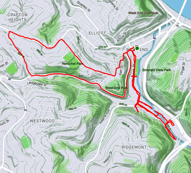
Monday, July 5th, was a day off work with no big plans. So, of course, I explored the city some more. My “A” goal was a few snickering little streets in the West End. Every time I drove my them, I could hear them, snickering, “He hasn’t found US yet. Ha Ha!” Well, today, with candy bar in hand and a patriotic shirt on for good luck, I set out to end that snickering once and for all.

The first little snickerdoodle to go down was Plank Street. It is pretty much a driveway from the bottom of a cliff, across Wabash Street and into Saw Mill Run (the creek). The next peanut in the gallery was China Street. There’s no wonder I had missed it before, because little is there. A few cobblestones near the billboard at the bottom of Greentree Road traced where the street had been. Pushing through the undergrowth I could feel remains of a street, but everything else was overgrown. Some time ago, I think there were steps from China Street to the train line above. On maps it appears they would have almost connected with Journal Street steps in Ridgemont, but I don’t know if that actually was the case. At any rate, I didn’t see evidence of steps. Perhaps in the winter I would have.

From there, I crisscrossed under railroad trestles off of McKnight Street, as it plays jump-rope with Saw Mill Run. Several businesses still hang on down there, from Johnny’s Diner to TMT Services. I would not want to be here in a flash flood, with water crashing down off the hills.

From here I ventured up Noblestown Road. I’ve used it for many years as an alternate route when the Fort Pitt Tunnel is backed up. As a driver, I appreciate its curvy efficiency. As a pedestrian, I’m traumatized its lack of sidewalks. At least there is a small shoulder, and, if I would rather risk falling down a slope than getting hit by a car, I have the option of trotting on the far side of a guide rail. On a normal day, this would be pretty dangerous. However, with little going on and no traffic, it was OK. I feel bad for folks who use that bus stop on a regular basis, though.

Around the curve, I was rewarded by thundering applause from dozens of Kennywood prize animals watching my progress. (Or maybe it was just my thundering heartbeat!) Continuing, I came across the Old Stone Tavern, in operation nearly continually from the 1780’s well into the 2000’s. There is a group, “Pittsburgh’s Old Stone Tavern Friends Trust Inc.” which is trying to keep the tavern from falling into disrepair. I hope they succeed.

Old Stone Tavern

Another building, more of a garage, struck me. “Mike Mannella” is proudly emblazoned across the lintel. I didn’t get as much information about that building and am curious if anyone knows the story there.

Mike’s parking spot?

I returned a different way, down the Kerr Street steps, one of my favorite flights in the city.

Kerr Street Steps

RATS #00425 in Squirrel Hill

Less adventurous than my last run, this one took me around the “North of Forbes” section of Squirrel Hill. Large single family houses are intermixed with condos on the shady streets.

Off of the major streets like Wilkins, Negley and Fifth, little dead-end streets curve up the hill providing privacy for unique houses.

Down near CMU, I took a little street off of Morewood behind frat houses. It’s off-season and a deer family quietly watched me run by. Robin Way is listed on CityStrides as a street, but in fact it is a private drive. With that, I was done on this lazy summer evening.

North Shore, Carrick and Belthoover Finishing June 2021

RATS #00421

RATS #00421 was a quick six miler after work. My main targets were alleys near PNC Park and Heinz Field as well as re-doing Children’s Way near Allegheny Center. As it turns out, there had been a Pirates baseball game that day, so my alley running included spectator dodging.

Once I had put some distance between me and PNC Park, I ran along Reedsdale Street, as it goes under the T, which carries hopeful gamblers to the Casino. It was rather precarious to walk along but I did see a number of “Marcher Arrant” stickers plastered on poles and guard rails. He blew through town earlier this summer and walked much of it. This section of town is not meant for pedestrians. It is meant to funnel people to the stadiums and back out.

Finishing Reedsdale, I decided to circle back to North Canal Street by way of the Children’s Museum. I always forget that West Park has a train track running through it, and, that the West Ohio Bridge is under construction. Whoops! I couldn’t get through, and had to detour via take West North Avenue. Isn’t it against some rule to put “West” and “North” in the same street name? It should be!

Anyway, upon emerging from the other end of West Park, I passed Allegheny Traditional Academy, which I believe is a charter school, before going through a section of Children’s Way. There’s some cool stuff there, including the sculpture reCARstruction. The link has a video of its creation.

Moving on, I trotted up North Canal Street. It starts as a ramp off of East Ohio Street and cars zip down it, perhaps expecting to get on the interstate. However, as it sweeps past the railroad and a high-rise building, it becomes just another way to get to Giant Eagle. I found out later that there is another section of North Canal, even more obscure. I ended near my start on Goodrich Street, a cobblestone relic of the past, interrupted by ramps.


RATS #00422 in Beltzhoover and Carrick

RATS run #00422 was all about alleys. Alleys in Beltzhoover and alleys in Carrick. Those aren’t exactly adjacent neighborhoods, so this ended up being a long run. But, let’s start with Beltzhoover Alleys. They are generally gravel and overgrown. Some are nearly footpaths.

Here along the alleys, you see garages falling down, with weeds on their falling roofs, but for the most part they are free of garbage and dumping (unlike Homewood). Heck, you see houses falling down on the main streets, so there’s no surprise the garages on the alleys would be in disrepair as well. I do have to say that Belzhoover is an active community. There’s always someone walking their dogs, riding bikes, doing lawn work or otherwise out and about.

Buffington Road, sits at the bottom of a steep hill lined with ominous houses. It was gated off. I really hate that. The maps show a public street, but the owners apparently think its a private drive.

Anyway, I shook the Beltzhoover dust off my feet and crossed over to Borough Way, forming the border of Pittsburgh and Mount Oliver. From here, I zigged and zagged my way to several alleys in lower Carrick, ending in Sinton Way. Sinton is a staircase from Dartmore (near Saw Mill Run) to Lucina, where it flattens into a paved street. The steps in the picture below, however, are just in Phillips Park. My heart rate exploded going up those.


That’s about it, both for this run and for June. I finished June with a respectable 112 miles, which included another “Take the Stairs Fatass” 50k.

Majestic Archon Oil

RATS Run #00420

Majestic Archon Oil; no isn’t the latest renaming of Standard Oil, but rather three of the alleys I finished up on this run in Friendship and Garfield. Archon Way is just a short little garage access road in Friendship. It dead-ends into a shabby garage, festooned with car parts.

Moving up the hill into Garfield, I came across this massive white house which still holds some glory, in spite of the window bars and peeling paint. I also came across this new recent construction, or is it a brutalist building? Only the architect knows for sure.

Up in Garfield, I darted in and out of alleys. Oil Way is little more than a small driveway, while Majestic Way is a steep stone stab into the hill. At the top of the hill in Garfield, the greenery takes over. One alley ends in an empty lot, now a playground. Fannel Street is as green as a lawn-bowling court with a rabbit directing traffic.

Gretna Way took me around an old school. On the way down, a sidewalk was brightly colored with this wall of names. I’m not sure what that is about. Last but not least, the Cathedral of Learning stands tall in the evening sun, the view coming down North Pacific.

Too Mundane

Well, it had to happen sometime. Some readers might have thought it already happened, but this, this is one for the record books. Two very mundane runs. Not a lot to see, although I still took pictures, to make sure you, the reader, also realizes how mundane these runs were. If you fall asleep mid-post don’t blame me, blame your coffee.

RATS Run #00418 in Shadyside and East Liberty

RATS Run #00418 was a short run from Mellon Park to the end of the rainbow, Rainbow Street, that is. Adding to the whopping 2.69 miles, I turned the corner on Fifth and Penn (East Liberty Version) and ended up high-stepping through downed tree limbs while hoping I didn’t fall into the turning lane. Grrr

The end of Rainbow Street isn’t all it’s cracked up to be; just a busway entrance.

Now I traipsed through little streets which have recently blossomed across from Bakery Square. I’m not sure what kind of soil they’re using, but those trees look pretty sparse. The condos look modern and sleek, but still sparse.

This took me to the back of Mellon Park. Softball and kick-ball leagues were in full swing, so I dodged them and ran behind the tennis bubble, from an earlier ‘future’. Finishing out my miles, I made sure to go to the very end of Cornelius Way, off of Howe. With that, I was done.


RATS Run #00419 in Banksville

Now for another abject lesson in mundanity. I started at the corner of Banksville and Banksville. The little sideroad, Banksville Avenue branches off of the express lanes that are Banksville Road. Outbound drivers are just realizing they aren’t on the interstate anymore, while inbound drivers are gearing up for tunnel traffic. Anyway, a couple of hotels grace Banksville Avenue. Catering to the visitor traffic are an Eat ‘N Park and a piggy BBQ place.

Catering to wedding guests is The Boiler Room. It is temporarily closed, but hopefully that’s just a short-term Covid thing. I must say, while it doesn’t sound like an elegant wedding place, it certainly had the look. Behind “The Boiler Room”, Alpark Avenue stretches back nearly to the Parkway West. When I laid out my route, I took a peek at Google Streetview to see what I was getting myself into. I saw a street lined with cars parked in front of semi-permanent trailers. However, things have changed. All the trailers and cars are gone. Wild grape vines are taking over.

From here, I started up Crane Avenue. It’s a steep, winding road with narrow shoulders and no sidewalks. Prior to running up here, I thought there was nothing around, so no sidewalks kinda made sense. However, two of Pittsburgh’s largest apartment complexes are off of this road (Hyland and Crane Village). Additionally, there’s a bus-stop, orphaned from any pedestrian access; a park at the top of the hill and a restaurant at the bottom. C’mon Pittsburgh, you can do better!

East Entry Drive bears off to the left and conjures up the entrance to a mansion, but in reality is just a short drive to a self-storage facility. There are a few businesses and apartments wedged in there as well. Crane Village is a sprawling campus of garden apartments. I could see the UPMC building and Oxford Center peek through the trees before getting caught in a short downpour. It turned all the streets to rivers and my shoes into canoes, floating me down the hill.


If you made it this far, maybe these runs weren’t THAT mundane. Just be careful going up Crane Avenue.

Squirrel Hill to New Homestead

https://www.strava.com/activities/5471340806
RATS Run #00417 Summerset and New Homestead

For this run, I started in the upper reaches of South Squirrel Hill then made my way across the Monongahela to New Homestead. I parked near Forward and Beechwood and trotted down the hill to Summerset. It’s a nice development of newer houses built atop a slag heap. There’s a tree-lined entrance and sweeping views of the Mon. More importantly, it’s a shortcut to Dunkin Donuts and Bruster’s Ice Cream! Mark down THIS route.

Below Summerset, the Jewish Association on Aging has several housing facilities from apartments to assisted living. In addition to a high-rise, college-like buildings dot the well-maintained grounds. This little bird seemed out of place, hopping around on the sidewalk, chirping.

This leads to Browns Hill Road. Take the right and you’re at Brusters, with Dunkin Donuts at the next light. Alas, my trek took me down Browns Hill Road, where the sidewalks are iffy. Sometime you have them, sometimes you don’t. I crossed the street at an inopportune spot and got a gutter. Finally out on the Homestead High Level Bridge, I was treated with views of the Mon and a laden train far below.

Between the still-standing smokestacks and the ever-present railroads, reminders of the steel heritage of Homestead remain. This is roughly the site of the famous “Homestead Strike“. Just off the end of the bridge to the left is a bar, Blue Dust, named for the blue dust which covered steelworkers’ clothes after a shift.

But Homestead is not within the city limits of Pittsburgh, I was just passing through. Heading toward New Homestead I found a short-cut; steps leading from 8th Avenue to Basic Street. At the top of the steps, there is a view of the old smokestacks.

Turning again, I slogged up the steep hill which would take me back into the City of Pittsburgh. Beyond the impressive retaining wall, I found a little grotto. Perhaps it isn’t the safest place, what with rocks tumbling about, but the “Park Here” sign was certainly welcoming.

Rounding the corner, Basic Street enters New Homestead and becomes a paper street, disappearing for a half-mile. It is an area of half-acre yards and modest homes. According to CityStrides, Benezet and Bench Way continue, making a circle. Well, not really. They are more like street stubs with new construction going on.

New Construction

And that was about it. I retraced my steps out of New Homestead, passing the Bulgarian-Macedonian National Economic and Cultural Center (BMNECC, for short). Last time I checked, it operated as an event venue, for dances and parties, while its bulletin board had flyers for lessons in Bulgarian. Eventually I crossed the Homestead High-Level Bridge again, this time getting an evening view of Duck Hollow.

Hitting the Rocks Bottom

Route of RATS #00416 Across the McKees Rocks Bridge and into Chateau

It was a humid summer evening in the ‘Burgh. Clouds pregnant with rain hung heavy over the city. Steam from earlier rains rose up to greet the newborns. This was the evening of Tuesday, June 8 and I was struggling. Mapping out ‘efficient’ runs has become more difficult. So, I figured, I’d do a simple run; complete Brighton Heights Boulevard, cross the McKees Rocks Bridge and then find the OTHER piece of Branchport Street I had previously missed.

I parked on Termon Avenue and scampered toward the McKees Rocks Bridge. It is a little annoying that sidewalks disappear from one side of the road, forcing you to cross. Par for the course, I suppose. Crossing Route 65, where it hits the bridge is a lesson in patience, but doable. If I remember correctly, only one side of the bridge had an open sidewalk. Once I got there, though, I was rewarded with great views down the Ohio on the right and down into an Alcosan waste water treatment plant on the other.

I must say, those churning tanks were mesmerizing. So many of them! Some were empty and surprisingly deep; maybe ten feet or more. On an amusing note, there is a high chain-link fence right above those tanks, presumably to reduce the chance of people falling in or having debris thrown in, mucking up the plumbing.

Unfortunately, the high fence stopped and only a low barrier separated me, the runner, from falling into the river. I found it unnerving, especially when the walkway went around the pier on the outside.

I made it to the other side just fine, of course, and was rewarded with steamy views of downtown, so far from the Bottoms, yet so close.

Downtown Pittsburgh from McKees Rocks Bridge

Simply returning across the bridge, I got to appreciate the views again. Then I trundled down California Avenue to the Eckert Street Steps.

Now, this section of the run was mainly due to poor planning. Earlier, I had run many of the streets in Chateau, but somehow missed that Branchport Street. This time, running down Eckert, I kept a mantra of “street after the marina”, “street after the marina”. I did get some nice views of the Ohio. “Street after the marina”, “street after the marina”. Look at that cool railroad bridge. “Street after the marina”, “street after the marina”.

Missed it. Whoops! Turning around, I finally came across it, a mere driveway.

Branchport Street, the Other

With this, I returned up the steps, up California Avenue and right onto Brighton Heights Boulevard. The Brighton Heights Bunny welcomed me back.

Brighton Heights Bunny

Long Way to Traverse

RATS run #00414 From South Side to Traverse Field

On this bright Saturday morning, a group of friends, led by Bob and Nancy, were doing the South Side Slopes piece of the “Take the Stairs Fatass” 50k. That route draws a jagged circle around Pittsburgh, starting in Spring Garden. An unsupported event (e.g. a ‘fatass’), it uses over 70 flights of city steps to bring the participants to some of the best views highlighting the city.

Anyway, I was NOT doing it, but figured I could meet up them. Sure enough, shortly after I parked in the South Side, I ran into them huffing and puffing up Eleanor Street. It has great views, and everyone in Pittsburgh should do them.

Breaking off after a few blocks, I continued through Arlington and to Amanda Street as it cuts down to Carrick. I needed to complete Charlock Way and Dove Way.

This area of the city; Knoxville, Mount Oliver, Mount Oliver Borough and Beltzhoover, are tightly packed. In some lucky areas, trees throw some shade, while in others, it is just sun, concrete and houses. Dove Way sounds pleasant enough, like the gentle cooing of mourning doves as the sun comes up over a green yard edged by flowers. The reality is different. It goes behind narrow towering houses leaning on each other for support. Grimes Avenue, while aptly named, at least has some trees.

Continuing the bird theme, I cut down through Partridge Way and a little unnamed alley off of Hawk Way.

Finally, I went back to Brownsville Road, passing the flower vendor en route to Borough Way. Borough Way straddles the southern border of the Borough of Mt Oliver and the City of Pittsburgh. At the end of Borough Way sits Traverse Field, which has little league baseball games. I finished up a little alley there and made my way back over the big hill, back to the South Side. It was a hilly seven miler. I was beat at the end.

Post Run

Beltzhoover and Edgebrook Avenue

Two runs in late May


Back-alleys in Beltzhoover

RATS run #00410 in Beltzhoover

Prior to this project, I did not appreciate the size of Beltzhoover. Now, I appreciate it, as I keep going back to ‘finish’ up more alleys and cul-de-sac’s. This run, run #00410, was on a beautiful Sunday morning, but my plans were immediately altered. My old nemesis, “Nonexisting Streets” was at it again; Pear Way, for example.

However, I persisted and found my way down many a country road there. Yes folks, this is a reputedly tough inner city neighborhood.

I’m often a little tense running through alleys like this because I’m not sure what I will find. I generally shouldn’t worry too much; mainly I’m dodging chipmunks, squirrels, groundhogs, the occasional cat and sometimes deer. Every once in awhile, I’ll come across someone walking their dog.

This is not to say these alleys are pristine. Often decaying garages house cars which haven’t moved in a generation. Tires and garbage are common. I do believe there is a City of Pittsburgh Ordinance about the cars, though. Oh, here it is:

The accumulation and storage of abandoned, wrecked, dismantled or inoperative vehicles, or parts thereof, on private or public property, not including highways, is found to create a condition tending to reduce the value of private property, to promote blight and deterioration, to invite plundering, to create fire hazards, to constitute an attractive nuisance creating a hazard to the health and safety of minors, to create a harborage for rodents and insects and to be injurious to the health, safety and general welfare. Therefore, the presence of an abandoned, wrecked, dismantled or inoperative vehicle, or parts thereof, on private or public property, not including highways, except expressly as hereinafter permitted, is a public nuisance which may be abated as such in accordance with the provisions of this chapter. [Ord. 664 C.S. § 1, 1973.]

https://www.codepublishing.com/CA/Pittsburg/html/Pittsburg08/Pittsburg0812.html#8.12.010

If only this were enforced! Maybe it is just too much hassle and paperwork, I don’t know.

Now, at some point someone decided that a directional sign pointing to Beltzhoover’s amenities was a good idea. It sounds like a great idea to me too! However, apparently there wasn’t any money to keep the right of way mowed or stairs intact, so now the sign is rather ridiculous. The pic below on the right were steps prior to 2007, if I’m not mistaken. Of course, these days, with smartphones and maps, I don’t think we need directional signs that much.

That was about it for alleys of Beltzhoover. I’m sure I’ve missed some and will be back.


An Epic Run From McKinley Park

RATS Run #00410 from McKinley Park to Brookline and Back

This run, RATS run #00410, started pretty close to the previous run, run #00409. However, I went in an entirely different direction, down Bausman to Saw Mill Run Boulevard. My main goal was completing Edgebrook Avenue. I did that and added a few charming streets.

McKinley Park is fairly large. The main access to it is along Bausman Street, where folks park along the road and have picnics, play hoops and skateboard. However, it was a rainy Saturday morning when I went through, so the park was deserted.

At the bottom of the hill, Bausman ends at Saw Mill Run Boulevard. This is only a quarter mile from the Liberty Tubes, so it is very busy. T-tracks tower overhead and a thriving thrift store sits across the intersection. You might notice the picture with the T is bright and sunny, while the Thift store is all gray. That’s because I did this one section twice. The first time, my GPS failed, so I felt compelled to do it again. (Argh!)

Behind the thrift store, Timberland Avenue crosses a closed bridge and runs past a couple of derelict houses before disappearing in a tangle of underbrush. The stream, Saw Mill Run, still has car carcasses littering the gravel.

Now running down Saw Mill Run Boulevard, the sidewalk disappeared, so it was crappy running. How about getting sidewalks here? Anyone? Buehler? Buehler?

There were some curiosities along the way. I feel like this truck was trying to hide, parked as it was between a shipping container and a billboard. However, it was as successful as an elephant hiding behind a refrigerator. While the door below is kinda cool, in that battered-steel-door genre, I really like the retro numbering next to it. (I’m sure it is original, not really retro at all.)

I finally got to Edgebrook Avenue. It actually starts under the T and even has a couch for resting. (Apparently having indoor furniture outdoors is against city ordinances, too.) Then Edgebrook Avenue passes a small car dealership and rises into Brookline, rising along a winding, wooded valley.

Up toward Brookline, several small streets branch off of Edgebrook Avenue. Milan Street used to have steps to Whited Street. But then, a tree fell. And fallen trees can’t be removed.

As always, people decorate their places. This goose was very appropriately dressed, while the fairy garden was trying to bring magic into the day.

I magically lumbered down Brookline Avenue to Pioneer Avenue, catching Oleatha Way en route. Then I decided to cross West Liberty Avenue and check out a couple of streets rising from beneath the Norfolk and Western train trestle. One just led to a city vehicle impoundment area, but Dawn Avenue rose on cobblestoned paths up the slope to Charm Street. Charm Street, ah, well, take a look and tell me how charming it is.

I was, honestly, surprised how far Charm Street extended. But at the end, well, it was dead. Again, I’ve taken a liking for doors, so here are a couple.

Dawn Street has its own South Busway stop and apparently a T stop. Stairs on one side led across to steep stairs on the other. Before coming down, I had a good look at that Norfolk and Western line. Such an impressive bridge for just one track.

Finally, I rounded the corner and found myself at the Thrift Store on Saw Mill Run again. I slogged up Bausman, taking a small detour for Lorna Way, another Beltzhoover alley.

Lorna Way

That’s all for now. Just remember, keep your couches inside and your cars operational. And, for goodness sake, stop driving into creeks.