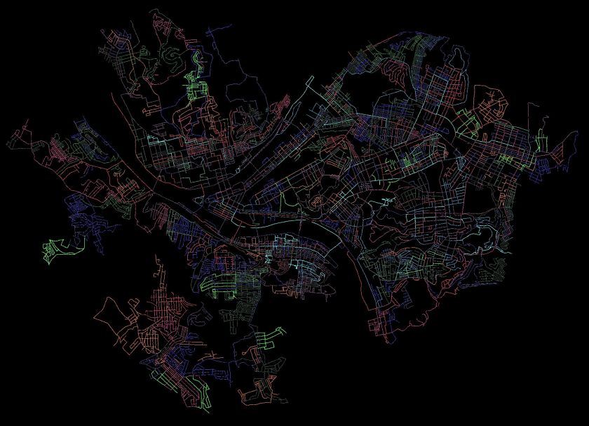
Finally! A Monthly Wrap-Up for November 2020

Summary

This November, I kept up my streak of 100 mile months and 10k+ elevation gains. I did hit some road blocks. While totally predictable, early darkness wreaked havoc on my running habits. Not so predictable was a week of quarantining due to Covid-19 exposure. Either way, I had sixteen runs in November, of which thirteen of them covered new streets. I am closing in on completing 70% of Pittsburgh’s streets. I wasn’t too good at blogging, though.

RATS #00328

https://www.strava.com/activities/4348197882
RATS #00328 in Brookline

This was a short run starting at Brookline Memorial Park covering Oakridge and Freedom Streets. The brilliant sunset gave way to just the slightest sliver of the moon. I caught the hippo in dusk, but the flag was still up when I returned in the dark. Aren’t flags supposed to be taken down or lit at night?

RATS #00329

https://www.strava.com/activities/4362738815
RATS #00329 in East Liberty

This four mile run also embraced the dark. I started with a few Shadyside streets and then ventured into East Liberty and Larimer. Missing my turn, I went up Lincoln Avenue instead of Lowell Street, seriously disrupting my planned route. Yet, with only 88 feet of elevation, I enjoyed this, the flattest run I had done in awhile. Eventually though, beyond the stores and street lights of East Liberty, the poorly lit streets and unfamiliar area got to me and I skedaddled back to my car, using the steps down to Ellsworth Avenue as a shortcut. It turns out, even those steps are “official” city steps.

RATS #00330

https://www.strava.com/activities/4370938579
RATS #00330 in the West End

Ah, the West End. The overlook has my favorite view of downtown. It also has a little parking lot, so it’s a great place to start. Balloons and candles remained for “KMB”, whomever that is.

I had visited this area several times already, but had missed some streets. The West End is unrelenting in its hills. Streets going toward the river are extremely steep, but even the cross streets bounce up and down. I ran up to St. Martin Cemetery crisscrossing the neighborhood on little streets and alleys. These unofficial steps on Navajo Way were a lucky break. Otherwise I would have had to run around those blocks again.

I headed downhill and ventured out Chartiers Avenue a bit; going up Litchfield Street. This “street” consists of several impressive flights of stairs. The streets are less impressive, generally winding up hills to arrive in someone’s garage. None of those streets are thruways.

RATS #00331

https://www.strava.com/activities/4377247944
RATS #00331 in Highland Park and East Liberty

A portrait of alleys in Highland Park. I amazed that it took nine miles to wander up and down all those alleys. Some were brick, some were asphalt. Mostly they were straight, while a few zigzagged.

Along the alleys were some immense houses and a few apartment buildings.

And, of course, I can’t resist a Little Library.
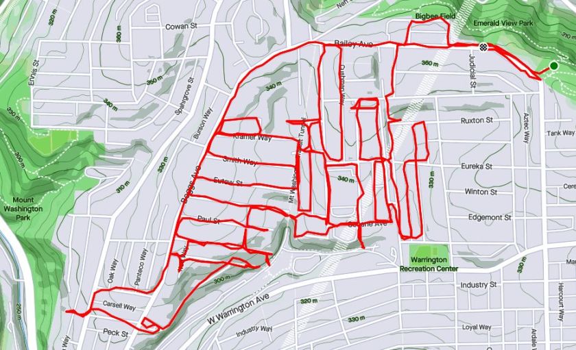
RATS #00332

https://www.strava.com/activities/4395003449
RATS #00332 – Homewood

This was a Thanksgiving Day run. I started in Swisshelm Park and went up Braddock Avenue to find its northern terminus, passing one of my favorite stores, 3 Rivers Outdoors. It is a small business specializing in outdoor gear. They also sponsor a trail running group and fun community activities. Going south, Braddock Avenue goes to Braddock, of course. ( Actually it veers east, trails past steel mills and winds up in Turtle Creek, if you must know.) On the northern end, it just stops unceremoniously in Homewood at a playground.

My previous run in Highland Park was mainly in alleys. Homewood has its alleys too, a bunch of “f”ing alleys; Formosa Way, Fleury Way, Finance Way, Forrest Way, Fuschia Way, and Fielding Way to name a few. I did a couple of these alleys, then climbed Calway Street. Calway Street struggles up a steep hill for a few houses and then is blocked off as it wanders into the woods. Turning around, I got a neat view of Homewood, its bowl filled with homes as downtown buildings peeked over the ridge. Returning down toward Braddock Avenue, I came across another Little Library, this one in purple. By the time I returned to Swisshelm Park through Frick Park, I had run ten miles.

RATS #00333

https://www.strava.com/activities/4398743439
RATS #00333 – Homewood and Belmar

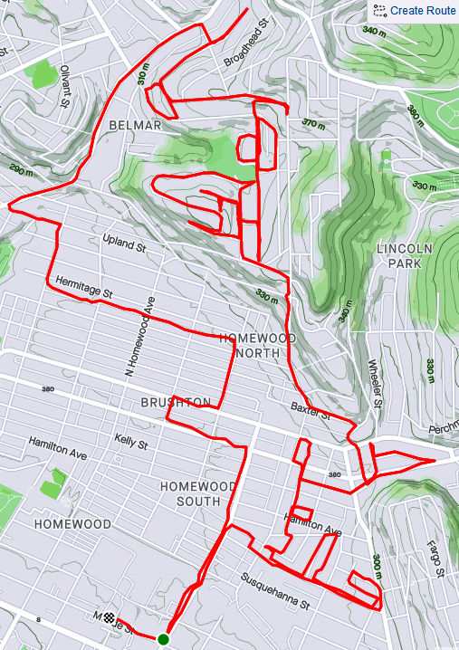
This run was something of a continuation of the previous run. I pushed further into North Homewood and Belmar. Right off the bat, I roused two deer from their Homewood bed under a stairwell. There’s a confusing mix of streets here, where Pittsburgh collides with Wilkinsburg. The older warehouses and buildings are mainly deserted. After crossing off a number of small streets and alleys off my list, I headed up Brushton Avenue and Stranahan Street.

After crossing several streets and alleys off my list, I headed up Brushton Avenue and Stranahan Street to a small subdivision. Water authority construction workers were busy digging and putting down pipe. Their store of fire hydrants looked like an arsenal of rockets. It was a rather chilly day and no one was playing hoops when I passed by.

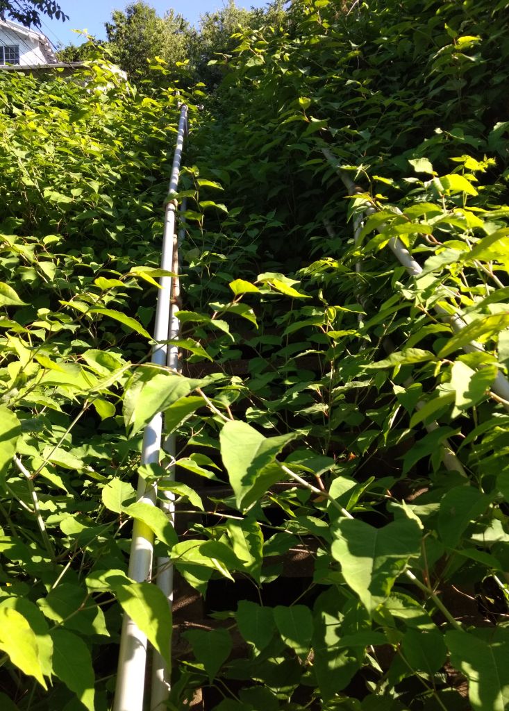
Completing the loop around Tilden, I went up Oberlin Street. At the end, a ragged set of steps took me up to Somerset Street. Somerset Street was high and wide, but I was ready to find my way home again so I found the Toga Way steps. Toga Way took me down steps littered with monkey balls. What are monkey balls? Check this Incline article for the full story, but they are the fruit of “Maclura pomifera”, commonly known as the Osage orange tree.

In another confirmation of boat theory, I saw several, nestled in the woods near the steps.

RATS #00334

https://www.strava.com/activities/4409006976
RATS #00334 with Rich

My friend, Rich, came with me on this adventure. Once again, I explored North Homewood and Belmar neighborhoods. We covered lots of ground and Rich made the miles go by easily. Here’s Rich, out standing in his field. He has a good eye for photography and takes nice pics.

A surprisingly sunny day, we made our way to the entrance of the VA Hospital grounds. Unfortunately, it was blocked off with vigorous “No Trespassing Signs”. With that route blocked, though, we found our way to a rusty water tower high above the Allegheny. I convinced Rich to NOT climb it.

From the top there, you could see way up the Allegheny River Valley. There was another water tower, but with its light blue paint and the sunny skies, it was actually hard to see.

In planning this route, I was using Google Street view to verify that streets went through. I was shocked when the street view took me from a rather derelict Ferdinand Alley to a sweeping country vista. Whoops! A glitch in the Matrix.

Ferdinand Way vs Google Street View

This is not the only street in North Homewood that does this.

Nonetheless, we ran by the quickly deteriorating Negro Opera House, took in the Laporte Street Steps and just meandered. Rich is pretty friendly and by the time we were done, he had waved to the black ladies going to church, some guys fixing their cars and just about anyone who showed their face.

It was nice to run with company to end this month.

Halsey Place n@

https://www.strava.com/activities/4200222449
RATS #00314

So, I’m jumping around in my blog posts. This run, #00314, was almost two weeks prior to run #00321 in my last post. However, it had too many interesting tidbits just to shove it into October’s cleanup post. My main goal was the Halsey Street Steps off of California Avenue. However, to get there, I ambled a bit more in California-Kirkbride.

I started in “Lower” California-KirkBride where a few residential streets struggle between Brighton Road and the USPS facility on California Avenue. I like the mural on the scrap yard door, only realizing later it was Warhola’s Scrap Metals. The Mero Way mural is impressive, as is the massive postal service facility which dominates the area. Up from California Avenue, streets A and B climb up the hill, sometimes with the aid of steps. A Street is shown on my map as climbing all the way up the hill. In reality it ends at Kirkbride Street. B Street has more luck, climbing to Lamont and then as steps to Morrison.

Lamont and Morrison both dead-end into a wooded slope where they used to be connected by A Street. Most of the houses in the area have been demolished, but there a few a still standing and being renovated. In fact, on my way up Morrison, a young guy impatiently waited for me to go by before continuing to clean in front of his house.

From here, I sauntered down to California Avenue, crossing Marshall Avenue, looking for Halsey Place on my right. Shortly I found it, a short street up a steep hill. It quickly became a set of stairs.

So, I was pleasantly surprised by the little streets around Halsey Place. It’s no Fox Chapel, that’s granted, but it was a decent little neighborhood. Kids were riding bikes, moms were chatting on the stoop, families were coming home from school.

From here, I completed Colorado Avenue, as it parallels California. This ended on Superior Avenue. I squiggled my way up Superior, to Stayton and eventually to North Charles. Off of North Charles were a few streets I’ve repeatedly missed, Strauss and Cross. I’ve been mystified why I never have been on Harlan Avenue either, then I realized it had been blocked off. The steps going to it are intact, but overgrown.

I ended by going up the cobblestone street, Melrose, then circling back down Buena Vista again. It was a rather long run for a weekday evening, but pretty invigorating. I’m thinking perhaps a run on blocked off streets is in order; Harlan, Metcalf, Irwin and Yale. Hmm.

Halloween’s Alive in Lincoln Place

https://www.strava.com/activities/4177544599
Run #00311 in Lincoln Place

Lincoln Place is the southernmost neighborhood in the City of Pittsburgh. If you take the Glenwood Bridge out of the city and keep going along Mifflin Road, you’ll come to it. There are three Pittsburgh neighborhoods down here, Hays and New Homestead being the others. Lincoln Place is, by far, the most populous.

Lincoln Place

I parked at McBride Park, intent on doing the grid of streets to the right of Mifflin Road. McBride Park, which is on the top of a ridge overlooking the neighborhood has a playing field, some tennis courts and wide open fields. There are a couple of pedestrian-only entrances which enhances its neighborly feel.

Speaking of the neighborhood feel – it is solidly suburban. Small, two and three bedroom houses at the top of the ridge give way to sprawling houses at the bottom.

This looks like a good neighborhood for trick-or-treating. Nearly every house is decorated, some more profusely than others. There is even a small graveyard off of Nollhill Street. I actually came upon it through a small path from Orchid Street where I can imagine a preteen Disney movie unfolding. You know, someone intrudes upon a house while the parents are at a Halloween party, so the kids must hide out in the graveyard which has its own dangers.

Completing these streets, I crossed over Mifflin Road and explored a bit. Interboro Avenue has the distinction of being parallel to itself for about half a mile. Physically, they are two distinct streets, as my feet can tell you. McElhinny Avenue is interesting in that one side is full of houses whereas the other looks out onto a wilderness. Turns out, most of that wilderness is just a couple of lots combining for 50 acres of land. Across that “wilderness” is the Allegheny County Airport.

Working my way back to McBride Park, I was pretty pleased. Over seven miles in another one of Pittsburgh’s great neighborhoods.

Turning 300 in Lincoln Lemington Belmar

https://www.strava.com/activities/4088625359
Route of run number 300

Whoo! My 300th time covering new streets on a run through Pittsburgh! This run was rather adventurous for me, covering streets from North Homewood to Lincoln-Lemington-Belmar. It is a residential area, with a few churches and small businesses. The houses tend to be older, occupied and in decent shape. There are big yards and lots of open spaces. There are also crowded streets, alleys used as dumping grounds, broken staircases and testy drivers.

My intention was to ascend the steps going from Lincoln Avenue to Arbor Street. Unfortunately, they were severely overgrown, so I ended up just running up Arbor Street. It was a steep one and there were several men in the street, cleaning brush and arguing. It was a little uncomfortable running past this group but happily they ignored me. Arbor Street makes a steep, sharp turn to the top of the hill where it becomes Pointview Street. There’s a small square of streets on this hilltop, which I had visited the previous day, working with Allegheny Cleanways, a group that is cleaning up illegal dump sites around the county. Pointview intersects Bower Street, another side of the square. One end of Bower Street are steps leading to Lincoln Avenue.

The other devolves from a decent residential street to a back-alley strewn with trash and cars. I continued along the alley until it started to curve closely around a house, like a driveway. I scooted back the way I came, noticing deer among the derelict cars and trucks.

Making the right onto Hyatt and then Hedge Streets, I noticed a driveway into that alley. Skull-decorated “Do Not Enter” signs adorned the entrance. Glad I didn’t go all the way around that building! While many areas I cover are empty, deserted streets, this area was alive with kids riding bikes, men walking home from the Dollar Store and people putzing around their yards. I got more than one quizzical look, as I suppose old white men don’t run up there too often.

I made my way to the start of Olivant Street, which has a long and meandering path. On one side, glass filled steps made their way from Olivant Street to a rather nice ball field. On the other, houses shouldered up the slopes.

From here, I crossed Paulson Avenue and explored the dead-end remains of Olivant Street on the other side. At the end of Olivant, as far as publicly accessible roads go, was a Duquense Light Power Substation. It’s desert-like gray gravel contrasted sharply with the surrounding lush green woods. Here, too, people were out; weed-whacking and taking in garbage cans. The streets up here are all dead-ends. Some are marked “Private” well before the end of the road. While frustrating to me, I don’t go down those roads.

I did manage to get to the end of Olivant Place, a narrow lane which became more and more grassy. I was awarded by the sight of a flock of wild turkeys, five or six large ones and maybe six smaller chicks. (Of course, turkey ‘chicks’ are rather large as well.) Startled, they abruptly scooted down the slope and flew into the trees. I only caught a fleeting photo of them. Usually the only Wild Turkeys I see are empty bottles. Must say, from the hilltops you get a pretty good view.

From here, I just ran a few more, flatter streets, before completing Paulson Avenue and heading back to my car. Eleven miles in the bank and some new areas covered.

More about the 300 runs

Pittsburgh Streets I’ve Run

I use a couple of methods to estimate how much I have done in Pittsburgh. The “golden standard” is my map of the Pittsburgh, where I color in each run as I do them. When the map is incorrect, I make notes. Streets that don’t connect are stricken through in black, additional streets are marked. In my ‘rules”, I state that doing 1/2 of a dead-end is acceptable. That is a bit weak, though, and generally, I’ll go to the end unless it becomes a private drive. I’ll be done when my “golden standard” is complete and anything I’ve ‘missed’ has an explanation such as “doesn’t go through”, “is a private road”, “not safe for pedestrians”.

Another method is CityStrides, which processes Garmin route data to determine which streets are completed. It uses a concept of “Nodes” to determine if you’ve completed a street. Do all the nodes, you’re done. Miss a node and and you’re not. With that being said, CityStrides has me at 58% of Pittsburgh streets completed. If this were all linear, that would mean another 217 runs. Of course, it is not.

I estimate I’ll need 90-110 more runs to complete the city. It depends greatly on how much I cover per run and how efficient I am at covering streets. Either way, it looks like I’ll be done sometime between New Years and Easter, 2021.

Carrick Buck and Bon Air Rooster

https://www.strava.com/activities/3949650172
Route for RATS #00285

First blog in a few days. Sorry, I’ve been running. Going back to last Sunday, me and a friend, Erin, tackled Bon Air and more of Carrick. I’ve known Erin for a few years and she has progressed from a beginning runner to quite the endurance athlete. Just the week before she had done a multi-day run/hike in the Laurel Highlands covering over forty miles. Last Sunday, she agreed to tag along in my all the streets adventure.

We started at the tip of McKinley Park and immediately went uphill on Bausman. Before we got into Bon Air, I had to cover some streets in Carrick. Aside from Brownsville Road, there are only a few small streets which continue into this area. Romeyn was one of them. It is impressive how high the houses are off the ravine floor.

This part of Carrick is densely populated and filled with Pittsburgh four-squares on small, hilly lots. There are few steps, notably Georgia Avenue, which go two blocks uphill. Also, as streets come off of Brownsville Road, there are often steps such as these Moore Street Steps.

Deeper into the neighborhood, away from Brownsville Road, vegetation starts to take over again, both controlled gardens and the lush mix of trees, wild grape vines and invasive Japanese Knotweed which is so prevalent in Pittsburgh. The green hillsides host a surprising amount of wildlife. We saw this buck nibbling grass along the top of Georgia Avenue Steps.

Moving up into Bon Air, we noticed a striking difference. While there were still some large Pittsburgh four-squares perched high on hills, there were many small two and three bedroom ranch houses and split-levels. These looked like houses built in the 1950’s. The yards were larger.

The streets were also long and straight. As I’ve mentioned previously, straight streets are attempts by planners to ignore the region’s topography. They are invariably very steep. At the bottom of one section, along Drycove Street, we saw not only another of Tom Murphy’s “Project Picket Fence” fences, but also a curious block of grass with steps into it. A lawn pool? I’m sure there’s a better explanation.

Bon Air was pleasant, in spite of the hills. We saw the largest lawn Rooster I’ve ever seen, ironically watched over by sunning cats. Lawn decorations were everywhere. I was impressed by this patio garden.

There are several flights of stairs in Bon Air. If you’re adventurous and go down a long asphalt alley, you’ll get to the Bon Air T-Station. I’m not sure why, but if you scour Bob Regan’s book on Pittsburgh Steps, you won’t find “Caperton”, but you will find a set of steps listed between Fodyce and Conniston, which are the steps on Caperton Street.

After rambling through Bon Air awhile, we went back to Carrick. Here, brightly colored yard decorations and a exquisitely planted pool awaited.

At the end of Amanda Street, we only had about 7 1/2 miles in, so we explored some more. We took streets which plunged down to Route 51. One woman on her porch suggested it would be easier to roll down than run down. I think she was right. Not wanted to dodge cars along Route 51, we made our way along Noble Street, encountering a number of flights of steps. These were fairly long.

We finally made it back with about ten miles under our belts. I was happy that Erin came along. We explored an area of the city neither of us had been in before. After such an exploratory run, I start to mentally connect different parts of the city together.

Bikes in Carrick

https://www.strava.com/activities/3860611348
Carrick – RATS #00275

I’m not familiar with Carrick and this area has flummoxed me before. I find Brownsville Road to be dusty, dirty and busy. I’m not sure where to park or what my “boundaries” are, so every turn is a mystery. Brownsville Road isn’t too hilly, but everything else seems to be falling off cliffs. So, for this run, my mindset was pretty much “just do it”, without much expectation for a dazzling run.

In most neighborhoods, I like to find a quiet street on which to park unobtrusively. However, here, people park all over the sidewalks in front of their house and I haven’t seen too much public parking. I resigned myself just to parking along Brownsville Road itself. From there, I took a right onto East Meyers Street. Almost immediately, I came across Highnote Way. Now, this felt familiar; an “alley” that transforms from steps to pavement every few blocks.

I came out on Birmingham Avenue. Birmingham was my college town, (Go Blazers!), so I rambled up that street back to Brownsville Road, intending to complete the square. By the way, that’s my favorite derivation of the quadratic formula, in case you were wondering.

That aside, I found myself trucking down Linnview Avenue. Again, cars were parked all over the sidewalk. Everything was cool until I spied an energetic girl clad in all black peddling like mad up the hill towards me. OK, I got on the sidewalk. And she did too. Argh, I scooted out into the street at the last minute to avoid her. Whew! I did have to admire her, as that was pretty steep.

Zoom! She swished right past me again, this time with earned downhill speed. I KNEW this was a dangerous area!

Past Susie Speedster, Linnview dead-ends into a grassy patch overlooking Becks Run Road, far below. I meandered a bit down there among the short streets, hoping that “Parallel Street” would actually continue to parallel Birmingham. Alas, it does not, so I’ve have to brave Susie Speedster for another trip down there.

Along the way back to my car, I found myself on “The Boulevard”, a surprisingly open and luxurious street. Then, on Transverse, it was back to tight houses on big hills. This time, a young man was zipping up and down the road doing wheelies on his motorbike. These folks seem to have a thing for bikes.

Finally, reaching Leolyn, I popped up the steps back en route to my car.

I must say, my feelings about Carrick have ameliorated a little, but I don’t feel I understand this area. Not ALL of Carrick is dusty and dirty, but it remains one of the more populous and sizeable of Pittsburgh’s neighborhoods. I’m sure I’ll see many things out here, if only I can avoid being run down!

Age of Discovery in Mount Washington

https://www.strava.com/activities/3679982962
RATS #00260 – Mount Washington Above Liberty Tunnels

Ah, history, it explains a lot. I had no intention of doing a historic run last Saturday, but I came across a couple of historic artifacts, some in use and some not. It all started with a rough plan to complete the Haberman Avenue between Bailey Avenue and Kingsboro Street. After that, I wanted to drift west to cover a series of streets off of Boggs Avenue in Mount Washington.

Not far down Haberman, I encountered Eureka Street where it transforms into steps leading to LaClede Street. While LaClede and Haberman are essentially parallel, and, at one point connected by a 50 yard span of asphalt, they ‘feel’ different. At this point, Habermann seems more spacious and open compared to LaClede. Perhaps it is because the yards off of Habermann have backyards sloping down and away, whereas the lots on LaClede are steeply sloped up, seeming closed in. Perhaps it is because Haberman continues across East Warrington, whereas LaClede dead-ends into Secane.

At any rate, the streets west of LaClede are in a regular grid. One street, Harwood, goes straight downhill. After Secane, it becomes Harwood Way, an increasingly steep set of steps. The steps descend all the way to the South Hills’ trolley line; the “T” as it is known. Coming back up those steps, I noticed that the last house on the steps, with all its gargoyles, actually faces away from the road. I also noticed immense brick towers rising out of the earth.

Running around them, I saw “Liberty Tunnels” emblazoned on the lintel. They were vents for the Tubes. A little digging revealed that these are the original ones, built 96 years ago after a traffic jam on May 10, 1924 caused motorists to get sick from carbon monoxide fumes. The Pittsburgh Quarterly has a great article about it. They had been planned anyway, but the May incident hurried those plans along.

Now my journey took me to Paur Street; that’s right “Paur” not “Paul”. At the end of Paur Street are a set of stairs with the touch of death – bar across them indicating they were closed. It was easy to get over. The steps were generally in great shape, except a couple of places where the concrete treads were totally missing. They were also fairly wide and took me to an asphalt path under the spreading trees.

One section, presumably going down to the South Hill’s trolley lines, was seriously closed; blocked by a chain link fence and missing platform. Apparently, in the ‘good ole days’, Brookline kids used these steps to get to school, as told in Brookline Connections.

On the right, the asphalt path continued. I dodged fallen trees and passed an old metal cabinet. Its slightly ajar door revealed a new, bright orange bag of Reese’s Pieces. Just then, I was startled by a man coming down steps towards me. In his short sleeve, light blue dress shirt and black pants he quickly bore left and went down another section of steps, ignoring me completely. The smell of his cigarette lingered, though, as I went down those steps far behind him. At the bottom, I looked up and saw a “No Trespassing Sign”. Whoops! I returned up the steps, retracing the man’s steps which led me to the intersection of Westwood Street and Albert Street.

Further down Westwood Street, I eventually came the Walden Street steps. Here, they are narrow, wooden and very overgrown. Cutting down an alley, I came upon Tuscola Street, with disintegrating sidewalk steps, also overgrown. Several streets off of Westwood, such as Kramer head straight up to Boggs Avenue. A high section of Albert Street near Boggs Avenue yields more distant views of the venting towers.

As you go south, the streets off of Boggs Avenue get shorter and shorter and more steeply fall on the end. Several of them have steps to South Hills Junction, where the South Busway and South Hills T line intersect.

For a moment, I ventured past Boggs, catching the Soffet Steps. However, my secret hope that they went all the way to Warrington Avenue was dashed and I had to backtrack. Along the way, I did come across this yard, complete with red table, Triceratops skeleton and Christmas lights strung along the fence.

Finishing up, I was tired, but pleased with this eight mile jaunt. The run was more interesting than I expected and I got to see those venting towers up close and personal.

Stairs In the Knotweed

https://www.strava.com/activities/3585301254
RATS #00253 – One Wild Place… and more!

This run took me around Highland Park, the park not the neighborhood, to the rear of the Pittsburgh Zoo and down Butler Street to Lawrenceville. I also was planning to hit three small areas that had short streets and steps. It turns out, one set of steps was just wildly overgrown, one was broken and one didn’t exist anymore.

But I’m getting ahead of myself. Starting in Highland Park, my troublesome hamstring reared its ugly head as I went up Farmhouse Road. From there on out I only managed a mostly slow trot. However, Highland Park, in the brightly sunny, blue-sky day was magnificent. Lush green trees towered over plush green lawns.

I made my way on Lake Drive to Carnegie Lake. This little man-made pond has wooden boardwalks out into the water. Earnest young men were trying to fish while excited little girls were throwing bread to the fish. The large swimming pool is still unfilled, but several beach volleyball games were underway on the sand courts. The players had gone all out, playing in bikinis and swim trunks. Past this beach scene, pavilions disappeared into the deep groves and a flight of stairs led to trails.

Lake Drive winds around the back of the zoo as it ascends to One Wild Place. This two lane road is split between a lower ascending lane and an upper descending lane. Along the wall between the two are cute mosaics fancifully depicting animal antics.

From there I went out on Butler Street then went up Baker Street. It is a fairly steep street going right up into Morningside.

Past the “Welcome to Morningside” sign was one of the little side streets I had targeted. It was shaped like an upside down “V” with a set of stairs crossing the open part of the “V”. Alas, the brilliant sun and ample rain caused everything to be overgrown on steps known as Dressing Way. I ventured up for a bit, crunching the Japanese Knotweed underfoot. Finally, it looked too dense to continue, so I backed down the crunchy steps and instead ran up Marietta Street. Marietta ends at the apex of the “V” and intersects Premo Street. As Premo dissoved into a driveway, I saw the top of the Dressing Way steps and thought “That looks doable!” So I went all the way down them through the forest of knotweed again. Whew! I hope I’m not allergic.

Along Butler Street again, I winded my way to Osborne Street, hoping to find a stairway down to Butler. No dice. No sign of those steps.

Back on Butler, I encountered a friend biking home. I don’t think I had seen Antonella since the Covid19 lockdown and we got to chat for a couple of minutes. I love it when I’m in a random spot in Pittsburgh and come across a fellow runner.

My next step encounter looked much better. This was a short flight up to Sawyer Street. Unfortunately, tree damage prevented a full traverse of those steps. The top conveniently doubled as a staging area for some brick work.

From there, I ran to Stanton and Holmes. I had one section of Holmes to complete and did it, crossing Holmes off my list for good. By the time I got to Kendall Street, though. my hammies had had enough and I walked back to the car. Over six miles in with a great evening, so can’t complain.

Noble way to Crafton Heights

https://www.strava.com/activities/3447167472
RATS #00238 – Into Crafton Heights from Noblestown Road

This was a pretty well-planned run in Crafton Heights. Instead of approaching Crafton Heights from Steuben Street, I approached it from Noblestown Road. Honestly, a big draw was the availability of parking at the Shop ‘N Save on Noblestown Road. I wasn’t familiar with the area and didn’t know what to expect. I must say, I was very pleasantly surprised and look forward to running more in this area.

To get to my designated parking spot at the Shop N Save, I actually went out of the city on the Parkway West, exiting at Greentree. A few minutes and a few turns later, there I was, pulling into a rather empty parking lot. Social distancing and Covid19 fears has certainly made traffic lighter!

Noblestown Road, at this point, is a broad avenue crossing street after street of modest two and three bedroom houses built in the 1950’s. It sweeps down to Crafton Boulevard, where I took a left and caught Stratmore Street as it climbed steeply. I turned around at Steuben Street, which is the border between Pittsburgh and Ingram. From there, I went back and forth on the grid of streets between Stratmore and Arnold. Much of the area resembled Hollywood Street shown above.

Round Top Street dives down a particularly steep hill. It also has one of the newest set of steps I’ve seen in the city.

Round Top Street Steps

Eventually, I got to Clairhaven Street. For cars, that’s where you have to turn left onto Norwalk Street, but people can take steps from Clairhaven Street to Arnold Street. These stairs are a little wonky. The wooden top section is a work-around. Older concrete stairs, having fallen into disrepair, were simply bypassed. There are two “orphan houses” here. An “orphan house” only has entrances on the stairs.

Crossing Crafton Boulevard again, I came across this, the busiest front yard in the ‘Burgh. They had at least a dozen shiny mannequin heads on stakes.

How many lawn decorations can you count?

Making my way back to the car, I was happy with this nice run in the sun in a pleasant part of Pittsburgh. I’ll be back.

Upper Lawrenceville – Mission Accomplished? Not quite.

RATS #00236

Today’s run embodied a simple plan; start in Lower Lawrenceville, struggle up the steep streets into Stanton Heights and come back around on Butler Street. It went pretty well and I covered a few holes in my map.

My rough approach to Stanton Heights was to ascend 54th Street, pick my way over the steps from Leydon Street to Kendall Street and go from there. In the top corner of Lawrenceville, it was interesting to see the differing housing type. That simple small house is on Kendall. The larger traditional house is on Duncan and the new modern condos are perched on the top of 54th Street, before it becomes a stairway. These are all within a couple of blocks from one another.

In an earlier blog I documented the stairs down to Upview Terrace and Woodbine Street. Today, I continued on Woodbine as it re-crossed Stanton Avenue into another section of suburban-in-the-city living. This is quite a contrast to the densely packed houses of Lawrenceville. Off to the left, down Oglethorpe Street, Garage Way and Drive Way (yes, that’s a real street name, “Drive Way”), the streets take you to the edge of bluffs where wildlife abound.

I would like to come here some quiet morning and just watch the birds. Continuing down to Morningside, I made my way to Baker Street with its nice view of the Allegheny. The road steeply falls toward Butler Street, where the sidewalk ends and the steps begin. From here, it was a flat fast run back to my car.

I’m now a half-block away from completing the streets between Butler and Stanton Avenue and have only a half-dozen streets in Stanton Heights itself. Once I get One Wild Place done and a couple of streets jutting off of Butler done, I will have run every street from Butler Avenue to North Negley Avenue.