Ridgemont and Westwood

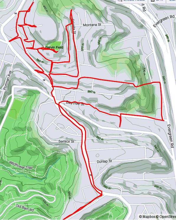
Three of my runs in January completed 99% of the streets in Westwood and Ridgemont. These two western neighborhoods perch atop hillsides on either side of Greentree Road. I’ve run extensively in Westwood, but Ridgemont was a whole new area.

https://www.strava.com/activities/4649360974
RATS #00358 Westwood

Run #00358 in Westwood was a “just get out there and do it” run. My intention was to complete Rydal Street and a couple of neighboring streets. In the darkness, I missed Sedley Way, but was otherwise successful. Nothing beats snowy steps at night!

https://www.strava.com/activities/4702189987
RATS #00362 – Ridgemont

Continuing with the evening running, my next run took me behind the Giant Eagle in the former Parkway Center Mall. Merely minutes outside the Fort Pitt Tunnels, Parkway Center Mall is torn down. Shadowy parking lots with feeble fences lead toward the bright Giant Eagle. The ubiquitous asphalt undulates, as if the land itself is trying to throw off the abomination of acres of paving.

I took a quick shaky selfie and headed on down Greentree Road and up Hamburg Street. The blue ice filter captured the temps appropriately. This, I must say, is the first the skull-decorated, smoking-moon outhouse I’ve found. I stayed on the hilltops, where the sun’s light lingered until the dazzling city lights came out.

It was a short, exploratory run in a new neighborhood.

https://www.strava.com/activities/4707540599
RATS #00363 – Ridgemont and Westwood

RATS #00363, a daytime run, pretty much completed the last two runs. I finished up lower sections of Ridgemont and in the end, even covered Sedley Way in Westwood.

With the knowledge from the previous run, I started right into Ridgemont along Springfield Street. This time, though, I made my way down New York Street to the dead-ends of Junius and Journal Streets. On the map they look like fork tines sticking into the hillside.

In real life, Junius and Journal are narrow streets clinging to the steep hill. A set of derelict steps gave me access to Journal without backtracking too much. On the farther side of Journal, the steps, now truly overgrown, fall off the hill. According to maps, they look like they go down to a railroad track. I’m not sure if they originally went further, for there’s a set of steps off of China Street below which look like they should meet. It’s all a rather moot point, though, because the steps are in bad shape and go nowhere. In the bottom picture, you can barely make out the steps and a few green rail posts still standing.

Just as a footnote, Junius continues on the map to Greentree Road. However, from the Ridgemont side, Junius ends in a veritable graveyard of cars in front of a narrow house. Journal Street, has a renovated house on the end, but also has ruins of houses along its course.

With Junius and Journal out of the way, I went to find the other side of Junius, off of Greentree Road. Junius does go up a bit, but Verna, a smaller road, is just blocked off from the street. While the bareness of winter allowed me to see everything, there’s not much to see. Steps, all twelve of them, took me from Ridgemont to Greentree. This rusty truck is hidden away at the end of an office park.

Now I explored the higher side of Westwood. Like Ridgemont, it has sweeping views. I daresay I can see the smokestacks from the Cheswick Power Plant! That’s about 14 miles away, as the indefatigable crow flies. I’m pretty sure that blue water tower on stilts is in the Upper Hill. That’s closer, only five miles away.

After such heights, I returned to lower Westwood; once again made my way up Milnor steps and finally ran Sedley Way.

Finally making my way back towards my car, I had to wait for a moment to cross Warriors Road. Looking down, I noticed gravestones at my feet. I think they must have originally been in Mt. Pisgah’s graveyard, across the street. Usually roads aren’t built across cemeteries. The picture below is a composite picture of two of the graves I saw.

With these three runs, I’ve covered most of Westwood and Ridgemont. I know there are a couple of alley’s I’ve missed, so one day I’ll be back.

Sandcastle And Beyond!

https://www.strava.com/activities/4600869666
RATS #00353 in Glenwood, and Glen Hazel

Water slides in winter are silent reminders of summer. Sandcastle, on the edge of the Mon, is a bubbling madhouse on hot August days, where lines of sparkling wet bodies, lathered with sunscreen, wait to speedily spill down the slides. Now, running past in early January, not a soul was to be found. Like Kennywood, an amusement park a few miles upriver, Sandcastle reminds me how work and play are so closely intertwined here, with an active railroad, a biking path and a water park within fifty yards of each other.

At the far end of Sandcastle is the Glenwood Bridge. I’ve never run across that bridge and wasn’t sure how to make it to the sidewalk across. It’s a large bridge, with ample room for floods. (Sandcastle, on the other hand, periodically gets flooded.) Fortunately, I came across several staircases which got me to the bridge. I’m thankful that the designers of these roads took pedestrians into account.

Once past Sandcastle, metal recycling facilities dominate the scene, a far cry from the steel factories which once were here. The Glenwood Bridge crosses the Mon and is a major roadway for South Hills commuters. On the far side of the bridge is Glenwood. Prior to poring over maps of Pittsburgh, I would have called that area “Hazelwood”. It is actually Glenwood, Glen Hazel and Hazelwood. Some do consider it “Greater Hazelwood” and it is encouraging to see community involvement as a part of recent urban planning. For a PDF of their recent neighborhood plan, click HERE.

I’ve recently done many runs in Glenwood and its companion, Hazelwood. With this run, I pretty much have completed the area. It has stunning views of the Mon Valley and a mix of houses, from hard-knock alleys to large houses wrapped with porches. Recently a fire gutted this house on Cust Street. The adjoining house was also damaged by the heat. It is likely that this house will just sit here for years, slowly falling apart.

Of course, there are stairs. Cust Street steps take you from Second Avenue all the way up the hill on two flights. Off the second flight are orphan houses – houses which front the steps and do not have direct road access. The Sunnyside steps take you from Glenwood Avenue up to Sunnyside Avenue. Further on, tiny Steelview Avenue steps took me down to Brownsville Road right above the Homestead Highland Bridge.

Finishing up in Glenwood, I made my way through Glen Hazel to the Homestead Highland Bridge. Glen Hazel’s Kane Living Center is a senior care home and had scary Covid numbers this past year. Generally, Glen Hazel has newer houses than Glenwood and Hazelwood, probably built in the 1960’s or 70’s and is largely subsidized, I believe. However, there’s lots of unused land and a few blocked-off streets. It seems typical for publicly owned land in Pittsburgh for housing – it’s mainly vacant (see also Arlington Heights and Saint Clair). Nonetheless, changes are in the works here as developers start work on the area. What will they build? I don’t think anybody knows.

At any rate, in times past there was a set of steps from Johnston Avenue to Broadview Street. Right now, they are hidden behind a bus stop and blocked off by debris. However, I found them. As they are built into the hillside, rather than soaring above it, I was willing to go up them.

Looking down from the top, I noticed the tops of the handrail posts were shimmering with light. At first I thought someone had put crushed beer cans on top of the posts, or someone had put LED lights there. The real reason was much cooler. These were ice caps. The recent snows and fluctuations of temperature left little hockey-pucks of ice in the slightly recessed pipe-ends. These icy pucks caught the fading sunlight and shone like beacons.

Ice cap shimmering
Ice cap shimmering

After this off-road and otherworldly experience, I made my way to the Homestead High Level Bridge. Formerly the site of Homestead Steel Works, it is now a shopping center.

There are still a few reminders of the days when 10,000 workers crossed the bridges and worked in mills, like these smokestacks.

Smokestacks

Bright in Brighton Heights

RATS Run #00350

https://www.strava.com/activities/4563278250
RATS #00350

This was a late afternoon run one January Sunday. I started from Riverview Park and made my way through Woods Run to Brighton Heights. A now familiar path, I cut through the park’s trails to Kilbuck Avenue. The dead-end at Kilbuck is always much more active than I expect. This time, someone was dropping off refuse at the Department of Public Works’ Kilbuck collection point. It seems out of place, this drop-off point. Picture the bottom of a ravine surrounded by steep hillsides of oak, maple and pine; very scenic until you come across a battered chain link fence, a twenty-foot concrete salt dome and muddy yellow front loaders. Last time, motor-cross bikes were zooming up and down the trail.

At any rate, I continued down Kilbuck and finally ran the length of Central Avenue, coming out at the Woods Run branch of the Carnegie Library. Just a little further I passed under the towering Shadeland Avenue Bridge and worked my way out of the valley.

Up top was an intricate lace of streets and alleys. Unfortunately, they weren’t all implemented as planned. Stokes Way, for instance, isn’t paved beyond Gass Avenue. Crossing Brighton Road, I touched on some dead-ends at the end of Davis Avenue. Harbison Road not only leads onto a trail, but also has this twin set of Little Libraries. Very cool.

Further on, I explored the end of Wapello Street. It is a classic, alternating between a residential throughway to stairs and back. It was also my “shortcut” when I realized that dusk was quickly gathering. Of course, by the time I had returned to the bottom of Riverview Park, there was a new group down there…having an evening of signing around the campfire.

RATS Run #00351

https://www.strava.com/activities/4568317810
RATS #00351

This run, on a Monday after work, was in the northern part of Brighton Heights. I must apologize now for the grainy pictures; with the later start, it was full on dark by the time I saw something new and noteworthy. I ran along flat Brighton Heights, with the large houses and ample yards, for a bit before climbing to the edge of Pittsburgh along Cliffview Road.

I putzed along Benton Avenue and took a stab at Lapish Street. Lapish appears to be an older road. The houses along it were large and haphazard. Thank goodness for steps, or else I would have gone far out of my way to reach Flora Street. I would like to go back in the daylight, as they had some spectacular views over the whole northern Pittsburgh area. I was surprised to hit upon some steps in the dark; but was guided home by a red-nosed reindeer and 50 of his brightest friends.

December 2020 Catch-Up

Summary

December 2020 wasn’t too bad in the running sense. Early on, I had missed some days due to quarantining for Covid, but I finished strong and had some long, street eating runs late in the month. The mileage, 79, wasn’t great, but with 8,878 feet of elevation, I once again, gained over 100 feet of elevation per mile. More importantly, for this project, 13 of 15 runs covered new streets and I’ve 99% covered East Hills, completely finished Arlington and continue to make significant progress in Hazelwood, Glenwood, Woods Run, and Brighton Heights neighborhoods.

Without further ado, here are the four remaining runs of December.

RATS #00344

https://www.strava.com/activities/4505906772
RATS #00344 Saint Clair and the Pittsburgh Neighborhood of Mt. Oliver

Down Mountain Avenue from Arlington lie two mostly forgotten neighborhoods. On the right is the Pittsburgh neighborhood of Mt. Oliver, not to be confused with the Borough of Mt. Oliver, which is adjacent. On the left is the neighborhood of Saint Clair.

Before getting to either of those, I ran down Parkwood Road. From the maps, I understood it to be one of these Pittsburgh roads which fade into the wilderness, probably for landslide reasons. It did become smaller and smaller, and finally was blocked by jersey barriers. However, there was much more traffic than I expected with large dump trucks, a UHaul driver and at least one Lyft ride roaring by.

Moving up to Mt. Oliver, on the other side of Mountain Avenue, I straddled the border between Pittsburgh and Mt. Oliver (the Borough) along Otilla Street. The houses were mainly on the larger size, typical Pittsburgh four-squares. I was surprised at the number of staircases. My favorite was the Como Street steps, between St. Joseph Street and Ormsby Street. It wasn’t on my map at all. The little set from Otilla to Gorgas were also a nice short-cut.

On the other side of Mountain Avenue, Ormsby Street dies off, but not before serious “No Trespassing” and “Private” signs were displayed. Reminds me a lot of the streets on the other side of the ravine, where I had seen similar signs.

St. Clair still has a few streets and houses. However, the large housing development known as St. Clair Village, has been torn down and mostly fenced off. St. Clair Village, was perched on a plateau is isolated from the rest of Pittsburgh by steep ravines on three sides. Unsurprisingly, this site was chosen for housing projects. Regardless of the reason, lots of people lived here, until the housing authority decided to close it down, in 2009. Here’s an article which gives some insight into Saint Clair as well as a blog by Ninetyhoods.

These days part of it is dedicated to urban farming. I have mixed feelings on this. I love gardening, plants and nature and understand that lack of accessibility to healthy food is a large issue. However, sustenance farming is not a ladder to wealth. Education, home ownership and skills applicable to today’s economy are. With its focus on building farming skills and partnering with local schools, perhaps Urban Hilltop Farm will have a outsized impact. I still wonder where the residents moved and whether this large tract of level land in the city could be put to a better use. Finally, this neighborhood has still more stairs, at least one Little Library and lingering decorations.

RATS #00345

https://www.strava.com/activities/4513239274
RATS #00345

On a rainy Christmas Eve, I decided to finish out the East Hills. I nearly did it, too, just missing the end of Angora Way. On Strava, there’s a ghost street, Roth Way. After my run, I looked at my route and was deflated to see I had completely missed that alley. Taking a closer look with streetview and satellite pictures shows that the alley doesn’t really exist after all. Grr!

Anyway, there were the normal yard decorations, as well as a REAL snowman who has been melting away. Perhaps the highlight of the run was seeing a group of wild turkeys. They were very clever. As soon as they saw me, they angled away, keeping bushes between me and them. They are large birds. Each one was about twice the size of a house cat.

Toward the end of this half-marathon distance, I came upon another border between Pittsburgh and Wilkinsburg. Ridiculously enough, the roads changed names as they crossed the border. At least each municipality thought it was important enough to put up their own street signs.

border between Wilkinsburg and Pittsburgh
Wilkinsburg, Pittsburgh border

RATS #00346

https://www.strava.com/activities/4526875256
RATS #00346 in Glenwood

Turning my attention to Hazelwood’s southern neighbor, Glenwood, I ran from Hazelwood Green to the Glenwood Bridge. It was a cold Sunday afternoon, a couple days after Christmas. Most of the run was on flat streets between Second Avenue and the Monongahela River. Glenwood Railyard spreads out down there. Dyke Avenue is shockingly close to the live tracks, with houses being no more than 50 yards from railcars.

Continuing the theme, I made it to the entrance to the yards. It remineded me a bit of Thomas the Tank Engine, a show my kids loved. For those unfamiliar with Pittsburgh, it is worth noting that surrounding hills are across a river from here.

From here, I climbed the hills a little, making my way back to the car.

RATS #00347 – Downtown

After all these far-flung adventures, I realized I still had streets and alleys Downtown to do. Garmin doesn’t do too well among the downtown buildings, so it looks like I had had too much holiday cheer. It was another run in rain, this time in darkness as well. Not one to take post-card shots, here you’ll see some of the darker areas of town.

https://www.strava.com/activities/4541744978
RATS #00347 – Downtown

I parked near Firstside Park. A couple years ago (just kidding, it was over 20 years ago), I remember seeing the B&O Railway Terminal being dismantled. The hot white flash of cutting torches blazing through the steel beams flashed like sparkling stars even at midday. That demolition was soon replaced by Firstside, which, I understand, houses much of PNC’s computer systems.

Literally overshadowing the end of First Avenue is the Liberty Bridge. The maze of steel beams throws a spidery shadow on the barron slopes below. Not far away, Fourth Avenue ends under the approach ramps to the bridge, providing parking, restricted as it is.

Continuing deeper into Downtown, I was dismayed to find that Strawberry Way was blocked by construction equipment. That threw me off my planned route a bit. Nonetheless, I made my way over towards the Convention Center.

There’s is still some holiday cheer down there, from stars shining on tall buildings to bubbles of “Covid safe” outdoor dining. I’m not sure how safe enclosed outdoor dining is, but I got to hand it to the restaurants being creative and trying to stay afloat. Youth cannot be denied and under the Garrison Place lights a couple was frolicking, even in the rain.

Before Snow After Snow

Snow livens up Pittsburgh in Winter. Without snow, Pittsburgh looks a little dreary and drab. Snow is like a fresh coat of paint. Here are two runs, a week apart in mid-December. They are in similar, rather suburban, parts of Pittsburgh. Before the snow, the streets are drab and faded, while afterwards, every hilly subdivision looks like a ski resort.

RATS #00340 – Brookline

Run in Brookline
RATS #00340 – Brookline

My 340th run for this project was on a chilly Sunday in Brookline. I started at Brookline Memorial Park and headed north to clear up a couple of alleys. Then I scooted across Fitch Way to Edgebrook Avenue on my way to a large block of streets off of Glenbury. In more social times, I’d expect the Boulevard Lounge to be hopping on a Steeler Sunday. As it was, it was empty and quiet. I only caught a block of Edgebrook Avenue, but it included steps. I was very good when I passed Santa Street. No use getting on the naughty list now. Very impressive weather station, I must say. It must have come in handy later in the week when the winter storm rolled in.

RATS #00341 – Westwood

https://www.strava.com/activities/4492917551
RATS #00341 – Starting in Westwood

Then a week later, I started a run from the Shop ‘N Save in Westwood. During the week, we had had an impressive snowstorm which plopped nine inches of snow throughout the area. The plow teams were efficient and the temps weren’t too cold, so the roads got cleared pretty quickly. The sidewalks, on the other hand, required some dedicated staff.

This section of Westwood has a a mix of suburban style subdivisions sprinkled with older homes. The snow blended everything into a ski-chalet look. Kearns Avenue was a key point to this run. On several maps, it is shown to be closed off for a section. That’s a pity, because it would be an alternate route for Greentree Road as it comes out of the West End. Anyway, I was curious as to just how “closed” it was, so intended to see how far I could go before it got dark.

Well, Kearns has been closed so long that grasping bushes are beginning to take it over. Passing the Jersey barriers, no foot falls crushed the snow before me, no tracks of dogs or strollers, no ski lanes; just deer tracks and rabbit paws. A little rivulet trickled down the hill with me. Tromping for two tenths of a mile, I finally came to the other side. Here, a pair of tire tracks slithered to the last house on the street. I followed the tire tracks, as they descended another two tenths of a mile.

Bunny Trails To You

Here, the single houses gave way to industrial buildings. Quality Concrete has a fleet of trucks parked beyond their barbed-wire fence. Kearns ends at McCartney Street. I took the left and ran about a quarter mile towards its dead-end. McCartney sits at the bottom of a ravine. Noblestown Road, aka Route 60, is high above on the right. The hills of Westwood were on the left. I would imagine the area is ripe for flooding. Where’s there’s flooding, there are boats. Where there’s boats, there are stairs. No exception here.

McCartney Street intersects Greentree Road in the West End, formerly known as Temperanceville. Boy, that’s a mouthful. There’s a concrete plant there, a glass studio and a couple of other businesses.

I took Greentree Road back up the hill, running in the street when it was clear and jumping into the slush when it wasn’t. The hill wasn’t a picnic either, rising 445 feet in a mile.

But before too long, I was back in Westwood climbing into my car. Cool run!

Missed Chance and Second Chance

Two Runs in Hazelwood

First Chance

https://www.strava.com/activities/4460056146
RATS #00338 in the dark, missing Chance Way

It was a chilly and wet Friday night. I hadn’t run since Tuesday. I had to get out and cover some streets if I was ever going to finish this project. So, I decided on a short jaunt in Hazelwood. There’s convenient parking, it isn’t too far away and super runner Alyssa’s recent posts about Chance Way motivated me to find it. Actually, I “knew” where it was, a little alley off of Tulleymet Street, but somehow kept missing it. I swear there are micro “Bermuda Triangles” all over Pittsburgh. Small areas which keep obfuscating themselves whenever I try to find them. Chance Way is in one of them.

I started at Hazelwood Green, formerly a coke plant and now undergoing a transformation into a research manufacturing facility. The plan was to go up to Sylvan Street, skip down the Tullymet steps and run Chance Way. Alas, there is another set of steps, Berwick Street, which I mistook for Tulleymet. I was confused not to see Chance Way, but figured it was just too dark. Along Irvine Street, I caught a glimpse of interesting flowers made of glass and rebar. Osprey Way and Finn Way were rather creepy, but music playing from one building gave some semblance of normalcy. It wasn’t until further on, looking down Chaplain Way was that I got the heebie-jeebies and called it a night.

Second Chance

https://www.strava.com/activities/4463550140
RATS #00339 – Second Chance

After Friday’s missed attempt at running Chance Way, I enlisted Naomi’s help and took another shot at finding Chance Way. It’s amazing what running in the daylight, with a friend, will do. We passed a veritable garden of flowers made from glass and rebar. I also espied a real garden, all buttoned up for the winter.

Further on, we went up Berwick Street and found the bottom end of Chance Way. It is actually blocked off by jersey barriers, but was passable. That brought us to Tulleymet and the lower section of its three tiers of steps.

From there, we went down Sylvan Avenue, passing the Berwick steps and this old church structure. It looks to be in use as a church or community center, now accepting mask donations.

Continuing on to Tecumseh Street, Champlain Street didn’t look as bad in the noon daylight. It’s still not an area you might go to for a picnic, but it is filled with small houses now broadcasting Christmas music through the streets.

So, while running, I had noticed the mural for Tonee Turner, and took the picture, but didn’t think too much more about it. Only now, as I’m writing, did I realize that she has been missing only since December 30, 2019. Just a week earlier, her sister and friends had had a walk to remind Pittsburgh she has never been found. This news story on KDKA tells more about it. It is worth noting that, while the mural was here in ragged Hazelwood, she was last seen in splendid Squirrel Hill. It is rather disconcerting that this happened at all, much less in places I’m very familiar with.

Moving on from the flats, we charged up the West Elizabeth Street railroad overpass. Need any tires? This wooden warehouse is full of them. At least they haven’t been dumped on a hillside yet. On the horizon were hillier parts of Hazelwood, past St. Stephen’s.

Up the hills we went. Found the sun on Rose Way and chatted with the owner of this overwhelmingly decorated house. Shortly afterwards, we made it to the top of Ashton Avenue, where it meets Mansion Street. Mansion Street has a nice set of steps down to Johnston Avenue.

Now we made our way down Johnston Avenue to Second Avenue. There are a couple of interesting places along Second Avenue, such as the French bakery, La Gourmandine and the Hungarian restaurant, Jozsa Corner.

Finally, we made it back to Hazelwood Green. I stopped to read about its future while Naomi rounded out her mileage. In spite of the 550′ of elevation she was still smiling.

Alleys in Mount Washington and Streets in East Carnegie

This blog will cover two runs I did earlier in December. RATS #00335 covered yet more little streets in Mount Washington. It seems that every time I look at my maps, I discover another missed street there. The second, RATS #00336, was a foray into East Carnegie, a small (Western) neighborhood jutting into Carnegie, a borough separate from Pittsburgh.

RATS #00335 – Niggly Alleys in Mount Washington

https://www.strava.com/activities/4433833694
RATS #00335 in Mount Washington

By this point, if you’ve read anything about Pittsburgh or followed this blog at all, you’ll know that Mount Washington has iconic views of Pittsburgh, overlooking the Point, where the Ohio is formed at the confluence of the Allegheny and Monongahela Rivers. Inevitably, I got a couple of such views.

However, I really planned this run to cover Beam Way, Laura Way (aka Thorpe Way on Google Maps) and Dill Way. I also had my eye on Volk Street, but I was unsure about it since it was marked as a “private drive”. Sometimes, a “private drive” is gated and guarded against the common folk. Perhaps that was their vision, but going up Volk’s street steps, I gather that maybe the rest of Mount Washington should be guarded from Volk Street. Laura Way is more of a service driveway between a couple of eateries.

That is it. Any run in December is a good run. And, it looks like I just have one more super-niggly alley to do in Mount Washington before finishing that whole damn area.

RATS #00336 – East Carnegie

https://www.strava.com/activities/4439460584
RATS #00336 – East Carnegie

East Carnegie is a small neighborhood in the western fringe of Pittsburgh; beyond Westwood and beyond Oakwood. It is generally bounded by Noblestown Road, Chartiers Cemetery and Chartiers Creek. This was my first foray into East Carnegie and I actually parked in Carnegie’s business district to trot over.

I’m always happy to see the “Welcome to Pittsburgh” signs on a run. However, East Carnegie is rather dominated by warehouses and mills along Chartiers Creek, and there’s not too much to see there. It was one of the flattest areas I’ve seen around here.

In Pittsburgh, ‘flat and near creeks‘ often spells “F L O O D I N G”. A cursory search revealed a few instances of flash flooding in East Carnegie, but not too much in the last decade. Mine run-off, seems to be a more persistent problem. This small creek, “Whiskey Run” is on the border with Carnegie and has the tell-tale orange look of an iron-laden stream. It doesn’t seem to impact Chartiers Creek much, but it does flow there.

In spite of the quiet and out-of-the-way nature of this neighborhood, while I was running, a car went off the road on Idlewood Road, so I avoided that area. I’ll be back, to get, all those, niggly streets.

Bluebelle to Gribble

https://www.strava.com/activities/4299049192/overview
RATS #00324 in Perry North

I wasn’t sure what to expect on this run. Just looking at the map, my route seemed to be a nondescript area tucked between Perrysville Avenue and I-279. In the more suburban neighborhoods, this area would have been a rather boring, just strewn with split level houses and big yards. Instead, I was treated to an exciting area with houses of all sizes, powerful views of the setting sun and steps galore. I started from Riverview Park and made my way north along Perrysville Avenue.

Finishing off Franklin Street at its northern intersection with Perrysville Avenue, I looked right and immediately saw my next street, Bluebelle (yes, with the delicate ‘e’ on the end). Up Bluebelle, a staircase, I went, finding myself on Amos Way at the top.

Through the houses at the end of Amos Way, I could see the Observatory at Riverview Park and even the faint outline of Trimont. I don’t think I’ve ever looked down on Riverview before. This high point was home to several communications towers and a rather squat water tower.

One of the more interesting finds were these murals at the top of Santiago Streets’ dozen steps; Fiasco Art Center.

High hilltops clutched the last rays of the rapidly setting sun, making this a relatively bright run. Good thing, too, because of all the steps I encountered; Santiago Street, Montana Street, Grizella Street, Radium Street.

Finally the daylight really started to fade as I made my way down Waldorf Street. Waldorf Street had huge houses, reminiscent of North Squirrel Hill, but on large, surprisingly flat lots. “No Outlet” signs did not deter me, for I had a feeling I would find a way through. (If I had studied the map more, it would have been more than a feeling.)

And so, I came upon a faded street sign, “Gribble”. That could only lead to no good, so on I went. It took me down to Dewey Avenue, a small street just off of I-279, opportune for making my way back to the park.

Along the way, I espied a small street, Eula, which I hadn’t yet done. Whats one more dark street among friends? So I wnt up it to East Street and back to Baytree. Coming down it I realized that it, too, had steps. They were mainly leaf-covered at the bottom, but no more treacherous than the cobblestone street.

Eula Street

Now fully dark, I scampered back to my car.

Stepping from Uptown to the Hill

https://www.strava.com/activities/4187229338
RATS #00321 – Uptown and Lower Hill

Starting under the Birmingham Bridge, near the Boat Ramp off of 18th Street, I crossed over the bridge and embarked on some more exploration of the Lower Hill and Uptown. While Forbes Avenue and Fifth Avenue take thousands of people downtown, it is rare for people to venture up the slope for even a street or two. There are reasons, of course. Most of these streets spill out onto Kirkpatrick Street and stop. Further into the Hill District, Centre Avenue is alone in continuing all the way through Oakland. Webster becomes a small residential street after Herron Avenue while Wylie stops entirely there.

It is also generally poor, rundown and is considered dangerous. Nonetheless, I needed to do these streets. Along Fifth Avenue, not far from the Birmingham Bridge, there’s a set of wooden steps (Rising Way) which take you to De Raud Street. One section of De Raud winds along past a couple of abandoned buildings to a little playing field off of Kirkpatrick Street. I was nervous about running there, but had no problem. In fact, the playing field had been used as a garden and several folks were out there in the cool early evening cleaning it up. (Don’t confuse Rising Way with Rising Main. Rising Main is in the Northside and is much longer.)

I actually did the Rising Way steps twice, because I looped around Kirkpatrick Street upon exiting the park. The second time around, I took a left to the corner of DeRaud and Wyandotte. A brief look at Strava indicates that Wyandotte continues on the right for a bit. In a sense, it does, but not for cars. It continues as a long set of steps and walks.

While not shown, when you make a left off of these steps at the end, you’re at the end of Diaz Way. There’s a lone house there with cars parked in front. That’s the only house on Diaz until you get to Wicks Street about a quarter mile away. Unfortunately, Diaz Way has been trashed for years. A fence on the uphill side holds back layers of leaves interspersed with cans, bottles and other debris. Halfway to Wicks Street are the Lombard Street Steps. The lower section takes you to Colwell Street, while the upper side takes you to Lombard Street.

I took the lower section, making a left to the end of Colwell Street, which, I must say, is blocked off and doesn’t actually meet Wyandotte anymore. Turning around, I got that view of the downtown skyline, a mile and millions of dollars away. Returning to Diaz Way took me to the Wicks Street Steps, very similar to Upper Lombard Street. Here, though, the steps don’t plop you out onto a street, but rather a narrow sidewalk. The street is held back by a shoulder-high retaining wall, even in front of a house.

Once up these steps, the small roads curve to Dinwiddie Street, where scores of homes have been reconstructed or built anew. From here, I wandered along Reed Street and Colwell Street but eventually worked my way to the end of Crawford Street. Crawford ends in Cliff Street, aptly named because it sits high above the Veteran’s Bridge and the East Busway. Cliff Street ends at a private walk strewn with leaves.

End of Cliff Street (this section, at least)

Working my way back to the Birmingham Bridge, I came across the construction at Mercy Hospital and some very stoic dogs. You might even say they were wooden.

Rolling on Rolla

https://www.strava.com/activities/4187229338
RATS #00313 – Manchester, California-Kirkbride with a little Perry Hilltop thrown in

This Monday evening run took me through the Northside, into Perry Hilltop and down through California-Kirkbride. The early evening in this area is quite active. There’s still lots of renovations going on in the Mexican War Streets. Kids are playing before dinner and men and women are getting home from work. My route meandered through the Central Northside, with its narrow streets eventually rising up Buena Vista Street.

Buena Vista is flat near West North Avenue, but by the time it passes behind Propel School, it has a 14% slope. It gets as steep as 17% before leveling off in three tenths of a mile. On my way down, I took the picture below, surprised how close Trimont seemed.

Overlook “intersects” Rolla with a nice set of steps. Rolla itself is just a short street from Buena Vista to Yale Street. Yale is blocked off and has been for a number of years, apparently. A cursory internet search didn’t turn up any specific reason, but checking the real estate site revealed that most lots on Yale are owned by the City of Pittsburgh. The other Yale Street in Pittsburgh is in Carrick.

That aside, one end of Rolla Street hits Buena Vista while the other drains down a steep staircase to Irwin Street. Those steps apparently had houses and other steps branching off from it. Towards the bottom, a sidewalk veers off of the steps to the Propel School grounds.

From here, I trotted over to California-Kirkbride. It is not a large area, but has bedeviled me with its grid of streets, for some reason. Ah, I know one reason, some of the “streets” are paper streets, which quickly ruin a planned route. Nonetheless, there’s things going on there recently. Many old houses have been demolished and lots have been landscaped. There are new houses and a little bit of artwork on the lonesome walls. One of the remaining buildings hosts a faded sign for “Clays”, a bar.

At this point, I had done most of my planned route and decided to venture further up California Avenue. I ended up in a land of exits and entries for cars where it intersects Marshall Avenue. Not sure, but do you think I can get to Route 65 or Route 19 from there?

Five signs for Rt 65 and three for Rt19

I finished off exploring by doing Ridgeland Drive. For the day’s final set of steps, I discovered this small set of steps at the end of Ridgeland Place going to Oliver High School and Brighton Road.

From here, I just made my way back to my car. It had been a good run with lots to see.