Here are three runs from Labor Day Weekend, 2022. Each one targeted a specific street or alley; Ceres Way, South Scroll Way and Library Road.
RATS Run #00500 in Allentown
This section of the city is a mystery to me. I don’t understand why it hasn’t become more upscale, or at least better taken care of. The location is decent, just east of Mt. Washington, with public transportation. It has great views, especially from Grandview Park. There’s a lively little business area. In some cities, Allentown would be prime, multi-million dollar real estate, but here it is a rather ragged collection of homes and garages. Can Allentown be rejunvenated without being gentrified?
But enough editorializing. I started on Bailey near Grandview Park, where I can always find a place to park, then turned down Beltzhoover Avenue and took a right onto Eureka Street.
Bailey AvenueMillbridge Street
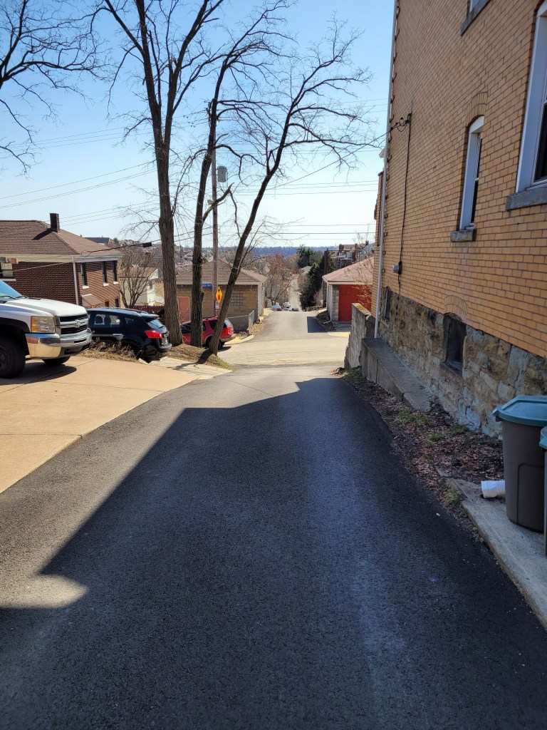
I hopped onto Ceres Way, determined to follow it to the very end. There were smiley faces on garages and cool cars, but it all ended unceremoniously in a patch of weed-encroached asphalt. Later in the Fall, this would have a nice view of the Mon.
Smiley GarageSporty BlueUnceremonious End
Wrapping around to Grandview Park was more fun. Lots of views and activities.
Downtown So Close!Cathedral of Learning and Birmingham BridgeExercise Class with a View
And that was it, one mile in a skyhigh neighborhood.
RATS Run #00501a in Brookline
While the previous run down Ceres Way was on a cloudy and humid day, this run, the next day, was a washout. It was to finish up South Scroll Way in Brookline. Where is South Scroll Way, anyway?
South Scroll Way is a little upper-cut of an alley between Glenarm and Starkamp. It only goes behind a few houses. Both Glenarm and Starkamp are steep streets which fall off of Brookline Boulevard, just past the business district.
Rainy Brookline BlvdGlenarm Avenue
On rainy days, the sensitive touch screen of my phone makes taking pictures difficult. So another mile run but only few pictures.
RATS Run #00501b – Overbrook
After conquering Scroll Way (whoops, I mean SOUTH Scroll Way), I hopped into my car and drove over to Brownsville Road. My goal? To complete a section of Library Road.
I also needed some more miles, what with run 501a being only a mile. I ran down Maytide from Brownsville to Saw Mill Run Boulevard. That was a nice downhill. On the other hand, while Saw Mill Run Boulevard is one of the flattest streets, it is also one of the ugliest and busiest roads in Pittsburgh. Skipping past small car dealers, transmission garages and family eateries I got to the eternity light at Library Road. After said eternity, I made my way over to Library Road, running the short section to the border of Castle Shannon. I did a loop and retraced my route, ending up with four miles. This isn’t a very great place to run, with several areas only having a shoulder to run on.
Thanksgiving is the start of the end of the year. I like to take a look at where I am and where I want to go. For this project, in particular, while I have been ticking off a few streets recently, this blog has been very neglected. The last one was way back in March 2023!
OK, so here’s my current status.
CityStrides shows there are 4,753 streets in the City of Pittsburgh. Since it uses OpenStreetMap, that number fluctuates, as people, sometimes mistakenly, add street names to driveways and trails. Apparently there are some editors who also take streets away as well. I’ll leave that to the urban planners and historians.
Anyway, I have about eight more to do. There’s also a “secret” street, with a nice blue street sign and everything, which has remained unnoticed. That will be my last street. Stay tuned!
As for blogs, I have 17 more runs to blog about, stretching back to early 2022. This blog, for instance, will cover two cold runs in January 2022. Without further ado, let’s go!
RATS #495 – Back to one of the hilliest sections of Pittsburgh
RATS #00495 in Beechview and Brookline
So, for this run, I had a couple of small streets targeted. West Blaine off of West Liberty Avenue and the end of Hillgrove, entangled in the hills of Beechview. I don’t really recall the weather, but Strava tells me that it was a chilly 41 degrees. Pics show a cloudy day with splotches of snow leftover from an earlier storm.
Blaine StreetHillgrove AvenueLooking Up BousteadBlue Garages Along West Liberty Avenue
After running up Blaine, I returned to West Liberty and cruised along Wenzell Avenue to Boustead Street. I turned right and quickly made the left onto Hillgrove. This time, I stayed to the left of a Y intersection and made it to the end of Hillgrove. On another run, I had made a right at the Y; just showing that the Right decision is sometimes wrong. With that word play behind me, I trudged up Boustead, up nearly 100 feet in a tenth of a mile. Whew!
I took the Rutherford Street steps as a shortcut to Hampshire Avenue. My intention was to get to the very end of Canton Avenue. Everyone knows Canton is the steepest public street in the United States, from Coast to Hampshire. But, do they know where it ends? It doesn’t end at the jersey barriers, but rather a tenth of a mile into the woods.
Rutherford Street Steps
Canton Street Continuation
With that, I trundled back to my parking spot along Brookline Boulevard’s business district.
RATS #496 – Eastern Hills of Pittsburgh
RATS Run #00496 in Homewood, Highland Park, Stanton Heights and East Liberty
My next RATS run, a week later, was on the other side of Pittsburgh. I wanted to clean up some small streets in Lincoln-Lemington as well as tackle terrifying Allegheny River Boulevard. This day was significantly colder than the previous run, with afternoon temps in the low 20’s.
I parked in North Point Breeze, took North Lang across the pedestrian bridge and straight up to Apple Street. I popped up the steps to Arbor Street and boldly continued all the way down Hedge Street through the back alley, Owasso Way.
Lower Arbor Street Steps Upper Arbor Street Steps
Continuing past Paulson Playground, I sought the end of Olivant Street. I had been in the area on an earlier run, but thought perhaps I could slide along a fence to the last node on Olivant. However, it wasn’t to be. There’s a Duquesne Light substation at the end of Olivant. A secured fence completely blocked the way.
Generally, this area has some nice homes, especially compared to the row-houses on Paulson Street. but it is pervaded by a high level of down-home security; fences, gates, dogs and signs. I find that unnerving.
From here I took Lemington Avenue down to Highland Drive and Washington Boulevard. I wasn’t sure about doing Allegheny River Boulevard (ARB), but I thought I’d see how busy it was. The intersection of ARB and Washington Road wasn’t too bad, so I set out along ARB.
Umm, not my best decision. Quickly, I lost the sidewalk and just ran along the road’s small shoulder. Every now and then, icy seepage jutted out into the road, forcing me to skate along. Eventually I made it to the border of Penn Hills and Pittsburgh. A small white “Penn Hills” sign was overshadowed by grinning Gus the Groundhog . I returned on slightly different route, along an old railroad below, the Brilliant Branch. Closer to the ARB, Washington Blvd intersection, there’s a cool train trestle which crosses the Allegheny. Recently, that railroad spur was transferred from Allegheny Valley Railroad to Aspinwall Riverfront Park. It will be converted to a bike trail, as described in this article in “Next Pittsburgh”.
Allegheny River BoulevardIcy Stretch Along ARBPenn Hills BorderBrilliant Branch SignOld RailroadUnderneath the Train Trestle
Back at the intersection of Allegheny River Boulevard and Washington Road, I took a “shortcut” though Highland Park to try to find a small alley in Upper Lawrenceville. I cut down Stanton Avenue and one of my favorite streets, Christopher Street. I like the way it emerges from Stanton Heights onto a dramatic downhill with views of the Allegheny River far below. It has a hidden, Sleepy Hollow feel. From Christopher, I dodged over to Duncan Street in search of Joy Way. All I found was steps alongside a house with a car in front. Street? Maybe on OpenStreetMap, but not on Google and not in reality.
Highland Park StepsChristopher StreetJoy Way?
A little sad with no Joy, I scurried through Stanton Heights, emerging at the top of North Aiken Avenue. Plunging down into Garfield, I “ran” a tiny alley off of Fairmont Street, Armitage Way. It is pretty much a wide driveway hovering above Negley Avenue.
Armitage Way
From there, it was a few more miles back to the strategic parking spot on North Lang, a few streets done and fourteen miles covered.
Here are two runs I did last December, as the daylight was approaching its minimum. Here in early September 2022, I seem to be stuck in eternal summer.
RATS #00485 in Carrick
RATS #00485 was on a rainy, cool Saturday afternoon. My main goals were to finish off Plummet Way, Alcove Way, and Lacona Street. Plummet and Alcove are non-contiguous alleys; ones that keep the same name but are interrupted, typically by houses, garages or hills. I also wanted to double check how far West Cherryhill went.
East Agnew All Ready for ChristmasPlummet WayView from the very end of Plummet
It wasn’t particularly cold, high forties, but was rather dreary. I was apprehensive about going all the way down Plummet but shouldn’t have been. A woman was out decorating her house and chatted amiably. Apparently, some of the trails down here used to go all the way to Beck’s Run Road. The last pic above was from the end of Plummet Way, just past her house.
From here, I made my back to Amanda Street and Alcove Way, going until the going was gone. Again, garages and vegetation crowded out the alley before too long. Then it was on to a low-point, Lacona Street. Lacona looked like a slightly newer development than the rest of Carrick, but, also ended in vegetation high above Beck’s Run Road.
End of AlcoveWheee!End of Lacona
From here I crossed Brownsville Road, such a fitting name for that drab street. I traversed West Cherryhill as it plummeted down the ridge. Maybe once upon a time, it continued to the ball field below, but these days it just ends at that fence. I must say, there was no end to the decorations in this neighborhood, which brightened up the afternoon.
End of West CherryhillEven the Lion has a hat!
RATS #00486 in Brookline
The next day, Sunday, December 19, 2021, I ran in Brookline. Brookline and Carrick have a lot of similarities. There are just across Saw Mill Run from each other and have hills upon hills, and lots of alleys. It was a little colder that day, in the mid-30’s, but otherwise fine. My first street target was Adara Street. Never heard of it? Well, it COULD be because it is just a little turn-around at the end of Denise Street. If you’re a South Hill’s T-Commuter, you might recognize the Denise Street Station. Anyway, I traipsed from Brookline Park down to Adara. After about twenty feet, the pavement ended. A far way to go for such a small street.
Adara StreetDenise Street T Station
I crossed Saw Mill Run at Whited Street and took a hilly detour on the right, ending up on Lynbrook. That’s a rather pleasant street for running, very suburban. That route also got me off of Whited Street, which has only intermittent sidewalks and a small shoulder. Made the left onto Marloff and scooted down Marloff Place. It just goes into a big parking area at the bottom of a hill. I got a kick out of these decorations. It looks like Bumble deflated the other creatures and looks a little abashed.
Honey, I Deflated the Kids!End of Marloff Place
From here, I made my way to find Pinegrove Drive. I usually write out my runs on a small piece of paper. The last time I tried Pinegrove, I was befuddled because I didn’t see a street where it was supposed to be. This time, I knew to be a little more observant and watched for a metal barrier. I hopped it ran a bit down “Pinegrove Drive”, which really is just a path along a fence into the woods. No wonder I missed it before.
Pinegrove Drive
From here, I traveled back to the heart of Brookline, those long hilly streets off of the Brookline Boulevard. Crossed off Oleantha Way, and danced down the Belle Isle Steps on Route to Pardee Way in route to the far end of Ingomar Street. OK, maybe I didn’t actually dance, but how many ways can I say “moved from one place to another”?
End of Oleantha Way With cool grass and leavesBelle Isle StepsIngomar Street
And that was it, nearly eight miles in the book and several streets done.
I’m looking out my third floor window and low, scuttling clouds are throwing out splatters of rain. The heat is on again and it seems much more like November than May. So, digging back into yet-to-post archives, here are three November 2021 runs.
RATS Run #00474 in Brighton Heights
This was a very targeted run in Brighton Heights. Only four miles, I was trying to finish out the ends of small streets above Brighton Heights Park then follow Farragut to the Ohio. Friend, runner and storytelling extraordinaire, Rich, “BugayMan”, came with me on this Sunday morning adventure.
Steese Street was typical; a gravel driveway past a half built extension at the end of a dead-end street. It was high on the hill off of Benton Avenue and Lapish Street. Then adventures in dead-ends continued as I wandered down Haller hill with the twin streets/driveways of Dugan and Karwich off of it.
Steese StreetHoller DownThe House at Holler and Speck
Making a right at the green house on Holler and Speck, we curved around the end of Edwin Street then made our way across Flora Street. Flora is pretty flat for this area. The back-windows of the homes must have great views. Transvaal Street dips back to Holler, where we caught steps down to Lapish Street. It was nice to see this in daylight; the last time I was here it was quite dark.
Transvaal StreetSteps from Holler to Lapish
Crossing Benton Avenue at San Pedro, we made our way through this area, with its mysterious twists and turns popping out onto the busy Brighton Road. We trekked downhill towards the old Giant Eagle. Finally, dodging grocery traffic, we made the left onto Farragut Road.
A few weeks prior, I had considered doing this road in the late evening and I’m very happy to have reconsidered. It looks much better in the daylight. Farragut straddles the Pittsburgh-Bellevue border as it snakes down to the Ohio. There are a number of business down there, businesses which need lots of room; auto yards, trees services, landscaping companies.
An isolated house remains under the Jacks Run Bridge. It looks older than the bridge, but I’m surprised it wasn’t torn down during bridge construction.
Jacks Run BridgeTroll House Under the Bridge
Farragut dies out at an outflow pipe just before the Ohio River. I believe that that flat black rubber nozzle protruding from the pipe allows water out, but collapses, closing before river water can go back into the pipes. Railroads rule the remaining 100 yards to the river. Peeking out, I got a nice view of the McKees Rocks Bridge.
RATS #00475 – Lime Street
Lime Street has been a sore spot for me for awhile. There’s no feasible, safe, way to run to it. It’s off of Saw Mill Run Boulevard as folks accelerate to highway speeds. I drove there, anxious about getting rear-ending as I made the sharp right turn then abruptly parked.
I ran a tenth of a mile to the end of the street, ran back and hopped in my car. Sorry, no pictures. But if you’ve been following along, I think you can picture it. Tall narrow houses clinging to the hillside with lots of old cars parked out front.
RATS #00476 – West Liberty and Brookline
This is the longest run of these three and served the same purpose; finishing up the ends of small streets I had missed and making sure I couldn’t go through such streets as Fercliffe or Elmbank, regardless what maps were telling me.
I parked in my favorite spot at Moore Park, then made my way to the end of Levitt Street. En route I re-ran Southcrest and Linda Drive. For some reason CityStrides calculated that I had missed Southcrest. This time, I ran right down the middle of the street. Levitt is at the end of Fallow, which overlooks Saw Mill Boulevard and the Bon-Air T Station. I think I had dog issues the last time I was on Levitt – in that a large German Shepard was running around unleashed. If I was as much a dog-whisperer as I am a cat-whisperer, this streets project would have been much quicker.
Southcrest Linda DriveFallow Street
Anyway, with no dog incidents here, I returned to Pioneer Avenue. Mayville Avenue, Elmbank and Ferncliffe were my first stops. These streets plunge off Pioneer’s Golden Path. The bottoms are wet and woody.
An end of ElmbankFerncliffe ? Ferncliffe? Where did ya go?Mayville Views
Next up was the OTHER end of Elmbank and the major thoroughfares of Raeburn Way and Alumni Way. Completeness is a curse.
Proud EagleWeeping Willow on GaylyAnother Elmbank EndRaeburn WayAlumni WayGoing Nowhere
After Alumni, I circled Kenilworth and returned to Moore Park along Pioneer. Once again I passed this cool Little Free Library. You can find @cheesemeadowlfl on Instagram.
CheeseMeadowLFL
I’m really hoping NOT to have snow in June, but that seems to be the blogging trend here. Thanks for continuing to follow along.
I’m writing this blog on March 12, 2022 and am very depressed by the current state of world affairs. I’m sad for Ukraine, angry at Russia and exasperated by the U.S. response. Nonetheless, here are four runs in October, spread across the city from Belmar to Fairywood. Hopefully recalling better days will brighten my mood, and yours too.
RATS #00463 Belmar
RATS Run #00463 in Belmar was another effort to finish up some small streets and dead-ends in the area. It was just to the northwest of RATS Run #00462. I started on Meade Street and caught Calway Street and Heart Court right off the bat. Then I made a long trek on Upland and Apple past the Negro Opera House. I’ve remarked on this house before. Now, it looks like renovations are underway. Yay! Perhaps these will be completed?
Negro Opera HouseStone Steps
Moving on, my next goal was Mingo Street. Earlier, on a run with Rich, I balked at going past the barriers at the bottom of the hill. Today, though, I wanted to take a closer look. It turns out that Mingo Street does, indeed, continue. It passes two houses which seem ready to fall down. Reflecting on yesterday’s run on Hallam Street, I expect these houses to be gone without a trace in ten years.
Up Mingo StreetPast Decaying HousesAround the leaf strewn path You’ll find cool toy trucks
I followed Mingo around the hill. It emerges onto Latana Way, where kids still play with trucks and a very red shed hosts basketball tournaments. Turning back onto Grotto Street, I crossed Lemington Avenue and made my way onto Elrod Way. Tucked up the hill was the alley of my destiny, Mayo Way.
One end of Mayo To the other end of MayoBut please, no parkingJoshua Street
I had some Mayo sandwiched between two dead-ends. Along the way, I daresay I surprised an old guy hanging out in his garage, but I made sure not to park it anywhere. To be honest these “No Parking” signs crack me up. I mean, really? Is this a problem? People parking in front of an inaccessible, broken down garage? Or is it that “No Parking” signs are more durable than your regular signs?
Anyway, moving on, I made it to both ends of Ebel Street and, again, verified that I’d be sanctioned heavily if I trespassed onto Highland Drive, a former site of the VA Hospital.
St. Peters Cemetery Cornerstone Baptist ChurchNo go onto Highland Drive
From here, I made my to Easton Way and through the Paulson Playground. On a warm afternoon, this place is swarming with kids. Today was quiet, though. Then it was a short jaunt up Clifford Way. I did not see a Big Red Dog, but he could have been hiding in the dense undergrowth.
Clifford Way UpClifford Way DownPaulson Playground
From here, I made my Dreary way across the Larimar Avenue Bridge and followed Relic Way to its bitter end. For some reason, the GPS thinks I ran through yards, houses and sheds instead of straight down Relic. And that was it, a solid 8.84 mile run.
RATS #00464 Fairywood
RATS #00464 was on the opposite edge of town; a few Pittsburgh streets off of Ingram Avenue and then into Fairywood. I was a bit surprised to find an historical marker for Pittsburgh way out here. I suppose it’s a border sort of thing.
Edge of PittsburghOld Sharp EdgeThis Way to Cellone’s Italian BakeryEnd of Napor
After running halfway across the Steubanville Pike Bridge, I came back skirted past an old “Sharp Edge” restaurant, with inviting red awnings. However, the windows were dark and the place was deserted. Closed. I have heard, though, that another restaurant will be moving in.
I ducked under the bridge to run along Napor Boulevard. Napor runs along the edge of an light industrial park on the edge of Chartiers Creek. Cellones is a large scale Italian bakery which has facilities here. Chartiers Creek looked peaceful.
Bridges Crossing Chartiers Creek Chartiers Creek
Coming back to West Steuban Street, I crossed over Ingram Avenue and onto Woodmere Drive. An Amazon warehouse sits at the end of Woodmere. With a quick left then right, I found myself back on Industrial Highway. While only 3/4 of a mile long, it is built like a full scale highway. I’m always a little scared to run on it and really push the pace. Today was no exception, as my leisurely 10 minute pace increased to a 7 min/mile pace before I got winded and had to drop back to an 8:30. Great place to sprint.
Chartiers Valley LaneNo Pedestrian Access
I intended to go to the end of Industrial Highway, or as Strava calls it, “Chartiers Valley Lane”. However, the road went through a gate, marked “No Pedestrian Access”. Hmm, that seems pretty clear. Hey, I went further than the Google Streetview car did! It looks like Maple Grove Aggregates is the only thing down there.
I turned back toward the heart of Fairywood. As I’ve mentioned before, there used to be a housing development here. That one is empty land now. An empty pool is starting life over as a forest, tree by tree. But there is a housing development on the other side of Broadhead Road and one of Pittsburgh’s biggest landowners, the URA is trying to develop this.
I finished up running along Windgap Road. That’s a street in bad need of sidewalks. I did get a peek into the 25 yrd long Medford Street before finishing up in the Ingram Crafton Shopping Center.
RATS #00465 Brookline
RATS Run #00465 was a quick run in Brookline to finish up alleys like Pontoon Way (both sides), Minor Way, Redbird Way, Mossrose Way and Georgette Street among others. However, it was already dark by the time I got going, so I don’t have many pics. I think this neighborhood, nestled between Glenbury Road and Carmalt Field is pretty nice. It is all suburban residential, but the hills and alleys give it a mysterious air. From the end of Wychelm you can see the lights of downtown.
Pontoon Way Ivy GarageWychelm Street With City Lights
After going up to the end of Wychelm, I went down Parklyn, catching the left and right to get to the end of Mossrose Way. I returned along the long stretch of Mossrose, where it rises above the houses as a lane covered in pine needles. Making two rights, I decided to be bold and go down Georgette Lane. It was not, indeed, a driveway, but rather a respectable, short street with a house at the end.
I finished up Minor Way and went to the end of Redbird. That alley just bailed out at the top of a hill into someone’s backyard. Whoops! A wet, short night run all done.
RATS #00466 Duquesne Heights and Mount Washington
Returning to daylight and hills again, RATS Run #0466 wrapped around Mt. Washington and Duquesne Heights. I spent some time on the Emerald View Trail, which encircles this section of town.
High VoltageCielo Lane
Cielo Lane juts off of Fingal Street to provide some nice views of the Point. I tromped down to Greenleaf, which dives toward the West End Circle. However, about half way down I took the steep right onto Homer Street. There are only a few houses there, perched high on the hill. Homer leads directly into Emerald View Park.
Homer StreetLooking Down Into West EndEmerald View Park EntranceEmerald View Park Trail
I took Emerald View until I popped up on Grandview. From there I completed Augusta Street, en route to Wyloa Street. I thought I had completed Wyola, but it turns out there is a little spur which remains to be done. However, I got to traverse some of my favorite steps, Greenleaf and Well.
End of AugustaMore Emerald View ParkGreenleaf Street StepsWell Street
Now, my next target was Chess Street, but that was well on the other side of Woodruff Street. I took a “shortcut” by going up the Mann Street Steps to get me closer to the southern end of Mt Washington Park. I was appalled by the lack of a retaining wall behind condos being built on Grace Street. I can already see the road being undermined.
In the woods I lost my sense of direction and ended up on Norton, instead of Spahrgrove. Chess Street, wasn’t much to see, in spite of the cobblestones.
Mann Street StepsWhat! No Retaining Wall?End of Chess StreetChess Street
From here, I ran back to my car on Bigham. Damn, this area is hilly!
RATS #00438 – California-Kirkbride and Marshall-Shadeland
Here’s a little Sunday funday runday. Fivish miles in California-Kirkbride and Marshall-Shadeland. With the bulk of the streets done, it was more about going down back alleys than an expansive opening of an area. Accordingly, while starting in Allegheny West, I made my way up California Avenue. Flowers at the corner of Marshall Avenue and California Avenue were as bright as the day.
Marshall California Parklet
Seiffert Way
One End of Thelma Way
Ludene Way
Moving up Superior Street, I took a side trip on Seiffert Way to Thelma Way. On Google Maps, it looks like Thelma Way goes through. It doesn’t. Rather it ends in a tangle of weeds and branches. Seiffert Way and Ludene Way were as advertised; short, dead-end alleys. I wonder how many times I’ve used ‘dead-end’ in this blog. At least a thousand. Next stop was Bland Street. How Bland was it?
Really Really Bland
Pushing forward through the myopic, dystopic fog, I came to a ballfield and Unit 56, waiting for orders. Unit 56 looks a little forlorn. Has the Mothership abandoned it? Did no one pick it for the team? How long has it been sitting there, with weeds growing into its brain?
Unit 56
Bland Street Ballfield
It was all downhill from here, though I had an AMAZING time!
Schimmer Street Steps
Bold, Very Bold
RATS #00439 into Duck Hollow
This run was even shorter than the last. I just wanted to complete a couple of streets in Duck Hollow. Rather late one Tuesday evening I made my way there via a bike trail below Summerset. Trails go off the main one into old slag heaps, although this one was apparently closed.
Trail to the Slag Heaps Closed
Bike Bridge Over Nine Mile Run
Nine Mile Run Below Summerset
Nine Mile Run as it goes into the Mon
Duck Hollow has four streets and maybe twenty houses. It is at the confluence of Nine-Mile Run and the Monongahela River. After some research I found a nice Pitt News article about it. Surprisingly enough, I sometimes run with Mike Portogallo whom they interviewed. Small world.
I do have some news! McFarren Street has been rerouted over a new bridge. Perhaps now Duck Hollow residents can get deliveries to their door. My pictures of the Hollow, itself, came out rather fuzzy between my running and the dusky light.
Duck Hollow
New McFarren Street Bridge
I went in on the new bridge and came out on the old, open grate bridge. The railroad trestle is striking in the twilight.
Old McFarren Street Bridge
Platform on Railroad
Trusses Under the Railroad Bridge
Finally, I came out onto the parking lot above the Mon. Sure enough, folks of all shapes and sizes were hanging out, enjoying the evening. I enjoyed the view of the river and the Homestead High Level Bridge.
Homestead High Level BridgeRATS #00440 in Brookline
Another short, evening run; this time in Brookline. July Way, Harex Way and Tariff Way were my goals. July and Harex I got, but Tariff Way continues to frustrate me.
End of July Way
Section of Harex Way
Woodbourne Ave
There’s a street sign on Sussex Avenue at it’s intersection with Tariff. I dutifully did that little driveway section which, incidentally, doesn’t even show up on CityStrides or Google Maps. Meanwhile the other section of Tariff Way, off of Thistle Street, goes about twenty yards before arriving at a broad expanse of lawn. I suppose I need to go across the lawn and have a beer at the neighbors for CityStrides to recognize it. Argh!
Tariff Way and Sussex Street
Stebbins Steps
At any rate, it was a decent little run on a hot summer’s evening. I even got to do the Stebbins Steps, again.
RATS #00441 in Greenfield
This is a Greenfield Re-Run. I was retracing a route which CityStrides hadn’t picked up. While that was initially a bit annoying, it turned out to be a good run with some amazing views. I love this one from the corner of Lydia and Bigelow.
Downtown from Lydia
From there I wrapped around a couple of alleys, some which dropped me into backyards, some of which allowed me passage. The grapevine arbor was pretty cool.
Bristol Street
Grit Way
Grapevine Tunnel
Whoops, another backyard
Eventually I found my way to Tasso Street, which has two distinct sections joined by the Noah Street steps and the Bud Hammer baseball field. The home team must have won, as heavenly beams of light shone down on the field.
View from Illion Street
Bud Hammer Field
And that was all, 4ish miles on a hot August evening. My watch recorded over 600 feet of elevation in this run. Not sure I believe that.
So, there are a few more runs in August I haven’t recorded here. I’ll get to those in the next blog. Thanks for reading along.
With alleys to do in West Liberty and busy streets to do on the Southern Edge of the World, I started RATS run #00415 from Moore Park in West Liberty. Moore Park is very convenient, just off of Pioneer Avenue. There are tennis courts, basketball courts, a spray park, a pool and large fields rolling down toward Moore Greenway. For my purposes though, there is a nice little parking lot.
Anyway, I started there and cut down through Our Lady of Loreto’s driveway, aka Herman Drive. Making the right onto Crysler Street, I found myself in the maze of driveways around West Liberty Elementary. I got spit out onto Elmbank Street, which falls precipitously to a green dead-end.
West Liberty Elementary
Elmbank Street
Speaking of green dead-ends, Fernhill Avenue has several, in spite of any map which shows that it continues in a long circuit. Inland Way took me on a ridge below Dunster. From there I headed toward Brookline.
Turkey on the run
End of Ferncliff
Fernhill Avenue
Inland Way
I think it was on Lugi Way that I found a salute to veterans and recycling as well as an alley duck. This tour of the lesser known views of Brookline eventually took me to McNeilly Road. McNeilly is rather busy and not meant for pedestrians. I ducked onto McNeilly Court as it curved up the hill. It dead-ends abruptly after the curve. Returning to McNeilly Road, I then went up another curvy street, Aidan Court. It turns out that that new subdivision was pretty much built on top of the older homes on McNeilly Court.
Salute!
Sunny Alley
Sun Duck
Aidan Court
McNeilly Court
Bottom McNeilly Court
Luckily, though, the wide shoulders and parking lots afforded places to run. I also found Black Dog Car & Dog Wash. I mused what the options could be:
One pass dog and car – “Just get him to sit on the hood, ma’am. He’ll be OK.”
Slobber wash – “We have ten golden retrievers just waiting to lick your dog and car clean.”
First World Wash – “Just open all your windows and let Fido sit on the front seat.”
Moving on, McNeilly narrows under a train trestle right before it hits the McNeilly T-Station. There’s a slim little sidewalk there and it takes you all the way to busy Library Road.
Approaching the McNeilly Tunnel
On the inside
Dump Trucks along McNeilly
T-Station
Library Road took me briefly out of the city into Castle Shannon. Again, it’s not very pedestrian friendly there, so I stayed up on the green embankment. My target was Belleville Street, up steep 6th Street. I was very happy that Belleville narrowed into a trail and I got a nice little shortcut back to Library Road, before any need to trespass on a power-line tower.
Aack! Nowhere to run!
Library Road
Happy Trails?
Circling back into the City, I braved the traffic along Saw Mill Run and Provost Road. I thought I’d need to scurry up Arcata Street, but it was just a 50 yard driveway to a washed-out bridge. No, I didn’t scale the bridge or swim the creek.
Arcata Street
Provost Road
With that, I trundled up Glenbury Street, gasping for air and watching out for cars. Upon returning to Moore Park, I ran right into the cold spray, screaming like a little kid. Or a like a dog going through a car wash.
Prior to this project, I did not appreciate the size of Beltzhoover. Now, I appreciate it, as I keep going back to ‘finish’ up more alleys and cul-de-sac’s. This run, run #00410, was on a beautiful Sunday morning, but my plans were immediately altered. My old nemesis, “Nonexisting Streets” was at it again; Pear Way, for example.
Irises Along Beltzhoover Ave
Cardiff Way
Supposed to be Pear Way
Once Habermann Street
However, I persisted and found my way down many a country road there. Yes folks, this is a reputedly tough inner city neighborhood.
Freeland or Cardiff
Typical
Lehr Way
Palmetto Way Ends at a School
Also Lehr Way
I’m often a little tense running through alleys like this because I’m not sure what I will find. I generally shouldn’t worry too much; mainly I’m dodging chipmunks, squirrels, groundhogs, the occasional cat and sometimes deer. Every once in awhile, I’ll come across someone walking their dog.
This is not to say these alleys are pristine. Often decaying garages house cars which haven’t moved in a generation. Tires and garbage are common. I do believe there is a City of Pittsburgh Ordinance about the cars, though. Oh, here it is:
The accumulation and storage of abandoned, wrecked, dismantled or inoperative vehicles, or parts thereof, on private or public property, not including highways, is found to create a condition tending to reduce the value of private property, to promote blight and deterioration, to invite plundering, to create fire hazards, to constitute an attractive nuisance creating a hazard to the health and safety of minors, to create a harborage for rodents and insects and to be injurious to the health, safety and general welfare. Therefore, the presence of an abandoned, wrecked, dismantled or inoperative vehicle, or parts thereof, on private or public property, not including highways, except expressly as hereinafter permitted, is a public nuisance which may be abated as such in accordance with the provisions of this chapter. [Ord. 664 C.S. § 1, 1973.]
If only this were enforced! Maybe it is just too much hassle and paperwork, I don’t know.
Now, at some point someone decided that a directional sign pointing to Beltzhoover’s amenities was a good idea. It sounds like a great idea to me too! However, apparently there wasn’t any money to keep the right of way mowed or stairs intact, so now the sign is rather ridiculous. The pic below on the right were steps prior to 2007, if I’m not mistaken. Of course, these days, with smartphones and maps, I don’t think we need directional signs that much.
That was about it for alleys of Beltzhoover. I’m sure I’ve missed some and will be back.
An Epic Run From McKinley Park
RATS Run #00410 from McKinley Park to Brookline and Back
This run, RATS run #00410, started pretty close to the previous run, run #00409. However, I went in an entirely different direction, down Bausman to Saw Mill Run Boulevard. My main goal was completing Edgebrook Avenue. I did that and added a few charming streets.
McKinley Park is fairly large. The main access to it is along Bausman Street, where folks park along the road and have picnics, play hoops and skateboard. However, it was a rainy Saturday morning when I went through, so the park was deserted.
At the bottom of the hill, Bausman ends at Saw Mill Run Boulevard. This is only a quarter mile from the Liberty Tubes, so it is very busy. T-tracks tower overhead and a thriving thrift store sits across the intersection. You might notice the picture with the T is bright and sunny, while the Thift store is all gray. That’s because I did this one section twice. The first time, my GPS failed, so I felt compelled to do it again. (Argh!)
T-Tracks
Behind the thrift store, Timberland Avenue crosses a closed bridge and runs past a couple of derelict houses before disappearing in a tangle of underbrush. The stream, Saw Mill Run, still has car carcasses littering the gravel.
Timberland Avenue
End of Timberland
Look! Rebar! And Water!
Car Carcasses
Now running down Saw Mill Run Boulevard, the sidewalk disappeared, so it was crappy running. How about getting sidewalks here? Anyone? Buehler? Buehler?
Pedestrian Paths Along Saw Mill Run Boulevard
There were some curiosities along the way. I feel like this truck was trying to hide, parked as it was between a shipping container and a billboard. However, it was as successful as an elephant hiding behind a refrigerator. While the door below is kinda cool, in that battered-steel-door genre, I really like the retro numbering next to it. (I’m sure it is original, not really retro at all.)
I finally got to Edgebrook Avenue. It actually starts under the T and even has a couch for resting. (Apparently having indoor furniture outdoors is against city ordinances, too.) Then Edgebrook Avenue passes a small car dealership and rises into Brookline, rising along a winding, wooded valley.
I found the golden sofa!
Dueling Dumpsters Under the T
Hmm, Can I get my car out?
Edgebrook Avenue into Brookline
Up toward Brookline, several small streets branch off of Edgebrook Avenue. Milan Street used to have steps to Whited Street. But then, a tree fell. And fallen trees can’t be removed.
Milan Street
Milan Steps, now Squished
As always, people decorate their places. This goose was very appropriately dressed, while the fairy garden was trying to bring magic into the day.
I magically lumbered down Brookline Avenue to Pioneer Avenue, catching Oleatha Way en route. Then I decided to cross West Liberty Avenue and check out a couple of streets rising from beneath the Norfolk and Western train trestle. One just led to a city vehicle impoundment area, but Dawn Avenue rose on cobblestoned paths up the slope to Charm Street. Charm Street, ah, well, take a look and tell me how charming it is.
Dawn Looking into the Busway
West Liberty Avenue
Charm Street
I was, honestly, surprised how far Charm Street extended. But at the end, well, it was dead. Again, I’ve taken a liking for doors, so here are a couple.
Dawn Street has its own South Busway stop and apparently a T stop. Stairs on one side led across to steep stairs on the other. Before coming down, I had a good look at that Norfolk and Western line. Such an impressive bridge for just one track.
Finally, I rounded the corner and found myself at the Thrift Store on Saw Mill Run again. I slogged up Bausman, taking a small detour for Lorna Way, another Beltzhoover alley.
Lorna Way
That’s all for now. Just remember, keep your couches inside and your cars operational. And, for goodness sake, stop driving into creeks.
March 2021 was one of my most productive months in terms of mileage and streets covered. Among my 162 miles and 20,000 feet of elevation gain, I completed 192 more streets in Pittsburgh in 15 RATS runs. I even completed the “Take The Stairs 50k” course I published last year. That course, a small revision of Lamar’s original course, took me on roughly 78 sets of steps throughout the city, but, alas, did not cover any new streets.
Blogging-wise, March was less than stellar. I only published four posts and it has taken me all of April just to get this summary out, touching on three short runs in Carrick, Brookline and West Liberty.
Route of RATS #00384 in Brookline
I had grand plans for this run, but was out-of-synch and got frustrated by small ‘streets’ just being driveways into hills. Argh! Just took one picture, before it all went downhill. I did end up with over four miles and several alleys covered.
Brookline AlleyRATS run #00386 Around South Side Cemetery
In this run, I inadvertently circumnavigated South Side Cemetery. I started on Brownsville Road and took the steep West Meyers Street to Oakhurst en route to Newett Street, one of the steeper roads I’ve been on. I took Plateau Street to its dead-end above Volunteers Park, then came back to Newett, expecting to see Plateau on the other side. However, Plateau falls off of Newett so quickly that the other side looked like a driveway which disappeared over the hillside. Once upon it, though, I found my way down Plateau and was pleasantly surprised to find that Volunteers Field was an active hubbub. It looked like a fire department team was practicing on one field, while on another field, a younger group practiced base-running under the tutelage of a barking coach.
Volunteers Field
Carrick Dugout
Moving on, I dodged cars on my way down Colerain to Noble Road. No sidewalks and not much of a shoulder made it tricky running. Then I peeled off and went down Denise Street. My internal map had Denise going a little way and dead-ending. It seemed to go on forever, but afforded nice views of the T tracks. Returning, I came across some steps which took me to Noble Road.
The T
Steps from Denise to Noble
Denise Street T Station
Once up on Noble, I backtracked a bit and went up Glade Street. The few streets up on that hill are tucked into a corner of the cemeteries looming above. It was a nicer area than I expected. Some kids were playing basketball in the street and others were riding bikes. Along the Montrose Steps I heard a rustling and noticed a deer in the woods. I took a picture and continued to Cloverdale Street. Only after looking at the picture more closely did I realize there were four deer there!
Glade Street Steps
Haunted House
Steps from Denise to Noble
Mosgrove Steps
How many deer do you see?
Cloverdale Street completed the southern border of the cemetery, bringing me back to Noble Street. This short, three mile run certainly had a lot to see.
Route of RATS #00387
This was an evening run in West Liberty to catch some alleys. I caught several in my alley catcher, but some were only paper alleys (here’s looking at you, Mascot Way!) Overall it was a pleasant, hilly run with over 400 feet of elevation in only three miles.
Gayley Way
Cool Trees
Section Way
Nope, nada, Mascot Way
So that was it for March, 2021. I’m still chipping away at the streets. At the end of March I had a little over 800 more to complete. I’ve come a long way considering there are over 4,800 streets in Pittsburgh. I can now see the light at the end of the tunnel.
With February gladly behind me, I started into March with several short runs. The weather had moderated and I was just getting out.
RATS #00373 Overbrook
RATS #00373
The main point of this run was the triangle of streets between Jacob Street, Groveland Street and Aaron Avenue. It was already dusk by the time I parked at Brookline Memorial Park, donned my safety vest, powered up my flashlight and took off. I shot down Brookline Boulevard to Jacob Street. Cars all have to make a left, but pedestrian runners like me have the option to make a right onto steps descend steps. At the bottom, there is a walkway to a South Busway Station, but tonight I went straight through the soggy area, lifting up on steps rising on the far side, emerging onto another section of Jacob’s Street. I apologize for the photo quality, but it does illustrate my mobile night vision, or lack thereof.
Jacob’s Ladder Steps
There are just a few streets down here, all going up to Aaron Avenue. The houses mostly sit on decent sized lots and over the years, residents have really made them their own.
My ambition was to finish off Aaron, crossing Glenbury, then do more alleys in the far neighborhood. However, my back twinged at the end of Aaron, and I just limped back to my car.
RATS #00374 Shadyside
RATS #00374 – Shadyside
Cutting the previous night’s run was probably a good idea, but I was still taking it easy, so I did another easy run, in Shadyside. Shadyside is full of cul-de-sacs and this run was mainly about touching on several of them off of Ellsworth Avenue.
Tree in the Light
Viney Garage
Mansion Hidden Away on Alley
I did come across a spectacular mansion of modern style along an alley. One side purports to be a driveway, but it is actually a through street. This was a pleasant, short and flat run.
RATS #00375 Greenfield
RATS #00375 in Greenfield
This was a cool run, again in the evening. I started along Greenfield Avenue and powered up Winterburn Avenue. Sun Way lived up to its name, with a grand vista of downtown bathing in pumpkin light, as river mists started rising.
Sun Way Looking Downtown from Greenfield
Besides the incredible hills, Greenfield has incredible views. The Cathedral of Learning prominently punches to the sky. It was no surprise that I came across steps; these continuing Noah Avenue, from Tasso Street to Tasso Street (yes, the upper and lower sections have the same name).
Cathedral of Learning Sticking into the Sky
Noah Street Steps
Downtown and South Side Lights
On Lower Tasso, I had great views of the South Side lights and downtown framed by the last sunlight. That was about it. This run, while only 3.73 miles had a healthy 581 foot elevation gain, over 150 feet per mile.