Hail to Pitt!

RATS #00437 from Swisshelm Park to West Oakland

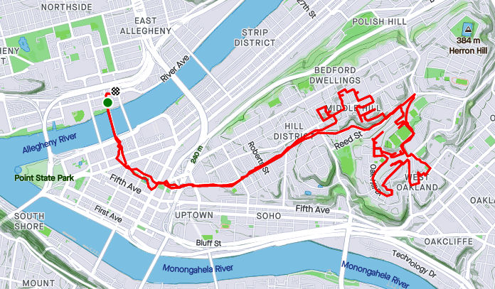
So, this was a rather ambitious run from Swisshelm Park, aka “The Land Beyond Frick Park” to the high reaches of the University of Pittsburgh. Going through Frick, one of my favorite routes is along Nine-Mile Run. It has been significantly cleaned up, but I still wouldn’t splash around in it. In a heavy rain, the upstream sewage systems in sections of Pittsburgh, Wilkinsburg, Edgewood and other communities tends to overflow into the drainage system, which, of course, flows through here.

Nine-Mile Run in Lower Frick

From there, I continued through Squirrel Hill into the Land of the Universities. CMU continues to build like a beaver. It is a place of learning, though, so good advice is everywhere. This wouldn’t be the last crane I saw.

Flossie Way was one of my target “streets”. It’s actually just a little alley in Oakland. ROTC students were gathered in the parking lot, doing drills. Beyond the asphalt was a green drainage swale, to slow runoff before it hits places like Frick Park. (Though that water would never go through that park, it’s already downstream.)

Coming into Pitt’s Upper Campus, I needed to complete “Benedum Square”. It’s a cozy little courtyard in which the engineering students can decompress. One, apparently had worked too hard for so long that he was just a shell of his former self. In seven years or so, I might see his offspring.

Moving up, I got a glimpse of the deconstruction of the Learning Research and Development Building. It’s not often that a building is taken down piece by piece. Further up the hill, I got some close-up views of WQED’s tower. More chances to look up!

I spent some time running in and out of the streets at the top of the hill. The Veteran’s Administration has a big shiny building there. Beyond Pitt’s sparkling athletic fields you can see downtown.

After dodging students moving in, I made my way past the Peterson Event Center. The steps provide a shortcut from the winding roads.

With that I made my way back to Frick Park. This was the first run in awhile and, by the time I got to Frick with 13 miles done, I was pretty beat.

Pears in the Pittsburgh Jungle

RATS #00436 in Oakland, South and West

RATS #00436 was a Saturday morning run in late July. I was aiming to capture Juno Street and a few streets in the Middle Hill. Juno Street starts down in Panther Hollow, but I had seen some steps just off the Boulevard of Allies that I thought might be a short-cut. I was on the right track, but the wonky wooden steps had been hit by trees. Trunks snapped by recent storms had broken the railings and lay across the steps. I’ve found that, sometimes, a path is clearer from the opposite direction, so I went around, hoping to come up Juno from Panther Hollow. However, after weaving through the Pittsburgh jungle, I came to the end of Juno Street as private drive replete with “No Trespassing” signs and (alleged) dogs.

Somewhat defeated, I trotted back down into Panther Hollow to take the Dawson Street Steps back into Oakland. Those, at least, were well maintained. I made my way down Bates Street to Technology Drive at the bottom. It looks so modern compared to the streets a half mile away.

Having enough of modernity, I re-crossed Second Avenue and traipsed up Hodges and Mackey Street. Here I went back at least 75 years. Hodges Street, as small as it is, has a couple of branches. I went up the left branch, assuming I’d find steps up to Lawn Street, but all I found were pears. They looked good, too, but I didn’t eat any. Keeping the slim figure, ya know.

Mackey Street, for its part, was much more overgrown. Steps sprouted from the end of the asphalt and clung to life as they ascended to Love Street. These steps weren’t in very good condition either, with stray tires and missing treads.

Nonetheless, I made it up to Craft Avenue and continued onto Fifth Avenue. Moving towards the Middle Hill, I took Brenham Street off of Fifth. It is a spit of asphalt splitting into the a jungle after 25 yards. Nothing there, so it was back to Fifth Avenue. A few yards further, the Mohawk Street steps gave me a shortcut Beelen Street. On the right, Beelen, has it’s own dead-end into a verdant Pittsburgh hillside while the left leads to Kirkpatrick Street. I took a sharp right onto Gazzam Avenue which was longer than I expected. No surprise, it dead-ended into a steep hillside covered with vines. There was a house back there, which I gave a wide berth.

From here, I just wound my way up Bentley Drive to Terrace Village (aka Oak Hill). I finished off Waring Court, an undeveloped street loping toward…you guessed it, a jungle.

This run complemented my earlier run into the Middle Hill from Downtown (run #00435). It turns out this was the last run in July and the last run in Pittsburgh until the middle of August. July was a big running month for me, with 134 miles, including 38 miles at Hell Hath No Hurry.

Roads Les Travld

RATS #00435 Middle Hill and Oakland

After work on a Friday, what to do? Head home and battle traffic? Naw

Happy Hour? Naw, a couple a beers and THEN battle traffic; no thanks.

Run? Of course!

Ironically enough, one of my cardinal rules has been to NOT run on hot Friday afternoons through sketchy areas. But there I was, on a sunny, hot summer Friday evening running through the Hill District . Spoiler alert, I survived, just slightly dehydrated.

At any rate, I ran across the Andy Warhol Bridge, through downtown and up Centre Avenue. First on my list were McClarren Street and Midtown Square. I was a little puzzled why I hadn’t hit these earlier. Then I got there and realized, they were just off of Wylie Avenue using the ole “street which looks like a driveway” ruse. Midtown Square was a cute little street at the top of a hill. McClarren was just a bit of asphalt disappearing into the greenery.

From here, I had a tour of lesser-user roads. Verdant Way, Upton Road, Jacobus Way were all deserted and blocked with debris. Oh yeah, Upton Road needs to be mowed.

Now I was intent on finding Whitney Terrace, allegedly across Centre Avenue and up past Brackenridge. The Watt Street steps shortened my journey.

So, I’m not sure if I found Whitney Terrace or not. The spot which the map indicated as Whitney Terrace was just a hillside of greenery. However, just twenty yards further on Brackenridge, I found steps up the hillside. Its likely those were just steps to a house. Nonetheless, I took them anyway.

After some bushwhacking I came to the top, where white tarps shaded precious salt for Pitt’s campus. I wandered into the Oak Hill complex and finally found my way out along Allequippa Street. Dodging into Wyandotte Street, I made it to the garden-end as a UPS tried to come down the street and got stuck.

With that, I made it out to Robinson Street, browsed a Little Library and trotted back to the Northside via Centre Avenue. Is there still time for the beer?

Pittsburgh Developments

Here are two short July runs chipping away at the block of incomplete streets. The first was in Hazelwood Green. The second on the North Side.


RATS Run #00433 in Hazelwood Green

This run was just a couple of miles in a rapidly developing area. “Hazelwood Green” now sits where the Hazelwood Coke Works once stood. Where once molten steel was poured, cooled and pounded, is a broad field of flowers. The superstructure of Mill 19 still stands and is being re-purposed for advanced manufacturing.

With re-development, new streets are popping up. When I thought of this project, Hazelwood Green was just an idea on a whiteboard. Before long, Blair Street was opened and little else. Now Lytle Street and Beehive Street have emerged.

Lytle Street took me from one end of Mill 19 to the other. Bright yellow gantries still stand, even outside the finished offices, while the unfinished area stretches a tenth of a mile under rusty steel girders.

Beehive Street goes to the now-defunct part of Second Avenue. I would imagine that that will be re-opened soon, too. It’s too early to tell whether the Rutherglen Street Footbridge will ever be re-opened. It was closed off when I ran by. From this broad curve on the banks of the Monongahela, you can see downtown. However, smoke from western wildfires muted the skyline that day.

That was it, two-ish miles.


RATS Run #00434 in the Strip District and North Side

This was a “busted play”. I had arrived at a City of Bridges group run too late to join in. So, I basically did the same route, but veered off to finish off a couple of streets, primarily North Canal.

Old map showing North Canal Street

Speaking of North Canal, I was fortunate enough to see an old real-estate atlas of Pittsburgh. Sure enough, before the massive I-279, Route 28, Veteran’s Bridge interchange was constructed, North Canal went continuously along the north side of a railroad trestle. South Canal was on the Pittsburgh side of the tracks. Nowadays, North Canal is interrupted by the highways. One section comes off of East Street to the North Side Giant Eagle. Another, disjoint section, lives on as a driveway into the Sarah Heinz House parking lot.

On my way to North Canal Street, I crossed the 16th Street Bridge. As it rises out of the Strip District, you can see some of the condo’s being constructed there. Those brick condos are going from $525K. I wonder if they realized the ones across the street would block their view of the Allegheny.

I caught up with the advertised route after finding the elusive “6” along Lacock Street. From there it was around the point and back to Lawrenceville, where beer and friends awaited.

Wish you were here

RATS #00432, Lawrenceville, Polish Hill, Troy Hill

RATS run #00432 covered a lot of ground, from Bloomfield/ Lower Lawrenceville through Polish Hill, into Troy Hill and the edge of Reserve Township. I started around noon with a leisurely Type-B pace which contrasted with the rigorous Type-A route I was following.

Foster Way, an alley off of the alley Obregon Way, was my first stop. Then it was on to the downside end of Lodi Way. Turning onto Lodi Way, I felt eyes upon me and hurried past.

My next stop was a section of Clement Way, between transformers and a ball field. It is funny how I rarely notice power substations, in spite of their size. I like the way the “Business Exchange” building stands out; perhaps it is the sandy color contrasting with the stormy clouds behind it. Also, do you think there are enough power lines there?

“Spray Paint on Corrugated Steel” could be an art installation decrying the gentrification of street art, but of course its not. It’s just graffiti. The back of that apartment complex on Clement Way was surprisingly ratty. With the booming real-estate market in Lawrenceville, I figured they would at least clean the building.

Moving on, I looped back and crossed the Bloomfield Bridge to come out on Oscar Way. I think the Grouch would be happy here, collecting garbage from those steps. Speaking of steps (and graffiti), I took the Finland Street steps across Bigelow Boulevard and was kinda impressed with this piece of street art. I took it as a “Oh no, I’m 40!” message. Undoubtedly, it means something else.

From here, my path took me down Ridgeway Street, with Leander being my eventual goal. I hadn’t done a huge amount of research, so wasn’t sure exactly what would be waiting for me on Leander. Turns out, it was just another Pittsburgh street, clinging to the hillside and going nowhere. I was actually surprised how well-kept the houses were. That gray shed caught my eye, with its small extra door cut in the big door, with a sign “Low Clearance”! What? Why not just use the big door? I suppose there are reasons…

Luckily for me, I had an escape route from Leander and didn’t have to go all the way back to Herron. The 30th Street Steps took me down to Bigelow. Further down, a section of the same steps are blocked off at Paulowna.

Speaking of Paulowna, it lead me right past the pool at the West Penn Community Recreation Center. For some reason, I had always called that the “Polish Hill Recreation Center”, but I stand corrected. The pool wasn’t open and not even filled with water, which was a shame, because a dip in the pool would have felt great. But the driveway to the pool was a red-herring. I needed to take the lower path which took me past a ball field, with a game in progress. This was actually a fortunate find, as I needed to do Kenny Way, the alley on the other side. I often have concerns about the safety of dead-end alleys, but, so far, its always been OK. This one did narrow after Harran Street, but continued above back-yards only to pop-out in the parking lot of Mt. Horran Baptist Church. The back end of Brereton took my down into the Strip District.

Now I made my way across the 31st Street Bridge. Downtown was obscured by a thundershower. However, once I realized that showers were upstream as well, I put away my phone and took no more pictures.

That was a wise move, but it didn’t really start raining in earnest until I had powered up Rialto and was on the far side of Troy Hill. By the way, the words “Just how wet can I get?” apparently angers storm clouds. They just try harder. Coming down the Wicklines River, I made a left on Spring Garden Creek then up Lager Falls. The knotweed made a nice canopy on Wet Purse Way, but eventually I had to get going again. I splashed through a few more Troy Hill streets and squished my way back to Liberty Avenue via the 40th Street Bridge, passing a wet band in the Millvale Riverfront Park en route.

Summer Evening Showers in the East

RATS #00428 in Regent Square, Park Place and Point Breeze

This run, #00428, was longer than average, but captured only a few streets. That seems to be the case more and more, as I go back over an area just to finish an alley here, a forgotten street there. At any rate, nothing wrong with run on a summer evening, cooled just slightly by showers.

I started out seeking the very end of Macon Avenue, that very end which slips out of Swissvale and punctures the Pittsburgh border. I found it at the bottom of a hill as I hurtled towards Frick Park. Coming back up, I got to enjoy Regent Square. Many of the roads are bricks, wavy as they freeze and thaw throughout the years. Nonetheless, the houses are cool and this Little Library was as well. It looks to be a modern design with a green roof. “Alpha Bakery”caught my eye, while “You Have to F##cking Eat”(with lemurs’ tails strategically placed) sent me away laughing.

Moving on, I went past Construction Junction to conquer Thomas Street. That’s right, “street”. Thomas Boulevard is well-known, but Thomas Street is just a little alley/ parking lot drive connecting both parts of the Boulevard, the Braddock Avenue side with the Fifth Avenue side. I daresay I’d never been there before. Large industrial buildings stretched to the East Busway.

From here, I cut through Meade Street to get to Wren Way. I love the pedestrian-only shortcut, but Wren Way was a nondescript garage alley.

From here I ventured a bit into Homewood. At this point, a few quick showers thoroughly doused me. I expected them to continue, but the setting sun quickly came out again. Eastview Street, surprisingly, had a garden at its end.

Now I stepped down a few alleys off of Hamilton, as the sun started to peek under the clouds. Yum, BBQ! That took me back to 5th Avenue, where I wiggled through a number of small streets in search of forgotten cul-de-sacs.

Most of these cul-de-sacs were early incarnations of the idea, as they are small turnarounds, not the grand circles you see today. These houses caught my eye, from the plain brown one to the spectacular modern one, hidden behind a green wall. I love the turreted blue one, too.

Finally, I trekked through Frick Park, returning to Regent Square. In the dusky trails I saw a family of deer, including this buck. They didn’t pay too much attention to me.

Buck in Frick

Clocking In

RATS Run #00427 Stretching From Banksville Road to the Liberty Tubes

This run covered lots of miles, 7.79 to be exact and lots of territory, but only a few new streets. It’s a good thing I like to run around Pittsburgh! Anyway, I started in the heart of Beechview, along Broadway Avenue. It’s similar to, but a little different than the Broadway of theatrical fame.

Right off the bat, I descended steeply along Boustead Street and took in part of Hillgrove Avenue. At the fork, each road looked like a narrow driveway and I returned to Boustead. Of course, I should have actually taken both tines.

From here, I stepped down Wentzell Avenue and crossed Banksville Road, exploring Jessie Street. It’s a little dead-end with two turns rising off of Banksville. I didn’t find anyone like Jessie’s girl but I did find a house which looks like it fell out of the sky.

Returning across Banksville Road, I came up the Potomac Avenue steps and made the left onto Bellingham en route to Durham and Dalemount, two small lanes shooting up the hill. They were nice.

On the other hand, Denlin Street, often mistaken for a parking lot driveway, was rather scrappy. It just goes behind some businesses along Banksville and below a few houses on the hill. While this handicap ramp is amazing, I feel rather bad for anyone who actually has to use it. It must add a half a mile to their walk to the mailbox. While the white house has the blue kiss of death on it, the lounge chairs seem to be enjoying themselves.

From here, I ascended the Beechview hill again en route to Bazore Street. I got a kick out of the “No Outlet” sign next to all those electrical transformers.

All that Power, but No Outlet

Moving on, I traipsed down West Liberty Avenue, passing many car dealerships. Going up the Peola Steps took me to Texdale Street, which I had previously neglected. Once again I got to run the beautiful, winding streets of Beechview, hopping along to Frog Way. It was a much bigger Frog than I had expected. However, it made sense, as houses on Ringwalt Street below didn’t have anywhere to park in front, so with Frog Way behind, they could park there.

Again I sped down West Liberty Avenue. This time I went all the way the the entrance of the Liberty Tubes. Once upon a time, there was a sidewalk through the tunnel. But then, as lanes were expanded the sidewalk was removed. Perhaps it’s for the best anyway; with all the car fumes, it would be a really long way to go on foot. The “Traffic Grade Separation” plaque is on the retaining wall as West Liberty curves under a bus lane. It must have been an important project, look at all those politicians’ names! Rankin, Herron, Woodside; all of these have streets named after them now.

Just past the “Traffic Grade Separation” project, I came to “Clocks and Antiques”, a store that has always caught my eye. I got to spend a few minutes gawking through the dusty window. Grandfather clocks, mantel clocks, wooden clocks and porcelain clocks, this store has them all. My Dad used to walk into a clock store, look around and declare “None of these are working!” since they all had different times on them. This place is no exception. Ironically enough they have a little “I’ll be back” sign with the manual clock hands instead of some mechanical timer.

Speaking of time, it was time to get back to my car. After bushwhacking my way through the weeds along West Liberty Avenue, I went up the 150 foot, 10 degree slope of Woodside Avenue and sauntered over to Broadway. Maybe I could catch a show.

Clocked Out

Here is an after-work jaunt through the North Side, concentrating on less traveled streets near the Casino.

RATS #00426

Just beyond PNC Park and Heinz Field, yet before the Casino, are a few alleys and buildings, seemingly left behind. This old building is on its way to becoming condos. From $250K, the condos at “Eleven06” look swanky in the drawings with their eight-foot windows looking into the beams of Heinz Field. The architectural details are neat and I hope it comes out well. However, the location seems a bit isolated when games aren’t in town.

Further down Reedsdale Street, another parking garage is going up next to the Casino. From there, I traipsed up Allegheny Avenue. Blank faced buildings, afraid of showing a friendly face stood against the oncoming clouds.

However, in addition to these blank wall buildings, there are pockets of Old Allegheny City with tree lined streets. The houses below hang on from a different age. Honestly, these aren’t the only ones. These are only a sample of the grandeur of the Mexican War Streets, lined with Victorian Row houses.

I trickled my way through past Chapel Way, through CCAC, to the end of Riversea (which is neither near river nor sea) and finally to Leduc Way, now only a driveway between buildings. I found this corner of Chapel Way to be intriguing, with it’s artsy metal grill contrasting with its bridge-like steel beams.

From Leduc Way, I scurried back to my car, five miles, and a few streets, done.

North Shore, Carrick and Belthoover Finishing June 2021

RATS #00421

RATS #00421 was a quick six miler after work. My main targets were alleys near PNC Park and Heinz Field as well as re-doing Children’s Way near Allegheny Center. As it turns out, there had been a Pirates baseball game that day, so my alley running included spectator dodging.

Once I had put some distance between me and PNC Park, I ran along Reedsdale Street, as it goes under the T, which carries hopeful gamblers to the Casino. It was rather precarious to walk along but I did see a number of “Marcher Arrant” stickers plastered on poles and guard rails. He blew through town earlier this summer and walked much of it. This section of town is not meant for pedestrians. It is meant to funnel people to the stadiums and back out.

Finishing Reedsdale, I decided to circle back to North Canal Street by way of the Children’s Museum. I always forget that West Park has a train track running through it, and, that the West Ohio Bridge is under construction. Whoops! I couldn’t get through, and had to detour via take West North Avenue. Isn’t it against some rule to put “West” and “North” in the same street name? It should be!

Anyway, upon emerging from the other end of West Park, I passed Allegheny Traditional Academy, which I believe is a charter school, before going through a section of Children’s Way. There’s some cool stuff there, including the sculpture reCARstruction. The link has a video of its creation.

Moving on, I trotted up North Canal Street. It starts as a ramp off of East Ohio Street and cars zip down it, perhaps expecting to get on the interstate. However, as it sweeps past the railroad and a high-rise building, it becomes just another way to get to Giant Eagle. I found out later that there is another section of North Canal, even more obscure. I ended near my start on Goodrich Street, a cobblestone relic of the past, interrupted by ramps.


RATS #00422 in Beltzhoover and Carrick

RATS run #00422 was all about alleys. Alleys in Beltzhoover and alleys in Carrick. Those aren’t exactly adjacent neighborhoods, so this ended up being a long run. But, let’s start with Beltzhoover Alleys. They are generally gravel and overgrown. Some are nearly footpaths.

Here along the alleys, you see garages falling down, with weeds on their falling roofs, but for the most part they are free of garbage and dumping (unlike Homewood). Heck, you see houses falling down on the main streets, so there’s no surprise the garages on the alleys would be in disrepair as well. I do have to say that Belzhoover is an active community. There’s always someone walking their dogs, riding bikes, doing lawn work or otherwise out and about.

Buffington Road, sits at the bottom of a steep hill lined with ominous houses. It was gated off. I really hate that. The maps show a public street, but the owners apparently think its a private drive.

Anyway, I shook the Beltzhoover dust off my feet and crossed over to Borough Way, forming the border of Pittsburgh and Mount Oliver. From here, I zigged and zagged my way to several alleys in lower Carrick, ending in Sinton Way. Sinton is a staircase from Dartmore (near Saw Mill Run) to Lucina, where it flattens into a paved street. The steps in the picture below, however, are just in Phillips Park. My heart rate exploded going up those.


That’s about it, both for this run and for June. I finished June with a respectable 112 miles, which included another “Take the Stairs Fatass” 50k.

Majestic Archon Oil

RATS Run #00420

Majestic Archon Oil; no isn’t the latest renaming of Standard Oil, but rather three of the alleys I finished up on this run in Friendship and Garfield. Archon Way is just a short little garage access road in Friendship. It dead-ends into a shabby garage, festooned with car parts.

Moving up the hill into Garfield, I came across this massive white house which still holds some glory, in spite of the window bars and peeling paint. I also came across this new recent construction, or is it a brutalist building? Only the architect knows for sure.

Up in Garfield, I darted in and out of alleys. Oil Way is little more than a small driveway, while Majestic Way is a steep stone stab into the hill. At the top of the hill in Garfield, the greenery takes over. One alley ends in an empty lot, now a playground. Fannel Street is as green as a lawn-bowling court with a rabbit directing traffic.

Gretna Way took me around an old school. On the way down, a sidewalk was brightly colored with this wall of names. I’m not sure what that is about. Last but not least, the Cathedral of Learning stands tall in the evening sun, the view coming down North Pacific.