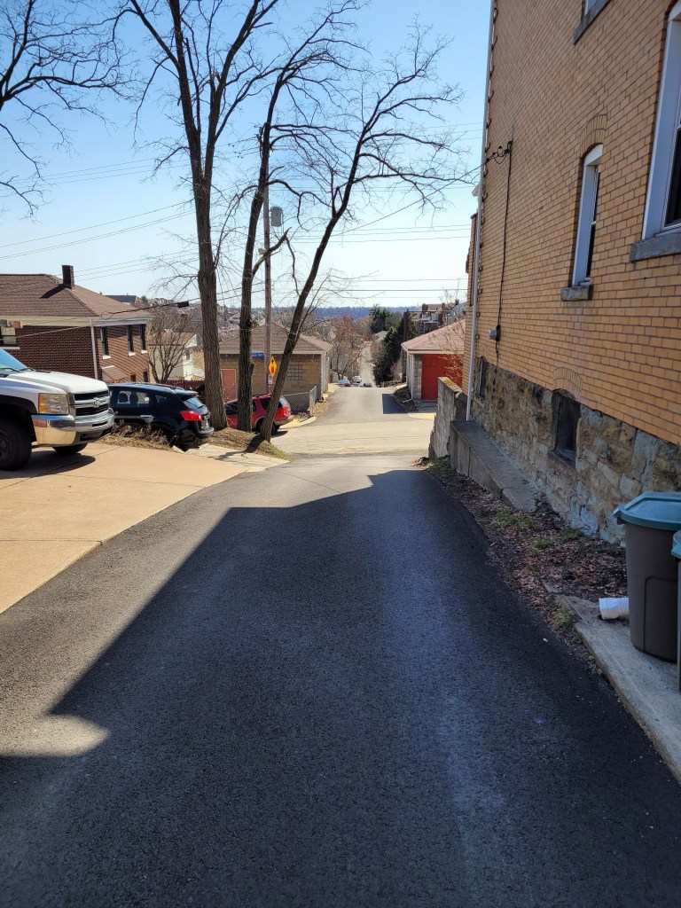
Old Upper Lawrenceville and Spring Garden Sidestreets

Once again, you get two May runs in this blog. The first, RATS run #00405, was on a gray day in Upper Lawrenceville. The second, RATS run #00406, was on a cool, but sunny, day in Spring Garden.


https://www.strava.com/activities/5254142747
RATS run #00405 in Upper Lawrenceville

51st Street, Berlin Way and Harrison Street were the objects of my footfalls on this Thursday evening. It was relatively flat, except the jaunt up to Bissel Way, with its little surprise.

Cavacini Landscaping was bursting with flowers and shrubs ready for planting. I’ve rarely been on this section of 51st Street in daylight, so this was a surprise for me. (Spirit, up the street, is a popular nighttime music venue.) Further towards the Allegheny, 51st Street crosses old railroad tracks and ends at a power line tower.

From here I scuttled past the Goodwill Building and onto Berlin Way. It is only a block from Butler Street and you can see murals on the back walls of Butler Street businesses.

But Berlin Way isn’t free end-to-end. Portions of it run afoul of chain link fences and nondescript buildings. However, Adelman’s Lumber looks cool, as did the sun setting way down a 55th Street alley.

Finally caught the end of Bissel Way and found this rusted monolith stretching to the next hillside. What is it? A lost railroad spur? A preemptive retaining wall with nothing to retain? I don’t know.

That was it. Three miles on a Thursday evening.


https://www.strava.com/activities/5263913969
RATS Run #00406 in Spring Garden

RATS run #00406 was my Saturday long run. I mainly focused on side-streets off of Spring Garden Avenue and then touched a couple of other missed streets as I rounded out the run in Perry Hilltop, California-Kirkbride and Allegheny West.

I started with a little detour up some steps to Salter Way. It looked like the yellow handrail has gotten hit by a car. Nonetheless, Salter Way is a short alley dead-ending into the hillside. Several houses are boarded up, and they even have guards. Cat guards, that it is. This no-nonsense kitty strode right up to me and, after shout-meowing at me, escorted me off the street.

The Welcome to Spring Garden sign is a bit of a ruse, I think. I don’t find it a very welcoming area, but perhaps it is just claustrophobia from the towering hills and overwhelming vegetation. I do get a kick out of the clock at the back wall there. Don’t stay too long!

Further on Spring Garden Avenue, I kept branching off onto the little streets, which tiredly run out of asphalt and just end. Some spots have several little streets with houses huddled together.

St. Peters United Church of Christ was pretty cool looking. About that point in the run, two little girls, bundled against the cold, decided to race me up Spring Garden Avenue. I was able to dodge into Giddy Way before they could catch up. Must say, I find Spring Garden Avenue dangerous to run on, much less ride a bike.

The turn onto Baun looked promising, but a half-dozen “No Trespassing” signs and “Beware of Dogs” signs later, I decided to cut it short.

So, away I went. Up towering Willams Road into Spring View/City View. I was lucky enough to find a shortcut to the top of Donora and was rewarded with a sweeping view.

Donora Street

From here, I wandered to the end of Hazlett Street and the curious little cul-de-sac, Boyer Street. Par for the course, Boyer actually is continuous, but someone keeps their car parked in the middle. Remnants of previous businesses still stand. Eventually I made it all the way down to Vista Street steps. There is a nice mosaic at the bottom, but the $600,000 step reconstruction is still not open. Is it just that the handrail is missing?

I used Milroy Street to cut through to Perry Hilltop. Those are some astounding steps which remain open, in spite of their flaws. As I approached several turkeys clucked their way out of sight while an old sad house came in sight. “Condemned”, said the blue sign of death.

Continuing my circuitous route, I caught the end of Hawkins Street, as it plunges toward Highwood Cemetery. Luckily there are steps there, too, so going back up wasn’t too bad. Eventually I made it to Riversea Road, a little inlet off of Brighton. By now, I was eager to finish up but got caught in the narrowing trap of West Park’s construction. Luckily, a little pedestrian bridge was available to cross.

Traipsing through Children’s Way and Allegheny Center, I found my way back to my starting point, a good 14 miles done.

Gaslights and a Wooden Street

Ah, take me back to the days of gaslights and wooden streets! Eh, not really. These curious and nostalgic scenes are delightful yet do not reflect the dismal quality of life in Pittsburgh in the early 1900’s. I much prefer the current cleaner Pittsburgh. As they say “The good ‘ole days weren’t so good.”


https://www.strava.com/activities/5243296842
Route of RATS run #00403 in Shadyside and Point Breeze

I started this run, number 403, in Frick Park even though the object of the run was the curious winding avenues of Chatham University. But first, a photo of the elusive groundhog, cousin to Phil. I’ve seen groundhogs everywhere in the city, from Uptown parking lots to Lincoln Place. They scurry into holes under porches. They dive into garden bunkers. There’s one that lives in my neighbor’s yard. It must have an agreement with their dog, as it boldly traipses across their yard and into my garden. It loves to sample tomatoes, preferable almost ripe and generously leaves the half eaten fruits for birds to gorge on.

Groundhog
Grr, a groundhog

Nonetheless, back to the roads through Chatham University. These ‘private’ roads are often used by pedestrians and patient short-cut seekers to cross from Fifth Avenue to Wilkins Avenue. They are also some of the most gorgeous streets in Pittsburgh, with large mansions (now college buildings) on small winding lanes flanked by flowering dogwoods and towering oaks.

After wandering the winding lanes of Chatham, I traveled up Shady Avenue as the evening became drizzly. There are many small dead-ends off of Shady, as well as a few private drives. I ended up by following Mellon Park Road from Shady to Beechwood. I’m not sure what’s going on with the green lights, but I can assure you they are not from photo-editing.

I simply ran up and down and up and down Beechwood to my starting point. No groundhog out now.


https://www.strava.com/activities/5248910773
Strava route of RATS run #00404

This run was in Shadyside as well, though in the busier sections near Walnut Street and Ellsworth Avenue. I was on a mission to snag a number of dead-ends and alley-ways I had previously overlooked. The south side of the busway is quite residential, though crowded. A large percentage of the huge ostentatious houses have been carved into apartments, condos and town homes. There are still a few mansions along Fifth Avenue, though. The north side of the busway is more inner-city urban, with six-story apartment buildings and parking garages.

Getting there, though, I ran to Canterbury Lane, a dead-end; Aiken Place, another dead-end and Roslyn Place, an historic street off of Ellsworth. What makes Roslyn so historic? Well, the street is ‘paved’ with wood. And it isn’t wooden planks, it is more like the ends of 4×8’s. Very odd, but here, take a look.

As I say, very odd. How do they plow in the winter? Anyway, from here, I scurried down the alleys off of South Graham Street. One side goes to a Boys and Girls Club and the other dead-ends into a beautiful wall of ivy.

Crossing over the busway on the Graham Street walkway took me to Centre Avenue. It is a hopping place, with a Whole Foods, a Giant Eagle and lots of construction. Commerce Street, little more than an alley, parallels Centre and yet is much quieter. I made my way to Motor Square Garden and came back on Dapper Way.

So, I must say, my GPS wasn’t super accurate on this run. Sections of the GPS’ route are ‘translated’ off my actual route by 75 yards or so. Unfortunately, this misses the ‘nodes’ on CityStrides and doesn’t ‘complete’ the street. Argh. I’m uncertain as to whether I’ll run them again, which is easy enough, or just mark them as complete. Hmm, decisions, decisions.

Love, Peace, and Joy and Those Beechview Hills

Here are two little five milers. One in the South Side Slopes and one in Beechview. One had twice the elevation gain as the other. Any guess which one? Read on to find out.


https://www.strava.com/activities/5233037880
Route of RATS run #00401

This run started in my favorite spot in Beechview, Vanucci Park. I can park there without worrying if the car is going to roll down the hill. At any rate, I wanted to cover a couple of streets I had neglected near Coast Avenue as well as to explore Crane Avenue a bit. My impression had been that Crane was not safely runnable and wanted to verify that.

Immediately out of the park, I made a right up the Andick Way Steps. They took me past a basketball court. The squeak of shoes, ball clanging off the rim and trash talking spoke of games being played, even though the retaining wall was too high to see over.

The next turn was a left onto Kenberma Avenue. Kenberma falls rapidly under the electric trolley line known as “The T”. From the bottom, I wrapped around Hampshire Avenue to the Boulevard and the Fallowfield T-Station, a hundred feet above.

The next stop on my tour was Alverado Street. At the north end of Alverado, a set of crazily tilted steps drunkenly fall down the hillside. I followed, only to realize they went to a house, not through to another street, and backed out.

To wrap up this area, I decided to run up Canton Avenue; the tenth of a mile street which is the steepest in the US. At the top, I explored the stairs off to the left which took me back to Coast Street, with only a 13% grade.

With this section done, I headed up Fallowfield to Crane Avenue. Crane is no bigger than the residential streets I had just been on, but has more traffic and fewer sidewalks. I feel like city planners intentionally said “we don’t want anyone walking here!” I crept down to Shadycrest, which, unfortunately is deemed government property and is awash with “No Trespassing” signs. From there, Crane Avenue makes a steep descent to Banksville Road; blind turn, no shoulder, no sidewalk, maybe another time.

I ventured the other direction on Crane, diving into Lowenhill Street behind Brashear High School. The basketball courts there were eerily silent while quiet dog-walkers ignored the signs and traipsed their canine cares around the field.


https://www.strava.com/activities/5238283756
Route of RATS run #00402

The evening was heavy with humidity when I started this run in the South Side flats. Going into the slopes by way of Quarry Street I passed under the Mission Street bridge and skirted the edge of South Side Park. The houses are tall and thin. All the houses in this row have three floors, a basement and attic.

Further on, as I criss crossed Freeland Street the skies opened up. A pedestrian shouted out “Great running weather!” and dodged into a house. The steps became gushing rivers.

Thoroughly soaked, I came back down Brosville Street and was awarded with some neat views of the retreating storm. Thank goodness for the towels I had in my car.


So, what was your guess? More elevation in Beechview or the South Side Slopes? If you guessed Beechview, you were correct! 1,034′ vs 596′

March 2021 Catch-Up

Summary

March 2021 was one of my most productive months in terms of mileage and streets covered. Among my 162 miles and 20,000 feet of elevation gain, I completed 192 more streets in Pittsburgh in 15 RATS runs. I even completed the “Take The Stairs 50k” course I published last year. That course, a small revision of Lamar’s original course, took me on roughly 78 sets of steps throughout the city, but, alas, did not cover any new streets.

Blogging-wise, March was less than stellar. I only published four posts and it has taken me all of April just to get this summary out, touching on three short runs in Carrick, Brookline and West Liberty.


https://www.strava.com/activities/4979989103
Route of RATS #00384 in Brookline

I had grand plans for this run, but was out-of-synch and got frustrated by small ‘streets’ just being driveways into hills. Argh! Just took one picture, before it all went downhill. I did end up with over four miles and several alleys covered.

Brookline Alley
Brookline Alley

RATS run #00386 Around South Side Cemetery

In this run, I inadvertently circumnavigated South Side Cemetery. I started on Brownsville Road and took the steep West Meyers Street to Oakhurst en route to Newett Street, one of the steeper roads I’ve been on. I took Plateau Street to its dead-end above Volunteers Park, then came back to Newett, expecting to see Plateau on the other side. However, Plateau falls off of Newett so quickly that the other side looked like a driveway which disappeared over the hillside. Once upon it, though, I found my way down Plateau and was pleasantly surprised to find that Volunteers Field was an active hubbub. It looked like a fire department team was practicing on one field, while on another field, a younger group practiced base-running under the tutelage of a barking coach.

Moving on, I dodged cars on my way down Colerain to Noble Road. No sidewalks and not much of a shoulder made it tricky running. Then I peeled off and went down Denise Street. My internal map had Denise going a little way and dead-ending. It seemed to go on forever, but afforded nice views of the T tracks. Returning, I came across some steps which took me to Noble Road.

Once up on Noble, I backtracked a bit and went up Glade Street. The few streets up on that hill are tucked into a corner of the cemeteries looming above. It was a nicer area than I expected. Some kids were playing basketball in the street and others were riding bikes. Along the Montrose Steps I heard a rustling and noticed a deer in the woods. I took a picture and continued to Cloverdale Street. Only after looking at the picture more closely did I realize there were four deer there!

Cloverdale Street completed the southern border of the cemetery, bringing me back to Noble Street. This short, three mile run certainly had a lot to see.


Route of RATS #00387

This was an evening run in West Liberty to catch some alleys. I caught several in my alley catcher, but some were only paper alleys (here’s looking at you, Mascot Way!) Overall it was a pleasant, hilly run with over 400 feet of elevation in only three miles.


So that was it for March, 2021. I’m still chipping away at the streets. At the end of March I had a little over 800 more to complete. I’ve come a long way considering there are over 4,800 streets in Pittsburgh. I can now see the light at the end of the tunnel.

Epic Eighteen To Fairhaven

https://www.strava.com/activities/4987052124
Route of RATS run #00385 from South Side to Fairhaven

On a bright Sunday morning in March, I undertook one of my longest RATS runs ever. I had a couple of goals. First, see how much of Beck’s Run Road I could traverse without getting run over and second, explore Fairhaven, nestled in the corner of Library Road and Saw Mill Run Boulevard, without getting run over. I was ramping up mileage in preparation for an April 50k.

First off, I decided to climb into the South Side Slopes in order to catch Parkwood Road, which I could take to Beck’s Run Road. While using East Carson is the fastest way by car, that whole ‘without getting run over’ idea convinced me the steps were a better idea. And of course, I would get to enjoy the great views.

Oakley Street has an impressive step-mosaic where it begins on Josephine Street. It does continue, however, for several more flights. I wonder about that handicap parking, though. It must be difficult for anyone with mobility issues to live in a spot surrounded by steps.

At any rate, now on the crest of the South Side Slope, the views were amazing. on breaks between houses, you could see across the Mon to Oakland, with the Cathedral of Learning prominently displayed. On the far side of the crest, the neighborhood forms a steep bowl, with steps on each side.

Once past Arlington Avenue, I made my way to Mountain Avenue and the long, one lane road known as Parkwood Road. On the left side of Parkwood, a ravine deepens and water drips down the cracking rock on its way to becoming a creek. Parkwood is blocked off about a tenth of a mile above Beck’s Run Road, due to erosion. Just before this, two small streets on the left are lined with houses. The creek has grown to a significant size by now and the city, I suppose, has built quite an impressive retaining wall to keep one house from falling in. It is very isolated, but the ten houses are all nicely maintained.

Once at Beck’s Run Road, I ran toward Paige’s Dairy Mart and then up towards Carrick. Even though it was a 40 degree day, people were lined up to get ice-cream goodies from that venerable establishment under a bridge. Beck’s Run is the name of the small creek alongside the road. The road is a major thoroughfare, but doesn’t have many buildings along it. The hills coming down are too steep to build on. The flat areas probably flood.

So, I made my way up Beck’s Run Road, then explored a little along Agnew Road. Not far from its intersection with Beck’s Run, there’s a heavily fortified water filtration plant.

I found one section of Beck’s run a bit too tight for running and went up Madeline Street instead. Crossing over Brownsville Road, I took Maytide to Saw Mill Run Boulevard. This is car heaven. Car dealerships of all shapes and sizes line the road. Luckily there is some thought to pedestrians, as there are walk signals. You just have to be willing to wait a long time. At least I could recover a bit.

Finally making it across, I came to the Fairhaven neighborhood. It is wedged between Saw Mill Run and Library Road. From this intersection, one lonely road and a set of steps lead you there. Once there, I was, actually, pleasantly surprised. Medium and large houses stood on large lots. The subdivision backs onto “Fairhaven Greenway”.

Hillview Street is steps in two sections, the one coming up from Saw Mill Run and another one, just slicing up the hillside between yards.

The far side of Fairhaven abuts Castle Shannon and Whitehall. I came down Elwyn Street and made my way along Transport Street, a half block behind Library Road. Transport Street had much more character than I expected.

At this point, I started heading back to the South Side. I went along Saw Mill Run until I could go no further. Luckily, a tiny section of steps became Dartmore Street and led me up into Carrick. From there, I just plodded along Brownsville Road and cut-through Mt Oliver along Amanda Street. I was surprised to find Amanda actually stopped and was separated from Hay’s Street by a barrier. It turns out Hays, at that point, is so steep, it is hard to even walk down. Still, those hilltops can see the downtown buildings peeking over.

With this, I made my way down South 18th, Mission Street and back to my car on the South Side. Whew, that was a long run!

Shadow Selfie

Alleys in Oakland

https://www.strava.com/activities/4915176085
Route of run #00378 in Oakland

As I’ve covered more and more of Pittsburgh, my runs are increasingly on smaller streets and alleys. This early March run into Oakland definitely fits that description. I started in Dinosaur Playground, as my kids used to call it. It’s a great little playground and field at the tip of Schenley Park. Pre-Covid, parking in Oakland was so expensive and scarce that many people would park here and walk to Pitt on a daily basis.

But let’s get things started with shoes and sunsets. Shoes on the wires and a nice sunset across the “Charles Anderson Memorial Bridge” carrying Panther Hollow Road out of the Park, where it mysteriously renames itself to Boulevard of the Allies.

Continuing into Oakland I made my way down Coltart Street to Iroquois Way. For some reason, it isn’t on most visitors’ “must-see” list! Coltart Street is very typical of Central Oakland. Low houses, duplexes and apartments struggle for space under the rising tide of Pitt development.

Students and medical professionals flow through Oakland, going to work, going home, going to classes, laundromats, restaurants, and bars. I think the colorful mural is along Bates Street, but Gene’s Place is harder to find, well hidden off of Atwood Street. It does not serve food, so with the strange restaurant laws in Pennsylvania, it still allows indoor smoking.

Rounding out the neighborhood tour, I came back to Dinosaur Playground via the Panther Hollow Bridge passing in front of Phipps. A short run, a short blog!

February Roundup

February was a bit of a slowdown. I only ran 75 miles strewn across eleven runs. Only eight of them earned the coveted RATS badge. However, February was pretty cold, snowy and icy, so any miles were good miles. I’m up to about 80% of the Pittsburgh streets done. Here are this month’s last three routes.

RATS #00370 in Garfield

https://www.strava.com/activities/4850441556
RATS #00370 in Garfield

This was on the periphery of Garfield along Mossfield Street, with a foray onto Brown Way as the sun set. It is a surprisingly rural route, given the dense housing all around.

I made my way to Mora Way. It looks a lot better now that Dumpbusters got a whack at it last year, carting away truckloads of trash and tires. We didn’t get rid of the hill, though!

Once up on Schenley Avenue (which is totally out of place from all the other “Schenley” named parts of the city), I circled back towards the Garfield Hill. I found steps at the end of Breesport. They go up to Fort Pitt playground, though they were crumbling, snow covered and fenced off at the top. Further down North Mathilda, there are some steps falling off the hill near Reno Way. Those seem to be the remnants of a house, as there are no handrails, posts or map evidence of a street there.

I cruised down Brown Way, taking in the evening views.

This neighborhood in undergoing a rapid transformation. Old houses are falling down next to new ones and construction proliferates.

And that was it, three and a half miles done, with a friendly reminder to “Call Your Mom!”, if you are fortunate enough to have her still around.

RATS #00371 – East Liberty, Garfield, Larimer

https://www.strava.com/activities/4861319000
RATS #00371 in Garfield, East Liberty and Larimer

As the weather improved, my runs lengthened. I also have an upcoming 50K, so I need to get more miles in. Today’s run was mainly about East Liberty, although I ventured briefly into Shadyside, Garfield and Larimer to cross off more streets.

East Liberty is also going through construction and destruction. At the site of former housing project, a Whole Foods is going up. On the back streets, you can still see hand-painted business signs.

This jaunt was over eleven miles.

RATS #00372 Beltzhoover

https://www.strava.com/activities/4868729046
RATS #00372 Beltzhoover

This was my fifth run in a row, so I was a bit tired and unmotivated. Nonetheless, it turned out well. Now Beltzhoover is less than pristine. Nearly every street has several “eyesore” houses. The steps are typically crumbling. However, it is a busy area, full of people walking their dogs, going to the store and working on their houses. It is also rather big.

I started along Eat Warrington Avenue, passing the metal vegan place and turning at the wild cat-snake mural next to the beer store. Of course the mural has a Steelers logo on it!

Then it was up and down alleys.

Finishing up, I caught a glimpse of South Hills Junction, where the T-Line goes into the Mount Washington Transit Tunnel.

And that’s it! Looking forward to a warmer and sunnier month!

January 2021 Catch-Up

Summary

January 2021 was a good month for running, by and large. I got seventeen runs in covering new streets. The weather wasn’t too bad and I explored Ridgemont, nearly completed Westwood, as well as continued to make progress around the city, exploring its nooks and crannies. The only setback was a fall one evening resulting in a few scrapes and bruises, but more tragically, a crushed phone. It took me a few days to get back on track after that. Unfortunately, the pics from that run remain on the old phone, with its ruined screen.

RATS #00354 – Point Breeze

https://www.strava.com/activities/4617306198
RATS #00354

A short evening run with a surprising number of steps, RATS #00354 was a night run on the edge of Point Breeze and Squirrel Hill. Solidly dark, the pics are not great. Thank goodness for a strong flashlight.

As I did crop-circles among the cul-de-sacs in Point Breeze, my flashlight illuminated several little libraries.

And that was it, 4.35 miles done.

RATS #00357 – Downtown and the Hill

https://www.strava.com/activities/4637917031
RATS #00357

This was a pretty long Sunday run. I explored a few downtown alleys and then climbed into the Middle Hill. I was chipping away at the portions of the Hill I had not yet done and covered covered eight good miles when it was all said and done.

Trekking up to through the Hill Distrist is old hat now. Lower Hill has seen a good bit of renovations and is dense with townhomes. If you’ve read along, you’ll know that I’m pretty much done with the Upper Hill. That area has some sketchy parts, but also has a number of renovated houses and the pressure of Pitt pushing down onto it. The Middle Hill, in my estimation, is the worst of the three sections, but still with bright spots. It’s cliff high above the Allegheny is dotted with housing projects. Bedford Square is in much better condition than I expected. At the edge of the cliff are several viewing areas with benches. From one such overlook on Memory Lane, you can see out over the Strip District and down the Allegheny River.

The next cul-de-sac of housing, Somers Drive, is rather utilitarian. At the far end, steps flow up to housing at the end of Chauncy Drive. The UPMC building downtown rose ghost like from the trees.

Now in the middle of the Middle Hill, vacant lots and boarded up buildings dominate the scene. I did run through a rather nice area off of Bently. The street has a nice curve in it, so folks wishing to do a Strava heart art route often run it. Downtown buildings are usually visible, not so far away.

Shortly after Bently Drive, I made my way back downtown. A few more things caught my eye, like this mural and the restaurant which bills itself as Pittsburgh’s Chinatown.

Finally back to Cherry Way, I had to take a pic of the 100+ year old Smithfield Street Bridge.

Smithfield Street Bridge

RATS #00359 – Splat!

https://www.strava.com/activities/4659644088
RATS #00359

Running down Bigelow Boulevard in the dark along a narrow sidewalk, I got some GREAT pictures of the downtown skylights. Unfortunately, they are locked in a cracked phone. For, as I turned away from the Sixth Street ramp, deeming it too dangerous, I tripped and fell flat on my face. My gloves and tights were torn while my hand and chin throbbed. However, there was nothing to be done but to keep moving. So, I did a slow jog and walk for the two miles back to my car. Damn that dry, empty sidewalk!!

RATS #00360 – Spring Hill and City View

https://www.strava.com/activities/4676034699
RATS #00360 in Springhill, Spring Garden and Cityview

After the run-in with the dry sidewalk, I took three days off. I must admit, I’m writing this a month later. It seemed like a cold day, and the Strava data claims it was 24 degrees with an 18 degree wind-chill. That sounds right. Nonetheless, before heading out, I verified that the streets would be wet and the route hilly. No flat, dry sidewalks to trip me up THIS day!

My target area was a squiggley section of Springhill, Cityview and Spring Garden off of East Street. A few months ago, I had come down a closed Gershon Street in the dusk and this was in the same area. It was going to be interesting to see it in daylight. My exploring friend, “Maggie Ess”, is walking all of Pittsburgh (see her blog here) and was in this exact neighborhood the day of my Splat event. I should have run here instead, perhaps? I have to say, between Maggie, Laura, Sherpes Hasher, Alyssa and me, we’ll have Pittsburgh thoroughly documented and vivisected in no time. Then, in ten years, someone will have to do it again to see what has changed.

Anyhoo, I parked over in a public lot near Allegheny City Brewery and trotted over I-279 on my favorite pedestrian walkway, Gerst Way. A short leg along East Street took me to Mt Royal Avenue where a large church building, St. Boniface, claims a swath of flat land. I had thought it semi-abandoned, but a little research shows that it is actually part of Christ Our Savior Parish. Besides the historic nature of the building, the current parish is interesting. Monthly, there’s a Mass in Vietnamese. I didn’t realize Pittsburgh had that large of a Vietnamese population. Many years ago, in a city far away, I visited the church of my baptism and got there early for 10 AM Mass. I patiently waited as the crowded church finished up the Rosary in a foreign language. I naively thought that, once Mass began, it would be in English. I was wrong. It was entirely in Vietnamese. But Mass is Mass and I could follow along.

St. Boniface Church Building
St. Boniface Church

But today, I wasn’t there for Mass. I was there to run streets and explore. Just past St. Boniface was a set of steps on the right. They were blocked off from the bottom, but not seriously. I ventured up them till the treads were largely missing.

Next on the explorers’ bingo card was Bly Street. This little dead-end shoots straight up the hill from Mt. Royal. It quickly ends in the hillside, and comes with those ever popular sidewalk steps.

Squiggling down at from the top of Mt. Royal is Luella Street. Below is a screen-shot of a map I found of Luella in Pitt’s archive. That’s a great resource.

The bottom of Luella intersects Gershon, which is sliding off the hill. Steps conveniently take you up into the neighborhood again.

An abandoned house sits at the end of Heim. It still has a chandelier-ceiling fan combo and skylights, but broken windows and shifting ground has doomed this one.

Further on, a step-alleyway bisects the little rectangular neighborhood.

Now that I’d climbed high on the street and steps, I was rewarded with wide-open spaces and sweeping views.

I spent a good bit of time wandering in and out these roads. Some became private roads before the end. Some took me up to a radio tower.

With this, I headed back to Allegheny City Brewery. In pre-Covid times, I would have stopped and had a beer, but not today.

RATS #00361 – Banksville

A short night run in the Banksville area. It is very suburban. Between that and the darkness, I didn’t have many pictures.

https://www.strava.com/activities/4687028631
RATS #00361

I started in Banksville Park and wound my way along the dark suburban streets. I had to pop out onto Greentree Road for a bit, where the ACE is located.

RATS #00364 – East Liberty & Homewood

https://www.strava.com/activities/4713197236
RATS #00364

Another Sunday morning run, this time in East Liberty. Passing East End Brewery was probably the most interesting thing that happened.

Much of the run was along streets dead-ending into the tracks along the East Busway.

Three December Runs

I had a pretty good December this year. So good, in fact, that I’m STILL blogging about it, a week into the new year! I had many significant runs towards the end of the month, so that whole “catch-up” thing will have to wait. My running tends to be done when the opportunity arrives, while my writing is more of a record than an instantaneous news feed.

RATS #00337

RATS #00337

It was a dark and stormy night…

Actually, it wasn’t stormy, just cold. I’m pretty comfortable running through the alleys of the Strip District and Lawrenceville at night. While they look creepy, they are typically deserted. Darkness and narrow streets are harmless without people. OK, upon recent news (fork-lift getting caught in a sinkhole), I guess I should be more worried about sinkholes. Those would, indeed, be a problem in the dark.

This run covered some alleys and streets I had missed in my previous jaunts. Outside of the quickly gentrifying areas marked by condos and bars, old Lawrenceville still exists. It’s an area of warehouses filled with products that people need. Above is a picture of A.R. Chambers, a construction supply company. There are tire stores, wholesale food warehouses and many more. The wide streets and flat land are rare in Pittsburgh and are perfect for these businesses.

RATS #00342 – With South Park Trail Runners:

Filthy Five Plus One Minus One

Filthy Five with SPTR
Filthy Five with SPTR – RATS #00342

The South Park Trail Runners is a local, down to earth, trail running group in Pittsburgh. Friendly and energetic, they run all over the area. For this day, they, meaning Suzanne, organized a run on the “Filthy Five” course – five of the steepest and toughest hills in Pittsburgh. Actually one of them was in Wilkinsburg, but it was really, really close to being in Pittsburgh.

At any rate, I joined this lively group of runners as we made our way from Frick Park to the East Hills, where most of these hills were.

Most of these roads I had already done, but taking a detour on Cassina Way made it a RATS run. Narcissus used to have a better place, I think; more like that Point Breeze mansion.

As is often the case on group runs, I got separated from the pack. I had raced several runners up the wrong hill and then completed the street. By the time I got back, the other runners were off on their merry way, voices echoing across the empty, snowy East Hills landscape. Luckily one of the residents told me “those marathoners went down the hill”. I pulled out the phone, found the maps and navigated to Ferndale Street, Dornbush Street and then to Hill Street, now in Wilkinsburg.

At this point I had finished Hill Four, and made my way back my car in Frick Park. I had forgotten all about the Fifth Hill, in the park itself. Oh well, counting the wrong hill, I ended up with five hills after all.

Big snowfall still hanging around

RATS #00343 – Arlington

RATS #00343

The day after the Filthy Five Plus One Minus One, I embarked on an efficient RATS run in Arlington. I had carefully mapped out the route and was pretty happy how it turned out. I saw the Cathedral of Learning from the high hills, as well as Santa nestled between two cattywampus houses. Were they wishing for a level lot?

Arlington is on the “back-side” of the South Side Slopes. It undulates wildly, with streets dead-ending at a steep ravine. It has it’s share of steps. The Dengler Steps are set back from the street and, it was only after seeing the boat that I thought, “there MUST be steps nearby”!

Speaking of dead-ends, I’m always disappointed when they are blocked off. However, I can read and don’t really want to see any dogs up close.

So that’s it for these three runs. I still have more of December 2020 to write about, but it’s almost done.

Missed Chance and Second Chance

Two Runs in Hazelwood

First Chance

https://www.strava.com/activities/4460056146
RATS #00338 in the dark, missing Chance Way

It was a chilly and wet Friday night. I hadn’t run since Tuesday. I had to get out and cover some streets if I was ever going to finish this project. So, I decided on a short jaunt in Hazelwood. There’s convenient parking, it isn’t too far away and super runner Alyssa’s recent posts about Chance Way motivated me to find it. Actually, I “knew” where it was, a little alley off of Tulleymet Street, but somehow kept missing it. I swear there are micro “Bermuda Triangles” all over Pittsburgh. Small areas which keep obfuscating themselves whenever I try to find them. Chance Way is in one of them.

I started at Hazelwood Green, formerly a coke plant and now undergoing a transformation into a research manufacturing facility. The plan was to go up to Sylvan Street, skip down the Tullymet steps and run Chance Way. Alas, there is another set of steps, Berwick Street, which I mistook for Tulleymet. I was confused not to see Chance Way, but figured it was just too dark. Along Irvine Street, I caught a glimpse of interesting flowers made of glass and rebar. Osprey Way and Finn Way were rather creepy, but music playing from one building gave some semblance of normalcy. It wasn’t until further on, looking down Chaplain Way was that I got the heebie-jeebies and called it a night.

Second Chance

https://www.strava.com/activities/4463550140
RATS #00339 – Second Chance

After Friday’s missed attempt at running Chance Way, I enlisted Naomi’s help and took another shot at finding Chance Way. It’s amazing what running in the daylight, with a friend, will do. We passed a veritable garden of flowers made from glass and rebar. I also espied a real garden, all buttoned up for the winter.

Further on, we went up Berwick Street and found the bottom end of Chance Way. It is actually blocked off by jersey barriers, but was passable. That brought us to Tulleymet and the lower section of its three tiers of steps.

From there, we went down Sylvan Avenue, passing the Berwick steps and this old church structure. It looks to be in use as a church or community center, now accepting mask donations.

Continuing on to Tecumseh Street, Champlain Street didn’t look as bad in the noon daylight. It’s still not an area you might go to for a picnic, but it is filled with small houses now broadcasting Christmas music through the streets.

So, while running, I had noticed the mural for Tonee Turner, and took the picture, but didn’t think too much more about it. Only now, as I’m writing, did I realize that she has been missing only since December 30, 2019. Just a week earlier, her sister and friends had had a walk to remind Pittsburgh she has never been found. This news story on KDKA tells more about it. It is worth noting that, while the mural was here in ragged Hazelwood, she was last seen in splendid Squirrel Hill. It is rather disconcerting that this happened at all, much less in places I’m very familiar with.

Moving on from the flats, we charged up the West Elizabeth Street railroad overpass. Need any tires? This wooden warehouse is full of them. At least they haven’t been dumped on a hillside yet. On the horizon were hillier parts of Hazelwood, past St. Stephen’s.

Up the hills we went. Found the sun on Rose Way and chatted with the owner of this overwhelmingly decorated house. Shortly afterwards, we made it to the top of Ashton Avenue, where it meets Mansion Street. Mansion Street has a nice set of steps down to Johnston Avenue.

Now we made our way down Johnston Avenue to Second Avenue. There are a couple of interesting places along Second Avenue, such as the French bakery, La Gourmandine and the Hungarian restaurant, Jozsa Corner.

Finally, we made it back to Hazelwood Green. I stopped to read about its future while Naomi rounded out her mileage. In spite of the 550′ of elevation she was still smiling.