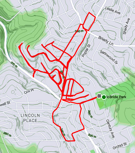
Map of running route through Lincoln Place – RATS #00326
Run number 326 took me out to Lincoln Place again. It was a beautiful, warm, sunny day and I explored some of the nooks and crannies off of Interboro Avenue. But first, I started at McBride Park, with an easy downhill start.
My first alley, K Way, took me behind houses underneath high-voltage power lines. These lines march across Lincoln Place, towers stomping down every few hundred feet or so. The hilltops of this residential area are quite high. In a previous post, I had described being able to see downtown buildings from out here. The view from Diller Place went on forever even though it didn’t have the angle to see Pittsburgh’s tall buildings.
Power Lines IMBY
Hello Pittsburgh!
Diller Place, looking North
Eventually, I ran out of Pittsburgh and into Munhall for a few blocks. Coming back in, I was happy, as always, to see the “Welcome To Pittsburgh” signs. There aren’t as many steps out here as in the city, but there are a few. I came across these steps from the lower part of Oakleaf Street to its upper section past Leaside Drive. Apparently I missed a couple of stairs, which I’ll have to come back for. I did see a few little libraries, most notably this very pink one. I also got a kick out of the ice-cream cone protruding from the Walk-Rite sign.
Little Library Largely Pink
Large Cone and an Orthotic To Go
On a more nerve-wracking note, I got a call in the middle of this run. It was a contact tracer and I had come into contact with someone who had tested positive for Covid. Without any symptoms, I wasn’t super-worried, but it was upsetting, and the start of another round of quarantining. That was several weeks ago and I did not, indeed, get sick. Unfortunately, as of this writing, I’m again quarantining due to Covid contact. I can’t wait for this to end, but still healthy.
I have sometimes disparaged Carrick as dark and dirty. Well, running there on a sunny Saturday morning will dispel those impressions. Unfortunately, the sunlight doesn’t flatten the hills nor expose all the pesky streets. My main goal was the grid of streets between East Agnew and East Meyers, and constrained by Brownsville Road and the Becks Run ravine.
First, a definition:
“Pesky Street” – a street clearly marked on map, yet consistently missed in spite of running all around it. Like your car keys sitting on the counter when you’re looking for them, a pesky street is not visible by direct observation.
ET May
I actually started on the other side of Brownsville Road to swat a few pesky streets into the “completed” column. Dellrose, Oakhurst and Kleiner Way were some of the most pesky streets around. I got Oakhurst, climbed the hill to Dellrose, confident of finding its intersection with Kleiner Way. But there was no Kleiner Way. I retraced my steps, only to discover the top section was more of a grassy slope than an alley! Damn! Oh, well. Moving on, I made my way back across Brownsville Road.
Falling into Fall
No way, Kleiner Way
There, in the midst of the neighborhood was a cemetery with no name plates, and no entrance. It is associated with Concord Presbyterian Church, on its periphery. Digging into this a little, I found this fairly interesting site, Concord Presbyterian Church Cemetery, dedicated to preserving its history. Many of the graves are very old, including some prominent early settlers.
Concord Presbyterian Church Cemetery
From here, I made my way down the long streets. Plummet Way did just that, ending at a section of Red Rose Avenue with sunken steps. This is not the only section of Red Rose Avenue with steps. The other section drops down to Madeleine Avenue. These steps weren’t as impressive as those. (And neither was my photography.)
After Plummet Way, I made my way across the grid of streets. The weather was great and the rolling hills afforded nice autumn views. There are lots of dogs in the area, each viciously guarding their territory. I liked the house below, with its stained glass and nicely painted dentils.
Red Rose Avenue Steps
Sunny Alley
Guard Dog
Striking House
Eventually, I came across East Cherryhill with its impressive steps and tilting walkway. These steps cross from Concordia to Amanda as steps alone, only to be joined by a driveable section of East Cherryhill Street up to Brownsville Road. Don’t take them if you’ve been drinking, else you might fall over into someone’s yard.
East Cherryhill Steps
East Cherryhill Steps and wavy walk
Leolyn Steps
Leolyn Street is one of the few cross streets and ends in these steps up to East Meyers Street. I love this picturesque view.
Of course, once I finished my run, and reviewed the maps, I realized I still had some pesky streets out there. D’oh!
I wasn’t sure what to expect on this run. Just looking at the map, my route seemed to be a nondescript area tucked between Perrysville Avenue and I-279. In the more suburban neighborhoods, this area would have been a rather boring, just strewn with split level houses and big yards. Instead, I was treated to an exciting area with houses of all sizes, powerful views of the setting sun and steps galore. I started from Riverview Park and made my way north along Perrysville Avenue.
Finishing off Franklin Street at its northern intersection with Perrysville Avenue, I looked right and immediately saw my next street, Bluebelle (yes, with the delicate ‘e’ on the end). Up Bluebelle, a staircase, I went, finding myself on Amos Way at the top.
Bluebelle Steps
Slightly Wonky Wooden Steps
From Amos Avenue, could see Riverview Observatory
Through the houses at the end of Amos Way, I could see the Observatory at Riverview Park and even the faint outline of Trimont. I don’t think I’ve ever looked down on Riverview before. This high point was home to several communications towers and a rather squat water tower.
Radio Tower
KDKA Weather Radar(?)
One of the more interesting finds were these murals at the top of Santiago Streets’ dozen steps; Fiasco Art Center.
World is on Fire
Gandalf
High hilltops clutched the last rays of the rapidly setting sun, making this a relatively bright run. Good thing, too, because of all the steps I encountered; Santiago Street, Montana Street, Grizella Street, Radium Street.
Santiago Street
Grizella Step Connector
Radium St to Waldorf
Montana Street
Last Rays
Finally the daylight really started to fade as I made my way down Waldorf Street. Waldorf Street had huge houses, reminiscent of North Squirrel Hill, but on large, surprisingly flat lots. “No Outlet” signs did not deter me, for I had a feeling I would find a way through. (If I had studied the map more, it would have been more than a feeling.)
And so, I came upon a faded street sign, “Gribble”. That could only lead to no good, so on I went. It took me down to Dewey Avenue, a small street just off of I-279, opportune for making my way back to the park.
Gribble Street
Gribble Steps
Down to Dewey
Waldorf Street House
Along the way, I espied a small street, Eula, which I hadn’t yet done. Whats one more dark street among friends? So I wnt up it to East Street and back to Baytree. Coming down it I realized that it, too, had steps. They were mainly leaf-covered at the bottom, but no more treacherous than the cobblestone street.
A run after work, this run quickly went from a jaunt through leaf-covered streets to picking my way through the dark on a closed road. Closed for good reason, it turns out.
I started near Heinz Lofts, apartments where once ketchup oozed. Who knows, perhaps ketchup is still oozing somewhere up there. I made my way through the Northside, eventually turning right onto Marshall Avenue, as it ramps up to the top of cemetery hill. I’ve sometimes wondered if the two huge cemeteries, Highland and Union Dale, has killed off normal urban development in the area. The sun was setting as I got to the small streets at the top of the hill. After snapping that pic, I crisscrossed the few small streets back there, then popped out onto North Charles, via Crispin Street.
Sunset over Union Dale
Tucked Away Urban Farm
North Charles rises like a ramp then jumps over I-279 on the Swindell Bridge. From the bridge, I glimpsed glowing towers downtown. With all the hills and ravines, effective darkness falls at strikingly different times.
Maple Street Viaduct
I-279 Streaming into the City
Shortly after crossing the Swindell Bridge, I had planned to come down Gershon Street. I found it blocked, but decided to venture down it anyway. Sometimes, it is only bad for cars and pedestrians have free rein. That was the case here and a short internet search revealed some answers. It turns out that Gershon has been closed since February 2018, when landslides made the road unstable. Apparently the no-nonsense Jersey barriers were installed a few months later, after a driver drove past the police sawhorses and subsequently had to be rescued. I can see why it’s still closed. Yawning gaps on the right side disappear down the hill.
Gershon Street
I wasn’t the only one on the street. A middle-aged man walking his dog waved as I ran by. Actually he challenged me to run up it! Maybe another day.
It was now fully dark and I simply ran along East Street, following the faint residual ketchup smell back to Heinz.
This run took me back to Lincoln Place – that southernmost of all Pittsburgh’s neighborhoods. I had prepared for a cold, wet run but was treated to a stunningly beautiful Fall day.
Starting at the Shop ‘n Save down by Brown’s Mobile Home Park, I quickly made it to quiet suburban streets off of Mifflin Road. The trees were in their full glory.
Here and there were small shops, like Velma’s Place. I did run into a group of ultra runners, discussing their latest 500 mile run.
Velma’s Place
Ultrarunners?
Overall, though, there wasn’t a whole lot to see here. However, Muldowney Road rises high off of Mifflin Road and affords views of the UPMC Building and the Oxford Building, over six miles away as the crow flies.
High-voltage power lines were a constant presence along the route. Also came across a huge Penn-American water tower.
Power! Power! Power!
Penn American Water Tower
That was about it. I had struggled to get myself out the door, but was truly rewarded with fine, sunny weather and neat views.
October 2020 was a pretty good month. I did not do big long runs on the weekends, but got a good fifteen runs done, with fourteen of them covering new streets. Final stats were 100 running miles with over 12,000 feet of elevation. I’ve made significant progress in north Pittsburgh, with 98% of the streets done from the Northshore to Riverview Park. I’ve also continued to cover southern neighborhoods such as Carrick and Lincoln Place. It’s been a beautiful Fall, with only a couple of cold days. Several runs swept through ‘stairy’ areas; run #319 hit at least half dozen long ones. For better or worse, there are several significant runs in this catch-up, so its rather long.
RATS #00315: Brookline, Overbrook and Carrick
RATS #00315
Starting at Brookline Memorial Park, I ventured down Breining to Briggs in that area of long streets. But Briggs turns into Seldon, which took me directly to the Fan Street Steps down to Glenbury. I’m constantly attracted to dead-ends, tunnels and steps. This had it all. I passed through the Glenbury Viaduct to find myself at the busy intersection of Saw Mill Run Boulevard and Library Road.
A typical Brookline street
Fan Street Steps
Pinecastle Avenue Steps
Glenbury Street Viaduct
I noticed a line of steps up the farther hill and waited patiently at the light wondering exactly where they would lead. Those steps turned out to be Horning Street, off of Ivyglen. Horning keeps rising, even after leaving the benefit of the steps behind. At any rate, in keeping with the spirit of the run, Horning dead-ends at a cemetery, Beth Abraham Cemetery. I kept on its perimeter, looking in briefly where Ivyglen enters.
Horning Street Steps
Beth Abraham Cemetery
I wandered further into Carrick, eventually getting to Brownsville Road and almost stepping into Brentwood. Thankfully, a sign alerted me, so I curved back. The curvy streets twice concluded in curvy sidewalk steps along Ivyglen, once where Lodge meets Ivyglen and again where Odette hits Ivyglen. For some reason, Odette is not in Bob Regan’s book and not on the City of Pittsburgh’s stair list even though they both include the Lodge Street steps, a block away. They also both include the Sanderson Street Steps which have been closed since at least 2007.
Sanderson Steps
Brentwood border street
Ivy on Ivyglen Steps
Odette Sidewalk Steps
Whoops, almost out of the city!
With that I made my way back, peeking in on Pinecastle Street in passing.
RATS #316 Brighton Heights and Marshall Shadeland
RATS #00316
This was a five mile run on a chilly misty Autumn evening starting at Legion Memorial Park. I have mixed feelings about this memorial. While I have the utmost respect for those whose names are listed, I find the Disneyesque Mr. Universe sculpture almost ridiculous.
War Memorial Legion Park
From there, it was just down Shadeland Avenue, then up Schimmer.
Schmimer Steps from the bottom
Schimmer from the top
Shadeland Avenue Bridge over Woods Run
RATS #00317 Just a bit of East Street
RATS #00317
There’s a new run club in town – City of Bridges Run Club. This run was supposed to be with them, but I was running late. No worries, I just took on a small section of East Street, climbed Suffolk and got a Fineview. It was great to hang out afterwards, masks and all.
Suffolk Street
Pittsburgh’s Version of Madison Avenue
Skyline from Fineview
RATS #00318 Back to Carrick
RATS #00318
Another run in Carrick, mainly along Spencer and Kirk avenues. Eventually, I stepped out of bounds, dipping my toe into Baldwin Borough for a bit. It was dark, so I can be forgiven. Speaking of dark, they could use a few lights along Custer Avenue I daresay. I skirted a couple of spooky cemeteries along the way.
Birmingham Cemetery
St Wendelin Cemetery
Sunset
A section of steps on Custer Avenue
Give and Take
RATS #00319 – Marshall-Shadeland and Woods Run
RATS #00319
Hold onto your hats and handrails! This was an epic half marathon in Marshall-Shadeland and Woods Run. What made it so epic? The autumn scenery, the crazy number of steps, the half-marathon distance, the 1,768 feet of elevation, and finally the hills and houses! I also took an epic number of pictures, which I pared down to fit here, believe it or not.
First, some Autumn scenery
Now for some steps. Of these, Wing Way was pretty neat because it intersected several streets on the way up and had a little walkway to Courtright Street, which took me under the Shadeland Avenue Bridge. Malden Street Steps were also pretty cool.
Wardwell Street looking up
Top of Wardwell Street
Westborn Steps
Top of Wing Way
Wing Way and Staho
Wing Way and Wadlow
Complete Street completely missing handrail
Top of Malden Steps
Towards bottom of Malden
Oakhill Steps
Eckert Street to Mullins
One section of Dickson Steps
In Riverview Park Down to Picnic Shelter
Now for some houses and scenes along the run. The neat white house is in Highwood Cemetery, while the multi-level ‘chalet’ at first looks impressive, until you see the boarded up windows. The rather rural looking Courtright Street runs under the very urban Shadeland Avenue Bridge. Deck gargoyles added a little spookiness to the streets, as if they needed it.
Finally, I got a kick out of the intersection of California Street with California Street and I always love seeing the belly of the bridges, like large dragons sprawling across the hollow.
At the acute angle of California with California
Eckert Street Bridges
RATS #00320 Sunday Afternoon in Carrick
RATS #00320
RATS #00320 took me back to Carrick. In particular, I wanted to finish up on some areas which had been cut short by darkness earlier. Unlike the epic run #00319, this one was fairly tame. A few steps, some deer and lots of suburban houses.
Custer Street Steps
UPMC Building Peeking Above Trees
Deer at end of alley
Cute House
Tops of water treatment pools across Becks Run Road
Ouch!
At the end, though, I got quite a scare. I had stepped out of the city again.
And that’s about it. November, with early darkness and poor weather was a struggle for me last year. Hopefully I can do better this year.
So, I’m jumping around in my blog posts. This run, #00314, was almost two weeks prior to run #00321 in my last post. However, it had too many interesting tidbits just to shove it into October’s cleanup post. My main goal was the Halsey Street Steps off of California Avenue. However, to get there, I ambled a bit more in California-Kirkbride.
Mero Way Mural
Post Office Fence Alley
Warhola Scrap Metal
I started in “Lower” California-KirkBride where a few residential streets struggle between Brighton Road and the USPS facility on California Avenue. I like the mural on the scrap yard door, only realizing later it was Warhola’s Scrap Metals. The Mero Way mural is impressive, as is the massive postal service facility which dominates the area. Up from California Avenue, streets A and B climb up the hill, sometimes with the aid of steps. A Street is shown on my map as climbing all the way up the hill. In reality it ends at Kirkbride Street. B Street has more luck, climbing to Lamont and then as steps to Morrison.
End of A Street
B Street Steps
Looking down B Street
Lamont and Morrison both dead-end into a wooded slope where they used to be connected by A Street. Most of the houses in the area have been demolished, but there a few a still standing and being renovated. In fact, on my way up Morrison, a young guy impatiently waited for me to go by before continuing to clean in front of his house.
Morrison Ends
Lamont Way
I’m Still Standing
From here, I sauntered down to California Avenue, crossing Marshall Avenue, looking for Halsey Place on my right. Shortly I found it, a short street up a steep hill. It quickly became a set of stairs.
Halsey Steps from Colorado
Become A Walkway
Boat Theory, Just Saying
Atmore Steps to Halsey Steps
So, I was pleasantly surprised by the little streets around Halsey Place. It’s no Fox Chapel, that’s granted, but it was a decent little neighborhood. Kids were riding bikes, moms were chatting on the stoop, families were coming home from school.
From here, I completed Colorado Avenue, as it parallels California. This ended on Superior Avenue. I squiggled my way up Superior, to Stayton and eventually to North Charles. Off of North Charles were a few streets I’ve repeatedly missed, Strauss and Cross. I’ve been mystified why I never have been on Harlan Avenue either, then I realized it had been blocked off. The steps going to it are intact, but overgrown.
Superior Avenue Steps
Stayton Ave Steps
Blocked Off Harlan Ave
Overgrown Steps from Irwin to Harlan
I ended by going up the cobblestone street, Melrose, then circling back down Buena Vista again. It was a rather long run for a weekday evening, but pretty invigorating. I’m thinking perhaps a run on blocked off streets is in order; Harlan, Metcalf, Irwin and Yale. Hmm.
Starting under the Birmingham Bridge, near the Boat Ramp off of 18th Street, I crossed over the bridge and embarked on some more exploration of the Lower Hill and Uptown. While Forbes Avenue and Fifth Avenue take thousands of people downtown, it is rare for people to venture up the slope for even a street or two. There are reasons, of course. Most of these streets spill out onto Kirkpatrick Street and stop. Further into the Hill District, Centre Avenue is alone in continuing all the way through Oakland. Webster becomes a small residential street after Herron Avenue while Wylie stops entirely there.
It is also generally poor, rundown and is considered dangerous. Nonetheless, I needed to do these streets. Along Fifth Avenue, not far from the Birmingham Bridge, there’s a set of wooden steps (Rising Way) which take you to De Raud Street. One section of De Raud winds along past a couple of abandoned buildings to a little playing field off of Kirkpatrick Street. I was nervous about running there, but had no problem. In fact, the playing field had been used as a garden and several folks were out there in the cool early evening cleaning it up. (Don’t confuse Rising Way with Rising Main. Rising Main is in the Northside and is much longer.)
Rising Way Steps from Fifth to DeRaud
Faces at DeRaud and Wyandotte
I actually did the Rising Way steps twice, because I looped around Kirkpatrick Street upon exiting the park. The second time around, I took a left to the corner of DeRaud and Wyandotte. A brief look at Strava indicates that Wyandotte continues on the right for a bit. In a sense, it does, but not for cars. It continues as a long set of steps and walks.
Wyandotte starts
and keeps going
and going
to its end in a path
While not shown, when you make a left off of these steps at the end, you’re at the end of Diaz Way. There’s a lone house there with cars parked in front. That’s the only house on Diaz until you get to Wicks Street about a quarter mile away. Unfortunately, Diaz Way has been trashed for years. A fence on the uphill side holds back layers of leaves interspersed with cans, bottles and other debris. Halfway to Wicks Street are the Lombard Street Steps. The lower section takes you to Colwell Street, while the upper side takes you to Lombard Street.
Lower Lombard Steps
Upper Lombard Steps
Colwell Street
I took the lower section, making a left to the end of Colwell Street, which, I must say, is blocked off and doesn’t actually meet Wyandotte anymore. Turning around, I got that view of the downtown skyline, a mile and millions of dollars away. Returning to Diaz Way took me to the Wicks Street Steps, very similar to Upper Lombard Street. Here, though, the steps don’t plop you out onto a street, but rather a narrow sidewalk. The street is held back by a shoulder-high retaining wall, even in front of a house.
Wick Street Steps
Wick Street Walkway
Animal Silhouettes on Lombard
Once up these steps, the small roads curve to Dinwiddie Street, where scores of homes have been reconstructed or built anew. From here, I wandered along Reed Street and Colwell Street but eventually worked my way to the end of Crawford Street. Crawford ends in Cliff Street, aptly named because it sits high above the Veteran’s Bridge and the East Busway. Cliff Street ends at a private walk strewn with leaves.
End of Cliff Street (this section, at least)
Working my way back to the Birmingham Bridge, I came across the construction at Mercy Hospital and some very stoic dogs. You might even say they were wooden.
RATS #00313 – Manchester, California-Kirkbride with a little Perry Hilltop thrown in
This Monday evening run took me through the Northside, into Perry Hilltop and down through California-Kirkbride. The early evening in this area is quite active. There’s still lots of renovations going on in the Mexican War Streets. Kids are playing before dinner and men and women are getting home from work. My route meandered through the Central Northside, with its narrow streets eventually rising up Buena Vista Street.
Buena Vista is flat near West North Avenue, but by the time it passes behind Propel School, it has a 14% slope. It gets as steep as 17% before leveling off in three tenths of a mile. On my way down, I took the picture below, surprised how close Trimont seemed.
Looking Down Buena Vista
Yale, another closed street
Steps from Overlook to Rolla
Overlook “intersects” Rolla with a nice set of steps. Rolla itself is just a short street from Buena Vista to Yale Street. Yale is blocked off and has been for a number of years, apparently. A cursory internet search didn’t turn up any specific reason, but checking the real estate site revealed that most lots on Yale are owned by the City of Pittsburgh. The other Yale Street in Pittsburgh is in Carrick.
That aside, one end of Rolla Street hits Buena Vista while the other drains down a steep staircase to Irwin Street. Those steps apparently had houses and other steps branching off from it. Towards the bottom, a sidewalk veers off of the steps to the Propel School grounds.
Rolla Steps
Towards the bottom
View from Irwin
From here, I trotted over to California-Kirkbride. It is not a large area, but has bedeviled me with its grid of streets, for some reason. Ah, I know one reason, some of the “streets” are paper streets, which quickly ruin a planned route. Nonetheless, there’s things going on there recently. Many old houses have been demolished and lots have been landscaped. There are new houses and a little bit of artwork on the lonesome walls. One of the remaining buildings hosts a faded sign for “Clays”, a bar.
Embryonic Twin Mural
Clays – Interesting Building Still Remaining in California-Kirkbride
At this point, I had done most of my planned route and decided to venture further up California Avenue. I ended up in a land of exits and entries for cars where it intersects Marshall Avenue. Not sure, but do you think I can get to Route 65 or Route 19 from there?
Five signs for Rt 65 and three for Rt19
I finished off exploring by doing Ridgeland Drive. For the day’s final set of steps, I discovered this small set of steps at the end of Ridgeland Place going to Oliver High School and Brighton Road.
From here, I just made my way back to my car. It had been a good run with lots to see.
Early on a Sunday afternoon, I got out and ran to catch some streets in Mount Washington. These were not the touristy streets near Grandview, but rather small residential streets and alleys on the backside of Mount Washington as it slides toward the Saw Mill Run ravine. Between the lunchtime start and an early breakfast, my stomach was grumbling right from the beginning.
Starting Point
Stairs are as ubiquitous here as Steeler’s flag. Here’s a quick collage of some of the steps I did.
Whitworth Street Steps
Dewitt Street Steps
Gray up to Dillworth Street
Sandwich Way
The area is filled with houses on impossible slopes packed right next to each other. The foliage was beautiful and I got a kick out of the fun Halloween decorations. Many of the houses were apparently built from the same plan, with slight variations.
Not every street was gorgeous. Some of the alleys in the hollow are lined with worn houses and old cars. I didn’t get a good pic of the car on blocks, but its age was notable. Just how long has it been on blocks?
Wrapping up on Sandwich Way and Dillworth Street, I glanced over and did a double-take. There were two live chickens peacefully pecking around the grass. If only I had had some buns and mayo! Speaking of double-takes, just up the street, Dillworth Street intersects Dillworth Street.
Now with my empty stomach was making louder noises, I scooted back to the car and headed off to lunch. Hmm, chicken sandwich anyone?