After work on a Friday, what to do? Head home and battle traffic? Naw
Happy Hour? Naw, a couple a beers and THEN battle traffic; no thanks.
Run? Of course!
Ironically enough, one of my cardinal rules has been to NOT run on hot Friday afternoons through sketchy areas. But there I was, on a sunny, hot summer Friday evening running through the Hill District . Spoiler alert, I survived, just slightly dehydrated.
At any rate, I ran across the Andy Warhol Bridge, through downtown and up Centre Avenue. First on my list were McClarren Street and Midtown Square. I was a little puzzled why I hadn’t hit these earlier. Then I got there and realized, they were just off of Wylie Avenue using the ole “street which looks like a driveway” ruse. Midtown Square was a cute little street at the top of a hill. McClarren was just a bit of asphalt disappearing into the greenery.
McClarren Street
Midtown Square
From here, I had a tour of lesser-user roads. Verdant Way, Upton Road, Jacobus Way were all deserted and blocked with debris. Oh yeah, Upton Road needs to be mowed.
Upton Road
Jacobus Way
Now I was intent on finding Whitney Terrace, allegedly across Centre Avenue and up past Brackenridge. The Watt Street steps shortened my journey.
So, I’m not sure if I found Whitney Terrace or not. The spot which the map indicated as Whitney Terrace was just a hillside of greenery. However, just twenty yards further on Brackenridge, I found steps up the hillside. Its likely those were just steps to a house. Nonetheless, I took them anyway.
Watt Street Steps
Steps off of Brackenridge
Steps to Whitney Terrace?
Pitt Salt Domes
After some bushwhacking I came to the top, where white tarps shaded precious salt for Pitt’s campus. I wandered into the Oak Hill complex and finally found my way out along Allequippa Street. Dodging into Wyandotte Street, I made it to the garden-end as a UPS tried to come down the street and got stuck.
New Constuction in Oak Hill
Garden-end of Wyandotte
Salt Shelter
With that, I made it out to Robinson Street, browsed a Little Library and trotted back to the Northside via Centre Avenue. Is there still time for the beer?
RATS #00421 was a quick six miler after work. My main targets were alleys near PNC Park and Heinz Field as well as re-doing Children’s Way near Allegheny Center. As it turns out, there had been a Pirates baseball game that day, so my alley running included spectator dodging.
Once I had put some distance between me and PNC Park, I ran along Reedsdale Street, as it goes under the T, which carries hopeful gamblers to the Casino. It was rather precarious to walk along but I did see a number of “Marcher Arrant” stickers plastered on poles and guard rails. He blew through town earlier this summer and walked much of it. This section of town is not meant for pedestrians. It is meant to funnel people to the stadiums and back out.
Finishing Reedsdale, I decided to circle back to North Canal Street by way of the Children’s Museum. I always forget that West Park has a train track running through it, and, that the West Ohio Bridge is under construction. Whoops! I couldn’t get through, and had to detour via take West North Avenue. Isn’t it against some rule to put “West” and “North” in the same street name? It should be!
Anyway, upon emerging from the other end of West Park, I passed Allegheny Traditional Academy, which I believe is a charter school, before going through a section of Children’s Way. There’s some cool stuff there, including the sculpture reCARstruction. The link has a video of its creation.
Moving on, I trotted up North Canal Street. It starts as a ramp off of East Ohio Street and cars zip down it, perhaps expecting to get on the interstate. However, as it sweeps past the railroad and a high-rise building, it becomes just another way to get to Giant Eagle. I found out later that there is another section of North Canal, even more obscure. I ended near my start on Goodrich Street, a cobblestone relic of the past, interrupted by ramps.
RATS #00422 in Beltzhoover and Carrick
RATS run #00422 was all about alleys. Alleys in Beltzhoover and alleys in Carrick. Those aren’t exactly adjacent neighborhoods, so this ended up being a long run. But, let’s start with Beltzhoover Alleys. They are generally gravel and overgrown. Some are nearly footpaths.
Letzkus Way
Chicora Way
Bannine Way
Orient Way
Here along the alleys, you see garages falling down, with weeds on their falling roofs, but for the most part they are free of garbage and dumping (unlike Homewood). Heck, you see houses falling down on the main streets, so there’s no surprise the garages on the alleys would be in disrepair as well. I do have to say that Belzhoover is an active community. There’s always someone walking their dogs, riding bikes, doing lawn work or otherwise out and about.
Buffington Road, sits at the bottom of a steep hill lined with ominous houses. It was gated off. I really hate that. The maps show a public street, but the owners apparently think its a private drive.
No Go Buffington
Borough Way
Solid Rock Church
Anyway, I shook the Beltzhoover dust off my feet and crossed over to Borough Way, forming the border of Pittsburgh and Mount Oliver. From here, I zigged and zagged my way to several alleys in lower Carrick, ending in Sinton Way. Sinton is a staircase from Dartmore (near Saw Mill Run) to Lucina, where it flattens into a paved street. The steps in the picture below, however, are just in Phillips Park. My heart rate exploded going up those.
Steps in Phillips Park
That’s about it, both for this run and for June. I finished June with a respectable 112 miles, which included another “Take the Stairs Fatass” 50k.
Route of RATS run #00407 in Chateau and Marshall-Shadeland
This was six miles after work one Tuesday evening to catch streets in the warehouse district between Route 65 and the Ohio River. The thought that crosses my mind in this area is “this is not meant for humans”, well, pedestrian humans, at least. For the most part, the streets are wide and long to accommodate large trucks coming and going. On some Pittsburgh streets, a PAT bus takes up the whole block, while here, it is just a speck in the distance.
As for my specific route, I traversed Westmar Way and Catrill Street. I wondered why I had missed them earlier, but, upon seeing them, realized they are so nondescript as to be easily missed. Nice and flat, though.
Westmar
Catrill
Some of the buildings here are old, but with this large, flat space, newer businesses have moved in, too. Duquense Light has a large space with dozens of their trucks; the Port Authority has a large bus servicing area along with here, too.
CommonWealth Warehousing
Aero Tech
Further down Beaver, there’s a defunct prison. As Beaver Avenue becomes Preble I passed the rear of a large Sherwin-Williams plant and dead-ended at the Alsocan gates. Alongside the Alcosan plant, a tiled smokestack rises high, while blue duct-work snakes along exterior walls.
Stone Water Fountains
Alcosan
Blue ducts
Then I trotted past the former prison. It was quite an impressive site, a tall stone wall topped by barbed-wire and watch towers. Westfall Street goes down one side and the Three Rivers Heritage Trail goes along the back.
Long Wall of the Prison
Closed Gate and Abandoned Watch Tower
Along the rear of the prison, a wrought-iron spiked fenced keeps folks out of the great hall, broken windows and all.
Wrought Iron Fence in Back of Prison
Main Prison Building
There are several entrances, one along Beaver Avenue and gates on the side and back.
Front of Prison
Graffitied Gate Along Trail
Stern Sidegate
Running along, the creepy prison was not the only thing to see. Some sort of large steam fittings sat, ready for use. A hawk drifting overhead and luxurious cat condos under the trees, with sparkling views of the Ohio, completed the scene.
Hmm, not sure. Perhaps Steam Fittings?
Hawk High in Sky
Cat Condo
The Ohio
Further down the bike path, I caught a glimpse of beached boats and several boats still in dry-dock. They look so much bigger out of the water.
Boats along the Ohio
Dry Dock
With this, I finished up. Good run for a workday evening!
Once again, you get two May runs in this blog. The first, RATS run #00405, was on a gray day in Upper Lawrenceville. The second, RATS run #00406, was on a cool, but sunny, day in Spring Garden.
RATS run #00405 in Upper Lawrenceville
51st Street, Berlin Way and Harrison Street were the objects of my footfalls on this Thursday evening. It was relatively flat, except the jaunt up to Bissel Way, with its little surprise.
Power Tower
Power Base
Cavacini Landscaping
Cavacini Landscaping was bursting with flowers and shrubs ready for planting. I’ve rarely been on this section of 51st Street in daylight, so this was a surprise for me. (Spirit, up the street, is a popular nighttime music venue.) Further towards the Allegheny, 51st Street crosses old railroad tracks and ends at a power line tower.
Transformer Cage
Takes You Right Dahntahn
From here I scuttled past the Goodwill Building and onto Berlin Way. It is only a block from Butler Street and you can see murals on the back walls of Butler Street businesses.
Dive Bar – “Come As You Are”
Interesting Historic Images Mural
But Berlin Way isn’t free end-to-end. Portions of it run afoul of chain link fences and nondescript buildings. However, Adelman’s Lumber looks cool, as did the sun setting way down a 55th Street alley.
Berlin and McCandless
No Go Berlin
Adelman Lumber Yard
55th Street and Setting Sun
Finally caught the end of Bissel Way and found this rusted monolith stretching to the next hillside. What is it? A lost railroad spur? A preemptive retaining wall with nothing to retain? I don’t know.
Little Houses of Lawrenceville
Reflection of Contruction
Rusted Monolith
That was it. Three miles on a Thursday evening.
RATS Run #00406 in Spring Garden
RATS run #00406 was my Saturday long run. I mainly focused on side-streets off of Spring Garden Avenue and then touched a couple of other missed streets as I rounded out the run in Perry Hilltop, California-Kirkbride and Allegheny West.
I started with a little detour up some steps to Salter Way. It looked like the yellow handrail has gotten hit by a car. Nonetheless, Salter Way is a short alley dead-ending into the hillside. Several houses are boarded up, and they even have guards. Cat guards, that it is. This no-nonsense kitty strode right up to me and, after shout-meowing at me, escorted me off the street.
Steps Around to Salter
Salter Way
Guard Cat Approaching
Guard Cat Escorting Me Away
Welcome To Spring Garden
The Welcome to Spring Garden sign is a bit of a ruse, I think. I don’t find it a very welcoming area, but perhaps it is just claustrophobia from the towering hills and overwhelming vegetation. I do get a kick out of the clock at the back wall there. Don’t stay too long!
Further on Spring Garden Avenue, I kept branching off onto the little streets, which tiredly run out of asphalt and just end. Some spots have several little streets with houses huddled together.
Marshall’s, of course
Borough Street
Cabin Street (is basically a driveway)
Schubert Street
Ends in a muddy rut
Houses in the Dell
St. Peters United Church of Christ was pretty cool looking. About that point in the run, two little girls, bundled against the cold, decided to race me up Spring Garden Avenue. I was able to dodge into Giddy Way before they could catch up. Must say, I find Spring Garden Avenue dangerous to run on, much less ride a bike.
St Peters United Church
Giddy Up and Go!
The turn onto Baun looked promising, but a half-dozen “No Trespassing” signs and “Beware of Dogs” signs later, I decided to cut it short.
Baun Street
Please, Just Go Away
So, away I went. Up towering Willams Road into Spring View/City View. I was lucky enough to find a shortcut to the top of Donora and was rewarded with a sweeping view.
Donora Street
From here, I wandered to the end of Hazlett Street and the curious little cul-de-sac, Boyer Street. Par for the course, Boyer actually is continuous, but someone keeps their car parked in the middle. Remnants of previous businesses still stand. Eventually I made it all the way down to Vista Street steps. There is a nice mosaic at the bottom, but the $600,000 step reconstruction is still not open. Is it just that the handrail is missing?
Closed Vista Steps
Nice Mural
Formerly known as…
I used Milroy Street to cut through to Perry Hilltop. Those are some astounding steps which remain open, in spite of their flaws. As I approached several turkeys clucked their way out of sight while an old sad house came in sight. “Condemned”, said the blue sign of death.
Milroy Steps
Milroy Haunted House
Boat Theory
Milroy Turkey
Continuing my circuitous route, I caught the end of Hawkins Street, as it plunges toward Highwood Cemetery. Luckily there are steps there, too, so going back up wasn’t too bad. Eventually I made it to Riversea Road, a little inlet off of Brighton. By now, I was eager to finish up but got caught in the narrowing trap of West Park’s construction. Luckily, a little pedestrian bridge was available to cross.
Hawkins Street Steps
Riversea Road
Cool Little Pedestrian Bridge
Traipsing through Children’s Way and Allegheny Center, I found my way back to my starting point, a good 14 miles done.
Here are a couple of runs done in mid-February. A “polar vortex” and the threat of it kept me inside for a bit. So, no didn’t do a 20-20, (twenty miler at twenty degrees). Perhaps the late January fall encouraged me to be more careful or I’m just tired of running in the dark and cold. At any rate, the Lincoln Place run covered a large section of that neighborhood while the Hill run just about completed it.
RATS #00368 Over the Hill
RATS #00368 – Finishing up the Hill
Prior to coming out, I used a popular hack for making ‘ice shoes’. You simply put small machine screws into the bottom of your shoes. Once started, they go into the dense rubber easily. With 15 screws on the bottom of each shoe, I was very confident, even on ice.
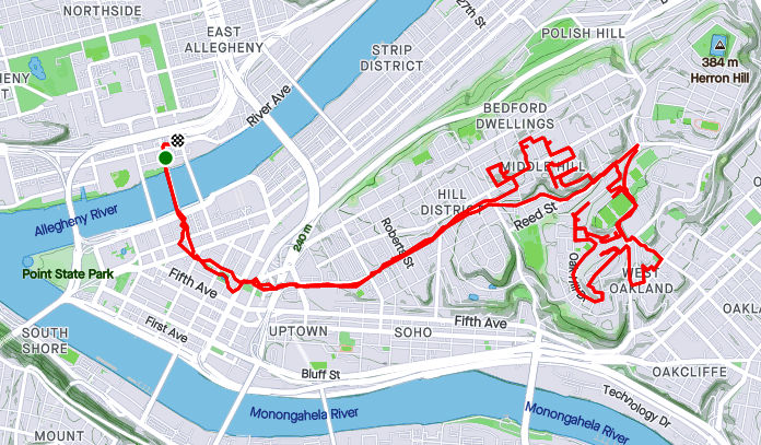
I started this Saturday afternoon’s run in North Oakland. The recent spate of snow had been cleared enough so that driving was tolerable, but dirty snow, pushed aside, lined most walks and gutters. University Drive in Oakland is still under construction, so I had to take a detour around that. Then I ran down Centre, crossing Herron and heading into the Hill. My target area was a number of small streets in the Middle Hill. Many of the streets were still undisturbed and had ankle deep snow in them.
Zero Street below Pitt
Blocked Off Hallet Street
Snowbound Horton
Snowy Wandless
Hallet, Horton, Humber, I must have stumbled into the “H” section of Pittsburgh, in the Hill District, no less. I have often pondered the easy alliteration of adjoining streets. Homewood has many “F” alleys, Brookline has its “B” streets. It’s kinda cute, unless you’re trying to remember where to turn by just the first letter. Oh, no!
At any rate, the alleys were deep in snow, but mainly passable. The ice-shoes were doing great and I wasn’t even too cold. Periodically, snow squalls blew through, diminishing my vision. Normally, you can see the UPMC building from the Somers’ steps.
Chauncy Drive
Steps into Somers Square
Humber Way
I came across a couple of sets of steps. One, Chauncy Street, I was familiar with. It’s a pretty impressive thoroughfare taking you down to Centre Avenue. The other, Caramel Way, was a bit of a surprise. On the map, it just looked like another alley. Blocked off at the top, it wasn’t from the bottom. Following some frozen footsteps up the mildly broken steps it was clear where treads were missing. I did have to duck under a downed tree, but it wasn’t too extreme.
Caramel Way Steps
Chauncy Street Steps
As usual, there were buildings ready to fall down and some historic markers. This plaque is dedicated to jazz great Art Blakey. Presumably he lived in the house? A rather oversized, chilly bass player was still out practicing in the snow.
Damn Gravity!
Bass Player
Art Blakey
I had fun on this run, in spite of the conditions. The shoes worked out well.
RATS #00369 – Lincoln Place
Route of RATS #00369 in Lincoln Place
And, now, to one of the southernmost neighborhoods in Pittsburgh. A week after that last run, the snow was still around, and it was a beautiful, sunny day. Snow really looks good on Pittsburgh.
My first order of business was to track down a staircase between Glenhurst and Lougean. I had missed it on an earlier run. So, I tromped down Mifflin Road, dodging cars until I got to Glenhurst. The wooden stairs were snuggled between two very suburban houses.
Steps from Glenhurst to Lougean
From there, it was an adventure on back alleys which went much further than I expected. “F” Way, “D” Way and “C” Way took me way back to country sheds. Overall, this was a nice area to run in. It was lacking in sidewalks, but also lacked in traffic.
Lincoln Place Greenway
Penguini
Eventually I found myself on Mooney Road, heading towards Mifflin Road. After Beechland Street, Mooney Road, itself, becomes a country road. This narrow street dives down a steep hill to Mifflin Road. Along this section, there are only three or four houses, each precariously perched on a hillside. As I approached Mifflin Road, I noticed a large house across the ravine. Strangely enough, no road or driveway was visible. I still wonder how those folks get home.
Mooney Road
Looking Down Mooney
By the time I had gone down Mooney and back to Beechland, the sun was sliding over the hillsides. I finished out a few more streets and cruised back to McBride Park, my favorite place to park.
I had a pretty good December this year. So good, in fact, that I’m STILL blogging about it, a week into the new year! I had many significant runs towards the end of the month, so that whole “catch-up” thing will have to wait. My running tends to be done when the opportunity arrives, while my writing is more of a record than an instantaneous news feed.
RATS #00337
RATS #00337
It was a dark and stormy night…
Lawrenceville Alley
Lonely Road
AR Chambers Supply
Actually, it wasn’t stormy, just cold. I’m pretty comfortable running through the alleys of the Strip District and Lawrenceville at night. While they look creepy, they are typically deserted. Darkness and narrow streets are harmless without people. OK, upon recent news (fork-lift getting caught in a sinkhole), I guess I should be more worried about sinkholes. Those would, indeed, be a problem in the dark.
This run covered some alleys and streets I had missed in my previous jaunts. Outside of the quickly gentrifying areas marked by condos and bars, old Lawrenceville still exists. It’s an area of warehouses filled with products that people need. Above is a picture of A.R. Chambers, a construction supply company. There are tire stores, wholesale food warehouses and many more. The wide streets and flat land are rare in Pittsburgh and are perfect for these businesses.
RATS #00342 – With South Park Trail Runners:
Filthy Five Plus One Minus One
Filthy Five with SPTR – RATS #00342
The South Park Trail Runners is a local, down to earth, trail running group in Pittsburgh. Friendly and energetic, they run all over the area. For this day, they, meaning Suzanne, organized a run on the “Filthy Five” course – five of the steepest and toughest hills in Pittsburgh. Actually one of them was in Wilkinsburg, but it was really, really close to being in Pittsburgh.
At any rate, I joined this lively group of runners as we made our way from Frick Park to the East Hills, where most of these hills were.
Colorful runners sliding up South Dallas
Going down Singer Steps
Dornbush Street, the Legend
Most of these roads I had already done, but taking a detour on Cassina Way made it a RATS run. Narcissus used to have a better place, I think; more like that Point Breeze mansion.
Cassina Way – that’s why its a RATS Run
Narcissus
Magnificent Point Breeze House
As is often the case on group runs, I got separated from the pack. I had raced several runners up the wrong hill and then completed the street. By the time I got back, the other runners were off on their merry way, voices echoing across the empty, snowy East Hills landscape. Luckily one of the residents told me “those marathoners went down the hill”. I pulled out the phone, found the maps and navigated to Ferndale Street, Dornbush Street and then to Hill Street, now in Wilkinsburg.
Snowy Mural
Cute House on Hill
At this point I had finished Hill Four, and made my way back my car in Frick Park. I had forgotten all about the Fifth Hill, in the park itself. Oh well, counting the wrong hill, I ended up with five hills after all.
Big snowfall still hanging around
RATS #00343 – Arlington
RATS #00343
The day after the Filthy Five Plus One Minus One, I embarked on an efficient RATS run in Arlington. I had carefully mapped out the route and was pretty happy how it turned out. I saw the Cathedral of Learning from the high hills, as well as Santa nestled between two cattywampus houses. Were they wishing for a level lot?
Lower Arlington
Santa Looking Bigger Than Life
I can see the Cathedral Of Learning from here!
Arlington is on the “back-side” of the South Side Slopes. It undulates wildly, with streets dead-ending at a steep ravine. It has it’s share of steps. The Dengler Steps are set back from the street and, it was only after seeing the boat that I thought, “there MUST be steps nearby”!
Boat Theory
Flack Street
Dengler Steps
Will Way
Rinne Street
Rinner Street Sign
Speaking of dead-ends, I’m always disappointed when they are blocked off. However, I can read and don’t really want to see any dogs up close.
No No No
Maybe
So that’s it for these three runs. I still have more of December 2020 to write about, but it’s almost done.
Snow livens up Pittsburgh in Winter. Without snow, Pittsburgh looks a little dreary and drab. Snow is like a fresh coat of paint. Here are two runs, a week apart in mid-December. They are in similar, rather suburban, parts of Pittsburgh. Before the snow, the streets are drab and faded, while afterwards, every hilly subdivision looks like a ski resort.
RATS #00340 – Brookline
RATS #00340 – Brookline
My 340th run for this project was on a chilly Sunday in Brookline. I started at Brookline Memorial Park and headed north to clear up a couple of alleys. Then I scooted across Fitch Way to Edgebrook Avenue on my way to a large block of streets off of Glenbury. In more social times, I’d expect the Boulevard Lounge to be hopping on a Steeler Sunday. As it was, it was empty and quiet. I only caught a block of Edgebrook Avenue, but it included steps. I was very good when I passed Santa Street. No use getting on the naughty list now. Very impressive weather station, I must say. It must have come in handy later in the week when the winter storm rolled in.
Steps on Edgebrook Ave
The Boulevard Lounge
Most color I saw all day
Santa Street
Brick Alley
Crazy About the Weather
RATS #00341 – Westwood
RATS #00341 – Starting in Westwood
Then a week later, I started a run from the Shop ‘N Save in Westwood. During the week, we had had an impressive snowstorm which plopped nine inches of snow throughout the area. The plow teams were efficient and the temps weren’t too cold, so the roads got cleared pretty quickly. The sidewalks, on the other hand, required some dedicated staff.
Slushy Sidewalks to Start
Kearns Avenue with Trimont peeking over the hill
This section of Westwood has a a mix of suburban style subdivisions sprinkled with older homes. The snow blended everything into a ski-chalet look. Kearns Avenue was a key point to this run. On several maps, it is shown to be closed off for a section. That’s a pity, because it would be an alternate route for Greentree Road as it comes out of the West End. Anyway, I was curious as to just how “closed” it was, so intended to see how far I could go before it got dark.
Looking out from Oak Brook Circle
Waning Sun
Well, Kearns has been closed so long that grasping bushes are beginning to take it over. Passing the Jersey barriers, no foot falls crushed the snow before me, no tracks of dogs or strollers, no ski lanes; just deer tracks and rabbit paws. A little rivulet trickled down the hill with me. Tromping for two tenths of a mile, I finally came to the other side. Here, a pair of tire tracks slithered to the last house on the street. I followed the tire tracks, as they descended another two tenths of a mile.
Bunny Trails To You
Here, the single houses gave way to industrial buildings. Quality Concrete has a fleet of trucks parked beyond their barbed-wire fence. Kearns ends at McCartney Street. I took the left and ran about a quarter mile towards its dead-end. McCartney sits at the bottom of a ravine. Noblestown Road, aka Route 60, is high above on the right. The hills of Westwood were on the left. I would imagine the area is ripe for flooding. Where’s there’s flooding, there are boats. Where there’s boats, there are stairs. No exception here.
Crumbling Steps to Noblestown Road
Boat Across From Steps
McCartney Street intersects Greentree Road in the West End, formerly known as Temperanceville. Boy, that’s a mouthful. There’s a concrete plant there, a glass studio and a couple of other businesses.
Quality Concrete
Temperanceville Sign
I took Greentree Road back up the hill, running in the street when it was clear and jumping into the slush when it wasn’t. The hill wasn’t a picnic either, rising 445 feet in a mile.
But before too long, I was back in Westwood climbing into my car. Cool run!
This November, I kept up my streak of 100 mile months and 10k+ elevation gains. I did hit some road blocks. While totally predictable, early darkness wreaked havoc on my running habits. Not so predictable was a week of quarantining due to Covid-19 exposure. Either way, I had sixteen runs in November, of which thirteen of them covered new streets. I am closing in on completing 70% of Pittsburgh’s streets. I wasn’t too good at blogging, though.
RATS #00328
RATS #00328 in Brookline
Hungry Hungry Hippo
Flag in the Dark Park
Twilight
This was a short run starting at Brookline Memorial Park covering Oakridge and Freedom Streets. The brilliant sunset gave way to just the slightest sliver of the moon. I caught the hippo in dusk, but the flag was still up when I returned in the dark. Aren’t flags supposed to be taken down or lit at night?
RATS #00329
RATS #00329 in East Liberty
Festive Lights
Steps from Highland to Ellsworth
This four mile run also embraced the dark. I started with a few Shadyside streets and then ventured into East Liberty and Larimer. Missing my turn, I went up Lincoln Avenue instead of Lowell Street, seriously disrupting my planned route. Yet, with only 88 feet of elevation, I enjoyed this, the flattest run I had done in awhile. Eventually though, beyond the stores and street lights of East Liberty, the poorly lit streets and unfamiliar area got to me and I skedaddled back to my car, using the steps down to Ellsworth Avenue as a shortcut. It turns out, even those steps are “official” city steps.
RATS #00330
RATS #00330 in the West End
Ah, the West End. The overlook has my favorite view of downtown. It also has a little parking lot, so it’s a great place to start. Balloons and candles remained for “KMB”, whomever that is.
West End Overlook
Luv U Too, KMB!
I had visited this area several times already, but had missed some streets. The West End is unrelenting in its hills. Streets going toward the river are extremely steep, but even the cross streets bounce up and down. I ran up to St. Martin Cemetery crisscrossing the neighborhood on little streets and alleys. These unofficial steps on Navajo Way were a lucky break. Otherwise I would have had to run around those blocks again.
Navajo Way Steps
West End Alley
St. Martin’s Cemetery
I headed downhill and ventured out Chartiers Avenue a bit; going up Litchfield Street. This “street” consists of several impressive flights of stairs. The streets are less impressive, generally winding up hills to arrive in someone’s garage. None of those streets are thruways.
Litchfield Street Steps
Chartiers Avenue Mural
RATS #00331
RATS #00331 in Highland Park and East Liberty
A portrait of alleys in Highland Park. I amazed that it took nine miles to wander up and down all those alleys. Some were brick, some were asphalt. Mostly they were straight, while a few zigzagged.
Along the alleys were some immense houses and a few apartment buildings.
Grand old house
Modern Remodeling
Tucked Away Up a Hill
And, of course, I can’t resist a Little Library.
RATS #00332
RATS #00332 – Homewood
This was a Thanksgiving Day run. I started in Swisshelm Park and went up Braddock Avenue to find its northern terminus, passing one of my favorite stores, 3 Rivers Outdoors. It is a small business specializing in outdoor gear. They also sponsor a trail running group and fun community activities. Going south, Braddock Avenue goes to Braddock, of course. ( Actually it veers east, trails past steel mills and winds up in Turtle Creek, if you must know.) On the northern end, it just stops unceremoniously in Homewood at a playground.
3Roc – Cool Store
Murals at the playground at the end of Braddock Avenue
My previous run in Highland Park was mainly in alleys. Homewood has its alleys too, a bunch of “f”ing alleys; Formosa Way, Fleury Way, Finance Way, Forrest Way, Fuschia Way, and Fielding Way to name a few. I did a couple of these alleys, then climbed Calway Street. Calway Street struggles up a steep hill for a few houses and then is blocked off as it wanders into the woods. Turning around, I got a neat view of Homewood, its bowl filled with homes as downtown buildings peeked over the ridge. Returning down toward Braddock Avenue, I came across another Little Library, this one in purple. By the time I returned to Swisshelm Park through Frick Park, I had run ten miles.
Homewood Alley
Pierogie Truck
Looking Downtown from Calway Street
Little Purple Library
RATS #00333
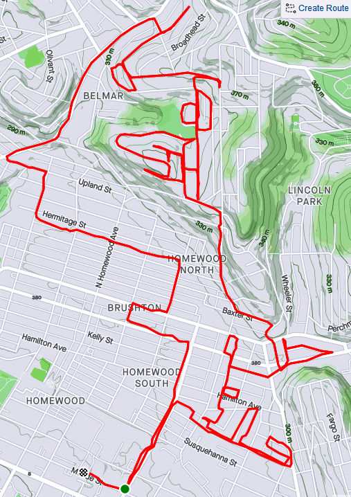
RATS #00333 – Homewood and Belmar
This run was something of a continuation of the previous run. I pushed further into North Homewood and Belmar. Right off the bat, I roused two deer from their Homewood bed under a stairwell. There’s a confusing mix of streets here, where Pittsburgh collides with Wilkinsburg. The older warehouses and buildings are mainly deserted. After crossing off a number of small streets and alleys off my list, I headed up Brushton Avenue and Stranahan Street.
Surprised Deer
Typical North Homewood Street
After crossing several streets and alleys off my list, I headed up Brushton Avenue and Stranahan Street to a small subdivision. Water authority construction workers were busy digging and putting down pipe. Their store of fire hydrants looked like an arsenal of rockets. It was a rather chilly day and no one was playing hoops when I passed by.
Lonely Hoop
Tilden Street
Rocket’s Red Hydrants
Completing the loop around Tilden, I went up Oberlin Street. At the end, a ragged set of steps took me up to Somerset Street. Somerset Street was high and wide, but I was ready to find my way home again so I found the Toga Way steps. Toga Way took me down steps littered with monkey balls. What are monkey balls? Check this Incline article for the full story, but they are the fruit of “Maclura pomifera”, commonly known as the Osage orange tree.
Steps to Somerset Street
A boat, of course
Togo Way Steps
Toga Way and Westmoreland Avenue
In another confirmation of boat theory, I saw several, nestled in the woods near the steps.
RATS #00334
RATS #00334 with Rich
My friend, Rich, came with me on this adventure. Once again, I explored North Homewood and Belmar neighborhoods. We covered lots of ground and Rich made the miles go by easily. Here’s Rich, out standing in his field. He has a good eye for photography and takes nice pics.
A surprisingly sunny day, we made our way to the entrance of the VA Hospital grounds. Unfortunately, it was blocked off with vigorous “No Trespassing Signs”. With that route blocked, though, we found our way to a rusty water tower high above the Allegheny. I convinced Rich to NOT climb it.
Big rusty water tower
Made it to the water tower
Back entrance to the VA was blocked off
Surprisingly Hidden Water Tower
Bring Me the Horizon
From the top there, you could see way up the Allegheny River Valley. There was another water tower, but with its light blue paint and the sunny skies, it was actually hard to see.
In planning this route, I was using Google Street view to verify that streets went through. I was shocked when the street view took me from a rather derelict Ferdinand Alley to a sweeping country vista. Whoops! A glitch in the Matrix.
Ferdinand Way vs Google Street View
This is not the only street in North Homewood that does this.
Nonetheless, we ran by the quickly deteriorating Negro Opera House, took in the Laporte Street Steps and just meandered. Rich is pretty friendly and by the time we were done, he had waved to the black ladies going to church, some guys fixing their cars and just about anyone who showed their face.
Laporte Street Steps
House high on a hill
Country Road?
Negro Opera House is in worse repair now than six months ago
It was nice to run with company to end this month.
February was a busy month for running all the streets of Pittsburgh. Of the twenty runs I recorded to Strava, fifteen of them covered new territory. I was also pretty good about posting, so there are only five runs in this wrap-up. Overall, I feel I’m making good progress, with an increasing number of runs in new areas, such as Homewood and Larimar in the East; Brighton Heights and Marshall-Shadeland in the North, as well another foray in Beechview. By the end of February I had completed 191 “Run All The Streets” runs, so that 200th one is coming up soon!
It’s also been an exciting month planning an event, “Take the Stairs FatAss” – a 50K and 25k fatass (unsupported run) around the city, using many of the Pittsburgh city steps along the way.
Run #00179
Run #00179 was a group run with PBR, from Cinderlands, a bar-restaurant. Towards the end of the run, I caught a few new blocks in Lawrenceville.
RATS #00179
Run #00181
RATS run #00181 was a Saturday group run organized by PBR. It also featured a pierogie and pie fundraiser for Team NDSS, organized by Gina. I ambled along the snowy streets of the Strip District, taking pics and trying to stay upright in those slippery conditions.
RATS #00181
It ran past 31st Street Studios Stage doors and under Iron City Brewing’s tall smokestack. I ran past old four-story warehouses and gleaming new condos.
31st Street Studios
Iron City Brewing
Old Warehouse – now UHaul
New Condos, in the Ugly Style
Some of the shortest stairs on the 50K route are here, as well as the 28th Street Bridge and a forlorn hopper, towering over silent tracks.
Short Stairs
28th Street Bridge
32nd Street along the 31st Street Studios
Remnant of a more industrial time
RATS Run #00186
Again, this was a PBR run, onto which I tacked on a couple of streets in Bloomfield, Garnet Way in particular.
RATS #00186
RATS Run #00187 – so Dark!
A run through the tiny streets of Park Place. Very nice houses crowded together in dark alleys, camouflaging many speed bumps, one of which tripped me up. Torn tights and a bruised hand were the result, but nothing serious.
RATS #00187
RATS Run #00191
This was a short run in the West End Overlook area with stunning views and merciless hills. Like some runs beforehand, a planned route with RunGo was interrupted by the reality that not all alleys on paper survive IRL.
RATS #00191
Marlow Street
West End Houses
West End Overlook
The West End neighborhood wraps around the hillside and spits you out on dirt roads ending on a cliff. Usually there’s a “No Outlet” sign, but not here.
Herrod Street
Where does this go?
Nowhere – just to a view over the Ohio River
With Spring almost upon us, the threat of cold weather is nearly gone and I’m looking forward to many miles in March.
This was my favorite type of run – start with friends and then grab some new streets on the way back. Actually, my FAVORITE run would have been to have all these folks come with me, but a 300′ hill is a hard sell.
Pre-run Groupfie with Pro Bike
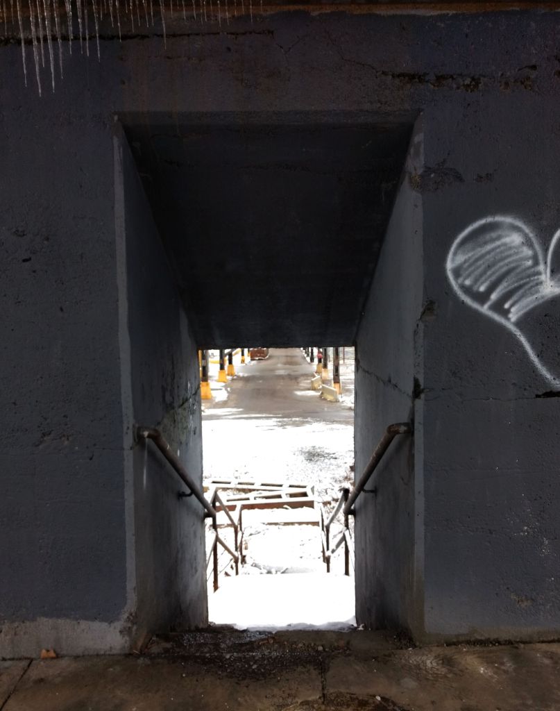
It was a cool, humid and cloudy morning. Temps held steady in the low 40’s with intermittent drizzle. We started at Ascend, nestled as it is between old multi-story brick buildings. We made our way to the Liberty Bridge, accessing the sidewalk via a muddy walk-way under the bridge and a short set of stairs to the deck. Once on the deck, the downtown skyline spread out before us.
Brew House Building outside Ascend
Downtown from the Liberty Bridge
Once in downtown, we zigged and zagged toward a water stop near the Wyndham. This was three miles in. The planned route took the group in a cloverleaf around downtown, coming back to this water stop several times. I decided to branch out on my own. I had various choices – explore more of Brighton Heights; criss-cross my way through Manchester; climb Greenleaf onto Mount Washington. Eventually, I decided on Greenleaf, in part because it was going to be closed for construction soon. After some tearful goodbyes (just kidding, a couple of people waved bye), I started out.
Downtown from West End Bridge
Looking Up the Ohio River
Now getting to Greenleaf is not straightforward. It is a small residential street which falls off of Mt. Washington into the West End Circle. To get to the West End Circle, I had to cross the West End Bridge and find my way to the other side of the Circle. The West End Bridge has approach ramps and stairs for pedestrians. The pedestrian ramps are notoriously flexible and you can feel it bucking up and down when a group runs across.
After crossing the bridge, I was able to cut across the circle, passing the end of Sawmill Run (notorious for flooding). Finally, I got to the base of Greenleaf Street.
Bouncy Bridge
Sawmill Run
Base of Greenleaf
Elevation Profile. Marker is at base of Greenleaf St
From here it was up. On one hand there’s no sidewalks, on the other hand, there’s not much traffic. Even though you’re supposed to run facing traffic, on hills like this, I find running on the uphill side better. Cars aren’t going to be zipping by. Pretty quickly, Greenleaf climbed high enough to start showing off views.
Looking down Greenleaf towards West End Bridge
West End Neighborhood
At the top, Greenleaf wraps around into the modest residential neighborhood of Duquesne Heights. George and Guy Trail hugs the cliff below Skookum Field, where a baseball hit 190′ would tumble far down the cliff.
Crazy Trail
Home Run Distance
The views are spectacular and several snazzy houses vie for space along the cliff with the WBZZ radio tower. Small lanes between the newer houses had the best security. I felt watched.
Ent Vision
View from WBZZ
Greenleaf Street continued through Duquesne Heights. This is an interesting area. Tall narrow houses are literally under large view-hogging condos. Street stairs and connecting stairs abounded. Greenleaf Street transformed into a stairway before transforming again into an alley. Sioux Way was part-stair, part brick.
Typical Duquense Heights View, with various types of houses and stairs
Finally, I made my way to Grandview Avenue, that popular promenade overlooking Pittsburgh. At the eastern end of Grandview, Vinecliff Street, a weathered set of stairs and asphalt, struggles down the hill. I took that en route to finishing back at Ascend.
Greenleaf Street Stairs, Sioux Way Stairs, Vinecliff, up and down.