For this run, I started in the upper reaches of South Squirrel Hill then made my way across the Monongahela to New Homestead. I parked near Forward and Beechwood and trotted down the hill to Summerset. It’s a nice development of newer houses built atop a slag heap. There’s a tree-lined entrance and sweeping views of the Mon. More importantly, it’s a shortcut to Dunkin Donuts and Bruster’s Ice Cream! Mark down THIS route.
Below Summerset, the Jewish Association on Aging has several housing facilities from apartments to assisted living. In addition to a high-rise, college-like buildings dot the well-maintained grounds. This little bird seemed out of place, hopping around on the sidewalk, chirping.
Summerset Entrance
Birdie!
Jewish Association on Aging
This leads to Browns Hill Road. Take the right and you’re at Brusters, with Dunkin Donuts at the next light. Alas, my trek took me down Browns Hill Road, where the sidewalks are iffy. Sometime you have them, sometimes you don’t. I crossed the street at an inopportune spot and got a gutter. Finally out on the Homestead High Level Bridge, I was treated with views of the Mon and a laden train far below.
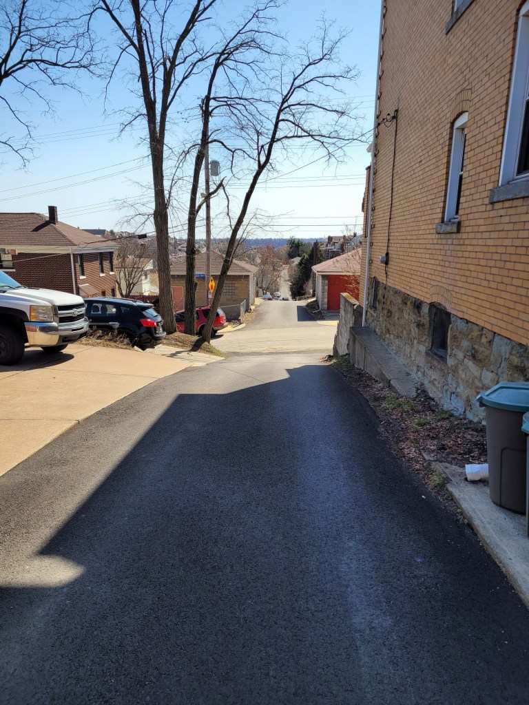
Brownshill Road
Homestead High Level Bridge
Blue Gravel Train
Between the still-standing smokestacks and the ever-present railroads, reminders of the steel heritage of Homestead remain. This is roughly the site of the famous “Homestead Strike“. Just off the end of the bridge to the left is a bar, Blue Dust, named for the blue dust which covered steelworkers’ clothes after a shift.
But Homestead is not within the city limits of Pittsburgh, I was just passing through. Heading toward New Homestead I found a short-cut; steps leading from 8th Avenue to Basic Street. At the top of the steps, there is a view of the old smokestacks.
HHLB
Steps from 8th to Basic
Old Smokestacks
Turning again, I slogged up the steep hill which would take me back into the City of Pittsburgh. Beyond the impressive retaining wall, I found a little grotto. Perhaps it isn’t the safest place, what with rocks tumbling about, but the “Park Here” sign was certainly welcoming.
Rounding the corner, Basic Street enters New Homestead and becomes a paper street, disappearing for a half-mile. It is an area of half-acre yards and modest homes. According to CityStrides, Benezet and Bench Way continue, making a circle. Well, not really. They are more like street stubs with new construction going on.
New Construction
And that was about it. I retraced my steps out of New Homestead, passing the Bulgarian-Macedonian National Economic and Cultural Center (BMNECC, for short). Last time I checked, it operated as an event venue, for dances and parties, while its bulletin board had flyers for lessons in Bulgarian. Eventually I crossed the Homestead High-Level Bridge again, this time getting an evening view of Duck Hollow.
Bulgarian Macedonian National Economic and Cultural Center
Route of RATS #00416 Across the McKees Rocks Bridge and into Chateau
It was a humid summer evening in the ‘Burgh. Clouds pregnant with rain hung heavy over the city. Steam from earlier rains rose up to greet the newborns. This was the evening of Tuesday, June 8 and I was struggling. Mapping out ‘efficient’ runs has become more difficult. So, I figured, I’d do a simple run; complete Brighton Heights Boulevard, cross the McKees Rocks Bridge and then find the OTHER piece of Branchport Street I had previously missed.
I parked on Termon Avenue and scampered toward the McKees Rocks Bridge. It is a little annoying that sidewalks disappear from one side of the road, forcing you to cross. Par for the course, I suppose. Crossing Route 65, where it hits the bridge is a lesson in patience, but doable. If I remember correctly, only one side of the bridge had an open sidewalk. Once I got there, though, I was rewarded with great views down the Ohio on the right and down into an Alcosan waste water treatment plant on the other.
Barge Coming Down the Ohio
Alcosan Waste Water
I must say, those churning tanks were mesmerizing. So many of them! Some were empty and surprisingly deep; maybe ten feet or more. On an amusing note, there is a high chain-link fence right above those tanks, presumably to reduce the chance of people falling in or having debris thrown in, mucking up the plumbing.
Unfortunately, the high fence stopped and only a low barrier separated me, the runner, from falling into the river. I found it unnerving, especially when the walkway went around the pier on the outside.
I made it to the other side just fine, of course, and was rewarded with steamy views of downtown, so far from the Bottoms, yet so close.
Downtown Pittsburgh from McKees Rocks Bridge
Simply returning across the bridge, I got to appreciate the views again. Then I trundled down California Avenue to the Eckert Street Steps.
RR Superhighway
Churning and Churning
Rivets and Plates
Eckert Street Steps
Now, this section of the run was mainly due to poor planning. Earlier, I had run many of the streets in Chateau, but somehow missed that Branchport Street. This time, running down Eckert, I kept a mantra of “street after the marina”, “street after the marina”. I did get some nice views of the Ohio. “Street after the marina”, “street after the marina”. Look at that cool railroad bridge. “Street after the marina”, “street after the marina”.
Eckert Street Viaduct
Ohio River Railroad Crossing
Missed it. Whoops! Turning around, I finally came across it, a mere driveway.
Branchport Street, the Other
With this, I returned up the steps, up California Avenue and right onto Brighton Heights Boulevard. The Brighton Heights Bunny welcomed me back.
On this bright Saturday morning, a group of friends, led by Bob and Nancy, were doing the South Side Slopes piece of the “Take the Stairs Fatass” 50k. That route draws a jagged circle around Pittsburgh, starting in Spring Garden. An unsupported event (e.g. a ‘fatass’), it uses over 70 flights of city steps to bring the participants to some of the best views highlighting the city.
Anyway, I was NOT doing it, but figured I could meet up them. Sure enough, shortly after I parked in the South Side, I ran into them huffing and puffing up Eleanor Street. It has great views, and everyone in Pittsburgh should do them.
Breaking off after a few blocks, I continued through Arlington and to Amanda Street as it cuts down to Carrick. I needed to complete Charlock Way and Dove Way.
Not All City Steps Are Impressive!
Charlock Way
Amanda Avenue
Also Amanda Avenue
This area of the city; Knoxville, Mount Oliver, Mount Oliver Borough and Beltzhoover, are tightly packed. In some lucky areas, trees throw some shade, while in others, it is just sun, concrete and houses. Dove Way sounds pleasant enough, like the gentle cooing of mourning doves as the sun comes up over a green yard edged by flowers. The reality is different. It goes behind narrow towering houses leaning on each other for support. Grimes Avenue, while aptly named, at least has some trees.
Courtyard with a pool
View from Dove Way
Grimes Avenue
Continuing the bird theme, I cut down through Partridge Way and a little unnamed alley off of Hawk Way.
Partridge Way
Hawk’s Neighbor
Finally, I went back to Brownsville Road, passing the flower vendor en route to Borough Way. Borough Way straddles the southern border of the Borough of Mt Oliver and the City of Pittsburgh. At the end of Borough Way sits Traverse Field, which has little league baseball games. I finished up a little alley there and made my way back over the big hill, back to the South Side. It was a hilly seven miler. I was beat at the end.
I’ve written about you often and been through your maze of streets and alleys more than once. However, there’s always a little more of you. This was a Sunday afternoon run to tie up loose ends. El Court, for instance. On my first run past, I thought it was a sketchy driveway. Going around the block and back, I decided it was just sketchy, not a driveway. It has the style of row houses facing each other. Of course, a car was parked at the end facing outward. Why not?
I’ve found that this style of housing, with its row houses enclosing some sort of walkway or driveway, is found occasionally across the city, typically in older neighborhoods, Lawrenceville, Oakland and Perry Hilltop for instance. El Court, however, takes the cake for disrepair.
Another street I needed was Annan Way. It intersects North Braddock and parallels the busway as it heads toward North Homewood Avenue. Cinnibar Way is a similar-looking alley but isn’t nearly as long. It does have that typical red-brick paving of most of Homewood’s alleys.
El Court – little more than a driveway
Annan Way and North Braddock
Annan Way
Cinnabar Way
Prior to getting here, though, I traipsed up Inglenook Place. I had done that area earlier, with its long flight of stairs up to Sickle Street. However, I had missed a tree-lined alley, Hackett Way, earlier. Actually, earlier I didn’t think it was even a street. But it is, and there I was, running it down. I didn’t get a good picture of it, but it’s right under those trees at the top of the steps.
Imposing House at Inglenook Steps
First Section of Inglenook Steps
In spite of rampant dumping in alleys, deer frequent the open grassy lots. Cuddy’s looks like a store from the 50’s.
Murals adorn many brick buildings. As I was discussing with a friend recently, these are ‘paid’ art; I call it graffiti gentrification. Most of it is pretty cool with real design and artistic talent. Of course, it’s just not the same as the midnight taggers marking their territory.
And that’s about it.
RATS Run #00412
I started this run, run #00412, across the Allegheny River. It is “officially” in the Lincoln-Lemington-Belmar neighborhood. Mostly, though, is a an Aspinwall, Fox Chapel shopping area.
“Cinema Hospital”?
Shopping R-Us
Stores Go On Forever
Old Railroad Trestle in Aspinwall
After getting all the way to Fox Chapel Road, I retraced my steps and crossed the Highland Park Bridge. It crosses the Allegheny just upriver from “Lock and Dam 2”. It is a fairly simple lock and dam, maybe nine or ten feet high.
Empty Traincars
Morningside Rising Above the River
Sixmile Island
Lock and Dam 2
View from Downstream
I ran past scads of cars slowly making their way into the Pittsburgh Zoo. It was a beautiful Memorial Day and the zoo looked packed. Just beyond One Wild Place, I took a detour off of Butler Street to do Ballard Way, Gallatin Street and the Jancey Street Steps.
Jancey Steps
Top Jancey Steps
Tall and Thin
Moving on down Butler Street, I noticed what seems to be large amounts of dumping down near railroad tracks. Turns out, this is an auto-salvage business and the mountain of metal will, I assume, be recycled. I stumbled upon a few streets which took me under the 62nd Street Bridge.
Apparently, the authorities frown on people dismantling their cars down here. What the heck?! In this land of the free, why can’t I just dismantle my car wherever I feel like it? Sheez! That sign made me so mad, I think I’ll just keep my car intact. Take THAT!
Silly rant aside, it was another world, down there under the bridge. Much more active than I thought it would be.
Moving on, I went up onto the bridge and ran across. Halfway across I was officially out of Pittsburgh and into Shaler. It does have some cools views of the city, must say. Of course, as I approached the northern end of the bridge, I crossed the ubiquitous railroad tracks again.
I love the sprawl of the clouds here
Downtown Pittsburgh
Railroads into the Distance
Another eight miles in the books.
So, that is it for May 2021. In spite of a week of travel, I ran over 100 miles. I’m slowly chipping away at the streets.
Prior to this project, I did not appreciate the size of Beltzhoover. Now, I appreciate it, as I keep going back to ‘finish’ up more alleys and cul-de-sac’s. This run, run #00410, was on a beautiful Sunday morning, but my plans were immediately altered. My old nemesis, “Nonexisting Streets” was at it again; Pear Way, for example.
Irises Along Beltzhoover Ave
Cardiff Way
Supposed to be Pear Way
Once Habermann Street
However, I persisted and found my way down many a country road there. Yes folks, this is a reputedly tough inner city neighborhood.
Freeland or Cardiff
Typical
Lehr Way
Palmetto Way Ends at a School
Also Lehr Way
I’m often a little tense running through alleys like this because I’m not sure what I will find. I generally shouldn’t worry too much; mainly I’m dodging chipmunks, squirrels, groundhogs, the occasional cat and sometimes deer. Every once in awhile, I’ll come across someone walking their dog.
This is not to say these alleys are pristine. Often decaying garages house cars which haven’t moved in a generation. Tires and garbage are common. I do believe there is a City of Pittsburgh Ordinance about the cars, though. Oh, here it is:
The accumulation and storage of abandoned, wrecked, dismantled or inoperative vehicles, or parts thereof, on private or public property, not including highways, is found to create a condition tending to reduce the value of private property, to promote blight and deterioration, to invite plundering, to create fire hazards, to constitute an attractive nuisance creating a hazard to the health and safety of minors, to create a harborage for rodents and insects and to be injurious to the health, safety and general welfare. Therefore, the presence of an abandoned, wrecked, dismantled or inoperative vehicle, or parts thereof, on private or public property, not including highways, except expressly as hereinafter permitted, is a public nuisance which may be abated as such in accordance with the provisions of this chapter. [Ord. 664 C.S. § 1, 1973.]
If only this were enforced! Maybe it is just too much hassle and paperwork, I don’t know.
Now, at some point someone decided that a directional sign pointing to Beltzhoover’s amenities was a good idea. It sounds like a great idea to me too! However, apparently there wasn’t any money to keep the right of way mowed or stairs intact, so now the sign is rather ridiculous. The pic below on the right were steps prior to 2007, if I’m not mistaken. Of course, these days, with smartphones and maps, I don’t think we need directional signs that much.
That was about it for alleys of Beltzhoover. I’m sure I’ve missed some and will be back.
An Epic Run From McKinley Park
RATS Run #00410 from McKinley Park to Brookline and Back
This run, RATS run #00410, started pretty close to the previous run, run #00409. However, I went in an entirely different direction, down Bausman to Saw Mill Run Boulevard. My main goal was completing Edgebrook Avenue. I did that and added a few charming streets.
McKinley Park is fairly large. The main access to it is along Bausman Street, where folks park along the road and have picnics, play hoops and skateboard. However, it was a rainy Saturday morning when I went through, so the park was deserted.
At the bottom of the hill, Bausman ends at Saw Mill Run Boulevard. This is only a quarter mile from the Liberty Tubes, so it is very busy. T-tracks tower overhead and a thriving thrift store sits across the intersection. You might notice the picture with the T is bright and sunny, while the Thift store is all gray. That’s because I did this one section twice. The first time, my GPS failed, so I felt compelled to do it again. (Argh!)
T-Tracks
Behind the thrift store, Timberland Avenue crosses a closed bridge and runs past a couple of derelict houses before disappearing in a tangle of underbrush. The stream, Saw Mill Run, still has car carcasses littering the gravel.
Timberland Avenue
End of Timberland
Look! Rebar! And Water!
Car Carcasses
Now running down Saw Mill Run Boulevard, the sidewalk disappeared, so it was crappy running. How about getting sidewalks here? Anyone? Buehler? Buehler?
Pedestrian Paths Along Saw Mill Run Boulevard
There were some curiosities along the way. I feel like this truck was trying to hide, parked as it was between a shipping container and a billboard. However, it was as successful as an elephant hiding behind a refrigerator. While the door below is kinda cool, in that battered-steel-door genre, I really like the retro numbering next to it. (I’m sure it is original, not really retro at all.)
I finally got to Edgebrook Avenue. It actually starts under the T and even has a couch for resting. (Apparently having indoor furniture outdoors is against city ordinances, too.) Then Edgebrook Avenue passes a small car dealership and rises into Brookline, rising along a winding, wooded valley.
I found the golden sofa!
Dueling Dumpsters Under the T
Hmm, Can I get my car out?
Edgebrook Avenue into Brookline
Up toward Brookline, several small streets branch off of Edgebrook Avenue. Milan Street used to have steps to Whited Street. But then, a tree fell. And fallen trees can’t be removed.
Milan Street
Milan Steps, now Squished
As always, people decorate their places. This goose was very appropriately dressed, while the fairy garden was trying to bring magic into the day.
I magically lumbered down Brookline Avenue to Pioneer Avenue, catching Oleatha Way en route. Then I decided to cross West Liberty Avenue and check out a couple of streets rising from beneath the Norfolk and Western train trestle. One just led to a city vehicle impoundment area, but Dawn Avenue rose on cobblestoned paths up the slope to Charm Street. Charm Street, ah, well, take a look and tell me how charming it is.
Dawn Looking into the Busway
West Liberty Avenue
Charm Street
I was, honestly, surprised how far Charm Street extended. But at the end, well, it was dead. Again, I’ve taken a liking for doors, so here are a couple.
Dawn Street has its own South Busway stop and apparently a T stop. Stairs on one side led across to steep stairs on the other. Before coming down, I had a good look at that Norfolk and Western line. Such an impressive bridge for just one track.
Finally, I rounded the corner and found myself at the Thrift Store on Saw Mill Run again. I slogged up Bausman, taking a small detour for Lorna Way, another Beltzhoover alley.
Lorna Way
That’s all for now. Just remember, keep your couches inside and your cars operational. And, for goodness sake, stop driving into creeks.
On this glorious Saturday morning, I ventured out to Esplen and Sheraden again. Nearly the site of my first run! I had no idea what I was getting myself in for! But now, I had to revisit to track down Bagdad Way in Esplen as well as several alleys up in Sheraden as well.
“Bagdad” conjures up visions of a sprawling, dusty strange city. Bagdad Way was nothing like that. Maybe the car wash at the end of the alley helps keep things clean? At any rate, its a short hop from the big bend of Rt 51 as it cruises out of Pittsburgh, crosses Chartiers Creek and hits the big city lights of McKees Rocks.
Chartiers Creek
Bagdad Way
Up Stadium Street Past the Tanker Cars
Drumming down Tabor Street from Rt 51 to Radcliffe Street, I took the left over railroad tracks down below. Right thereafter took me up Stadium Street. It rises sharply, quickly towering above the tracks filled with a waiting train full of tanker cars. Stadium Street is blocked off halfway up. It seems that the road is sliding off the hill, as it has been for at least a year. At the top of Stadium, I found myself in a rather pleasant, rather flat neighborhood. Fronona Way did an excellent job trying to hide, but eventually I found it.
Now, I have done much of this area before, but since I’m doing streets end-to-end, a missed block here or there means I need to revisit it. Ironically enough, CityStrides will call it complete if I just hit all their nodes (intersections). Speaking of which, take Wyckoff Avenue, part stairs, part alley and all hill, I had done most of Wyckoff earlier, but was determined to finish it end-to-end. I get a kick out of the “Avenue” moniker. It is slightly better than an alley for the most part.
Wyckoff Steps
Wyckoff and Merwyn
At any rate, a short jaunt up Narcissus Avenue took me high above the Ohio. Properly taking a selfie, as everyone should, I took some time out from admiring myself to admiring the sweeping views. The Glasgow Steps took me even higher.
Selfie on Narcissus
Sacramento Street
Glasgow Street Steps
Coming back down to earth, I followed Stafford Street to the little dead-end of Adena Street. On my original (OpenStreets) map, Adena meets up with Joslyn Street, which connects with Strickler Street. However on Google Maps, Adena dead-ends, Joslyn doesn’t exist and Strickler dead-ends after a sharp elbow. Running to the end of Adena these days, I saw some hints an ongoing street, but houses and fences blocked the way. I cut over to “lower” Adena street, which meets Stadium. Curious about the view, I progressed on Stadium towards the Ohio River. The street is blocked-off on this end, too. There was some pavement on the other side of the jersey barrier, so I continued. The pavement disappeared into underbrush but not before a little switchback. I wonder if this is the remains of Joslyn Street? Or of the mysterious Saratoga Street and Gilroy Street?
Saratoga? Gilroy? Or just Fridge?
Joslyn, is that you?
Ohio River Looking at McKees Rocks Bridge with Esplen in Foreground
I retraced my steps and again crossed Chartier Creek, happy with this adventure.
Once again, you get two May runs in this blog. The first, RATS run #00405, was on a gray day in Upper Lawrenceville. The second, RATS run #00406, was on a cool, but sunny, day in Spring Garden.
RATS run #00405 in Upper Lawrenceville
51st Street, Berlin Way and Harrison Street were the objects of my footfalls on this Thursday evening. It was relatively flat, except the jaunt up to Bissel Way, with its little surprise.
Power Tower
Power Base
Cavacini Landscaping
Cavacini Landscaping was bursting with flowers and shrubs ready for planting. I’ve rarely been on this section of 51st Street in daylight, so this was a surprise for me. (Spirit, up the street, is a popular nighttime music venue.) Further towards the Allegheny, 51st Street crosses old railroad tracks and ends at a power line tower.
Transformer Cage
Takes You Right Dahntahn
From here I scuttled past the Goodwill Building and onto Berlin Way. It is only a block from Butler Street and you can see murals on the back walls of Butler Street businesses.
Dive Bar – “Come As You Are”
Interesting Historic Images Mural
But Berlin Way isn’t free end-to-end. Portions of it run afoul of chain link fences and nondescript buildings. However, Adelman’s Lumber looks cool, as did the sun setting way down a 55th Street alley.
Berlin and McCandless
No Go Berlin
Adelman Lumber Yard
55th Street and Setting Sun
Finally caught the end of Bissel Way and found this rusted monolith stretching to the next hillside. What is it? A lost railroad spur? A preemptive retaining wall with nothing to retain? I don’t know.
Little Houses of Lawrenceville
Reflection of Contruction
Rusted Monolith
That was it. Three miles on a Thursday evening.
RATS Run #00406 in Spring Garden
RATS run #00406 was my Saturday long run. I mainly focused on side-streets off of Spring Garden Avenue and then touched a couple of other missed streets as I rounded out the run in Perry Hilltop, California-Kirkbride and Allegheny West.
I started with a little detour up some steps to Salter Way. It looked like the yellow handrail has gotten hit by a car. Nonetheless, Salter Way is a short alley dead-ending into the hillside. Several houses are boarded up, and they even have guards. Cat guards, that it is. This no-nonsense kitty strode right up to me and, after shout-meowing at me, escorted me off the street.
Steps Around to Salter
Salter Way
Guard Cat Approaching
Guard Cat Escorting Me Away
Welcome To Spring Garden
The Welcome to Spring Garden sign is a bit of a ruse, I think. I don’t find it a very welcoming area, but perhaps it is just claustrophobia from the towering hills and overwhelming vegetation. I do get a kick out of the clock at the back wall there. Don’t stay too long!
Further on Spring Garden Avenue, I kept branching off onto the little streets, which tiredly run out of asphalt and just end. Some spots have several little streets with houses huddled together.
Marshall’s, of course
Borough Street
Cabin Street (is basically a driveway)
Schubert Street
Ends in a muddy rut
Houses in the Dell
St. Peters United Church of Christ was pretty cool looking. About that point in the run, two little girls, bundled against the cold, decided to race me up Spring Garden Avenue. I was able to dodge into Giddy Way before they could catch up. Must say, I find Spring Garden Avenue dangerous to run on, much less ride a bike.
St Peters United Church
Giddy Up and Go!
The turn onto Baun looked promising, but a half-dozen “No Trespassing” signs and “Beware of Dogs” signs later, I decided to cut it short.
Baun Street
Please, Just Go Away
So, away I went. Up towering Willams Road into Spring View/City View. I was lucky enough to find a shortcut to the top of Donora and was rewarded with a sweeping view.
Donora Street
From here, I wandered to the end of Hazlett Street and the curious little cul-de-sac, Boyer Street. Par for the course, Boyer actually is continuous, but someone keeps their car parked in the middle. Remnants of previous businesses still stand. Eventually I made it all the way down to Vista Street steps. There is a nice mosaic at the bottom, but the $600,000 step reconstruction is still not open. Is it just that the handrail is missing?
Closed Vista Steps
Nice Mural
Formerly known as…
I used Milroy Street to cut through to Perry Hilltop. Those are some astounding steps which remain open, in spite of their flaws. As I approached several turkeys clucked their way out of sight while an old sad house came in sight. “Condemned”, said the blue sign of death.
Milroy Steps
Milroy Haunted House
Boat Theory
Milroy Turkey
Continuing my circuitous route, I caught the end of Hawkins Street, as it plunges toward Highwood Cemetery. Luckily there are steps there, too, so going back up wasn’t too bad. Eventually I made it to Riversea Road, a little inlet off of Brighton. By now, I was eager to finish up but got caught in the narrowing trap of West Park’s construction. Luckily, a little pedestrian bridge was available to cross.
Hawkins Street Steps
Riversea Road
Cool Little Pedestrian Bridge
Traipsing through Children’s Way and Allegheny Center, I found my way back to my starting point, a good 14 miles done.
Here are two little five milers. One in the South Side Slopes and one in Beechview. One had twice the elevation gain as the other. Any guess which one? Read on to find out.
Route of RATS run #00401
This run started in my favorite spot in Beechview, Vanucci Park. I can park there without worrying if the car is going to roll down the hill. At any rate, I wanted to cover a couple of streets I had neglected near Coast Avenue as well as to explore Crane Avenue a bit. My impression had been that Crane was not safely runnable and wanted to verify that.
Vanucci Playground
Andick Way Steps
Kenberma Avenue
Fallowfield Station
Immediately out of the park, I made a right up the Andick Way Steps. They took me past a basketball court. The squeak of shoes, ball clanging off the rim and trash talking spoke of games being played, even though the retaining wall was too high to see over.
The next turn was a left onto Kenberma Avenue. Kenberma falls rapidly under the electric trolley line known as “The T”. From the bottom, I wrapped around Hampshire Avenue to the Boulevard and the Fallowfield T-Station, a hundred feet above.
The next stop on my tour was Alverado Street. At the north end of Alverado, a set of crazily tilted steps drunkenly fall down the hillside. I followed, only to realize they went to a house, not through to another street, and backed out.
Start of Alverado’s Steps
But deteriorate quickly
Steps to Coast
To wrap up this area, I decided to run up Canton Avenue; the tenth of a mile street which is the steepest in the US. At the top, I explored the stairs off to the left which took me back to Coast Street, with only a 13% grade.
Canton Avenue
Steepest Street in America
With this section done, I headed up Fallowfield to Crane Avenue. Crane is no bigger than the residential streets I had just been on, but has more traffic and fewer sidewalks. I feel like city planners intentionally said “we don’t want anyone walking here!” I crept down to Shadycrest, which, unfortunately is deemed government property and is awash with “No Trespassing” signs. From there, Crane Avenue makes a steep descent to Banksville Road; blind turn, no shoulder, no sidewalk, maybe another time.
Shadycrest Drive
Art Studio on Crane
I ventured the other direction on Crane, diving into Lowenhill Street behind Brashear High School. The basketball courts there were eerily silent while quiet dog-walkers ignored the signs and traipsed their canine cares around the field.
Lowenhill Street
Brashear Courts
Sad house
Route of RATS run #00402
The evening was heavy with humidity when I started this run in the South Side flats. Going into the slopes by way of Quarry Street I passed under the Mission Street bridge and skirted the edge of South Side Park. The houses are tall and thin. All the houses in this row have three floors, a basement and attic.
South Side Park
Three floors, basement and attic
Quarry Street Steps
Quarry Street Houses
Further on, as I criss crossed Freeland Street the skies opened up. A pedestrian shouted out “Great running weather!” and dodged into a house. The steps became gushing rivers.
Freeland Steps
Loyal Way
Johnos Art
Thoroughly soaked, I came back down Brosville Street and was awarded with some neat views of the retreating storm. Thank goodness for the towels I had in my car.
Sun’s coming out
18th Street Mural
So, what was your guess? More elevation in Beechview or the South Side Slopes? If you guessed Beechview, you were correct! 1,034′ vs 596′
Here is a run from the first week of May, RATS run #00400 in Summer Hill.
Summer Hill and the Livin is Easy – RATS run #00400
On this bright sunny Saturday a group of friends were doing their Virtual Pittsburgh Marathon. With Covid-19 still lingering, the in-person event had been cancelled, but Cathy, Avi, and Danielle were determined to do their first marathon while Dennis and Mark came along and added another marathon to their long list. ( I apologize if I’ve missed anyone.) So, while waiting to cheer on these folks at their 20 mile mark, I popped up to Summer Hill for a run, keeping a close eye on my phone for word that the runners were approaching 20 miles.
Today’s run was about clearing Dewey Street, the northernmost section of Evergreen Road and Golf Way in Summer Hill. Additionally, if the bat phone didn’t ring, I’d sneak in a few side streets off of Colby.
Dewey Street is a short thoroughfare squished between a steep hill and I-279. A long flight of stairs, Gribble Street, lands at its beginning and only a half-dozen houses are scattered along the tree lined street.
Dewey and Gribble
Dewey Street
From there, I followed the pedestrian walkways under a rocky moonscape created by the I-279/Evergreen Street interchange. With limited visibility, I waited patiently for the lights to change and made sure no car was whizzing by when I did eventually cross, periodically checking the bat phone. Ironically enough, that led me up the long curving hill of Evergreen Road with no sidewalks, so I was still anxious about getting hit by a car zipping down the blind curve. Guess what? I made it.
Halpern Road led me to Colby Road and hence to Gold Way. It is just a little alley, ending in a nice green pathway. The neighbors should really get together and make a putting green there. It’s not like any cars are coming.
Golf Green
The bat phone still didn’t ring, so I got a chance to run out of the city on Faber Street. It was all lush and green suburbia.
Faber Road
The bat phone still wasn’t ringing, so I checked off Husk Street, little more than a driveway. But then, I looked up in the sky and saw a tiny plane high spelling out words…
March 2021 was one of my most productive months in terms of mileage and streets covered. Among my 162 miles and 20,000 feet of elevation gain, I completed 192 more streets in Pittsburgh in 15 RATS runs. I even completed the “Take The Stairs 50k” course I published last year. That course, a small revision of Lamar’s original course, took me on roughly 78 sets of steps throughout the city, but, alas, did not cover any new streets.
Blogging-wise, March was less than stellar. I only published four posts and it has taken me all of April just to get this summary out, touching on three short runs in Carrick, Brookline and West Liberty.
Route of RATS #00384 in Brookline
I had grand plans for this run, but was out-of-synch and got frustrated by small ‘streets’ just being driveways into hills. Argh! Just took one picture, before it all went downhill. I did end up with over four miles and several alleys covered.
Brookline AlleyRATS run #00386 Around South Side Cemetery
In this run, I inadvertently circumnavigated South Side Cemetery. I started on Brownsville Road and took the steep West Meyers Street to Oakhurst en route to Newett Street, one of the steeper roads I’ve been on. I took Plateau Street to its dead-end above Volunteers Park, then came back to Newett, expecting to see Plateau on the other side. However, Plateau falls off of Newett so quickly that the other side looked like a driveway which disappeared over the hillside. Once upon it, though, I found my way down Plateau and was pleasantly surprised to find that Volunteers Field was an active hubbub. It looked like a fire department team was practicing on one field, while on another field, a younger group practiced base-running under the tutelage of a barking coach.
Volunteers Field
Carrick Dugout
Moving on, I dodged cars on my way down Colerain to Noble Road. No sidewalks and not much of a shoulder made it tricky running. Then I peeled off and went down Denise Street. My internal map had Denise going a little way and dead-ending. It seemed to go on forever, but afforded nice views of the T tracks. Returning, I came across some steps which took me to Noble Road.
The T
Steps from Denise to Noble
Denise Street T Station
Once up on Noble, I backtracked a bit and went up Glade Street. The few streets up on that hill are tucked into a corner of the cemeteries looming above. It was a nicer area than I expected. Some kids were playing basketball in the street and others were riding bikes. Along the Montrose Steps I heard a rustling and noticed a deer in the woods. I took a picture and continued to Cloverdale Street. Only after looking at the picture more closely did I realize there were four deer there!
Glade Street Steps
Haunted House
Steps from Denise to Noble
Mosgrove Steps
How many deer do you see?
Cloverdale Street completed the southern border of the cemetery, bringing me back to Noble Street. This short, three mile run certainly had a lot to see.
Route of RATS #00387
This was an evening run in West Liberty to catch some alleys. I caught several in my alley catcher, but some were only paper alleys (here’s looking at you, Mascot Way!) Overall it was a pleasant, hilly run with over 400 feet of elevation in only three miles.
Gayley Way
Cool Trees
Section Way
Nope, nada, Mascot Way
So that was it for March, 2021. I’m still chipping away at the streets. At the end of March I had a little over 800 more to complete. I’ve come a long way considering there are over 4,800 streets in Pittsburgh. I can now see the light at the end of the tunnel.