Route of RATS run #00407 in Chateau and Marshall-Shadeland
This was six miles after work one Tuesday evening to catch streets in the warehouse district between Route 65 and the Ohio River. The thought that crosses my mind in this area is “this is not meant for humans”, well, pedestrian humans, at least. For the most part, the streets are wide and long to accommodate large trucks coming and going. On some Pittsburgh streets, a PAT bus takes up the whole block, while here, it is just a speck in the distance.
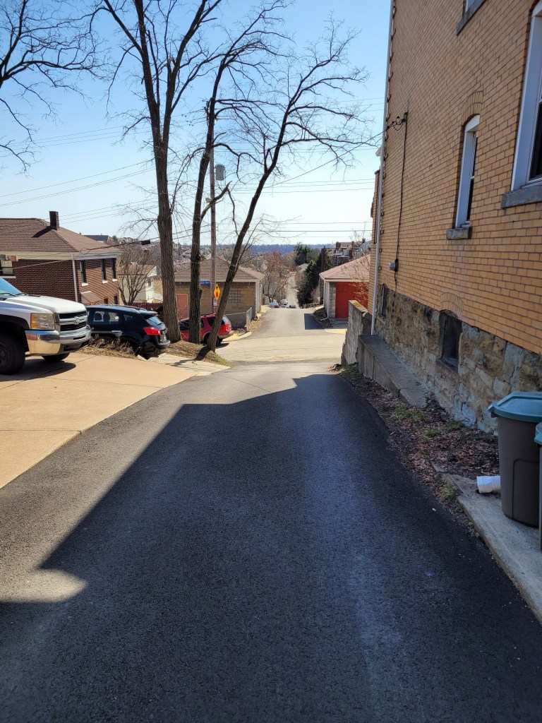
As for my specific route, I traversed Westmar Way and Catrill Street. I wondered why I had missed them earlier, but, upon seeing them, realized they are so nondescript as to be easily missed. Nice and flat, though.
Westmar
Catrill
Some of the buildings here are old, but with this large, flat space, newer businesses have moved in, too. Duquense Light has a large space with dozens of their trucks; the Port Authority has a large bus servicing area along with here, too.
CommonWealth Warehousing
Aero Tech
Further down Beaver, there’s a defunct prison. As Beaver Avenue becomes Preble I passed the rear of a large Sherwin-Williams plant and dead-ended at the Alsocan gates. Alongside the Alcosan plant, a tiled smokestack rises high, while blue duct-work snakes along exterior walls.
Stone Water Fountains
Alcosan
Blue ducts
Then I trotted past the former prison. It was quite an impressive site, a tall stone wall topped by barbed-wire and watch towers. Westfall Street goes down one side and the Three Rivers Heritage Trail goes along the back.
Long Wall of the Prison
Closed Gate and Abandoned Watch Tower
Along the rear of the prison, a wrought-iron spiked fenced keeps folks out of the great hall, broken windows and all.
Wrought Iron Fence in Back of Prison
Main Prison Building
There are several entrances, one along Beaver Avenue and gates on the side and back.
Front of Prison
Graffitied Gate Along Trail
Stern Sidegate
Running along, the creepy prison was not the only thing to see. Some sort of large steam fittings sat, ready for use. A hawk drifting overhead and luxurious cat condos under the trees, with sparkling views of the Ohio, completed the scene.
Hmm, not sure. Perhaps Steam Fittings?
Hawk High in Sky
Cat Condo
The Ohio
Further down the bike path, I caught a glimpse of beached boats and several boats still in dry-dock. They look so much bigger out of the water.
Boats along the Ohio
Dry Dock
With this, I finished up. Good run for a workday evening!
Ah, take me back to the days of gaslights and wooden streets! Eh, not really. These curious and nostalgic scenes are delightful yet do not reflect the dismal quality of life in Pittsburgh in the early 1900’s. I much prefer the current cleaner Pittsburgh. As they say “The good ‘ole days weren’t so good.”
Route of RATS run #00403 in Shadyside and Point Breeze
I started this run, number 403, in Frick Park even though the object of the run was the curious winding avenues of Chatham University. But first, a photo of the elusive groundhog, cousin to Phil. I’ve seen groundhogs everywhere in the city, from Uptown parking lots to Lincoln Place. They scurry into holes under porches. They dive into garden bunkers. There’s one that lives in my neighbor’s yard. It must have an agreement with their dog, as it boldly traipses across their yard and into my garden. It loves to sample tomatoes, preferable almost ripe and generously leaves the half eaten fruits for birds to gorge on.
Grr, a groundhog
Nonetheless, back to the roads through Chatham University. These ‘private’ roads are often used by pedestrians and patient short-cut seekers to cross from Fifth Avenue to Wilkins Avenue. They are also some of the most gorgeous streets in Pittsburgh, with large mansions (now college buildings) on small winding lanes flanked by flowering dogwoods and towering oaks.
Woodland Road
Gaslamp
Not your typical house
After wandering the winding lanes of Chatham, I traveled up Shady Avenue as the evening became drizzly. There are many small dead-ends off of Shady, as well as a few private drives. I ended up by following Mellon Park Road from Shady to Beechwood. I’m not sure what’s going on with the green lights, but I can assure you they are not from photo-editing.
Great Gate
Mellon Park in Greenish Light
Mellon Park Road
I simply ran up and down and up and down Beechwood to my starting point. No groundhog out now.
Strava route of RATS run #00404
This run was in Shadyside as well, though in the busier sections near Walnut Street and Ellsworth Avenue. I was on a mission to snag a number of dead-ends and alley-ways I had previously overlooked. The south side of the busway is quite residential, though crowded. A large percentage of the huge ostentatious houses have been carved into apartments, condos and town homes. There are still a few mansions along Fifth Avenue, though. The north side of the busway is more inner-city urban, with six-story apartment buildings and parking garages.
Temple Way
Commerce Street
Mansion on Fifth
Getting there, though, I ran to Canterbury Lane, a dead-end; Aiken Place, another dead-end and Roslyn Place, an historic street off of Ellsworth. What makes Roslyn so historic? Well, the street is ‘paved’ with wood. And it isn’t wooden planks, it is more like the ends of 4×8’s. Very odd, but here, take a look.
Rosyln Place
Close-up of Wooden Pavers
Wooden Street
As I say, very odd. How do they plow in the winter? Anyway, from here, I scurried down the alleys off of South Graham Street. One side goes to a Boys and Girls Club and the other dead-ends into a beautiful wall of ivy.
Boys and Girls Club
Lovely Ivy Wall at the end of Japonica Way
Crossing over the busway on the Graham Street walkway took me to Centre Avenue. It is a hopping place, with a Whole Foods, a Giant Eagle and lots of construction. Commerce Street, little more than an alley, parallels Centre and yet is much quieter. I made my way to Motor Square Garden and came back on Dapper Way.
Harts Detailing
Motor Square Garden
Sunset at corner of Baum and Friendship
So, I must say, my GPS wasn’t super accurate on this run. Sections of the GPS’ route are ‘translated’ off my actual route by 75 yards or so. Unfortunately, this misses the ‘nodes’ on CityStrides and doesn’t ‘complete’ the street. Argh. I’m uncertain as to whether I’ll run them again, which is easy enough, or just mark them as complete. Hmm, decisions, decisions.
Here are two little five milers. One in the South Side Slopes and one in Beechview. One had twice the elevation gain as the other. Any guess which one? Read on to find out.
Route of RATS run #00401
This run started in my favorite spot in Beechview, Vanucci Park. I can park there without worrying if the car is going to roll down the hill. At any rate, I wanted to cover a couple of streets I had neglected near Coast Avenue as well as to explore Crane Avenue a bit. My impression had been that Crane was not safely runnable and wanted to verify that.
Vanucci Playground
Andick Way Steps
Kenberma Avenue
Fallowfield Station
Immediately out of the park, I made a right up the Andick Way Steps. They took me past a basketball court. The squeak of shoes, ball clanging off the rim and trash talking spoke of games being played, even though the retaining wall was too high to see over.
The next turn was a left onto Kenberma Avenue. Kenberma falls rapidly under the electric trolley line known as “The T”. From the bottom, I wrapped around Hampshire Avenue to the Boulevard and the Fallowfield T-Station, a hundred feet above.
The next stop on my tour was Alverado Street. At the north end of Alverado, a set of crazily tilted steps drunkenly fall down the hillside. I followed, only to realize they went to a house, not through to another street, and backed out.
Start of Alverado’s Steps
But deteriorate quickly
Steps to Coast
To wrap up this area, I decided to run up Canton Avenue; the tenth of a mile street which is the steepest in the US. At the top, I explored the stairs off to the left which took me back to Coast Street, with only a 13% grade.
Canton Avenue
Steepest Street in America
With this section done, I headed up Fallowfield to Crane Avenue. Crane is no bigger than the residential streets I had just been on, but has more traffic and fewer sidewalks. I feel like city planners intentionally said “we don’t want anyone walking here!” I crept down to Shadycrest, which, unfortunately is deemed government property and is awash with “No Trespassing” signs. From there, Crane Avenue makes a steep descent to Banksville Road; blind turn, no shoulder, no sidewalk, maybe another time.
Shadycrest Drive
Art Studio on Crane
I ventured the other direction on Crane, diving into Lowenhill Street behind Brashear High School. The basketball courts there were eerily silent while quiet dog-walkers ignored the signs and traipsed their canine cares around the field.
Lowenhill Street
Brashear Courts
Sad house
Route of RATS run #00402
The evening was heavy with humidity when I started this run in the South Side flats. Going into the slopes by way of Quarry Street I passed under the Mission Street bridge and skirted the edge of South Side Park. The houses are tall and thin. All the houses in this row have three floors, a basement and attic.
South Side Park
Three floors, basement and attic
Quarry Street Steps
Quarry Street Houses
Further on, as I criss crossed Freeland Street the skies opened up. A pedestrian shouted out “Great running weather!” and dodged into a house. The steps became gushing rivers.
Freeland Steps
Loyal Way
Johnos Art
Thoroughly soaked, I came back down Brosville Street and was awarded with some neat views of the retreating storm. Thank goodness for the towels I had in my car.
Sun’s coming out
18th Street Mural
So, what was your guess? More elevation in Beechview or the South Side Slopes? If you guessed Beechview, you were correct! 1,034′ vs 596′
Here is a run from the first week of May, RATS run #00400 in Summer Hill.
Summer Hill and the Livin is Easy – RATS run #00400
On this bright sunny Saturday a group of friends were doing their Virtual Pittsburgh Marathon. With Covid-19 still lingering, the in-person event had been cancelled, but Cathy, Avi, and Danielle were determined to do their first marathon while Dennis and Mark came along and added another marathon to their long list. ( I apologize if I’ve missed anyone.) So, while waiting to cheer on these folks at their 20 mile mark, I popped up to Summer Hill for a run, keeping a close eye on my phone for word that the runners were approaching 20 miles.
Today’s run was about clearing Dewey Street, the northernmost section of Evergreen Road and Golf Way in Summer Hill. Additionally, if the bat phone didn’t ring, I’d sneak in a few side streets off of Colby.
Dewey Street is a short thoroughfare squished between a steep hill and I-279. A long flight of stairs, Gribble Street, lands at its beginning and only a half-dozen houses are scattered along the tree lined street.
Dewey and Gribble
Dewey Street
From there, I followed the pedestrian walkways under a rocky moonscape created by the I-279/Evergreen Street interchange. With limited visibility, I waited patiently for the lights to change and made sure no car was whizzing by when I did eventually cross, periodically checking the bat phone. Ironically enough, that led me up the long curving hill of Evergreen Road with no sidewalks, so I was still anxious about getting hit by a car zipping down the blind curve. Guess what? I made it.
Halpern Road led me to Colby Road and hence to Gold Way. It is just a little alley, ending in a nice green pathway. The neighbors should really get together and make a putting green there. It’s not like any cars are coming.
Golf Green
The bat phone still didn’t ring, so I got a chance to run out of the city on Faber Street. It was all lush and green suburbia.
Faber Road
The bat phone still wasn’t ringing, so I checked off Husk Street, little more than a driveway. But then, I looked up in the sky and saw a tiny plane high spelling out words…
April 2021 was a busy month in the running department. I ran 133 miles and completed the Hyner 50k, a challenging, rocky trail race. Group runs had returned and at least once a week I ran with City of Bridges run club. As for neighborhoods, checking my April maps, it looks like I was really hitting the edges – Lincoln Place, Hays, Belmar, East Carnegie and Summer Hill. Blogging in April took such a hit that I spent most of the month talking about March. That trend has gotten worse, as it is early June and I’m just now finishing up these April runs. Oh well, I’ll get to them all eventually. For this catch-up I’ll be running you through six gorgeous routes, ending with RATS run #00399.
RATS run #00394 in Carrick
I love a little quickie in the dusky evening. Here, I did a couple of miles circumnavigating Phillips Park. Nice two-mile run!
Love the Greenery
Carrick Downhill Backyards
Phillips Park
Lybrig Way, maybe
Eye Stump
RATS run #00395
RATS run #00395 was a long hard run from Point Breeze, to East Liberty, through Larimar and into Lincon-Lemington. It was mid-morning on Saturday and I was surprised to find a crowd along Paulson Avenue. It seems that Mt. Ararat Baptist Church was having a mass vaccination event. I felt a bit odd running down dead-end Tyler Way with dozens of people milling about. At the end of Tyler Way, this odd structure stands. I have no idea what it is, but UFO has to be a choice.
Tyler Way
Landed UFO
Graffiti and artwork adorn many of the neighborhood’s walls. Raymer did a Mac Miller tribute, while a lesser known artist renders bold angles and a someone remembers a friend. Artful graffiti is slowly outpacing the simple spray job; graffiti gentrification.
Loud and Bright
Old School Memorial
Mac Miller
Moving deeper into Larimar, there’s a lot going on. Houses with the deadly blue ‘condemned’ sign are getting renovated. The “Know Thyself” school is surrounded by bulldozers and fences. Just remember to report to the office when you get there and ask “What ARE you doing?”
Renovations Planned
Looks Great!
Report to Office, Please
Elmer Williams Square has some cute houses while the Freedom Temple Church looks like it’s seen better days. Those painters didn’t spend much time accentuating the detail of that building, did they? Further into Lincoln-Lemington, the land rises enough to provide a decent view all the way to Oakland’s Cathedral of Learning.
Elmer Williams Square
Freedom Temple Church
Cathedral of Learning in distance
Way up on Lemington Avenue, I saw an interesting school facade and took a closer look. Earthy, bold, colors and Mayanish tiles contrasted with the “young Queen Victoria” face staring out. And perhaps it is a theme, but make sure you report to the office here, too. Now it is called “Catalyst Academy” and I wonder if chemistry is the core curriculum.
Above this school several streets dead-end into St. Peters’ Cemetery. Some dead-ends you can go right up to, like this wall, while others are guarded by downed trees and old home foundations.
End of Churchland
End of McClary Way
Flath Way
Older Brick Alley
Catalyst Academy
Speaking of St. Peters Cemetery, they spared no expense with the sign. The front declares it is “Historic”, while the back lists which wars the vets fought in. All the way back to the Revolutionary War, I see. That’s impressive.
Front Sign
Back Sign
From here, I trundled down Highland Avenue to Washington Boulevard. The greenspace on the left is actually part of Highland Park. I didn’t see any cat tails, neither mammals nor plants.
Cat Tail Trail
Blooming Trees
Lastly, the arched bridges along Washington Boulevard are quite impressive. Several carry the streets above, such as Lincoln Avenue and Larimer Avenue. One, though, carries an old railroad. Apparently this railroad spur crosses the nearby Allegheny River and is being considered for a rail-to-trails project. At the moment, though, the Brilliant Bridge just crosses Silver Lake Drive, home to storage warehouses and a car wash. It used to actually be a lake, then a drive-in movie theater.
Highland Drive at Washington
Common Place Coffee?
Over Silver Lake Drive
From here, I trotted back to my car with fourteen miles in the running bank.
RATS Run #00396 in the West End and Elliot
RATS run #00396 was a short run in the West End and Elliott. This was one of those frantic days, where just getting out for a run was an effort. Par for the course, I ended up in the wrong lane driving to the West End and just decided to park in Allegheny West, near Modern Cafe. It was OK, as I wanted a little more mileage than my planned route.
Crossing the West End Bridge has become an adventure these days. There are a couple of fenced-in walkways suspended above the street and below the bridge, taking you from the street to the bridge deck. I’ve run across it without a problem for years, but recently people have been sleeping on the walkways well into the day, leaving their bags and things strewn about. Covid or not, it is much closer to people and personal items than I’m comfortable with.
At any rate, I crossed the Ohio on the West End Bridge and made my way up to Elliot, Janewood Way in particular.
Janewood Way
Amherst Street Steps
Ohio River
Marking that one off, I visited Herndon Street, high on the opposing hill. I had previously taken it for a driveway and did not realize how long it was. A few houses clung to the hillsides there. I used the Attica Street Steps to come back down to the quaint business district of the West End.
Herndon Street
Attica Steps
Hello Down There!
The West End Business district is a small grid of street off of Steuban. Motorists trying to avoid tunnel backups often zip through this alternate route. On the far side from Steuban, a mere two or three blocks, streets generally end at the Saw Mill Run (creek), while cars on Saw Mill Run Boulevard scream by. Mount Washington rises above in steep cliffs.
Old buildings cut off from the main road
Creekside
Mount Washington
That’s acute angle
There are some cute parts of town. It even has a gazebo. However, trudging on Violet Way I looked up and became concerned. There seemed to be a police incident in progress, as several officers were milling around. Indeed, as I passed, it turned out maybe a dozen officers, in full gear were there behind a building.
Gazebo!
Sanctus Steps
Yoga Wellness!
Violet Way
They were chatting and joking. Shift change, I suppose. In 25 feet or so, it was a dead-end and I felt a little sheepish going back through the police crowd. With that I crossed the West End Bridge again, this time seeing two dudes rummaging through the homeless guys’ debris. I thought about the police a half-mile away as I whizzed past.
RATS run #00397 in Banksville
Not a whole lot to say here. This was a short evening run in Banksville. Banksville Park was quite active this time through. The last time, it was a rather cold evening. Now, guys were playing cricket in a ballfield, while scads of people lined a dek-hockey game in progress. Further on, it looked like a Little League baseball game was starting.
The surrounding neighborhoods are quite residential, with big lawns and big garages. Oakville Drive, though, is a mass of apartments. There could be as many as 1,000 garden apartments there. It looked pretty nice, honestly. Just know that you can’t actually drive the way I came. The northern section of the apartment complex overlooks the Parkway West as it bends toward the Fort Pitt Tunnels.
Daleland Avenue
Oakville Drive
Nice sky!
More apartments with downtown buildings peeking out
A cell tower dominated the end of the playground. Lots of satellite dishes are clustered around that thing. Who knows how many antennae are on the tower? 50? 100? It’s hard to say.
Banksville Cell Tower
So many dishes
Route of RATS #00398 in Northview Heights
Northview Heights is an area I had been avoiding. There are security gates on Mt Pleasant Road and Penfort Street, which I found intimidating. However, I had taken some time off work to recovery from Hyner 50k, so had the chance to run here on a sunny weekday morning. I had no problems, other than a little soreness in the legs. People were out, waiting for buses or picking up kids. Maintenance workers were vigorously mowing lawns and doing repairs.
Crossing I-279 on Swindell Bridge
Church of Our Savior
Penfort Street
Northview Heights
Chicago Street branches out of the housing development and stops at a cliff above I-279. I wonder if it ever went across. A lone turkey sauntered into the woods as I passed. Eventually I made my way out of the development, down to Spring Garden Avenue and back to Essen Street.
Chicago Street
Is this a fire-pit which gleams with “Church of Our Saviour” when lit?
Essen Street
Crossing the Swindell Bridge again, there’s a neat glimpse of Downtown through the fence links.
Swindell Bridge
I Spy Downtown
RATS run #00399 in Squirrel Hill
Last but not least, RATS run #00399 was a 5K run in Squirrel Hill North, land of the big houses. But I’ll start out on an alley and end on the public golf course.
Bainbridge Way
Robin Road
Now, Robin Road is private, but since I’m not immune to doing private roads, I intended to go down it. However, it really felt more like a private driveway, so I bailed. This section of Squirrel Hill, “Murdoch Farms” has immense, imposing homes beautifully kept. Not so far away, little developments off of Schenley Park Golf Course include various “modern” style houses. Oh, so modern, they were built in the 1960’s.
North of Forbes area
Darlington Court
The sun was setting across the golf course as I finished up, just past 5K distance.
That’s a Wrap!
(May was a busy month, too, but only 106 miles. I’ll start blogging about those soon. Thanks for reading.)
March 2021 was one of my most productive months in terms of mileage and streets covered. Among my 162 miles and 20,000 feet of elevation gain, I completed 192 more streets in Pittsburgh in 15 RATS runs. I even completed the “Take The Stairs 50k” course I published last year. That course, a small revision of Lamar’s original course, took me on roughly 78 sets of steps throughout the city, but, alas, did not cover any new streets.
Blogging-wise, March was less than stellar. I only published four posts and it has taken me all of April just to get this summary out, touching on three short runs in Carrick, Brookline and West Liberty.
Route of RATS #00384 in Brookline
I had grand plans for this run, but was out-of-synch and got frustrated by small ‘streets’ just being driveways into hills. Argh! Just took one picture, before it all went downhill. I did end up with over four miles and several alleys covered.
Brookline AlleyRATS run #00386 Around South Side Cemetery
In this run, I inadvertently circumnavigated South Side Cemetery. I started on Brownsville Road and took the steep West Meyers Street to Oakhurst en route to Newett Street, one of the steeper roads I’ve been on. I took Plateau Street to its dead-end above Volunteers Park, then came back to Newett, expecting to see Plateau on the other side. However, Plateau falls off of Newett so quickly that the other side looked like a driveway which disappeared over the hillside. Once upon it, though, I found my way down Plateau and was pleasantly surprised to find that Volunteers Field was an active hubbub. It looked like a fire department team was practicing on one field, while on another field, a younger group practiced base-running under the tutelage of a barking coach.
Volunteers Field
Carrick Dugout
Moving on, I dodged cars on my way down Colerain to Noble Road. No sidewalks and not much of a shoulder made it tricky running. Then I peeled off and went down Denise Street. My internal map had Denise going a little way and dead-ending. It seemed to go on forever, but afforded nice views of the T tracks. Returning, I came across some steps which took me to Noble Road.
The T
Steps from Denise to Noble
Denise Street T Station
Once up on Noble, I backtracked a bit and went up Glade Street. The few streets up on that hill are tucked into a corner of the cemeteries looming above. It was a nicer area than I expected. Some kids were playing basketball in the street and others were riding bikes. Along the Montrose Steps I heard a rustling and noticed a deer in the woods. I took a picture and continued to Cloverdale Street. Only after looking at the picture more closely did I realize there were four deer there!
Glade Street Steps
Haunted House
Steps from Denise to Noble
Mosgrove Steps
How many deer do you see?
Cloverdale Street completed the southern border of the cemetery, bringing me back to Noble Street. This short, three mile run certainly had a lot to see.
Route of RATS #00387
This was an evening run in West Liberty to catch some alleys. I caught several in my alley catcher, but some were only paper alleys (here’s looking at you, Mascot Way!) Overall it was a pleasant, hilly run with over 400 feet of elevation in only three miles.
Gayley Way
Cool Trees
Section Way
Nope, nada, Mascot Way
So that was it for March, 2021. I’m still chipping away at the streets. At the end of March I had a little over 800 more to complete. I’ve come a long way considering there are over 4,800 streets in Pittsburgh. I can now see the light at the end of the tunnel.
Route of RATS run #00385 from South Side to Fairhaven
On a bright Sunday morning in March, I undertook one of my longest RATS runs ever. I had a couple of goals. First, see how much of Beck’s Run Road I could traverse without getting run over and second, explore Fairhaven, nestled in the corner of Library Road and Saw Mill Run Boulevard, without getting run over. I was ramping up mileage in preparation for an April 50k.
First off, I decided to climb into the South Side Slopes in order to catch Parkwood Road, which I could take to Beck’s Run Road. While using East Carson is the fastest way by car, that whole ‘without getting run over’ idea convinced me the steps were a better idea. And of course, I would get to enjoy the great views.
Oakley Street has an impressive step-mosaic where it begins on Josephine Street. It does continue, however, for several more flights. I wonder about that handicap parking, though. It must be difficult for anyone with mobility issues to live in a spot surrounded by steps.
Approaching Oakley Steps along 27th Street
The Oakley Mosaic
Up Close
Oakley Keeps Going
And Going
Convenient Storage Spots
Oakley On Up the Hill
At any rate, now on the crest of the South Side Slope, the views were amazing. on breaks between houses, you could see across the Mon to Oakland, with the Cathedral of Learning prominently displayed. On the far side of the crest, the neighborhood forms a steep bowl, with steps on each side.
Cologne Street Steps
Clover Street Steps
Bowl Between Arlington and the Crest
Blue Butterfly Sun Catcher in Arlington
Cathedral of Learning in Distance
Once past Arlington Avenue, I made my way to Mountain Avenue and the long, one lane road known as Parkwood Road. On the left side of Parkwood, a ravine deepens and water drips down the cracking rock on its way to becoming a creek. Parkwood is blocked off about a tenth of a mile above Beck’s Run Road, due to erosion. Just before this, two small streets on the left are lined with houses. The creek has grown to a significant size by now and the city, I suppose, has built quite an impressive retaining wall to keep one house from falling in. It is very isolated, but the ten houses are all nicely maintained.
Deep Ravine off of Parkwood
Parkwood Road
Clogged Creek
Blocked Parkwood Road
Typical Rock Formations
Once at Beck’s Run Road, I ran toward Paige’s Dairy Mart and then up towards Carrick. Even though it was a 40 degree day, people were lined up to get ice-cream goodies from that venerable establishment under a bridge. Beck’s Run is the name of the small creek alongside the road. The road is a major thoroughfare, but doesn’t have many buildings along it. The hills coming down are too steep to build on. The flat areas probably flood.
BaddAzz BBQ
Paige’s Dairy Mart
Beck’s Run
Neat house at the end of Parkwood
Massive Piers of the Railroad Bridge
So, I made my way up Beck’s Run Road, then explored a little along Agnew Road. Not far from its intersection with Beck’s Run, there’s a heavily fortified water filtration plant.
Steps to Water Tower
Filtration Plant
Fences
I found one section of Beck’s run a bit too tight for running and went up Madeline Street instead. Crossing over Brownsville Road, I took Maytide to Saw Mill Run Boulevard. This is car heaven. Car dealerships of all shapes and sizes line the road. Luckily there is some thought to pedestrians, as there are walk signals. You just have to be willing to wait a long time. At least I could recover a bit.
Wide intersection
With crosswalk
If you’re willing to wait
Finally making it across, I came to the Fairhaven neighborhood. It is wedged between Saw Mill Run and Library Road. From this intersection, one lonely road and a set of steps lead you there. Once there, I was, actually, pleasantly surprised. Medium and large houses stood on large lots. The subdivision backs onto “Fairhaven Greenway”.
Hillview Street is steps in two sections, the one coming up from Saw Mill Run and another one, just slicing up the hillside between yards.
Fairhaven
Fairhaven Greenway
Bottom of Hillview Steps
Middle of Hillview
The second section
Small Person View of Hillview Steps
Fairhaven View (Can you see UPMC Building?)
The far side of Fairhaven abuts Castle Shannon and Whitehall. I came down Elwyn Street and made my way along Transport Street, a half block behind Library Road. Transport Street had much more character than I expected.
Top Elwyn Street
Elwyn Street
Two artists, I think
WTF?!?
JB’s
At this point, I started heading back to the South Side. I went along Saw Mill Run until I could go no further. Luckily, a tiny section of steps became Dartmore Street and led me up into Carrick. From there, I just plodded along Brownsville Road and cut-through Mt Oliver along Amanda Street. I was surprised to find Amanda actually stopped and was separated from Hay’s Street by a barrier. It turns out Hays, at that point, is so steep, it is hard to even walk down. Still, those hilltops can see the downtown buildings peeking over.
Dartmore Street
Is a sidewalk
And Steps
UPMC Building from Hays Street
With this, I made my way down South 18th, Mission Street and back to my car on the South Side. Whew, that was a long run!
Here are three short runs I did in mid-March. These were “squeeze-them-in-runs”, where I had only a short time and planned out a very limited route. Though perhaps not as epic as some runs, they still took me to interesting places.
Route of RATS run #00381 in West Liberty
This run started at Moore Park along Pioneer Avenue. I had mapped out a shorter, “nearly flat”, route for my girlfriend to run while I tackled the longer hill on Dunster Street.
Dunster is pretty much suburbia up near Pioneer Avenue, with a long straight stretch rolling east. After reaching the sunrise, it drops precipitously. Large lawns spread out and the bottom cross-street, Timberland, ends in trails. (The trails, incidentally, go back up to Moore Park.)
Dunster Street the Suburb
Timberland Ends in a Trail
Bucolic Dunster
Following Timberland away from its trail end brought me to Edgebrook Avenue. At this point, Ballinger Street ascends as a staircase. This area was a bit more junky. I did spy what must have been an elf playhouse off the stairs. Also, I garnered more evidence for “Boat Theory”, as a speedboat was right next to the stairs.
Ballinger Steps
Boats and Steps
Playhouse in the Woods
I continued all the way to Whited Street before turning back. It is a neat area, off the beaten path but literally a quarter mile to Saw Mill Run Boulevard and overlooking the South Busway.
The Lorenz, an Old Style Apartment Building
Welcome To Brookline
Returning to Moore Park, I had the pleasure of running up Dunster. Turns out that is a Strava Segment (“What a Dunster Fire”) and for the moment, I’m 4th overall! I also had the pleasure of getting some feedback for the “flat” run I had planned for Naomi. Ha! Perhaps it wasn’t as flat as I remembered.
RATS #00382, Brook Street in Carrick
Nestled between South Side Cemetery and Saint Georges Cemetery, a handful of streets and an amazing number of houses cling to steep slopes. This run, #00382, was a rare morning run and I just had enough time to do a couple of miles. I parked along Brownsville Road and ran north on that dusty road to Cedricton Street. Between the houses on the left, it was a long way down.
Minooka Street
South Side Cemetery
Long Way Down
Once at the end of Cedricton, I jigsawed my way over to Brook Street, which flowed downhill, an amazingly far way downhill. There was actually a turn-around at the bottom, where all the views were up, up along fallen vine covered trees. A brook did emerge at the bottom.
End of Brook Street
A Brook!
Holy Retaining Wall, Batman!
RATS #00383 in California-Kirkbride
This was a short run I tried to squeeze in before my regular City of Bridges Wednesday night run. I managed to catch Sigel Street, which has recently been repaved then ascended the Hyena Street Steps. No pictures, I suppose I forgot my phone.
Turns out I misjudged my timing as well, for by the time I got back, the COB runners had already left. Whoops! I had the map and tracked after them. However, with a ten minute head start, I only caught up with a couple. At least Modern Cafe was open and I got to enjoy some post-run libations with them.
Here are a couple of runs I did in early March, 2021. The first, a short evening run in Stanton Heights, finished up that area. The second, an epic wandering run through Corliss, Chartiers and Windgap was in the blinding sunlight and pretty much finished those areas as well.
Route of Run #00379 in Stanton Heights
Starting in Upper Lawrenceville, I clambered up Stanton and finished off a few streets and alleys for run #00379. Previously I’ve pictured this pleasant, residential area. This evening, dog walkers were out and kids played in the streets. The end of Downlook Street has an unexpected view of Sharpsburg across the Allegheny River. I finished up in Dinian Park, skirting a baseball field overlooking Morningside. It was cool to see the sparkling lights through the bare trees.
Lights of Sharpsburg Across the Allegheny
Morningside Houses Twinkling
Route of RATS #00380 through Corliss, Windgap and Chartiers
At the start of most every run, I have some anxiety about part of my route. For this run, I was worried about the area near Hollywood Cemetery as well as Alora Way and a confusing section of streets Windgap. I was also worried about how safe it would be to run on Windgap Avenue. Let’s see how my worries played out.
Off the bat, I screwed up my route coming out of Ingram. Instead of going on West Prospect, I went on East Prospect and ended up coming into Pittsburgh along Steuban Street instead of Berry Street. This turned out OK, as I made sure to complete Charlton Street coming into Berry right at Jenkins Street. I’m not sure if you recall, but in an earlier run, I came across the Jenkins Street steps and through internet sleuthing, found that they go nowhere. Today, emboldened by the bright sun, I battled the scrubby brush and went to the top of the stairs. Nothing, nada, zilch. And, on the way down, I stepped on a nail protruding from an overturned plank. Luckily, it missed my foot and toes. But it was a hassle stepping into the street with a three foot piece of wood attached to my shoe. Once on Berry, I was able to remove it.
Jenkins Street
Isn’t much to look at
Steuban Street Entrance to Pittsburgh
The next stop was a little cul-de-sac, Kathy Drive. Looks like a nice residential street. From there I made my way to Evanston Road, winding around Harrisburg Road to Clearfield. Clearfield went right into Hollywood Cemetery. The map show Clearfield continuing through the cemetery to Windgap on the other side. The road does not clearly go through. At the far end, though, I was treated to a neat view of Windgap and the Windgap Bridge.
Kathy Drive
Hollywood Cemetery
Windgap Bridge
I traced my way through the streets and alleys here off of Middletown Road then took Middletown Road’s curvy dive down to Chartiers. The far side of Chartiers Avenue has a number of small residential blocks and with some roads leading right up to an active railroad. Down here, power lines towered above the houses.
Rolling Down The Railroad
Now, I had to face my fears and venture to the steps on the end of Alora Way. The first time I saw the steps from Chartiers Avenue to Alora Way, a large dog was yelping at me from the bottom of the stairs. I was concerned he would still be there. But I was in luck! No dog. The steps were an adventure to get to, but led straight up to Chartiers, as expected. Flushed with this success, I decided to see, one last time, if I could find the steps which were supposed to come off of Moyer Street in Sheridan. From the end of Moyer, last summer, all I could see was gardening debris at the end of the street. This time, though, on this sunny, leafless day, I found them! Shallow red brick steps climbed alongside a Jewish cemetery until they were buried under branches near the top.
Steps from Alora Way to Chartiers
Moyer Street Steps
A Jewish Cemetery
Top of Moyer Street Steps
Now I needed to face some more uncertainty. Alora Way also has steps which rise on the other side, towards Oltman Street. I had run on Oltman before, and only saw a rundown house at the end, no steps. From this direction, though, the Oltman steps looked good. Well, they looked good until I came across a fairly large broken section. Sometimes, I stop when I see steps like these, but not today. I made my way on the edges and fought my way through the new growth to the other side, on Oltman Street. While there was a lot of trash and dumped appliances, there really wasn’t much to be afraid of.
Alora Way to Oltman Steps
Need Repair
From here, I wandered around the streets and alleys of Windgap. I found an amazing scene, ferocious deer cornering a wild T-Rex. Poor T-Rex, he looked scared to death.
Cornered T-Rex
Windgap
With this, my exploring was done. I decided to run straight up Windgap Avenue. It wasn’t pretty or particularly safe, but I made it without a problem. I was so close to a half-marathon, I ran an extra block just to get in that last tenth of a mile.
With February gladly behind me, I started into March with several short runs. The weather had moderated and I was just getting out.
RATS #00373 Overbrook
RATS #00373
The main point of this run was the triangle of streets between Jacob Street, Groveland Street and Aaron Avenue. It was already dusk by the time I parked at Brookline Memorial Park, donned my safety vest, powered up my flashlight and took off. I shot down Brookline Boulevard to Jacob Street. Cars all have to make a left, but pedestrian runners like me have the option to make a right onto steps descend steps. At the bottom, there is a walkway to a South Busway Station, but tonight I went straight through the soggy area, lifting up on steps rising on the far side, emerging onto another section of Jacob’s Street. I apologize for the photo quality, but it does illustrate my mobile night vision, or lack thereof.
Jacob’s Ladder Steps
There are just a few streets down here, all going up to Aaron Avenue. The houses mostly sit on decent sized lots and over the years, residents have really made them their own.
My ambition was to finish off Aaron, crossing Glenbury, then do more alleys in the far neighborhood. However, my back twinged at the end of Aaron, and I just limped back to my car.
RATS #00374 Shadyside
RATS #00374 – Shadyside
Cutting the previous night’s run was probably a good idea, but I was still taking it easy, so I did another easy run, in Shadyside. Shadyside is full of cul-de-sacs and this run was mainly about touching on several of them off of Ellsworth Avenue.
Tree in the Light
Viney Garage
Mansion Hidden Away on Alley
I did come across a spectacular mansion of modern style along an alley. One side purports to be a driveway, but it is actually a through street. This was a pleasant, short and flat run.
RATS #00375 Greenfield
RATS #00375 in Greenfield
This was a cool run, again in the evening. I started along Greenfield Avenue and powered up Winterburn Avenue. Sun Way lived up to its name, with a grand vista of downtown bathing in pumpkin light, as river mists started rising.
Sun Way Looking Downtown from Greenfield
Besides the incredible hills, Greenfield has incredible views. The Cathedral of Learning prominently punches to the sky. It was no surprise that I came across steps; these continuing Noah Avenue, from Tasso Street to Tasso Street (yes, the upper and lower sections have the same name).
Cathedral of Learning Sticking into the Sky
Noah Street Steps
Downtown and South Side Lights
On Lower Tasso, I had great views of the South Side lights and downtown framed by the last sunlight. That was about it. This run, while only 3.73 miles had a healthy 581 foot elevation gain, over 150 feet per mile.